
dfs346
Pre-Flight
Could anyone provide a photo of the Battle Ground (BTG) VORTAC at 7799 NE 174th St, Vancouver, WA 98662?
Last edited:


Here's a request for you flyers in the Vancouver, WA, or Battle Ground, WA, areas. Attached is a photo of the Battle Ground (BTG) VORTAC at 7799 NE 174th St, Vancouver, WA 98662. Could anyone provide a photo from a similar perspective (or slightly closer) with permission to use it, with attribution, in a publication? Many thanks.
(The attached photo is from Google Maps who, I suppose, own the copyright. The author is identified only as Scott P. and Google Maps will not disclose his contact details.)
Thanks a million. I think today's smartphones make good photographers of all of us. Yes, I had heard of the Victor 23 brewery and they get a brief mention in my book. Happy to attribute both @EdFred and yourself.


I just mapped it. 72nd Avenue, which I’d have to take to get there is closed, but there’s houses so it’ll be open to local traffic. I’ll give it a try.
There’s another way to get there. You can go up I-5 to the 179th St exit, which also is where the Clark County fairgrounds are. Head east off the down ramp. In 3 miles you’ll come to an intersection with 72nd Ave. The VOR is SE of the intersection. Behind a church if I remember correctly.
 ) would have been way out of my way. I live close enough just doing surface streets was faster. The road closure is still there but the barricades were off the street on weekends.
Thanks a million. I think today's smartphones make good photographers of all of us. Yes, I had heard of the Victor 23 brewery and they get a brief mention in my book. Happy to attribute both @EdFred and yourself.

Southern California is not all of California!...Doing the 5(yes,THE 5, not I5, I lived in California for 30 years where proper reverence is given to freeways

Southern California is not all of California!

Didn’t see a church. Doing the 5(yes,THE 5, not I5, I lived in California for 30 years where proper reverence is given to freeways


Still need this? I can bop over tomorrow. Didn't notice this earlier. I have few reasons to visit Vantucky and try to never cross the columbia river without cause, but I can stretch a point.

The Battleground VOR used to the Portland VOR.
Many thanks, I think @luvflyin has got them.

That must have been a very, very long time ago before there was a Portland VOR/DME, ID PDX, on the airport at PDX. It got decommissioned about 8 years ago.


That's also when there was a 9677' mountain a few miles northeast of the VOR ...
I'm certain it was still operating when I moved to Vancouver in 1995. Beyond that I really don't recall.Hey, do you remember when the PDX VOR/DME got decommissioned? And when it got commissioned, had to be after 1980?

Mt. St Helens is about 1300 ft shorter than on that chart.
That's also when there was a 9677' mountain a few miles northeast of the VOR ...


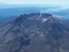
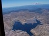
I remember the next day some kid bringing some rocks into school claiming they were from the eruption and he found them in his yard. We were in Michigan.
Can't believe I paid him $35 for them.

It's still there in spirit. Hey, do you remember when the PDX VOR/DME got decommissioned? And when it got commissioned, had to be after 1980?
I'm certain it was still operating when I moved to Vancouver in 1995. Beyond that I really don't recall.
kgruber, the second chart seems to be newer, as the PDX 332 no longer has the Adcock range markings. New Adcock ranges were not created after the VOR system became well established. What was the date on the first chart?

Didn’t see a church. Doing the 5(yes,THE 5, not I5, I lived in California for 30 years where proper reverence is given to freeways