WINGS: Larry Oliver, AFS 430, GPS/WAAS/LNAV-VNAV & LPV approaches

TangoWhiskey

Touchdown! Greaser!
Joined
Feb 23, 2005
Messages
14,210
Location
Midlothian, TX
Display Name

Display name:
3Green
This is a follow-up to this post: http://www.pilotsofamerica.com/forum/showpost.php?p=296512&postcount=36

I attended this event last night. Some points and observations of interest (Larry is a great and entertaining speaker, by the way):

  • Next month, LPV approaches will outnumber ILS approaches in the U.S. for the first time!
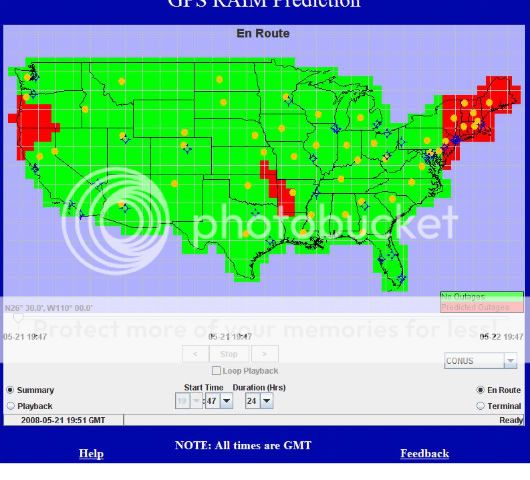
  • There is zero funding for ILS approaches--no new installations are planned. All money is going to space-based WAAS approach development.
  • Yes, NDB's are going away too--through attrition (after that initial decom sweep they made). When the units break, they aren't being fixed.
  • VORs will be go away too... that is, terminal and low-altitude VORs. The High-Altitude VORs will be kept in service. VOR counts will drop from 1200 or so currently to around 450 when they're done.
  • There is another new approach category under development, to augment our current LNAV, LNAV/VNAV, and LPV approaches, and it's called "LP". LP approaches will be "localizer precision" but without vertical guidance/advisories. Designed for WAAS-enabled receivers, you can consider them "enhanced accuracy LNAV" approaches, and thus may have lower minimums than LNAV approaches. Look for the first of these by the end of the year.
  • You can fly the new RNAV arrival/departure procedures ONLY IF you can load it from the GPS database. The primary reason for this is manual entry of the procedure does not allow you to encode the "fly-over" or "fly-by" aspect of any given waypoint. Secondary is accuracy and distraction while flying, of course.

And finally, a pop quiz on some topics, to keep this thread going, and to introduce some other interesting points:

  • Are LPV approaches considered "precision" or "non-precision" approaches?
  • The new "G" MEAs appearing in blue letters on some Victor airways--do you need WAAS to fly those altitudes, or is standard IFR-enroute approved GPS good enough?
  • True or False: All GPS approaches use LINEAR navigation, as opposed to the ANGULAR navigation of ground-based VOR and ILS/LOC approaches.
  • What is the primary differentiating factor between a "conventional" SID/STAR and an RNAV departure procedure?
 
  • Yes, NDB's are going away too--through attrition (after that initial decom sweep they made). When the units break, they aren't being fixed.
And maybe not NOTAMed OTS. DKB comes to mind. We haven't been able to get a signal there in about three different planes for a while now..
  • Are LPV approaches considered "precision" or "non-precision" approaches?
No. They're actually a third classification.
  • The new "G" MEAs appearing in blue letters on some Victor airways--do you need WAAS to fly those altitudes, or is standard IFR-enroute approved GPS good enough?
Can't categorically answer, but I wouldn't think that WAAS would be required.
 
Last edited:
TangoWhiskey said:
  • Are LPV approaches considered "precision" or "non-precision" approaches?
No. They're actually a third classification.

Correct. There are actually THREE approach categories now. Precision, Non-Precision, and APV (APproach with Vertical Guidance).

Follow-on question: Since precision approaches are also "approaches with both lateral and vertical guidance", why did they create a new APV approach category? Why are LPV's not "precision approaches"?

TangoWhiskey said:
  • The new "G" MEAs appearing in blue letters on some Victor airways--do you need WAAS to fly those altitudes, or is standard IFR-enroute approved GPS good enough?
Can't categorically answer, but I wouldn't think that WAAS would be required.

Good job, Grant. You're correct. You can use any enroute-certified GPS to navigate the lateral course defined by a Victor airway, and thus you can use the GPS MEA. Even though "normal GPS" can be hundreds of yards off on it's altitude, whereas WAAS is within a few yards, one has to remember that you're reading altitude off your ALTIMETER, not the GPS, when flying the "G" altitude. The reason they can give you a lower altitude along that route when you're navigating via GPS is you no longer have to be high enough to receive both ground-based nav aids defining the route endpoints.
 
Correct. There are actually THREE approach categories now. Precision, Non-Precision, and APV (APproach with Vertical Guidance).

Follow-on question: Since precision approaches are also "approaches with both lateral and vertical guidance", why did they create a new APV approach category? Why are LPV's not "precision approaches"?
So they aren't bundled with "precision approaches" in currency (I think the new NPRM deals with them specifically) and PTS requirements?
 
So they aren't bundled with "precision approaches" in currency (I think the new NPRM deals with them specifically) and PTS requirements?

You are correct that the new NPRM deals with them specifically--though they are pushing to get "either / or" to qualify on the practical test. I still think they should be tested separately. The SYSTEMS-SPECIFICS knowledge required to program a GPS/WAAS LPV approach and handle re-routes, missed approaches, etc. should be tested separately from the more generic "fits-all-aircraft" ILS, in my opinion.

That said, the REAL reason they aren't bundled in with "precision approaches" is not replated to NPRM or PTS requirements.

Mr. Oliver said it's because they are not coded to the 4-inch stack of TERPS requirements that apply to "Precision Approaches". Yes, "standards" for glideslope penetration do apply, but "APV" approaches are an ICAO recognized term and have different criteria. There is no way they'd be able to issue the approaches as quickly--or affordably--as they have been, if they had to adhere to the TERPS process/criteria.

Other things I forgot to mention in the initial post:

20% of the "planned" approaches get thrown out the window because of not meeting APV standards for slope penetration, missed approach capability, runway clearways, etc.

You can see the list of approaches they are working on coding for the next 12 months at http://gps.faa.gov. Here's the link for that: http://avnweb.jccbi.gov/schedule/production

For example, I can see that Mesquite (KHQZ) in the DFW area has an RNAV (GPS) RWY 17 AMDT 1 under development, scheduled for publication 9/25/08, that will bring an LPV approach to the airport.

Useful web sites:

Real-time WAAS coverage: http://www.nstb.tc.faa.gov/RT_VerticalProtectionLevel.htm

RAIM Prediction website (I'd not seen this before):
http://www.RAIMprediction.net

(NOTE: There appears to be significant enroute RAIM "outages" for the Pacific Coast (Oregon / Northern CA), Western Arkansas/Eastern Oklahoma, and the NE as I write this.

RAIM_May-21-2008.jpg


With the RAIM site, you can check for predicted (or HISTORICAL) RAIM outages based on satellite geometry or track issues. Remember that if you're wanting to shoot an approach, you'll want to set the date/time to your ETA at your destination. And, if you see a RAIM issue plotted at your destination, adjust your ETA +/- 15 minutes-30 minutes and try again--satellites are MOVING and you might get a good solution just a few minutes either way.... (i.e., have another cookie, a cup of coffee, hit the restroom, then go!).
 
Last edited:
  • True or False: All GPS approaches use LINEAR navigation, as opposed to the ANGULAR navigation of ground-based VOR and ILS/LOC approaches.
  • What is the primary differentiating factor between a "conventional" SID/STAR and an RNAV departure procedure?

Anybody want to take a crack at those last two?
 
(NOTE: There appears to be significant enroute RAIM "outages" for the Pacific Coast (Oregon / Northern CA), Western Arkansas/Eastern Oklahoma, and the NE as I write this.
That's a very cool utility.

Note that in "summary mode", a red area just means "future outage" and not "there's an outage right now", so it could denote a very brief outage occurring any time in the next 24 hours (or whatever you have the duration set to).

I think the idea here is that you take a glance in summary mode, and if you see no red, then you know you're good for the next 24 hours. If you do see some red, then you switch into playback mode, and get more specific information about when the outage will occur. If you do this, you'll see that there are actually no outages at "this moment" (when I'm typing), and that the giant red blotch across the NE is really just a 15 minute occurrence later this afternoon.
-harry
 
False: See AIM 1-1-20 (b)(2):

A new type of APV approach procedure, in addition to LNAV/VNAV, is being implemented to take advantage of the lateral precision provided by WAAS. This angular lateral precision, combined with an electronic glidepath allows the use of TERPS approach criteria very similar to that used for present precision approaches, with adjustments for the larger vertical containment limit.

Correct. LP approaches are the "new type of APV approach" they are referring to, per the 2008 FAR AIM update, 1-1-20(b)4. My understanding is that LPV approaches, already available, also act this way (true?). The needles get MORE sensitive when you approach the threshhold, just as they do with an ILS. It's a function of software implementation scaling down the sensitivity inside the FAF.

FAR-AIM update said:
4. A new nonprecision WAAS approach, called Localizer Performance (LP) is being added in locations where the terrain or obstructions do not allow publication of vertically guided LPV procedures. This new approach takes advantage of the angular lateral guidance and smaller position errors provided by WAAS to provide a lateral only procedure similar to an ILS Localizer. LP procedures may provide lower minima than a LNAV procedure due to the narrower obstacle clearance surface.
 
Last edited:
That's a very cool utility.

Note that in "summary mode", a red area just means "future outage" and not "there's an outage right now", so it could denote a very brief outage occurring any time in the next 24 hours (or whatever you have the duration set to).

I think the idea here is that you take a glance in summary mode, and if you see no red, then you know you're good for the next 24 hours. If you do see some red, then you switch into playback mode, and get more specific information about when the outage will occur. If you do this, you'll see that there are actually no outages at "this moment" (when I'm typing), and that the giant red blotch across the NE is really just a 15 minute occurrence later this afternoon.
-harry

Cool, Harry! Thanks for that additional information. I've not had time to play with it extensively yet. This seminar was the first I'd heard of it.

He (Larry) also said that with a WAAS-approved GPS, you are no longer required to check predicted RAIM availability before departure, unless the specific avionics manufacturer's POH specifies otherwise. Anybody know if that's true? I guess I'm bringing a Garmin mindset to the table, and seemed to recall they actually produced software that 430W and 530W users have to use to verify RAIM before the flight...
 
He (Larry) also said that with a WAAS-approved GPS, you are no longer required to check predicted RAIM availability before departure, unless the specific avionics manufacturer's POH specifies otherwise.

That's true. I just read that recently either in the Instrument Procedures Handbook, the AIM, or the Garmin G1000 stuff. Basically the WAAS units eliminate the need for RAIM unless WAAS isn't available, and if you need to check something you'll get a message.
 
Another thing I, and the friend I went to this event with, noticed: 98% of the folks there were very old. Where are our young ones with an interest in aviation?? If we die, this will be why.
 
What is the primary differentiating factor between a "conventional" SID/STAR and an RNAV departure procedure?

Conventional SID/STARs use waypoints based on VOR radial/DME distances.

The new "RNAV" titled procedures use strictly lat/long waypoints. The waypoint coordinates are not printed on the plate, thus part of the reason for the restriction of "you must be able to load it, by name, from your GPS database".
 
Troy,

Thanks for the posting. I wanted to attend, but was unable to make it. It sounds like there were quite a few people there. I would have been among the "older" group, but the benefit would have been the same. I have downloaded the PowerPoint and viewed the links you provided. I'm a new member to this site, but glad to be able to participate. I've recently started flying a Cherokee 6X with a 430w/530w, STEC 55x and I'm excited about learning everything I can. Thanks again for sharing.
Welcome aboard, Bob! We cater to all ages here!
 
Back
Top