JCranford
En-Route
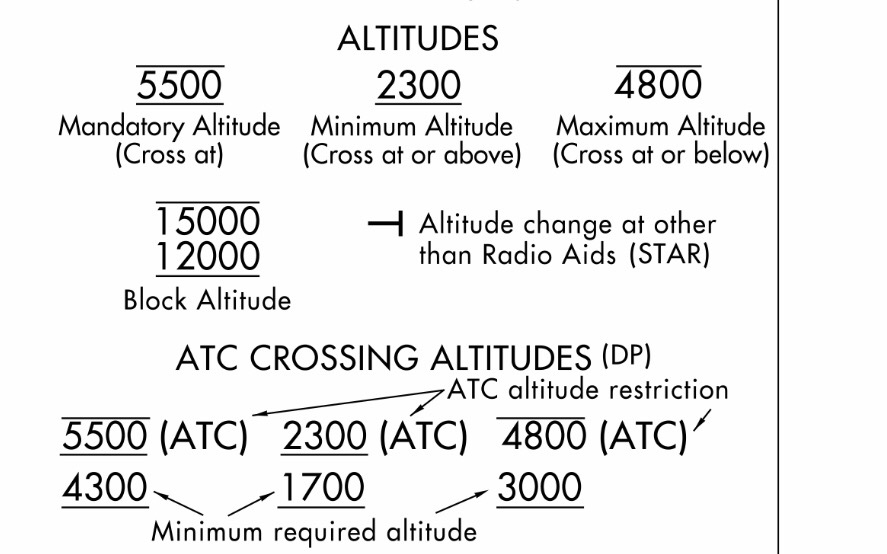
Look at the Texoma5.IRW departure from ZEMMA to IRW. The MEA is shown to be 11000. Correct?Compare that to the IFR Low chart. Nothing in the area is over about 3600.
1. Why is it so radically different than the Low chart
2. If I fly that SID I would be expected to comply with the MEA, right?
3. Why did ATC let me fly it yesterday at 5000?
1. Why is it so radically different than the Low chart
2. If I fly that SID I would be expected to comply with the MEA, right?
3. Why did ATC let me fly it yesterday at 5000?