Whats going on in the northeast? (persistant Tstorm activity)

jasc15

Pre-takeoff checklist
Joined
Apr 21, 2009
Messages
443
Location
New Jersey
Display Name

Display name:
Joe
Normally, a few days of heat and humidity are broken with a nice intense thundershower with some cooler dry air moving in from the west. We've had about 10 solid days of these conditions with daily forecast thunderstorms.

How does a weather system stick around so long? Are the air masses actually changing, just being replaced by air masses with similar properties, or is it the same airmass lingering?
 
The system is moving in from the south. Dragging all that tropical moisture with it and sharing it with us in the mid-atlantic.

I was hoping to fly to the beach tomorrow. I may have to drive :mad: or wait and fly Thursday.
 
Don't know why we have it, but I'm tired of it.:mad2:
 
The upper level plot has shown a persistent sw component for the 2 weeks - its not just the northeast but the entire eastern third of the country. It's ugly and there is nothing to move it off. Its summer - the jet is far north, and you have cooler than normal upper level air - combine warm and moist flow at low levels and coolers temps aloft and its a recipe for thunder . ..
 
I've only been in the Mid Atlantic for 8 years and I have never seen so much rain this late in the year.
 
Being a new private pilot, I generally keep my feet firmly planted on the ground on days that have "scattered thunderstorms" as a part of the forecast. Needless to say, I have not been a happy camper this last week and a half. Every. single. freaking. day!
 
The system is moving in from the south. Dragging all that tropical moisture with it and sharing it with us in the mid-atlantic.

I was hoping to fly to the beach tomorrow. I may have to drive :mad: or wait and fly Thursday.

Gary -- Delaware is the new Florida!
 
I have yet to de-winterize the sprinklers and there are mushrooms growing in my front-yard :confused:
 
Recently, I have had two cancelations and a 0.2 hour flight in my TW training due to TStorms in SW OH. Still managed three good 1.0 days in between.;)

Cheers
 
I've managed 0.5hrs in the last 4 weeks. :le sigh:
 
I've been waiting almost two weeks to schedule my solo long x-country. Weather is definitely NOT my friend right now, but I'm certainly not going to risk any "scattered thunderstorm" activity on my first long x-country - especially if my CFI isn't riding right seat... Ugh.
 
its insane this weather on my way home saw huge black clouds, starting pouring like crazy then stopped 2 minutes later, then drizzled by the time i got home after canceleing a big lesson for me it cleared up compeltly now again cloudy.
 
The upper level plot has shown a persistent sw component for the 2 weeks - its not just the northeast but the entire eastern third of the country. It's ugly and there is nothing to move it off. Its summer - the jet is far north, and you have cooler than normal upper level air - combine warm and moist flow at low levels and coolers temps aloft and its a recipe for thunder . ..
The jet stream is way south.
 

Attachments

  • JetStream-7-3-2013.bmp
    273 KB · Views: 26
Bermuda high off the coast and a trough transporting Gulf of Mexico moisture up here with Precipitable Water(PWAT)= 1.5-2".
 
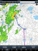
That same big scale effect has been causing lines of t-storms to march down north to south along the Front Range on and off for a couple of weeks. They don't have much moisture, but they're traveling north to south which is very odd for around here.

Start up near Wyoming and continue on south by southeast for a long way.

Throwing the NWS office for a loop around here a bit. Predictions are way off and mix in the new radar toys and they're botching it pretty good.

The NWS alerts for "1" hail" are completely bogus right now. It's either all melting before hitting the surface or wasn't ever there to begin with. Only one storm with that warning has actually produced hail, and that was in Boulder a few days ago.

That or we have a newbie doing the radar warnings... Hahaha. Who knows...

In the unpopulated areas, NWS does a lot more estimates by radar than in the past and the continual theme is "Spotter activation is not needed" almost every day...

At least when spotters are out, they get accurate ground-level intel.

I'm geeking out lately on the alert system... And wondering why the SAME code and alerts for Elbert County aren't broadcast on the WNG550 Franktown transmitter on 162.450 MHz.

I receive it much better than the Denver KEC76 162.55 or Deer Trail WXJ45 162.500 (which is only 100 W and further out East). Denver is blocked by a ridgeline and weak, Deer Trail would be okay with a 300 W transmitter out there but is just a little over 12 dB SINAD here by ear... Good enough for the SAME decoder but the background white noise is annoying, when Franktown is nearly full-quieting.

I told you I was geeking out about it. :)

http://www.nws.noaa.gov/nwr/CntyCov/nwrCO.htm

http://www.nws.noaa.gov/nwr/Maps/PHP/site.php?State=CO&Site=WNG550

http://www.nws.noaa.gov/nwr/Maps/PHP/site.php?State=CO&Site=KEC76

http://www.nws.noaa.gov/nwr/Maps/PHP/site.php?State=CO&Site=WXJ45
 
Agreed. Enough of this nonsense. It's due to the jet stream being so far south. I have a VFR trip from NY to FL planned for next week. From the looks of things, it's a good thing I have a backup reservation in the human mailing tube...
 
Agreed. Enough of this nonsense. It's due to the jet stream being so far south. I have a VFR trip from NY to FL planned for next week. From the looks of things, it's a good thing I have a backup reservation in the human mailing tube...

Maybe that Burmuda high will shift West and clear the way down the coast for your trip.
 
We will just have to get used to flying like they do in Florida fly early in the morning before the convection builds.
 
We will just have to get used to flying like they do in Florida fly early in the morning before the convection builds.

Right in that window after the fog clears and the thunderstorms fire up.

The thing with this weather pattern has been that I have seen convective activity at 5 in the morning :confused:
 
I don't know, but it seems a lot more active than normal for sure. Did a trip this weekend from OH to NC and back this weekend. Sheesh I was glad it was over.
 
A lot of systems are being held in place. Around St. Louis, we've had a low just sitting here for days.

Could be systems are becoming longer lasting -- like the Great Red Spot of Jupiter, they may hang around for 400 years.
 
I don't know, but it seems a lot more active than normal for sure. Did a trip this weekend from OH to NC and back this weekend. Sheesh I was glad it was over.

You may have flown over my place. You like that tropical air huh? How was visibility? Did visibility improve at the normal 5-10,000' range with a transition line at that level? Glad you made it back safe.
 
A lot of systems are being held in place. Around St. Louis, we've had a low just sitting here for days.

Could be systems are becoming longer lasting -- like the Great Red Spot of Jupiter, they may hang around for 400 years.

I think I read global warming is causing the Bermuda high to move further West and persist longer. I know we are sick of monsoon season. My garden and honeybees too.
 
You may have flown over my place. You like that tropical air huh? How was visibility? Did visibility improve at the normal 5-10,000' range with a transition line at that level? Glad you made it back safe.
Flew right over your place. Visibility was zero. 5.9 total time and 5.5 actual instrument. 2 approaches and a two year old in the back laughing, saying "do it again daddy!" :rolleyes:

Weather on the stratus made all the difference, but coming back into OH yesterday on the back side of the storms was-interesting.
 
I noticed that the N-S line of rain/storms shifted east quickly at one point during the day Saturday. I bet the yellow and red scattered throughout kept you from getting bored. I heard 1-2 small planes out yesterday and 5-6 today.
 
Thats good, Isn't that M's first flight?
Yea it was. She was so excited, it was all she talked about before we got there. Told everyone she was going in an airplane. :D She did get bored sitting there for a few hours, but it think it went well.
 
I've found so far that local flights are fine, but she will turn on you quick.
 
Here ya go from Saturday. :mad:
 

Attachments

  • Weather.PNG
    Weather.PNG
    371.5 KB · Views: 24
Back
Top