ARFlyer
En-Route
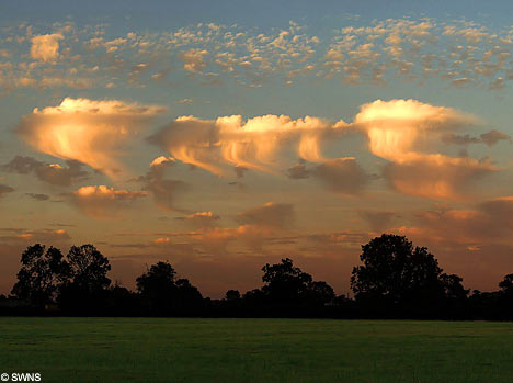
I have noticed over the past few weeks an uptick in Altocumulus Castellanus clouds. These clouds are also know by their name Jellyfish Clouds. From what I have read, they occur in a moist section of the atmosphere trapped between two dry layers. I have also read that these clouds are rare, since specific atmospheric conditions must be met for them to form.
I had never noticed them before last month when I saw some over Northwestern Arkansas. Since then I have seen them at least three more times, including this
morning.
So is there a reason for the increase in sightings of these apparently rare clouds?
I had never noticed them before last month when I saw some over Northwestern Arkansas. Since then I have seen them at least three more times, including this
morning.
So is there a reason for the increase in sightings of these apparently rare clouds?

 Well at least you are honest!


