The Driving Activity Reporter GPS

jkgoblue

Pre-takeoff checklist
PoA Supporter
Joined
Sep 16, 2008
Messages
346
Location
Sands Point, NY
Display Name
John K.
Home Airfield
Islip, NY
Saw this in the Hammacher Schlemmer catalog and thought this would be a great thing in the cockpit. I wonder it it would report your altitude accurately?

http://www.hammacher.com/Product/76467

Looks like a easy solution to tracking your long XC flights (right to Google Earth!) without a lot of effort.
 
No raw GPS reports altitude accurately...that's why AIM 1-1-19 says ""GPS derived altitude should not be relied upon to determine aircraft altitude since the vertical error can be quite large and no integrity is provided."

Bob Gardner
 
Saw this in the Hammacher Schlemmer catalog and thought this would be a great thing in the cockpit. I wonder it it would report your altitude accurately?

http://www.hammacher.com/Product/76467

Looks like a easy solution to tracking your long XC flights (right to Google Earth!) without a lot of effort.

Unless you were maybe an FBO or CFI that wanted to know where the student and/or rented plane went. how would this bring you anything you don't alreadt get with the breadcrumbs in your handheld (or panel) GPS?
 
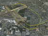
I just thought it was an easy way to map your flight without having to go through a whole process of extracting it from you panel mounted GPS. And since it is meant for cars, I was wondering if it was show your altitude so that it would give you a picture sort of like this:
 

Attachments

  • 5244-Picture2.png
    5244-Picture2.png
    1.1 MB · Views: 12
You might want to look at this: http://photofinder.atpinc.com/how.html

It's about half the money and appears to do more than the H$ device. I am evaluating a sample right now for a SAR photo application. It does provide both GPS altitude and direction-of-travel though I don't know if Google Earth KML can use either of those parameters. Photo tagging is fairly standard EXIF (http://en.wikipedia.org/wiki/Exif) though I am seeing some wrinkles I don't yet understand.

Fiightprep ChartCase, and probably others, will also show your flight directly on georeferenced charts and plates. That's great fun after flying practice approaches and holds, especially if you were the right-seater and not the victim!
 
Back
Top