eetrojan
Pattern Altitude
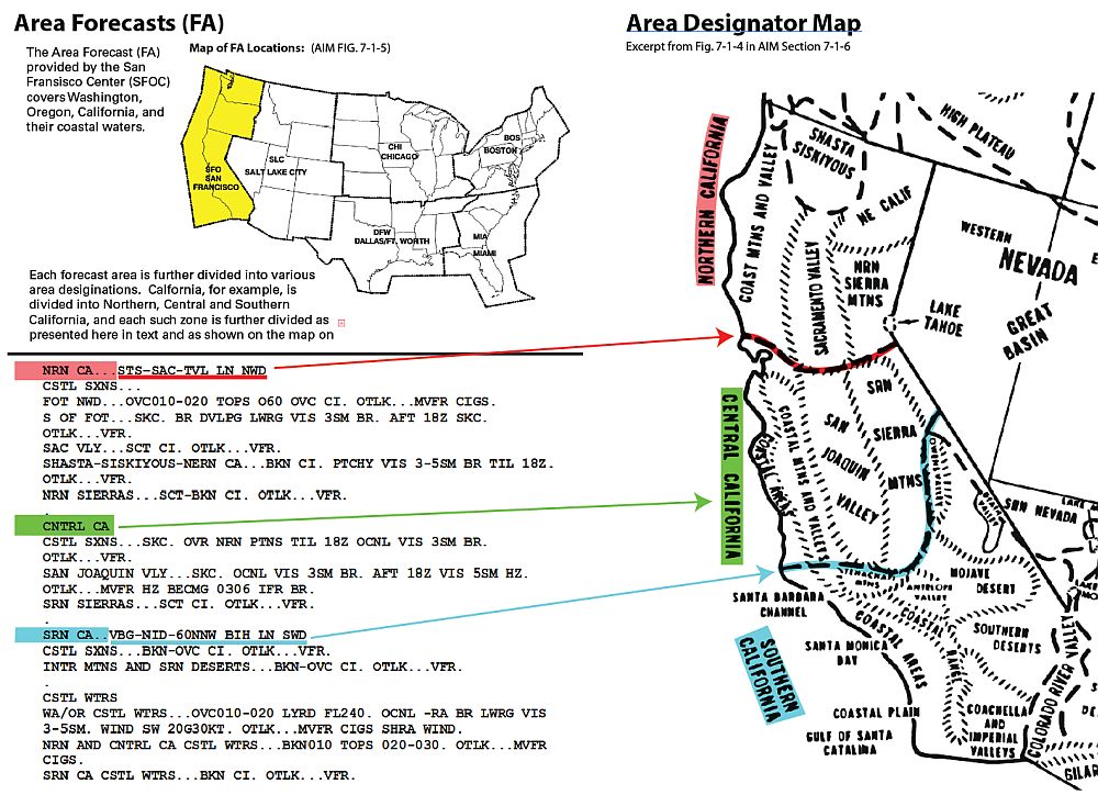
Hi all, during my final stage check (I passed!), the senior instructor walked through the weather briefing I got from duat.com. The first part of the briefing is a standard Area Forecast and she seemed genuinely disappointed that I had never precisely figured out exactly where the borders were between Northern, Central, and Southern California.
I know this is almost certainly overkill, but I’d like to understand. So, I found what appears to be some relevant maps from the AIM, looked at the area forecast from my WX report, and drew the diagram below to try to figure it out.
What I think I’m seeing is that there is a connect-the-dot like description of the bottom of “NRN CA” (the red line) and the top of “SRN CA” (the blue line). In other words, the top of my home Southern California area is described as:
“VBG-NID-60NNW BIH LN SWD”
Where,
VBG = Vandenberg AFB
NID = China Lake NAWS
BIH = Eastern Sierra Regional Airport, Bishop, CA
How do I read this phrase in English?
In practice, do I decode this phrase by creating a line (“LN”) by regarding the airports (or perhaps VORs) as dots to be connected, and then regard everything “SWD” from that line as the area? Or something else?
Should it look like the dashed line that I colored blue from AIM Fig. 7-1-4? It’s in the ballpark, but doesn’t seems to work, especially the part where I’m supposed to go “60NNW” from NID before dealing with BIH.