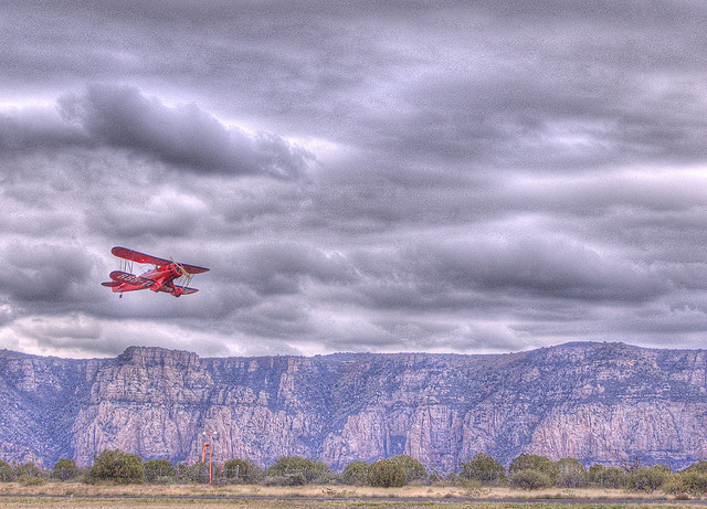
Sedona

maggot

Filing Flight Plan
Joined
Jan 16, 2011
Messages
21
Display Name

Display name:
maggot
I am in West Virginia considering a VFR flight to Sedona and back this mid February. I have not flown in the west mountains before. Do I need any special mountain flying training for this trip ? Does anyone have a suggested route to avoid any high mountain hazards ? Any thoughts or advice is welcome. I will be in a 180 HP C172.
Thanks, Steve
 
Last edited:
I wouldn't consider Sedona in the mountains. The highest peak/s you would see enroute is the Sandias near ABQ. No special training is needed. If you go north towards Colorado then you are getting into some foothills and I would consider reading up on mountain flying. I don't know what you have for mtns in West VA though.
 
This time of year, the worst part about going to Sedona is landing on the "carrier top mesa" that the airport sits on (and forgetting the key code to get thru the gate from the FBO back to the ramp).
Your highest terrain will probably be between Grants and Black Rock (by Gallup) in NM, otherwise clear sailing.
If you are going OVER the ABQ Class-C, they prefer you do it at 10,500, but otherwise it's a non-issue.
Concerns with turbulence really don't start until mid to late March. February is a good time to make the journey.
Enjoy the scenery -- especially around the Painted Desert, Mogollon, and the Sedona area.
 
You don't need any special mountain training for that trip. Watch your speed on final - lots of folks have come in hot and consequently overshoot the runway/go off the end. Watch the winds at SEZ- can sometimes get squirrely. And make sure you properly lean your mixture before takeoff. The DA won't be super high that time of year, but it is still probably higher altitude taking off than you might be used to.
 
Find I-40 and follow it until about Winslow. Note ground elevation for any fuel stops. Note OAT and resultant density altitude (shouldn't be too bad in Feb.). Lean for max power prior to departure when appropriate. If you're uncertain about leaning for max power, discuss with a CFI at some high (~5000'+) elevation airport. Fly your indicated airspeeds on departure and landing. Your TAS at 5,000' will be a little higher than you are used to so you might feel that you're too fast.

The 180 hp 172 is a decent aircraft for the altitude required for the trip. Fuel planning requires a little care as always (watch the headwinds on the trip out).

Lots of open spaces and good visibility out here, enjoy the trip. Mind the fronts when they come through...
 
Just pass the mountain on the upwind side.

Are you comfortable at 8500 MSL? Which would be 1500 AGL over the continental divide.

Look at the chart. Look at the MEAs and restricted areas. MOAs are not a problem to go through.

Radar will lose you in areas below 9000 MSL. Watch for weather. We can have isolated snow showers that can be flown around.

Sedona is not really mountainous. Most of the airports in New Mexico are around 5000 to 6500 MSL, and the same going into Arizona, so be sure to be familiar with leaning on the ground. Hard to miss seeing the big mountain north of Flagstaff though. The airport is on a mesa so it will be like landing on a very oversized aircraft carrier.

I live in northwest New Mexico so feel free to ask any questions.
 
I agree with everything said here but let me be a bit contrarian; for an eastern flier, the western part of this trip will feel like foreign territory. Nothing out there feels like WV or anywhere in the east.

No actual problem with the territory involved - mountains aren't too high unless you plan legs around some but everything is higher than you are used too. You can encounter heat and snow on a single leg - that never happens back east. There are some longer distances between fuel stops than you are used to. The terrain can look landable when it isn't. Storms can be stronger, winds tend to be stronger and low level turbulence at midday is stronger. Carry water for emergencies and drink some of it while flying.

However, you are going at a near ideal time of the year which means little of the above may be experienced.... and the Grand Canyon is nearby.
 
Last edited:
Visually, it will be different from what you've experienced in the WV mountains. But operations at Sedona are pretty standard unless you're overloaded on a hot day. It's an absolutely gorgeous place.
 
I visited Sedona last year by car and a few days before I arrived a Mooney went off the end of the runway. Thankfully nobody was hurt but the plane was destroyed. He landed during the very frequent shift in the wind and attempted to go around but sank, sank sank. There's a video of the incident out there.

By the way, I highly recommend the airport restaurant.

Great place to fly around but do be careful.
 
Find I-40 and follow it until about Winslow. Note ground elevation for any fuel stops. Note OAT and resultant density altitude (shouldn't be too bad in Feb.). Lean for max power prior to departure when appropriate. If you're uncertain about leaning for max power, discuss with a CFI at some high (~5000'+) elevation airport. Fly your indicated airspeeds on departure and landing. Your TAS at 5,000' will be a little higher than you are used to so you might feel that you're too fast.

The 180 hp 172 is a decent aircraft for the altitude required for the trip. Fuel planning requires a little care as always (watch the headwinds on the trip out).

Lots of open spaces and good visibility out here, enjoy the trip. Mind the fronts when they come through...

:yeahthat:
Pick up I-40 in NM to at least Winslow. The self serve pumps at Winslow are hidden behind the airport terminal building. There was a great Mex resturant there.

The ABQ airspace is a non issue, just talk and squawk.

180HP C-172 should be a great plane for the trip in winter.
Sedona is a great place to visit. Thought of retiring there, but there is snow in the local hills in winter.
 
Did a trip by car,stayed in a cabin at the airport,the restaurant on the field was excellent. can't wait to fly there in the future.
 
I agree with everything said here but let me be a bit contrarian; for an eastern flier, the western part of this trip will feel like foreign territory. Nothing out there feels like WV or anywhere in the east.

No actual problem with the territory involved - mountains aren't too high unless you plan legs around some but everything is higher than you are used too. You can encounter heat and snow on a single leg - that never happens back east. There are some longer distances between fuel stops than you are used to. The terrain can look landable when it isn't. Storms can be stronger, winds tend to be stronger and low level turbulence at midday is stronger. Carry water for emergencies and drink some of it while flying.

However, you are going at a near ideal time of the year which means little of the above may be experienced.... and the Grand Canyon is nearby.


Oh, yeah, huh!

Also different --- don't be surprised to be somewhere during your trip, that if you HAVE to let down in an emergency, the NEAREST inkling of ANY civilization may be LITERALLY no closer to you than 100 nm in any direction (and Cell Phones will have ZERO bars, and don't even remotely think about Wi-Fi -- private or public --- maybe no radio reception once on the ground --- VHF or even broadcast. Satellite phones are good insurance as are gallons of spare water). MRA's are frequently in the 5-digit altitudes, so don't sweat the small stuff. And don't plan on doing any flying or climbing with your mixture firewalled
 
What type of camera did you use there ?

Contour +. This was the Nflightcam before they moved to GoPro. It is an excellent camera with a neutral density filter to help with the prop distortion issue.
 
Also different --- don't be surprised to be somewhere during your trip, that if you HAVE to let down in an emergency, the NEAREST inkling of ANY civilization may be LITERALLY no closer to you than 100 nm in any direction (and Cell Phones will have ZERO bars, and don't even remotely think about Wi-Fi -- private or public --- maybe no radio reception once on the ground --- VHF or even broadcast. Satellite phones are good insurance as are gallons of spare water).

In an emergency, don't forget about 121.5 - I had an issue in the middle of the Sahara desert in a 182 and managed to raise a British Airways flight that was overhead using that frequency. Bound to be a lot more airline traffic around the Western USA who'd be happy to assist than there was in the Sudan!
 
On that route you're only going to know you crossed the continental divide because it says so on the map.
 
'Sounds like a Flying Adventure you'll remember for life. Short flights from Sedona: Grand Canyon, Lake Powell, Monument Valley, Bryce, Meteor Crater and more. I have to agree, Sedona isn't "Mountain Flying"... but it's in the mountains, so watch winds and DA.
 
On that route you're only going to know you crossed the continental divide because it says so on the map.


:) Same thing applies when you drive the route. Variation in topography is next to non-existent
(but they do place road signs to tell you "Continental Divide")
 
A few years ago a couple crashed a 172 about 10 miles from Sedona. It took them two _years_ to find what was left of them. So yeah, there is a lot of unpopulated area.
 
JHhT1Kn.jpg


Taken from the airport cafe.
 
Today , 07009G20KT pilot was trying to land 21. it was a mess, just don't be that guy and you will be fine.
 
Did a trip by car,stayed in a cabin at the airport,the restaurant on the field was excellent. can't wait to fly there in the future.
I did that too. Loved it there. I wasn't a pilot then, but it's on my list to fly there some day.
 
If for some reason you can't get into Sedona, KPRC is close by with a 5000' runway at 5000 MSL. If you are a riddle alumni, they will let you park on their ramp for free if they have room. Just call before hand and let the flight line know if you are in the area.
 
If for some reason you can't get into Sedona, KPRC is close by with a 5000' runway at 5000 MSL. If you are a riddle alumni, they will let you park on their ramp for free if they have room. Just call before hand and let the flight line know if you are in the area.

Actually the Prescott long runway is 7600 ft long while the smaller parallel is 4800 and the crossing runway is 4400 ft.

I've been trying to get to Sedona as well. One of these days I'll get there.
 
Last edited:
Thanks everyone for the replies. As far as following I-40, is that for elevation sake, and or for staying near civilization ? Maybe I should follow 40
;)beyond Winslow to Flagstaff and then down ? Is 8,500 comfortable in that area ? I'll have to swing south of ABQ to maintain airspace and terrain clearance at 8,500. O2 is probably a good idea for sustained flights at 8,500 ?
Thanks again.
 
Actually the Prescott long runway is 7600 ft long while the smaller parallel is 4800 and the crossing runway is 4400 ft.

I've been trying to get to Sedona as well. One of these days I'll get there.

Huh. I remember a 5045x75 runway as the long one with the shorter one at 3500x45. It has been since 2006 since I flew there. I am probably wrong.
 
In an emergency, don't forget about 121.5 - I had an issue in the middle of the Sahara desert in a 182 and managed to raise a British Airways flight that was overhead using that frequency. Bound to be a lot more airline traffic around the Western USA who'd be happy to assist than there was in the Sudan!

Flying a 182 in Sudan? Sounds interesting. I've flown a 182 around southern African - Mozambique, Malawi etc, but it would seem much more logistically difficult in a place like Sudan. When I was in Sudan it was all by road... fantastic place to travel tho!
 
Thanks everyone for the replies. As far as following I-40, is that for elevation sake, and or for staying near civilization ? Maybe I should follow 40

;)beyond Winslow to Flagstaff and then down ? Is 8,500 comfortable in that area ? I'll have to swing south of ABQ to maintain airspace and terrain clearance at 8,500. O2 is probably a good idea for sustained flights at 8,500 ?

Thanks again.


I think I'm going to answer a question with two questions, because if you don't know the answers to these, you should not be attempting long cross country flight planning without a significant refresher and some assistance from a CFI.

What do the blue numbers scattered around on this chart mean, and what does the tan coloring of the chart topography mean?

a2285bca8f6a9b8baf8a2f0033b0d0d6.jpg
 
Thanks everyone for the replies. As far as following I-40, is that for elevation sake, and or for staying near civilization ? Maybe I should follow 40
;)beyond Winslow to Flagstaff and then down ? Is 8,500 comfortable in that area ? I'll have to swing south of ABQ to maintain airspace and terrain clearance at 8,500. O2 is probably a good idea for sustained flights at 8,500 ?
Thanks again.

I just use I-40 to describe the general route - it's easier than typing in VORs or some other descriptor. That said, it never hurts to be near civilization/cell phone signal if one has to arrive off airport. The interstates have fairly good cell phone coverage these days. It's also mighty considerate of one to deposit one's aircraft where any potential helper can drive right up to it if one must leave the aircraft somewheres between airports.

Another reason to follow a road is simple navigation. The magenta line is wonderful and generally one can follow it without ever raising ones eyes to the porthole. Some of us like to look out of the porthole to view the countryside - sorta be a sight seer ya might say. While sightseeing it might be beneficial to verify the navigation just in case that silly magenta line decides to take us somewhere other than our desired destination. Of course no one ever mis-programmed the silly magenta line so we don't need to worry about it or the minuscule chance that some dirty rotten bastard fouled the GPS.

As far as O2 goes, well the average airliner maintains an 8,000' cabin. So as long as you're okay on an airliner you'll be okay in your aircraft. OTOH if you're going to be flying at night the O2 will help. Don't fly over the mountains at night.
 
Last edited:
Thanks everyone for the replies. As far as following I-40, is that for elevation sake, and or for staying near civilization ? Maybe I should follow 40
;)beyond Winslow to Flagstaff and then down ? Is 8,500 comfortable in that area ? I'll have to swing south of ABQ to maintain airspace and terrain clearance at 8,500. O2 is probably a good idea for sustained flights at 8,500 ?
Thanks again.

Other than around Mormon Lake, 8500 is going to be fine. A quick hop up to 9000 or so should get you in just fine. I wouldn't bother with O2, but when I lived there, I was living at 7000 ft. I would regularly be at 11500 without O2 (for less than 30 min). Not that big of a deal.
 
Thanks everyone for the replies. As far as following I-40, is that for elevation sake, and or for staying near civilization ? Maybe I should follow 40
;)beyond Winslow to Flagstaff and then down ?

I recall leaving Amarillo and following I-40 "airport to airport" for quite some distance on the way to Page.
 
I spent 5 hours between 8,500 and 9,500 and found it difficult to remember the name of the airport on departure.
I felt somewhat euphoric.
It appeared to me I had the symptoms of hypoxia.
I live at 300 feet MSL so I am not acclimated to the higher altitudes.
I have had several TBIs so I am predisposed to hypoxia.
I often follow roads so if I survive an emergency landing I won’t perish walking out.
 
I live at 5,000 ft so flying at 11,500 for hours doesn't bother me but I think it is great you guys are flying smart and using O2 well before where one legally must.
 
Back
Top