Route advice: KSMX-KRNO VFR

farmrjohn

Pre-takeoff checklist
Joined
Mar 26, 2018
Messages
405
Display Name

Display name:
farmrjohn
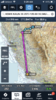
I'd like to fly VFR in an Alon A2 from Santa Maria (KSMX) to Reno (KRNO) and am considering this routing: KSMX to KJAQ to refuel. Then from KJAQ over Donner Pass via KGOO, KBLU, and KTRK then on into Reno. The return leg would be the reverse. Planned altitudes would be 11500 east bound and 10500 westbound, and either direction a no go with strong winds or any type of low level clouds or convective activity over the Sierras. Does this sound doable or is there another way to get to Reno other than commercial or with a different plane,?
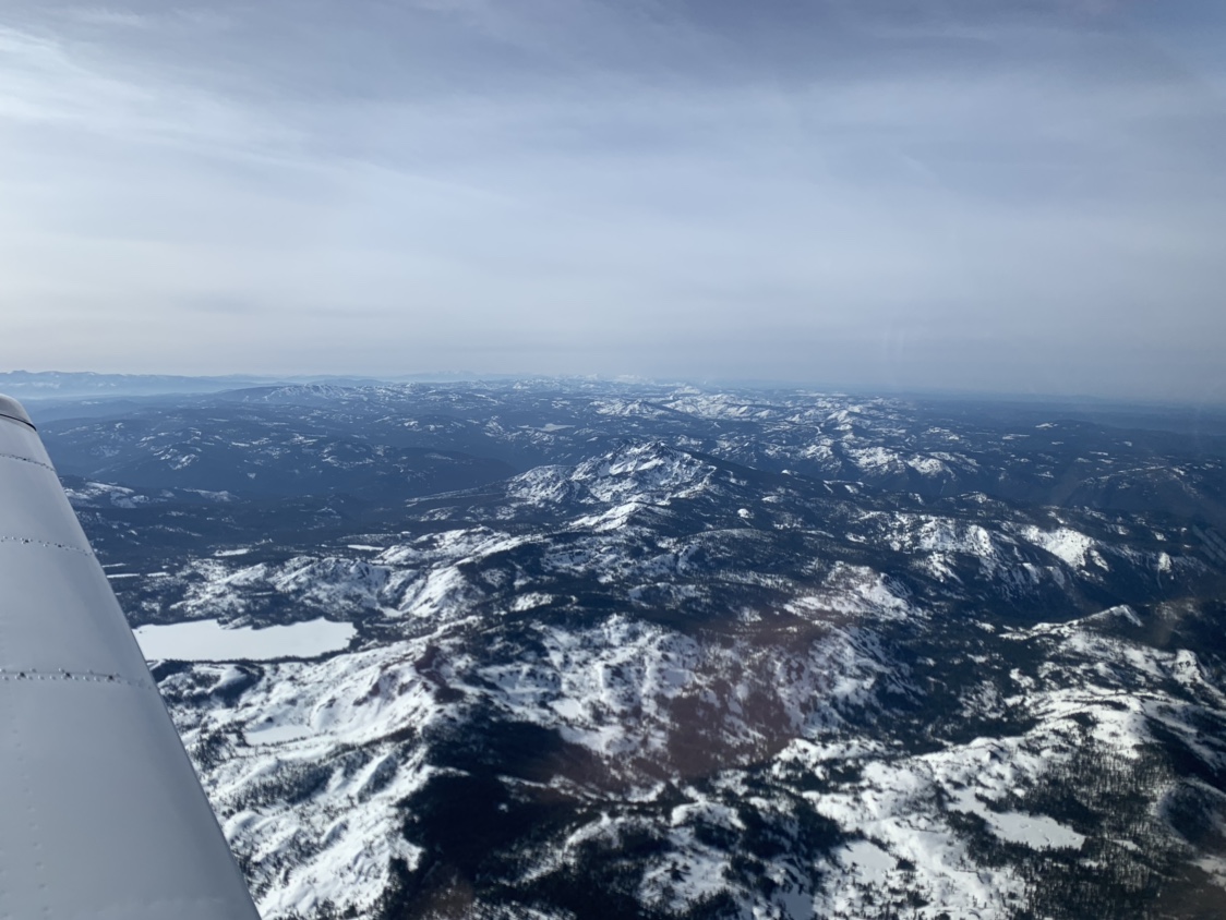
 
I would be mindful of ridge top wind speeds. I’ve been caught in downdrafts in the Sierras in a 160 warrior that it couldn’t overcome. Turn 180 and try another place.
 
I’d go IFR.....that’s I80.
 

Attachments

  • 9B26FE69-DAE6-430E-BBF3-73CEC858F205.png
    9B26FE69-DAE6-430E-BBF3-73CEC858F205.png
    2.1 MB · Views: 30
What's your planned TAS, and how do-able is your 11,500 altitude?

90 Kts, Do-able but not instantaneously.

Why not add 100 miles and go KSMX-KIYK-KBIH-KRNO?

On a more serious note, make sure you pay attention to density altitudes and ridgetops winds. Do you have oxygen? Pulse ox? Not a trip I would recommend without some mountain flying experience.

I looked up that model...with a service ceiling of 13k and a ROC of 550 FPM you better have some good instruction before you go mess around in the mountains.

Getting to Bishop is not an issue, and I'd skirt a little further south to get there. I'm not sure about the leg from Bishop to Reno paralleling the ridge lines if the winds were from the west.

No oxygen. I'm quite aware of the interaction of winds and terrain and associated turbulence and downdrafts, hence my limitation of light winds and no clouds. Forgot to mention of course no sigmets either.

I’d go IFR.....that’s I80.

That's basically what I was looking at with the airports as known "bail out" spots.
 
Last edited:
ECBDEB97-B1F3-4B0C-AB17-E32DAA13B8DE.png I usually take something similar to this. It leaves me a lot of outs, you can always make it to hwy 50 or an airport if something goes south
 
What altitude do you use? A couple of those peaks top out over 9000'.

I tend to fly higher than most, 12+ depending on direction. There are a couple of saddles towards south lake, one is by heavenly valley ski resort. You don’t need that much altitude to get through them but I prefer the options of longer glide and turbulence avoidance. Using the glide distance rings on foreflight and taking that route I have many options if the noise maker quits.
 
Plastic cigar, how’s the turbulence in the Owens valley? Someone told me it always seemed bad to him but he never told me what the winds were when he went thru there.
 
It’s not uncommon to go to Hangtown, follow I50, then take that pass just SE of TVL to get into the lake. I just drove on I50 a couple of weeks ago and I remember thinking that there really aren’t a lot of great places to land. I usually fly up the Owens valley, stop in Bishop and then land at MEV when I go to Tahoe. Easier to get into then TVL. I had some uncomfortable experiences with my dad’s 200 HP Arrow in the mountains and I probably wouldn’t try it without good mountain flying instruction. There are some instructors in Minden. I guess the whole thing depends on how badly you need to go. With the perfect weather, it’s certainly possible. If you have bad weather or a mechanical problem, you may be wishing you hadn’t gone.

Making the trip is not a super high priority. If the weather conditions are not spot-on conducive it's a no-go for sure. The mechanical possibility with the single engine is the most worrisome so I'd like to minimize my time over the "rough terrain" with few options if the engine conks out.

I tend to fly higher than most, 12+ depending on direction. There are a couple of saddles towards south lake, one is by heavenly valley ski resort. You don’t need that much altitude to get through them but I prefer the options of longer glide and turbulence avoidance. Using the glide distance rings on foreflight and taking that route I have many options if the noise maker quits.

I use the distance rings on FltPlanGo for gliding distance contingency planning. Unfortunately the Alon glides like a well thrown rock.
 
Every time I fly I’m crossing the Sierra in that area. I always use hangtown as a waypoint. And I’m either 11.5 or higher. If you get much lower than that you’ll get bumped around.

Here’s Friday’s flight to Sac.

I agree with the sentiment “not many places to land”


611b7dcf98bac8863fbd9371f2a1ad9f.jpg
 
Nice to see there is still a decent snow pack from a water supply point of view. I'm evaluating the glide vs. terrain clearance from the equal time points between airports for the two routes coming from the west side. Unfortunately my plane won't go high enough to eliminate the gaps in gliding capability to a field.
 
I usually take something similar to this. It leaves me a lot of outs, you can always make it to hwy 50 or an airport if something goes south

US 50 is not exactly the straightest road there.
 
US 50 is not exactly the straightest road there.

Yep, but if you have to put it down at least people will be able to find the wreckage easy:) If you fly high enough you will have other options most of the flight.
I have friends that fly to Nevada over the worsts areas possible with no outs what so ever. That’s not for me.
 
Back
Top