jasc15
Pre-takeoff checklist
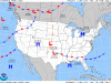
It's quite gusty in northern NJ today. I work a stone's throw from KTEB, and the METAR naturally indicates this. However, when I decided to check the prog chart to see what it looked like, I didnt see anything that would suggest high winds in the area. The pressure gradient looks fairly typical. Am I missing something?
Attachments
Last edited:
