Dav8or
Final Approach
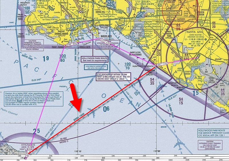
The other thread about the guys ditching on their way to Catalina got me to thinking about the safest way to get there. I calculate that if I flew my Mooney from San Pedro there and back and I went at 8500' out (with Bravo clearance) and 7500' return, that I should always be with glide distance of either KAVX, or land in San Pedro, even with a head wind. On departure from KAVX, I would circle overhead the airport until reaching 7500' and then cross.
Does this make sense? Do other people do this?
Does this make sense? Do other people do this?
 BTW, if you're in a 182 and you land long, DON'T get on the brakes, the 'speed bump' about 1/3rd of the way up the runway has collapsed more than a few 182 nose gears from guys standing on the brakes not realizing that there was another half of the runway they couldn't see. My boss at the CRS at LGB used to have me store a 182 prop in my apartment on the island for that purpose.