azpilot
Line Up and Wait
- Joined
- Jul 27, 2015
- Messages
- 821
- Display Name
Display name:
azpilot
I have a general flight planning question here. If I am planning a flight from PHX to SLC, what do I do about the grand canyon and the mountains in Southern Utah and Norther Arizona? There are a few different general routes I am looking at. (Just so everyone knows, I am going to do a mountain flying course before I attempt this.)
1) Stay to the West, get a bit closer to Las Vegas. Avoid the Grand Canyon and then stay to the West of the Mountains in Southern Utah. This would add about 80 to 100 nm over the direct path.
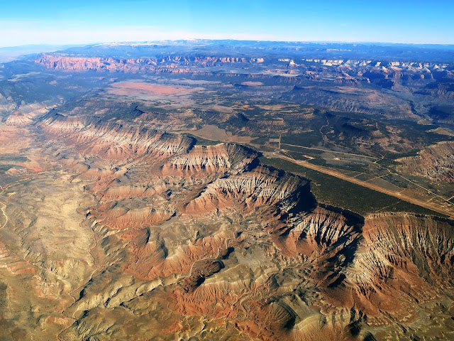
2) Stay to the East of the grand canyon. Stay to the East of the mountains in Southern Utah and cut over back to the West side at the I-70 interstate. This would be just pass the Hanksville Vortac. This end up being about 40 nm farther than direct. This seems like a great idea until I would have to transition the mountain pass. The bottom of the pass is about 7,500 feet or so, but the peaks are over 11k on both sides.
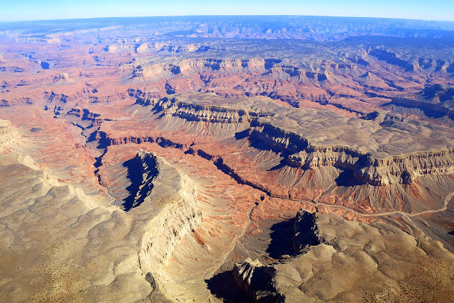
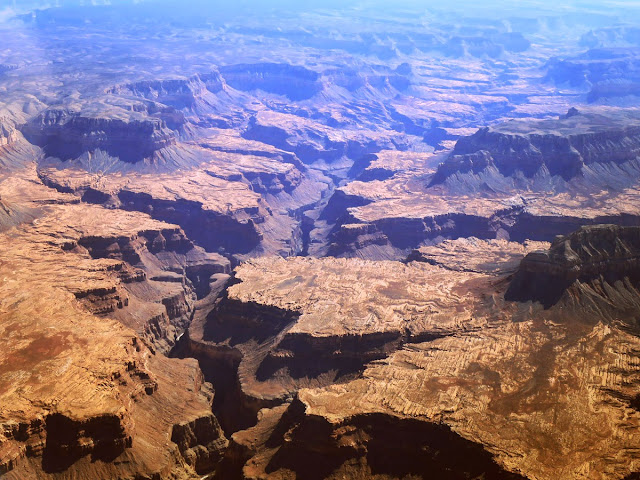
3) Fly right over the grand canyon. It looks like the Tuckup transition would work best for me. I'll admit, this seems pretty cool, and it ends up being the shortest route (of these three) at about 35 nm farther than direct. I'd get on the North side of the canyon, wave to the polygamists in Colorado city, then head towards cedar city and stay to the West of the mountains all the way North. This seems like the best option to me.
Any thoughts? This flight would be in an Archer III.
1) Stay to the West, get a bit closer to Las Vegas. Avoid the Grand Canyon and then stay to the West of the Mountains in Southern Utah. This would add about 80 to 100 nm over the direct path.
2) Stay to the East of the grand canyon. Stay to the East of the mountains in Southern Utah and cut over back to the West side at the I-70 interstate. This would be just pass the Hanksville Vortac. This end up being about 40 nm farther than direct. This seems like a great idea until I would have to transition the mountain pass. The bottom of the pass is about 7,500 feet or so, but the peaks are over 11k on both sides.
3) Fly right over the grand canyon. It looks like the Tuckup transition would work best for me. I'll admit, this seems pretty cool, and it ends up being the shortest route (of these three) at about 35 nm farther than direct. I'd get on the North side of the canyon, wave to the polygamists in Colorado city, then head towards cedar city and stay to the West of the mountains all the way North. This seems like the best option to me.
Any thoughts? This flight would be in an Archer III.