TangoWhiskey
Touchdown! Greaser!
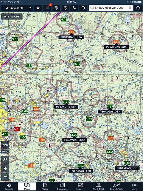
I have a Phillips 66 AvGas card, but their "WingPoints" app is awful for finding a location that is along your route of flight. So, I emailed their support, and they sent me a dump file of all airport codes and FBO's that carry Phillips 66 avgas. I imported the list, cleaned it up to match ForeFlight's import requirements, and wrote some VBA scripting to iterate over the airport ID's, retrieve their lat/longs online, and reformat them to ForeFlight import requirements. This created the attached "user_waypoints.txt" file, which is what users will need to import the file per ForeFlight's instructions, which are here. Note that you'll need to rename the file as user_waypoints.csv; our board software doesn't allow .csv files, but does all .txt files.
Here's what it looks like in ForeFlight, with the User Waypoints layer turned on, and with the User Waypoints and 100LL Fuel Prices layer turned on:
More screenshots: https://flic.kr/s/aHskmdjxuZ
Feel free to use it if you're a fellow Phillips 66 card user.
Here's what it looks like in ForeFlight, with the User Waypoints layer turned on, and with the User Waypoints and 100LL Fuel Prices layer turned on:
More screenshots: https://flic.kr/s/aHskmdjxuZ
Feel free to use it if you're a fellow Phillips 66 card user.