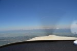
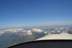
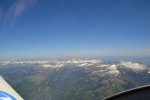
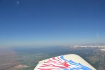
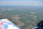
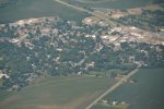
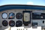
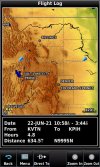
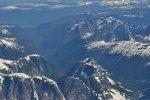
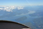
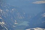
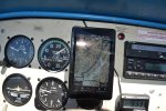
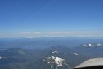
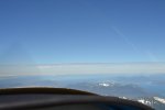
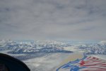
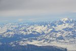
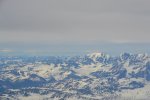
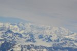
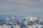
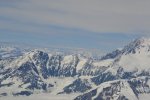
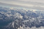
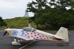
PAEN to KFFA Kenai, Alaska to Kitty Hawk, NC

mbauer

Pre-Flight
Joined
Jul 5, 2026
Messages
60
Display Name
mbauer
The Vans RV-6 is a great cross country airplane.

Purchased mine on 24DEC2016, flew to California to pick it up and fly back to Alaska March of 2017.

Flown it around Alaska taking photos.

Winter 2018/Spring 2019 planned a trip to Kitty Hawk, NC. Left Memorial weekend of 2019 and started the journey. An engine issue when climbing over the Cascades, the time to repair cancelled the attempt. After visiting friends/relatives in Utah/Idaho/Nevada returned to Alaska. Not enough time left, had to be back to work.

2021 scheduled more time off, wanting to leave in early May. Weather didn't cooperate until June 11, 2021.

Here is the story and photos of that trip.

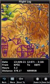
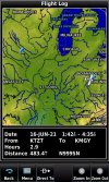
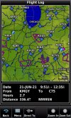
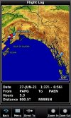
Kenai to Petersburg PAEN - PAPG:
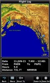
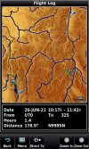
GPS FLIGHT LOG PAEN -PAPG 6-11-21.jpg

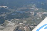
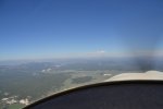
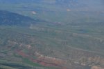
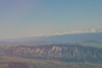
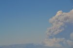
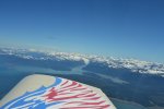
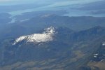
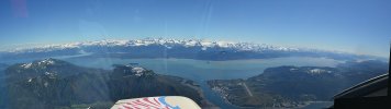
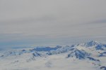
A few clouds leaving Kenai, up over the Kenai Mountains, across Prince William Sound (PWS) to PACV, Cordova, then along the North shore of The Gulf of Alaska to Yakutat, PAYA, Still following the shoreline of the gulf to the southeastern Islands that make up the panhandle of Alaska, final stop for a night and fuel is Petersburg, Alaska. PAPG

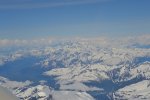
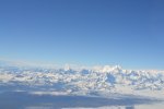
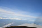
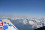
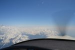
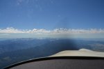
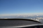
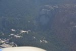
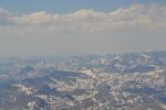
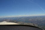
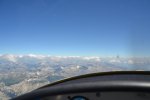
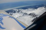
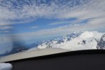
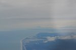
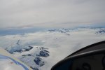
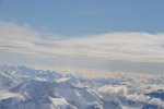
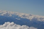
Photo 21 is climbing up over the clouds and the Kenai Peninsula Mountains.
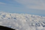
Dsc_0021.jpg


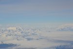
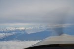
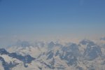
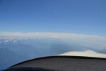
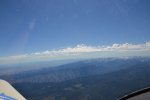
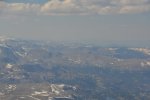
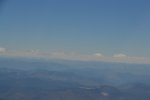
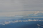
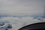
Photo 23 is looking to the right towards the south is Seward, Alaska
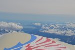
Dsc_0023.jpg


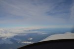
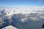
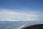
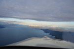
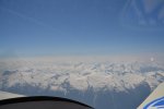
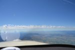
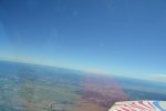
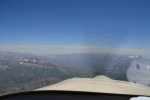
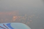
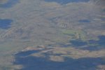
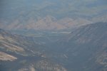
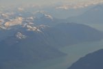
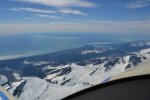
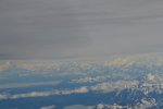
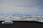
Photo 25 is Prince William Sound (PWS)
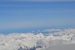
Dsc_0025.jpg


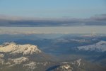
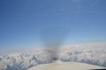
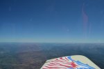
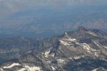
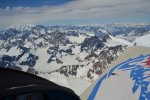
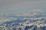
Photo 29 Portage Lake
Dsc_0029.jpg


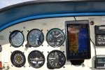
Photo 36 Outside temp while climbing to 13,500ft altitude
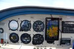
Dsc_0036.jpg


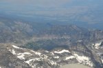
Photo 45 Looking North towards Valdez
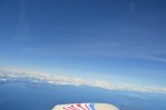
Dsc_0045.jpg


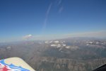
Photo 49 note I have a great tailwind pushing me along! Deviate and fly the islands here, that track is COLD Open water.
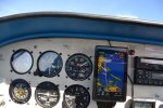
Dsc_0049.jpg


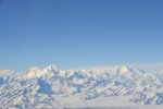
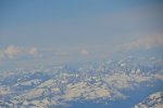
Photo 71 MTNS to the north, I’m currently over PWS
Dsc_0071.jpg


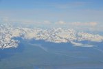
Photo 78 PACV, Cordova Airport Background is awesome!
Dsc_0078.jpg


That's the limit for photos. I'll post more.

Mike
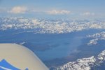
 
2021 was still a bad year for Covid. Soon to learn about that in Alaska.

City/Village of Cordova on the side of the inlet:
Photo 82 Cordova Village
Dsc_0082.jpg

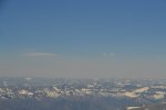
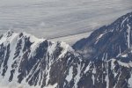
Photo 95 Glaciers between Cordova and Yakutat looking to the north.
Dsc_0095.jpg

Photo 103 North Shore Gulf of Alaska heading to Yakutat
Dsc_0103.jpg

Photo 108 Location photo on map to show the next photo of what it looks like
Dsc_0108.jpg

Photo 109 What the location map from above looks like out the canopy
Dsc_0109.jpg

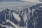
Photo 118 Closeup of one of the Glaciers
Dsc_0118.jpg

Photo 138 Blue sky, clouds, snow, ice rocks and finally some green
Dsc_0138.jpg

Photo 142 More Glaciers
Dsc_0142.jpg

Photo 158 Nice View
Dsc_0158.jpg

More to follow

Mike
 
Photo 164 Location Photo, directly over Yakutat, Alaska PAYA
Dsc_0164.jpg

Photo 165 Location photo 164 view out canopy
Dsc_0165.jpg
Photo 166 Location Photo 164 view out canopy
Dsc_0166.jpg

Photo 167 YUK! Mt Crillion far distance with sun poking through, Mt Fairweather [located in Canada] top is in clouds
Dsc_0167.jpg

Photo 173 Nice View
Dsc_0173.jpg

Photo 189 Mitkof Island directly ahead. Petersburg is located ahead.
Dsc_0189.jpg

Photo 193 of Petersburg, PAPG
Dsc_0193.jpg

Mike
 
Leaving PAPG my plan was to fly into KSZT Sandpoint, Idaho for fuel. It was forecast to be bad, mountain obscuration, convection. This would allow visiting my sister in Montana as a next stop. Everything east of Yakima Valley was Thunder Storms, something we don't see much of in Alaska.

Decided to go to Pendleton, Oregon, didn't make it, landed at Pasco, Washington instead. Reason was heat exhaustion.

When I left PAPG, it was 42 degrees, without thinking, had a jacket, long sleeve shirt on, top of that was a survival vest. Was over dressed for the 95 degree heat flew into at 9500'. You can not trim my RV-6 to remain level for more than 2-seconds. Trying to remove the jacket was not an option.

Had an insulated cooler bag full of ice and king crab, the outer bag with more ice had a couple of water bottles, I needed at least 4. Lesson learned about this.

Not many photos it was an extremely bump day, camera wouldn't focus.

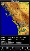
2021 GPS= 22 gallon Aux tank sitting on passenger seat (range 1150miles):
PAPG-KPSC 6-12-21.jpg

However here are a few photos of the same route taken during my 2019 attempt.
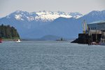
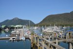
A few of Petersburg's main attraction:
DSC_0079.JPG
DSC_0103.JPG


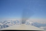
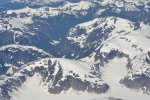
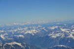
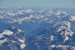
The Coastal Mountains are incredibly Beautiful: 2019 photos
DSC_0108.JPG
DSC_0111.JPG
DSC_0122.JPG
DSC_0131.JPG
DSC_0132.JPG

DSC_0184.JPG

South end near Comox.
DSC_0200.JPG

Mike
 
Last edited:
The Covid 2021 lesson in Alaska was:
1) Hotel Lobby closed at 9pm, got there at 830pm, barely got a room, room access= In and Out through a back door fire escape....
2) The Main and only grocery store was only open 3-days a week, closed at 8pm the day, June 11, 2021, I arrived at 830pm.
3) Restaurant Closed 4-days a week. Yep, same days as grocery store

Morning June 12: Nothing open for breakfast or coffee. Back to hotel room, brew coffee. Vending machine was completely empty located in lobby.

Walk to airport, enjoying the early morning light, was cold at 40 degrees. Jacket and long sleeve shirt helped.

One thing I always do when flying this route. I call the Kamloops FSS. They have some of the best briefers there. A lady briefer told me to wait, I did, the next day was great flying, the day wanted to leave was convection zone near the border with Washington State.

The Covid issue was to be in front of me the whole route. Learned to have something ready for breakfast in the hotel room.

Mike
 
-Late start to get to Pasco Airport. 8am and already 85 degrees F.

Turned rental car in. Cranked up airplane and taxied for fuel on other side of airport. Bubble canopy heat was 135-degrees F inside airplane. Greenhouse effect big time.

Once topped off with fuel, had issue closing canopy. By the time ready to go at the runway, temp was near 90 degrees.

RV-6 used lots of runway in this heat to take off. Normal take off run in Alaska is around 550ft. Here at this temp used 1000ft.

130mph IAS climb helped with cooling after rotation reduced power to 2500 rpm and 130mph best climb speed. Oil temp still reached 215, close to 220 redline.

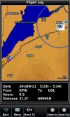
After yesterdays distance of 1003 miles this will be a short hop into Burley, ID where one of my sister’s is located. She lives in a small mountain town called Albion. Total planned distance is 370 miles.
KPSC-KBYI 6-13-21.jpg


Photo 231 Over Oregon, start of Blue Mountains near La Grand/Union area
Dsc_0231.jpg


Photo 233 Same as above same view but more to the left or North as I head south east.
Dsc_0233.jpg


Photo 235 same as above
Dsc_0235.jpg


Photo 239 Oregon, but looking north into Washington State
Dsc_0239.jpg


Photo 240 Entering Idaho Primitive Area foothills
Dsc_0240.jpg
Dsc_0247.jpg


Photo 251 Looking towards Boise Idaho
Dsc_0251.jpg


Photo 260 Zoom looking deep into Idaho Primitive Area
Dsc_0260.jpg

June 14, 2021
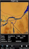
Left at 0830 AM for U01 airport American Falls. Short flight of just 60 miles. Sister had to be at work 9am, she dropped me off at 0830. 90 degrees already and climbing fast.

Brother-in-Law has a hangar at American Falls airport. He will meet me there.

Plan is to do some maintenance today. New struts for canopy, having issues with it closing, already have the new struts, just need help installing.

A few other minor issues needing addressed.

Cheaper fuel here as well. Will top off main tanks and aux tank before leaving for Tetons and east direction.

Spent night at Pocatello, Idaho with sister and Brother-in-Law. He knows how important it is to get in the air early with these temps. Plan is to be up heading to the hangar by 5am tomorrow.

Mike
 
Last edited:
June 15-2021
Big day of flying today. Plan to leave Idaho, fly past Grand Tetons, continue north to Yellowstone National Park, turn right and fly to The Devil’s Tower in Wyoming, another right turn to the south east and fly to Mt Rushmore. Land at KCUT, Custer County Airport and spend the night at Custer, SD.

Hot, day for flying. Lots of bumps and plenty of smoke/haze in the distance. There are several wildfires burning in Idaho, Montana and Wyoming.

Decided to go to a really good Mexican Food restaurant before leaving. This caused an issue when trying to get back to the airport for take off. Road crew was oiling and then adding gravel to the road. Finally getting to the turn for the airport, they had the intersection closed allowing –one direction of travel only, no turns. Jumped out and traveled by foot half mile to get to my airplane and leave.

When someone is used to 50-60 degree weather; this walk was debilitating to say the least, only salvation was I bought a Stetson straw cowboy hat to stop my bald head from getting burnt.
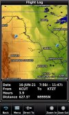
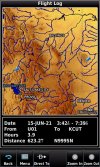
U01-KCUT 6-15-21.jpg


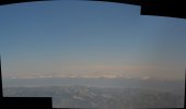
Photo s 265 & 267 are of the Grand Tetons from a distance using a zoom lens. They combine to show the ridge line that leads to them.
265-267 Tetons.jpg


Photo 272 Driggs, Tetonia, and Swan Valley Idaho, Tetons shown as well.
Dsc_0272.jpg


Photo 278 and 281 are the Tetons zoomed in close
Dsc_0278.jpg
Dsc_0281.jpg


Photo 289 Idaho Farmland-Tetons
Dsc_0289.jpg

Mike
 
Last edited:
June 15, 2021 Yellowstone

Yellowstone National Park Photos

Didn’t get to see any gysers erupting. 90 degree right turn to head east into Wyoming from Idaho.

Photo 303 Yellowstone as I turned east.
Dsc_0303.jpg

Photo 309 Yellowstone Lake
Dsc_0309.jpg

Photo 313 Yellowstone with big wildfire in the distance
Dsc_0313.jpg

Photo 319 Zoom on fire
Dsc_0319.jpg

Photo 320 Yellowstone heading towards Wyoming side
Dsc_0320.jpg

Photo 322 Yellowstone mountains to the east
Dsc_0322.jpg

Photo 326 The wildfire again
Dsc_0326.jpg

Photo 331 Yellowstone eastern mountains in the smoky haze.
Dsc_0331.jpg

Photo 337 Yellowstone mountains almost to the eastern edge in Wyoming
Dsc_0337.jpg

Photo 341 Smoky haze again
Dsc_0341.jpg

Wyoming next.

Mike
 
June 15 2021 Wyoming
Wyoming is a beautiful place. After seeing the following photos, I think you agree.

After clearing the western mountains, I saw a speck in the distance that rapidly became a Red Tailed Hawk. It was soaring along at 13,500ft wings level with my RV.

Before I realized what it was, it peeled off and got out of my way. I would have given it a wide berth if I would’ve known what it was. Actually was in formation for about 1.5seconds before it saw me. Incredible flyer!

Don’t know the names of these photos, but adding them so you can see.

Photo 348 Wyoming Mountains (MTNS)
Dsc_0348.jpg

Photo 351 WY MTNS
Dsc_0351.jpg

Photo 357 WY
Dsc_0357.jpg

Photo 358 WY
Dsc_0358.jpg

Photo 362 Wildfire again
Dsc_0362.jpg

Photo 366 Bad place to land if you have too
Dsc_0366.jpg

Photo 369 No Place to land
Dsc_0369.jpg

Photo 371 WY
Dsc_0371.jpg

Photo 382 Smoky Haze
Dsc_0382.jpg

Photo 402 WY Still
Dsc_0402.jpg

Mike
 
Awesome pictures! X 100

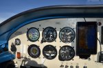
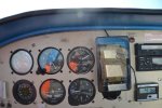
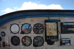
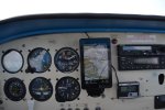
I really like the balance of steam guages and electronic instruments, white on black is readable in any light, but electronic has so much more that it can display.

I have flown in Alaska twice, spring and fall, and the proper clothes are important for where you are, seasonally, and geographically.

I have also suffered from heat exhaustion bad enough that when I added 6 5 digit numbers 3 times, I had 3 different answers. High 90's day in a railroad yard, no clouds, no breeze, and no nearby source of liquids. I would have hated to be flying.

You have more confidence in headwind and ailwind predictions than I do, but there may have been alternates with fuel that you did not mention. Very fast and fuel efficient plane, beautiful paint job!

Launching during Covid had its own challenges.
 
Last edited:
June 15 2021 Devil’s Tower Wyoming near Hulett W43 airport

After seeing this and getting some photos, time for a right turn to head towards Custer South Dakota and Crazy Horse/Mt Rushmore

Photo 405 Devil’s Tower in the distance
Dsc_0405.jpg
Photo 418 DT
Dsc_0418.jpg
Photo 420 DT up close
Dsc_0420.jpg

June 15, 2021 Mt Rushmore
Shadows in the evening made it hard for camera to focus. Could not find Crazy Horse. Thought to look on the map and try to find it in the morning. You’ll soon see why I couldn't find it in the morning either.

Photo 432 George Washington and the visitor center
Dsc_0432.jpg
Photo 453 All four
Dsc_0453.jpg


Mike
 
June 16, 2021
Woke up before the sun was lighting the sky. Left the hotel where I was staying in Custer. Drove the rental car to the airport. Had to stop for some deer that decided to cross the road in front of me right as the sky was getting light. Boy are deer easy to see after looking for moose all the time. Bright and shiny, easy to see.

Finally at the airport, sky getting lighter and lighter. Perfect will be in the air as the sun comes up!
Take off and I’m immediately in a thick smoky haze. Completely dark, no lights from the homes nearby, nothing.

Transition to Instruments, maintain climb, wing levels. pop out as fast as entered , about 300ft thick. Oh, boy is this going to be fun trying to find the monuments! First stop Crazy Horse.. Then Mt Rushmore. No joy can’t find it anywhere, map says I should be directly over it. Can't see it at all.

Okay, lets head towards Mt Rushmore. Hopefully can find them in this thick smoke. The first photo shows what it looked like in the distance.

Photo 469 Mt Rushmore in the distance completely surrounded by smoke
Dsc_0469.jpg
Photo 474 Zoom on faces, wow morning sun lighting them up! Yabadaba
Dsc_0474.jpg

Photo 482 Distance shot as I leave
Dsc_0482.jpg


June 16 2021 KCUT to KMGY
KCUT-KTZT 6-16-21.jpgKTZT-KMGY 6-16-21.jpg
Had to out run the smoke and haze from the wildfires out west. Great tailwind pushing me almost to 200mph with only 130 showing as indicated. Super Hot day!

Since I’m flying by where my Dad crashed in 1971 when I turned 14 y/o, decided to take some photos of where he crashed at. He was flying a WWII TBM Torpedo Bomber when he crashed. It had been converted into use for fire fighting.

Mapleton is a small town and looks to be a farming community. He crashed on the east side near some homes in a farm field.

Stopped at Belle Plaine, IA (KTZT) for fuel. Met a MMA fighter on his way to weigh in for a fight. Didn't catch his name. He fueled and left in a hurry.

I was taking a water break after fueling up, topped off mains and aux tank here, cheap gas.

Next stop the Wright Brother’s Airport near Dayton, OH.

Photo 519 Mapleton, IA
Dsc_0519.jpg
Photo 536 near Dayton
Dsc_0536.jpg
Photo 539 almost to Dayton
Dsc_0539.jpg
Terrain looks the same. Rolling hills/flat lands with small towns along the way. Plenty of wind turbines, didn’t take very many photos.

Forgot to charge camera batteries.

Mike
 
Last edited:
Dayton, OH was a Planned stop:
1) Oil Change at 40hr (17JUN21) and rest in Hotel Suite (RV-6 Lag)
2) Visit Wright Patterson AFB Museum, they have the XB-70 and X-3 there. (morning-early afternoon 18JUN21)

Back to hotel around 230pm. Using a courtesy vehicle from First Flight Aviation-Great place. Hotel connection as well.

Fell asleep soon after returning to the hotel room.

Phone woke me up. At first it sounded like a Tsunami Alert, we get them in Alaska, living near Cook Inlet.

Walking to the phone thinking the Great Lakes are over 100-miles to the north....

Phone display: Tornados in the area. Plural....

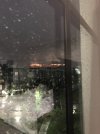
Never seen a tornado before, straight to the window. Third floor. Notice police are directing travelers into my hotel. Great, explains why nobody is calling to evacuate.

What a rain and wind show, completely dark outside. No, cars on freeway. Wind about 60-mph (my estimate) rain sideways till it hits something. Lights in parking lot work as a rain stop, horizontal to waterfall as soon as the drops hit the light. Total waterfall.

Then the wind stops, the rain is gone.
DSC_0970.JPG

20-seconds later, boom 180 wind shift, rain, not as bad, horizontal again. Second Tornado passing.

Go over to computer start looking for airline schedule back to Alaska. My RV is parked two blocks away.

Then it quits. Dark but quiet. People start leaving the hotel.

Looking to the west I see a Sunset. The sun has been up the whole time.
Tornado Sunset 6-18-21.jpg

Finally it is calm, warm, humid outside. Go to the airport, my RV-6 is okay, no airline needed. Spectra Rope was worth the investment.

Mike
 
Awesome pictures! X 100

I really like the balance of steam guages and electronic instruments, white on black is readable in any light, but electronic has so much more that it can display.

I have flown in Alaska twice, spring and fall, and the proper clothes are important for where you are, seasonally, and geographically.

I have also suffered from heat exhaustion bad enough that when I added 6 5 digit numbers 3 times, I had 3 different answers. High 90's day in a railroad yard, no clouds, no breeze, and no nearby source of liquids. I would have hated to be flying.

You have more confidence in headwind and ailwind predictions than I do, but there may have been alternates with fuel that you did not mention. Very fast and fuel efficient plane, beautiful paint job!

Launching during Covid had its own challenges.
Yes, about the fuel, once over Washington state, plenty of places to land. Usually go to Oregon, the fuel is slightly cheaper there.

Like you mention, about the heat. super hot, stopped sweating, ran out of water, getting dizzy, decided to land. Plenty of pint size water in the cargo bay. Poured the first one over my head after hopping out and removing the vest, jacket. Then I drank. Once feeling better inside the airport terminal to get rental car, air conditioning was wonderful.

Fuel stop for instance: Hermiston has a t-hangar, courtesy car and hotel arrangements.

Everything in Idaho was mountain obscuration, leaving the eastern edge or central Washington to choose from.

Mike
 
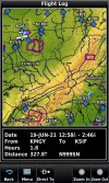
Saturday June 19, 2021 left KMGY for
KMGY-KSIF 6-19-21.jpg

Called ahead, remarks said they have a courtesy car. Also found out they have an agreement with a local hotel.

Looks like the path for the storm leaving the gulf should pass by to the south, the storm currently following is well to the east. Looks like KSIF is the option looking for.

Landed, fueled up and then tied down.

Walked inside to the FBO and walked straight into a huge meeting. Emery goes, "Where you from sonny?" I'm 60+ years old, so you know these guys were well above that age.

My reply created another question: Me, "From Kenai, Alaska."
Emery, "Do you know Terry?"
Me, "Sure do, he is chief pilot for Everts Fuel Service flying C-46 Commandos, and owns a RV-6A, almost like mine, his has a training wheel up front."
Emery, reaches for his phone and calls Terry.

Yep, that stop proves the Aviation World is rather small and a very interesting group.

Only thing that happened, to get to the hotel, several right and left turns for 17-miles. Open window feeling the 85 degree heat blasting by. In the right lane heading to the hotel in a 35mph zone, then on the right side of the curb as sign, SHAVE ICE. Quick look in the mirror, blinker on brakes already getting applied, verified nobody behind me. Total brakes now, made the turn with room to spare.

Here in Alaska the fruit is hard as a rock, unless you know where to buy next day air shipping fruit. This retired couple had fresh tree ripened fruit. Bought a little of every fruit on the table. The biggest Shave Ice they had.

Great stop. People awesome everywhere I stopped on this visit. If ever heading that way again, it is on the list to visit.

Mike
 
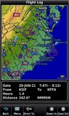
Kitty Hawk June 20, 2021
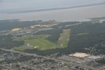
First Flight Airstrip KFFA
KSIF-KFFA 6-20-21.jpg


Today will visit the Wright Brother Monument at Kitty Hawk, NC


Kill Devil Hill


Leaving Rain and clouds behind on the way from Rockingham County Airport, NC, KSIF the airport for Stoneville, NC.


They had a courtesy car that I used to drive to Eden, NC for a hotel. On the way I found a Shave ICE sign.


Left early am to get out of the heat.


Took off around 6am heading east on the final leg of my eastern trip to KFFA. FFA stands for First Flight Airstrip where the Wright Brothers flew the first controllable airplane.


Photo Rain and clouds as I get near Kitty Hawk
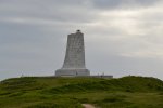
Photo 980 Monument and light rain
Dsc_0980.jpg

53 Monument
Dsc_0053.jpg

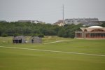
64 Sheds / Visitor building
Dsc_0064.jpg
78 Metal sculpture depicting first flight
Dsc_0078.jpg
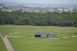
95 Location of first 4-flights, rocks show distance of the first 4-flights big rock depicts take-off point.
Dsc_0095.jpg

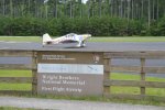
164 RV and sign
Dsc_0164.jpg

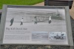
167 sign about gliders they flew
Dsc_0167.jpg

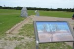
181 Launch rail sign and rocks depicting first 4 flights
Dsc_0181.jpg

266 zoomed photo as I leave of the monument sight
Dsc_0266.jpg

Mike
 
June 20 2021
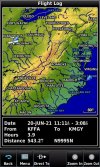
KFFA – KMGY
KFFA-KMGY 6-20-21.jpg

Left KFFA and immediately found myself in rain heading northwest to Dayton area. After about an hour, some blue sky ahead.

Plan to spend the night in Dayton, take-off early for flight back to Idaho in stages.

Photo 272 Leaving Outer Banks where Kitty Hawk is located.
Dsc_0272.jpg
275 Rain and windmills
Dsc_0275.jpg

281 leaving rain behind
Dsc_0281.jpg

285 Blue sky to the right
Dsc_0285.jpg

287 Yuk, cloud layers to the left
Dsc_0287.jpg
291 Blue Ridge part of Appalachian Mountains
Dsc_0291.jpg
298 Appalachians
Dsc_0298.jpg
305 Edge of weather front over Appalachians
Dsc_0305.jpg
318 Appalachians
Dsc_0318.jpg

Mike
 
June 21 KMGY to C75 Marshall County
No photos plenty of turbulence this flight.
KMGY-C75 6-21-21.jpg

Rough day of flying, 40kt headwind, gusts, moderate bumps after 300-miles started looking for an airport with a runway directly into the wind. Found C75.

What a great place to find.

Airport manager came out while I was refueling, found some really cheap Avgas, decided to fill mains and aux tank.

Hotel, car and T-Hangar available for overnight.

Usually the car fuel is near empty, not at this stop-completely full.

Hotel a short drive into Peroia.

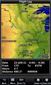
June 22, 2021 C75 to KVTN Valentine, NB
C75-KVTN 6-22-21.jpg
Marshall County to Valentine, NB
Took off around 0730am. Barry and Tom were painting the office when I arrived to leave.

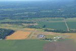
Took a photo of the airport as I left. Next time I try something like this, will stop in and visit if anywhere near!

Temp at 7am was 85° F and climbing fast.
Photo 319 Marshall County Airport
DSC_0319.JPG

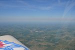
358 windmills
Dsc_0358.jpg

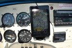
383 GPS shows towers and gives height-can see them just to the left front of the airplane symbol
Dsc_0383.jpg

384 Towers up close This is a novelty for me, not many towers in Alaska, big time reminder to check route for other items not used to.
Dsc_0384.jpg
392 more windmills and getting ugly again
Dsc_0392.jpg
422 Mapleton, IA
Dsc_0422.jpg

462 Valentine, NB airport KVTN
Dsc_0459.jpg
Dsc_0462.jpg

Mike
 
One thing I always do when flying this route. I call the Kamloops FSS. They have some of the best briefers there. A lady briefer told me to wait, I did, the next day was great flying, the day wanted to leave was convection zone near the border with Washington State.
Sigh... Back before the FAA privatized FSS in the rest of the country, we had briefers this good EVERYWHERE.
 
June 22 2021
KVTN to KPIH
Valentine, NB to Pocatello, ID to stay with sister and family.
KVTN-KPIH 6-22-21.jpg
Super hot at Valentine. Used almost full length of runway to take off, then had to go around a pivot sprinkler system a farmer was using to water his crops. Could have climbed over it, but wanted to keep airspeed, needed to get to 130mph to climb better/faster.

Several mountain ridges to cross before reaching Idaho. Wyoming has some really awesome rugged mountains as you will soon see.
Airplane canopy is a greenhouse. I have two small vents that blow air at whatever speed I’m doing. No, air conditioner! As the air gets cooler, it helps to cool me off, however the sun is still cooking me. Drank lots of water on this trip, 5-16oz bottles. No need to pull over for a restroom stop.

Photo 477- 10,400ft, temp 55.2° F
Dsc_0477.jpg

484 Casper, Wyoming
Dsc_0484.jpg

528 13,500ft minimum crossing altitude needed for the coming ridge lines, will go to 16,500ft because of winds causing down drafts and up drafts in this heat. Approx 30 mph head wind can cause serious issues. Extra 3,000ft clearance will smooth the winds out. On Oxygen.
Dsc_0528.jpg

553 Temp at 15,400, temp 41.8° F and it feels Great flowing from the vents!
Dsc_0553.jpg

613 / 622 high altitude lakes-some are still frozen with an ice layer on top
Dsc_0613.jpg
Dsc_0622.jpg

627 Rocky ridge line
Dsc_0627.jpg

638 looking to the right
Dsc_0638.jpg

680 Just about to Pocatello a few lower mountains to clear
Dsc_0680.jpg


Mike
 
Last edited:
June 23-24-25 2021

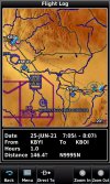
Pocatello to American Falls to Burley and finally Boise Idaho
Spent 23rd resting cool house!
KPIH-U01 6-24-21.jpg U01-KBYI 6-24-21.jpg KBYI-KBOI 6-25-21.jpg

June 24 Left early Am because of two reasons
Sister broke her foot, she has surgery today at 7am. Brother-in-Law drove me to the airport at 6am.

Already super hot 6am it was 89° F and climbing fast.
Short flight to American Falls for fuel. KPIH to U01. They had a wild land fire while I was gone. Attached photo shows the burn area. Two homes were burned before they could get it out.
Dsc_0718.jpg

Fueled up all tanks, Avgas 100LL was $4.59 per gallon. Pushed Airplane in the heat to brother-in-laws hangar.
Used some de-greaser to remove oil from bottom of fuselage belly. Not sure if I have a leak or just because of bumps the last few days causing oil to spill out of Air/Oil separator on engine.

Cleaned up and time to go. Oil was more than I at first thought, so decided to follow freeway to Burley instead of cutting across lava flow in desert. Lava Flow is part of Craters of the Moon flow from 2500+ years ago. South eastern edge of flow.

Landed at Burley and checked for oil. More than I want to see. Okay time to talk with Kevin at the Flight Line to see if he can help.

Pulled the cowling off, no small job, and we looked for leaks. Oil everywhere!
He has the setup to clean up the engine. Using Stoddard solvent and air he soon had the engine oil free. Now taxi over to remote part of parking apron and rev engine to 2300 rpm for 3-minutes. Engine warmed right up in the heat without the cooling baffles to direct cooling air.

Taxied back to Kevin's work hangar. We checked for leaks.
Whew got lucky only small nuisance leaks, nothing to worry about. Air Bumps probably spilled oil out the already mentioned breathing tube.

UPDATE: Next condition inspection found the front crankshaft seal had an issue. Someone used regular silicone to install, silicone and hydrocarbons don’t mix. You can use gasoline to clean up silicone after it has cured. The seal could be moved back and forth, it was not sealing anything. Runnup was performed on the ground, not actual flying-no way to tell if it was the culprit at this time.


Now for the magneto check, was having issues with my RPM fluctuating. Magneto check showed no problems with my ignition system, perfect.
Bumps once again probably caused issue with my Tachometer cable as RPM is now jumping around. New cable is cheap compared to replacing a magneto.
UPDATE: Soon after returning to Alaska this TACH locked up and destroyed the cable with it. It was in failure mode with swings of 100rpm towards the end of life

Visiting relatives in Boise area next.

Mike
 
Last edited:
6-26-2021
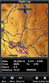
KBOI – U70 - 32S Bosie, Cascade, Idaho and Stevensville, Montana
KBOI-U70 6-26-21.jpg U70-32S 6-26-21.jpg

One more day and I’ll be home in Alaska where it is cool.
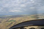
Left Boise early Am at 85° F. Flew to Cascade Idaho, U70 by climbing the mountains north of Boise.
Visited with my Aunt/ Uncle. We went to breakfast and had a really enjoyable conversation before heading to their camping spot and some much needed shade trees.

After a short visit took off for Stevensville Montana to visit with my other sister.
Hot day flying the Idaho Primitive Area from West to East.

Photos tell the story.
724 Idaho Primitive Area
Dsc_0724.jpg
Lots of clouds and mountains today.
741 Mountains
Dsc_0741.jpg

774 Chamberlain Basin Airstrip
Dsc_0774.jpg

859 Looking to the front Almost to Montana
Dsc_0859.jpg

865 Montana Valley ahead
Dsc_0865.jpg

881 Montana Valley
Dsc_0881.jpg
883 Montana Valley
Dsc_0883.jpg


Mike
 
June 26, 2021
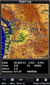
32S-KORS Stevensville, MT to Orcas Island, WA
32S-KORS 6-26-21.jpg
Incredibly hot day today. Flew to Stevensville to visit my sister. Now time to head to Orcas Island for the flight to Alaska.

Orcas Island has a nice grassy area for camping. Every time I’ve visited it has been in use.

Had to climb out in high heat/density altitude.
Standard day temp at 14,500ft should be 9.1° F , for this flight it was 46.6° F well above freezing.

After an extremely long take off run, finally in the air.
Now As I enter the mountains along the Montana/Idaho border I will need to do several climbing 360° climbing turns.

Finally at a safe altitude I can head northwest over the Idaho Primitive Area for a second time today.

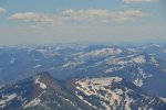
Photo 937 shows climbing through 10,500ft and a temp of 54.2°F I'm in a standard rate turn with clouds slightly above. This is the final climbing turn before heading to the Orcas Island direct.
Dsc_0937.jpg


Idaho Primitive Area photos:
947
Dsc_0947.jpg

Photo 967 Above scattered clouds
Dsc_0967.jpg

0012 Eastern Edge of Cascades
Dsc_0012.jpg

82 Beautiful view
Dsc_0082.jpg
110 Left wing
Dsc_0110.jpg
125 Right Wing
Dsc_0125.jpg
130/134 West edge of Cascades
Dsc_0130.jpg
Dsc_0134.jpg


Mike
 
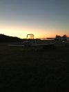
Orcas Island Camping June 26-27, 2021
Orcas Island 6-26-2021.jpg

Super hot here as well. The locals were saying this is the hottest they have ever seen it. 88 degrees F when this photo was taken.

Mike
 
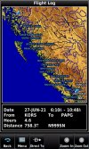
June 27 2021 KORS to PAPG
Orcas Island, Washington to Petersburg, Alaska
KORS-PAPG 6-27-21.jpg

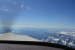
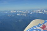
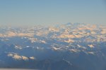
Lots of photos, what a beautiful day to fly the British Columbia Coastal Mountains. Willing to bet you'll think so as well.

For the first time I had a fellow Alaskan Pilot doing the same route almost. A Cessna 182 was following me.
When I left Orcas Island at 6am it was 85° F on its way to 108° F for the day. It was a super hot record, Orcas Island is 16ft above sea level at the airport. 8.5 miles from the Canadian Border.

When I left in the morning, had to have a flight plan entered into the FAA system. When you cross an international border you have to have a flight plan and also communication with the USA controller and the Canadian Controller before crossing.

Flight following is a big help with Victoria Control.

I know from flying this route several times that the Canadian controller will want me to fly at 8500ft altitude. Once my climb reached 8500ft I turned to the west, once again already know the drill, the controller has two Canadian airports with jets taking off and landing. They don’t like it when you get in the way.

I threaded the middle space between both airports. Then I heard another airplane leaving Friday Harbor, WA for Ketchikan, Alaska. The controller routed him just like me towards Comox, a military airfield.

Once near Comox, I asked the controller if I could resume my own navigation and climb to altitude. The request was approved. Once I reached 10,500ft I leveled off to let the engine cool down. Oil was reaching for 200degrees F.

Wow, looks like a 30 mph tailwind once I was established on my course. Awesome!

Then the Cessna that was following me asked the controller if I would report the winds aloft. My reply was 30mph at 10,500ft. He asked to climb to that altitude.

After a few minutes I continued my climb to 12,500ft. Once there the wind was almost 50 mph! Yabadaba Do! This is going to be a quick 700 miles. It actually varied between 48mph and 20mph along different sections of the route.

My airplane is quite a bit faster with 160hp than the 230hp Cessna 182 that was following me. After a few freq. changes I lost him when changing the radio to communicate with different controllers.

Photo 171 is a right wing view as I head north near Comox.
Dsc_0171.jpg


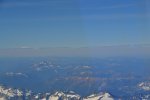
173 distant mountains for the next 680 miles.
Dsc_0173.jpg


lots of photos today.
180
Dsc_0180.jpg

188
Dsc_0188.jpg
191 Heading to Alaska front view, 650 miles to go
Dsc_0191.jpg
213 L side
Dsc_0213.jpg
215 R Side
Dsc_0215.jpg
217 Front
Dsc_0217.jpg
218 L side
Dsc_0218.jpg
More photos to follow.

Mike
 
Photos Continued Orcas Island to Petersburg:
228 Pacific Ocean far distance on the left
Dsc_0228.jpg

229 Frozen lake
Dsc_0229.jpg
232 R side
Dsc_0232.jpg
236 Steep Terrain
Dsc_0236.jpg
241 Lake
Dsc_0241.jpg


246 Speaks for itself
Dsc_0246.jpg


249 Long ways to go still
Dsc_0249.jpg


256 Green Valley
Dsc_0256.jpg


261 Tall peak
Dsc_0261.jpg


265 K
Dsc_0265.jpg

More photos

Mike
 
288 L side of Skeena River
Dsc_0288.jpg
301 Reflection in lake
Dsc_0301.jpg


314 International Border is behind me. Over Alaska Finally! Having issues contacting Anchorage Approch, climbing to higher altitude.
Dsc_0314.jpg


Alaska Islands
325
Dsc_0325.jpg

326 Mitkof island far distance-where Petersburg is located
Dsc_0326.jpg
328 Off the right wing view
Dsc_0328.jpg

336 Mitkof Island
Dsc_0336.jpg


Combo Photo of Petersburg, Alaska looking East.
PAPG June 27 2021.jpg


Mike
 
June 27 2021 PAPG to PAYA
Petersburg to Yakutat leg
PAPG-PAEN 6-27-21.jpg

After walking into town and getting lunch, at a favorite Mexican Food Bus. Decided to head back to the airport for the final flight home.

While walking back I called the FAA Flight Service weather located at Juneau, Alaska.
Walking and talking at the same time!

The weather is beginning to look not so good for the Prince William Sound past Cordova, AK. Marginal VFR is okay to fly in most places, not over Prince William Sound though.

I figure it is two hours from Petersburg to Yakutat, I can then make a choice to continue or land at Yakutat.

Decided to check the forecast for Yakutat with this thinking. Supposed to turn bad after 11pm Alaska time, staying bad for the next 4-5 days. Not good! Plus there is no fuel at Yakutat, fuel barge was late getting in.

Ouch! What is Petersburg weather forecast, same bad news, 4-5 days before weather maybe to leave, how about Juneau, same, same, Haines is just as bad.

By this time I’m back at the plane. Time to go.

A pre-flight inspection and I was on my way. Why not complaining about hot temps? Because Alaska was normal at 60° F. Just like home, no more sweating just standing around!

Some photos of the Inside Passage until reaching Glacier Bay and the main land.
Mt Crillion and Mt Fairweather are part of the Glacier Bay Wilderness Park

359 Looking at Mainland Mt Crillion and Mt Fairweather zoom
Dsc_0359.jpg
375 Main Land
Dsc_0375.jpg
378 Mt Crillion Alaska
Dsc_0378.jpg

395 Looking towards Yakutat in far distance past mountains
Dsc_0395.jpg
403 Light Effects
Dsc_0403.jpg


406 Mt Fairweather: top is in clouds. It is the tallest mountain in British Columbia, Canada. Top is 15,325ft, is right on the border with Alaska.
Dsc_0406.jpg

424 Gulf of Alaska
Dsc_0424.jpg

430 Black rocks
Dsc_0430.jpg


436 Yakutat airport is the 7 Shaped clearing just before the bay you can see in the distance,just to the right of center, on the far side of the bay is Malispina Glacier, it is bigger than Rhode Island State!
Dsc_0436.jpg

Mike
 
June 27 2021

Last Leg Getting Back to Kenai and Home: PAYA to PAEN Yakutat to Kenai
Near Yakutat I could tell that flying over Prince William Sound was a bad idea.

After a long conversation with Juneau radio, determined that I could fly inland over the glaciers you’re about to see. The weather report was two hours old, but the briefer looked at the webcams we have in Alaska.

It was a good VFR day in Gulkana. Changed my flight plan to Gulkana. Weather near Anchorage was cloudy the same for Kenai. They were both reporting cloud bases at 5500ft, tops above 14000ft. Not good.

If I can fly to Gulkana, I can fly home the next day, or just maybe I can get under the clouds and make it to Kenai by flying past Anchorage.

I used to fly helicopters from Anchorage to the surrounding mountains. This became an important piece of how I got to Kenai.

Once near Gulkana, I could see the top of Mt Marcus Baker, Knik Glacier feeder mountain. I knew if I could see it that the Knik Glacier itself would be open without clouds covering it.

The problem would be climbing up to 14,500ft and then a quick descent to get under the clouds if it was open. If not, a return to Gulkana for the night was my other option. Following the road into Sutton/Palmer areas meant mountain obscuration, fog, low clouds with rain.

The Knik Glacier is lined with really steep mountains on either side. The glacier itself soon turns into a river that feeds the northern most point of the Pacific Ocean. Lake George Glacier is to the south of Knik. They combine to form the Knik river, for a short run before emptying into the Pacific.

Stopped taking photos once I could see that the Knik Glacier was in fact open. Had a bit of flying to do, without distractions. I think the path to this point will more than make up for the lack of photos of the actual chore of getting under the clouds.

Lots of photos-most of this area I have not flown before, so I was looking outside at the views. I will make a special trip back for investigating further.

Here are the photos:
Photo 438 is the Malispina Glacier on the far side of Icy Bay.
Dsc_0438.jpg

442 R View
Dsc_0442.jpg
445 Glaciers
Dsc_0445.jpg
447 More glaciers, still near Yakutat these are to the right or east direction
Dsc_0447.jpg

452 R view
Dsc_0452.jpg
454 Over Yakutat-notice cloud layer
Dsc_0454.jpg

458 YUK!
Dsc_0458.jpg
463 Malispina Glacier
Dsc_0463.jpg

467 zoom
Dsc_0467.jpg
468 Glacierville for sure (not really the name)
Dsc_0468.jpg

More photos, lot more photos to add next.

Mike
 
472 clouds Fun looking ones to the right.
Dsc_0472.jpg
473 zoomed
Dsc_0473.jpg
479 Cordova is IFR, visibility really bad, Prince William Sound super cloudy, multiple layers
Dsc_0479.jpg
484 Is that blue sky?
Dsc_0484.jpg
485 zoom lens, yep it is blue sky-good to have a zoom lens!
Dsc_0485.jpg

486 yep blue sky
Dsc_0486.jpg
487 wow
Dsc_0487.jpg
489 zoom
Dsc_0489.jpg
490 almost to blue sky
Dsc_0490.jpg
500 cockpit view – GPS shows Glacier is Bagley Ice Valley
Dsc_0500.jpg

More photos to see.

Mike
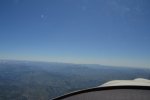
 
503 shows view of Bagley Ice Valley
Dsc_0503.jpg
504 same
Dsc_0504.jpg
508 Heading towards Gulkana
Dsc_0508.jpg
514 zoom
Dsc_0514.jpg
516 zoom
Dsc_0516.jpg
517 blue sky
Dsc_0517.jpg
520 low ceiling
Dsc_0520.jpg
522 Prince William Sound view to the left
Dsc_0522.jpg
529 my favorite color of blue this trip
Dsc_0529.jpg
532 zoom
Dsc_0532.jpg

More photos to see...

Mike
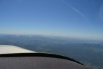
 
533 zoom2
Dsc_0533.jpg
542 my path
Dsc_0542.jpg
546 Green Valley
Dsc_0546.jpg
551 Left view
Dsc_0551.jpg
554 Interesting clouds
Dsc_0554.jpg
557 Following valley to Gulkana
DSC_0557.JPG
560 Green again
DSC_0560.JPG
562 Near Gulkana
DSC_0562.JPG
564 Right side
DSC_0564.JPG
567 Left side
DSC_0567.JPG

Still more photos...

Mike
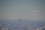
 
568 12 oclock
DSC_0568.JPG
571 nice view
DSC_0571.JPG
577 Tall peak is north side of Knik Glacier Mountain
DSC_0577.JPG
578 Nice view
DSC_0578.JPG
582 closer to Knik glacier mtn
DSC_0582.JPG
586 Knik Glacier is open you can see clear of clouds, angle doesn’t show much, but I know from experience I can make it!
DSC_0586.JPG
591 Left view
DSC_0591.JPG
595 Hole in clouds over Knik Glacier to get to Palmer
DSC_0595.JPG
597 Right view
DSC_0597.JPG
Time to stop taking photos and get ready to do some serious flying!

Made it to Kenai soon after this. Once clear of the mountains, all I had to do was stay under the clouds, called for flight following through the Anchorage area
Pat a friend of mine was working the Kenai Tower, he welcomed me home. Said he was following me on-line. Total time flying was 9.9 hours and over 1558 miles covered.

I went home. I slept for 13-hours straight. Got up and went for breakfast. Carla had a new sign up in her cafe: took a photo and I've added it because it explained exactly how I felt!
Z-Distracted.JPG


Hope you enjoyed the photos and stories! It was a vacation to remember. Needed to get to work to relax/rest! Ah' cool weather Alaska….
12 days, 9112 miles round trip 62-hours of flight time.

Mike
 
Last edited:
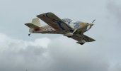
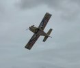
Designed the graphic using AutoCAD to generate full size pattern. Hand painted with a paint brush. About a 20ft away to look good paint job.

It is for sale. Asking $55,000. 1998 RV-6, 1070.8 hours SMOH
IMG_1802.JPEG
IMG_1805.JPEG
Dsc_0998.jpg

Mike
 
Last edited:
Back
Top