One Hour Till Spring - - - - -

Lawreston

En-Route
Joined
Feb 23, 2005
Messages
4,573
Location
Georgetown, ME
Display Name

Display name:
Harley Reich
- - - and I'm feelin' giddy.A POEM

Shopping

There is a time when one must shop
When in the need for a type of top.
A lady goes and tries-on for test
From all the rows to look her best.

A man will go for that fitted shirt;
Provided, though, the neck won't hurt.
He may not have the lady's taste,
She more careful about her waist.

So there I go with thoughts to buy,
The fitting room I ought to try.
But it's not to show a curvy ass,
I'll only go for a piece of glass.
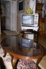
(for the antique coffee table)
 

Attachments

  • Coffee Table.jpg
    Coffee Table.jpg
    191.1 KB · Views: 16
Spring. Hrmph. Minus 11 at home right now.

But I'm at SEA on my way to RNO at the moment. Supposed to be mid-70's on Easter day :yes: :cheerswine:
 
Wow Matt, that's a nice hand-flown hold! :D The line stopped short because the local radar station stopped feeding position updates to the national system, which is where FA gets its info from. Local radar probably had him though until he was on the ground.
 
I was looking at custom glass tops for some home improvement idea that went in one ear, and out the other, last year. Can't even remember where I thought I'd use it.

Harley, that TV won't work come next February. :D
 
I was looking at custom glass tops for some home improvement idea that went in one ear, and out the other, last year. Can't even remember where I thought I'd use it.

Harley, that TV won't work come next February. :D

Yes it will; I have my name on four converter box certificates(when they arrive); 2 for this house and 2 for the other house. And that bi-pole antenna in the picture? I'm up on a hill and with the bi-pole and wave-length tunable antennae on two other sets I get NBC, ABC, CBS, FOX, CW, and some other channel on #51. Who needs cable?

HR
 
The Flightaware looks as though you kept circling between Augusta and Waterville. But the green line seems to end over Jefferson or Coopers Mills. What's the story on that?

HR


We launched from RKD, bound for AUG, but the AWOS was calling FZRA. We can land in -FZRA, but not FZRA. So we held over the VOR, on the 350 radial, 10 mile legs. After about 40ish minutes in the hold we bugged out and rejoined the localizer back into RKD. Parked the airplane there last night. It was an 80 minute flight from Rockland to Rockland, by way of the AUG VOR.

The line that starts going NW, then turns N, then turns direct AUG was our departure from RKD when we went direct AUG, vector for the downwind (for the ILS), then direct AUG again as we climbed out of the ice into the hold.

That was the other fun part, between 1700 and 3000 feet...moderate to severe ice with significant runback. We were only down there on the two approaches into RKD that night, but that was more than enough for us. Above and below those altitudes, though, it was raining hot water...that was nice.
 
Wow Matt, that's a nice hand-flown hold! :D The line stopped short because the local radar station stopped feeding position updates to the national system, which is where FA gets its info from. Local radar probably had him though until he was on the ground.

Thanks :yes::D, I was happy with it. It was really happy I made a good entry, it was kind of thrown together at the last second. Their actual holding instructions were "Direct AUG, hold north, somewhere, turns either direct and 10 mile legs approved." We had to query them to get a radial to hold on and which side they wanted us on...they really didn't seem to care much.

Local radar loses us pretty early out at RKD...it's Navy Brunswick's radar a ways to the south...I'm not sure if that track is the result of FA losing the feed from the center system or if that's actually the end of radar coverage out there.
 
We launched from RKD, bound for AUG, but the AWOS was calling FZRA. We can land in -FZRA, but not FZRA. So we held over the VOR, on the 350 radial, 10 mile legs. After about 40ish minutes in the hold we bugged out and rejoined the localizer back into RKD. Parked the airplane there last night. It was an 80 minute flight from Rockland to Rockland, by way of the AUG VOR.

The line that starts going NW, then turns N, then turns direct AUG was our departure from RKD when we went direct AUG, vector for the downwind (for the ILS), then direct AUG again as we climbed out of the ice into the hold.

That was the other fun part, between 1700 and 3000 feet...moderate to severe ice with significant runback. We were only down there on the two approaches into RKD that night, but that was more than enough for us. Above and below those altitudes, though, it was raining hot water...that was nice.

Yup; that about covers my earlier question. My reference to "Jefferson or Coopers Mills" probably doesn't mean much to you -- seeing as how there's no airports there -- but from the FlightAware graphic, I knowing the areas, could tell that's about where the green line stopped(and you'da been in the trees if that's where you landed. :eek:)

HR

I've seen Jefferson on the map, but I'm not familiar with Coopers Mills. Hopefully I'll get to know the area a little better once the weather warms up and I can actually get out and about. I am happy to say, though, that we avoided all trees on this flight :yes::D.
 
Back
Top