Pilawt
Final Approach
- Joined
- Sep 19, 2005
- Messages
- 9,479
- Display Name
Display name:
Pilawt


Bonus points ... Do you remember your Ground to Air Emergency Code Distress Signals and Visual Emergency Signals (1957)?

View attachment 75199
View attachment 75200
View attachment 75201
Bonus points ... Do you remember your Ground to Air Emergency Code Distress Signals and Visual Emergency Signals (1957)?
View attachment 75202
Beautiful; Thank you, but where's the magenta line?
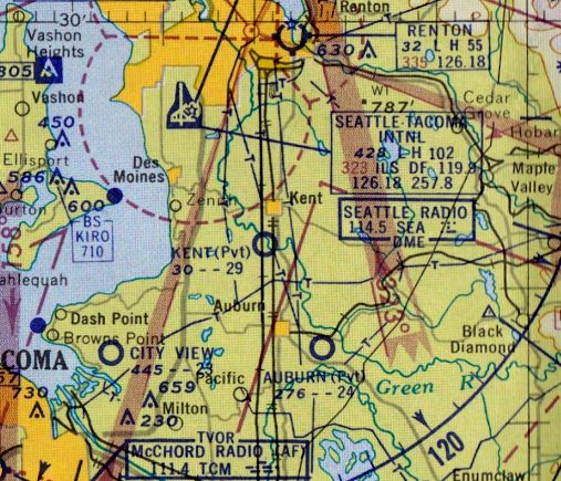
Huh! Auburn was private! Wonder what the hangar rent was. Don't ask what it is now.1959 Seattle sectional:
Another Auburn airport, not the current one (S50). This one was on the east hill on the south side of the White River, where the Muckleshoot casino is, now.Huh! Auburn was private! Wonder what the hangar rent was. Don't ask what it is now.
Actually, if you asked nicely, the government would send you the charts for free. I had a couple when I was a kid that they sent me in the mail just for the asking.
State DOT Aviation will often do that too, even now.
View attachment 75199
View attachment 75200
View attachment 75201
Bonus points ... Do you remember your Ground to Air Emergency Code Distress Signals and Visual Emergency Signals (1957)?
View attachment 75202


I just wrote them. I think they were in Riverdale MD or something similar at the time. This was back in the 1960's.Address, phone number, link? How do you ask?

Is there a Legend for that Chart?

What I’m trying to make sense of is the Core of of the Magenta depicted airspace around BUR having a floor of 2300. @aterpster , weigh in here. Is that an ARSA? I thought that BUR was one of the original ARSA’s. Or were they depicting TRSA’s in Magenta also back then?
POTUS Prohibited Area, 1969 style:
View attachment 75226
View attachment 75227
This was for President Nixon's San Clemente "Western White House". R-2503 and R-2533 were for the nearby Camp Pendleton Marine Base, and were there pre-Nixon. R-2533 only went up to 2,000'.
I was trying to recall the dimensions of the Prohibited Area over President Reagan's ranch northwest of Santa Barbara. The Gaviota (GVO) VORTAC was, and still is, located on the 668-acre ranch property. A landing pad was cleared for Marine One on the hill right next to the VORTAC, and it was a quick Jeep ride down the dirt road to the ranch house. Anybody remember how big the P-area was, and how high it went?
On each radio range there are four of them...Beautiful; Thank you, but where's the magenta line?
")
View attachment 75229
It was a TRSA (see the box at the very top of the chart scan in Post #16). TRSAs were shown in magenta, same as today's Class C.
View attachment 75230
View attachment 75199
View attachment 75200
View attachment 75201
Bonus points ... Do you remember your Ground to Air Emergency Code Distress Signals and Visual Emergency Signals (1957)?
View attachment 75202
Wow! Are you older than dirt? I am. A-N range flying was such a big thing when it came out, and it revolutionized air travel, pre-VOR. Thanks for your comment.


There were airspace challenges back in the '50s, as well. This from the back of a 1957 sectional chart:
View attachment 75237
They're not ... ?Looks like the West Coast, The Midwest and the East were at war with each other
They're not ... ?
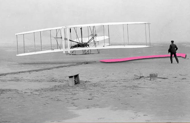
I wonder what static looked like back in the olden days.My predecessor circa late 20's. Rolled up flags in a wheelbarrow.
My predecessor circa late 20's. Rolled up flags in a wheelbarrow.