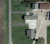
Objectionable Airport With Weird Objection

iamtheari

Administrator
Management Council Member
Joined
Mar 15, 2016
Messages
5,585
Display Name
Ari
As mentioned in the $100 hamburger thread, North Dakota has a program to get a free (read: minimum of 40 flight hours if you do nothing but this) leather jacket if you land and get stamps at each of the state's 89 public airports. One of the airports that you need to visit is 64G Page Regional. That's the one at the 36 DME from the 305 radial of the FAR VOR, cleverly charted only as a paved runway symbol and the word OBJECTIONABLE. It's also not in the A/FD.

Here is the text you can get from Skyvector, Airnav, ForeFlight, etc.:

OBJECTIONABLE TRAFFIC PATTERN CONFLICT WITH CONRAD & THOMPSON ARPTS. IN ADDITION MAN-MADE OR NATURAL OBJECTS OBSTRUCT. NOTE: AIRPORT NOT PUB IN AF/D, NOR SECTIONAL DUE TO OBJECTIONABLE AIRSPACE IAW JO 7400.2G, PARA 10-4-1B. (INFO IS AVAILABLE TO NASR USERS (E.G. AIRNAV.COM))

Let's assume the man-made or natural objects obstructing the airport are a legitimate objection to the airport. I'm not sure they are. It is in the flattest part of the world and it's 9nm away from the nearest real obstruction, the shorter of the two ridiculously tall radio masts that had the title of world's tallest man-made structures until the Burj Khalifa was topped out. But maybe there was a very tall cow standing in line with the runway when the FAA came by to check it out back in 1987 when the airport was activated.

The traffic pattern for the Thompson airport (NA21) cannot possibly be a legitimate objection unless people are flying the SR-71 and even then extending their downwind quite a bit. Thompson is 57nm away. And I can't even find an airport called Conrad in the area, although there is one in Montana (S01, 590nm away) and a Conrads Airport in Kentucky (19KY, 760nm away).

So, what gives? Is there a way to find out more about the review process for this airport to understand why it's not charted after 30 years of public use?
 
The Page airport has been there for a long time.

There is an automatic algorithm that bumps airports out of the AFD if they are within X miles of this or that. Sometimes, that other 'senior' airport is a farm-strip that may or may not be charted and may not even be in use anymore. I doubt that the 'Conrad and Thompson' airports refer to the ones you mention. There are two 'Thompson airports' in ND, but both are not anywhere close to Page either (one near GF the other near Milnor).

If there is an airport manager who keeps on top of this and gets letters of agreement from the farmers who own the strips with 'conflicting traffic patterns', the airport stays on the chart and in the AFD. Same with obstructions. The obstruction doesn't make the airport objectionable, the lack of a survey and charting is. There are only towers on the chart, one 456AGL the other 217AGL. Neither of them should be an issue. The big towers are quite some way from Page.

This all looks like a database screwup that wasn't caught by anyone.

The airport is run by a helicopter spray outfit 'Tall Towers Aviation ;-) ', he may be just fine with it not showing up on any maps. Ag guys can be funny......
 
Last edited:
And yes, that's the pothole region, possibly the flattest piece of earth anywhere.
 
Is there a way to find out more about the review process for this airport to understand why it's not charted after 30 years of public use?

You could read through the whole JO 7400.2...Or you could go on Airnav under the Airport Ownership and Management section and call the airport manager and ask...
 
That airport is only about 30 minutes flight time from me, I've never been there though. Looking at it, it appears to be privately owned and attached to someone's farm.

As for obstructions I believe it is in the middle of a big wind tower farm but I see no mention of it on the skyvector page for it. Skyvector also states there are about 4500 GA operations a year and 12 planes based there but I don't see any hangers other than the farmers out buildings.

My guess, it was a private strip leased to the town or county and it is in a state of disrepair so it's no longer public.
 
These look like decent hangars on google maps - you can see the bifold doors. Theres also a irrigation sprinkler northeast of the runway that would be pretty close based on its current position, but not perfectly in line.
upload_2016-9-7_11-59-41.png
 
There are a LOT of leather jackets you can buy for less than the $1,440* bucks you'd spend just on gas alone.

*based on average 9 gallon fuel burn at $4 a gallon; likely higher in most cases.
 
There are a LOT of leather jackets you can buy for less than the $1,440* bucks you'd spend just on gas alone.

*based on average 9 gallon fuel burn at $4 a gallon; likely higher in most cases.
As mentioned in the $100 hamburger thread, only pro golfers can get a more expensive free leather jacket than pilots can. :)
 
Texas should have a similar deal... only 393 public airports!
 
That's a cool program, does the jacket have something embroidered on it or a patch or anything?

Actually sounds like a cool mission for someone building hours.

Ether way, I wouldn't have an issue flying into that airport based on what I see.
 
That's a cool program, does the jacket have something embroidered on it or a patch or anything?

Actually sounds like a cool mission for someone building hours.

Ether way, I wouldn't have an issue flying into that airport based on what I see.
Looks like it has a patch on it:
http://www.doav.virginia.gov/vaap.htm#Participation_levels

They give you a little passport book that you take around to the airports and get them stamped.
 
The ND program is:
30 airports + 1 FAAST seminar = shirt
60 airports + 2 FAAST seminars + 1 air museum = flight bag
all 89 airports + 3 FAAST seminars + both air museums = jacket

The jacket has a Flying Legacy patch on it. Here's a news article about a recipient that shows the jacket:
http://bismarcktribune.com/news/loc...cle_bac2a4c8-7f37-5189-90e9-f1880701df56.html

Each airport has a stamp with the airport code, usually in a metal box or a plastic container and in a place that the passport book describes at least in brief terms. I missed a few stamps early on because the airports I landed at were out of stock of the passport books. It's all honor system as far as landing at the airports, although they may want to see your log book before parting with a leather jacket to verify you didn't drive to a few of them.

Of all the reasons to fly, this type of program is certainly one of them. It forces you to go places you would otherwise have no reason to visit. We have some other neat excuses to fly, like this past spring when an FBO sponsored a poker run fly-in. Land at 3 of the designated airports across the state and then end up at Mandan (central part of state) for lunch and prizes. I didn't get a prize but I did fly the J-3 cross-country and land on a gravel strip on the bottom side of the Garrison Dam, things I wouldn't have experienced without that push.

Don't think I'd want to be rolling around work with a FAAST shirt ;)


Looks like it has a patch on it:
http://www.doav.virginia.gov/vaap.htm#Participation_levels

They give you a little passport book that you take around to the airports and get them stamped.

Ha! That's cool, wish more states did that, makes sense in the amount of money you'd have to spend in the state to get the jacket, nice to see some places understand and welcome GA

Jacketsm.jpg


If I were a time builder there I'd be all over this, well this and I've always wanted to follow the old mail route arrows in something low and slow
 
Don't think I'd want to be rolling around work with a FAAST shirt ;)
The shirt will say FLYING LEGACY, not FAAST, as far as I know. If it says FAAST on it, then just use it for changing oil on your farm equipment.
 
As for obstructions I believe it is in the middle of a big wind tower farm but I see no mention of it on the skyvector page for it.

The Ashtabula wind farms are about 20miles west of there. I am not aware of any major wind projects near Page. The offending obstruction may be the adjacent irrigation system.

Skyvector also states there are about 4500 GA operations a year and 12 planes based there but I don't see any hangers other than the farmers out buildings.

There is a large hangar with 4 doors. Most of the operations are agricultural. There is a helicopter precision spray outfit at the airport.

My guess, it was a private strip leased to the town or county and it is in a state of disrepair so it's no longer public.

It is still privately owned but leased to the 'Page regional airport authority'. These small airport authorities exist for the sole purpose of getting the airport into a position where they can accept grants from ND aeronautics.
 
There are a LOT of leather jackets you can buy for less than the $1,440* bucks you'd spend just on gas alone.

*based on average 9 gallon fuel burn at $4 a gallon; likely higher in most cases.
Or spend $480 in a light sport (4 gal. burn at $3 mogas, but only 120kts. so may be more)

Any excuse to fly.

My own practice of keeping track of states I land in got me to BWW, Bowman, ND this summer.
 
The Ashtabula wind farms are about 20miles west of there. I am not aware of any major wind projects near Page. The offending obstruction may be the adjacent irrigation system.


There is a large hangar with 4 doors. Most of the operations are agricultural. There is a helicopter precision spray outfit at the airport.


It is still privately owned but leased to the 'Page regional airport authority'. These small airport authorities exist for the sole purpose of getting the airport into a position where they can accept grants from ND aeronautics.

OK, I didn't look at a sectional or map, I thought Page was straight north of Valley City, that's why I thought it was in the wind farm.

When I looked at the picture on Skyvector all I saw was the farmers equipment lined up and assumed the buildings were just his shop and maybe a place to keep his plane but yeah, evidently it is multi hangers.

Thanks.
 
The solution is obvious. I'm going to have to fly to Page and see it for myself.
 
Each airport has a stamp with the airport code, usually in a metal box or a plastic container and in a place that the passport book describes at least in brief terms. I missed a few stamps early on because the airports I landed at were out of stock of the passport books. It's all honor system as far as landing at the airports, although they may want to see your log book before parting with a leather jacket to verify you didn't drive to a few of them.

Of all the reasons to fly, this type of program is certainly one of them. It forces you to go places you would otherwise have no reason to visit. We have some other neat excuses to fly, like this past spring when an FBO sponsored a poker run fly-in. Land at 3 of the designated airports across the state and then end up at Mandan (central part of state) for lunch and prizes. I didn't get a prize but I did fly the J-3 cross-country and land on a gravel strip on the bottom side of the Garrison Dam, things I wouldn't have experienced without that push.

If you don't get the stamp, you can contact the Aeronautical commission for a sticker. I did that with Bowman. I flew in there on the very last day of operation, not even knowing they had built a new one that would open the next morning. No stamps anywhere.

And Garrison Dam was interesting in a Skipper with two adults with that hill off the departure end :P First time I've ever done a slow climb while circling
 
If my state had a program like this I would definitely do it. I wouldn't take a weekend and just go hit every airport and bust them out. I would probably do it over a period of time, but if I knew there was an airport between my departure and destination that I didn't hit yet, I would be more inclined to go there. Would be great to start from the cross country phase of private training for someone trying to build hours to get their commercial license since you have to do cross countries anyways for the private & instrument and build 250 hours total time for the commercial. I would have rather done that than fly to arbitrary airports.
 
If my state had a program like this I would definitely do it. I wouldn't take a weekend and just go hit every airport and bust them out. I would probably do it over a period of time, but if I knew there was an airport between my departure and destination that I didn't hit yet, I would be more inclined to go there. Would be great to start from the cross country phase of private training for someone trying to build hours to get their commercial license since you have to do cross countries anyways for the private & instrument and build 250 hours total time for the commercial. I would have rather done that than fly to arbitrary airports.
Exactly. That's what I'm using it for. Have to build time anyways, why not make different trips out of it rather than just pick airports at random.
 
Back
Top