Now, If ONLY ----

Lawreston

En-Route
Gone West
Joined
Feb 23, 2005
Messages
4,573
Location
Georgetown, ME
Display Name
Harley Reich
Home Airfield
KIWI
- - - - I can get in touch with all the property owners. This is only a few miles
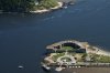
down the road from me but only one or two live there year-round; most are from out-of-state. I printed this on 20" x 30" canvas and stretcher-frame mounted it. By the time I got it finished, only one part-time resident had not fled to warmer climes as of last week.

HR
(I'm surprised it uploaded, based on its size.) One fellow owns five properties within the area covered.
 

Attachments

Interesting how that beach appears carved out of the rock. Just does not appear to be natural. The EPA tree (beach) huggers would not allow someone to make a beach like that.

To bad all that is owned by out-of-staters. But then they get to pay the Maine taxes.
 
On that image, Sony A100, though I don't remember which lens. These days my #1 body is the Sony A900 Full-frame DSLR with a spectacular lens: Carl Zeiss 24-70mm f2.8. The lens is so sharp, and with the body delivering initial 6048 x 4032 (up to 27 megabyte) images, I like to shoot wide-angle and can do numerous post processing crops, still getting sharp, crisp secondary images. This flight was piloted by Rob Lemay, not seen recently on PoA, during which I took 300+ images.
After mounting the 20 x 30 I drove to the scene with print in hand to get the ground-level perspective; sort of a reversal of the "Things take on a whole new perspective from the air" concept. And an irony occurred.
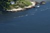
On 10/25 I was boated out to Seguin Island for a 2nd lengthy photo shoot for the society that owns the island and lighthouse. When we returned to the Fort Popham float there was a lobster boat just leaving. Its stay-s'l featured a large French Poodle --unique -- and I took several shots of the boat and crew. When I went to Bay Point and had big print in hand I walked down to the wharf that just under the "r" (Proof) in my image. Moored near the wharf was the Poodle boat. When I photographed her she had offloaded the catch at Phippsburg, the next "point" just out of the upper left corner of my image. The single house in that corner(Gilbert Head) was the home of the late, world-famous artist Stephen Etnier and his author wife Samuella. Both were long-time customers at my old camera store. Now that house is owned by a California fellow who made a fortune in the Dot-Com era. He visits it several times during the summer, I'm told. From another angle, see below:
The float I referenced earlier is at the bottom center of the first image; the adjacent dock is a former U. S. Coast Guard dock that goes back many decades.

HR
 

Attachments

  • DSC05271(2).JPG
    DSC05271(2).JPG
    5.4 MB · Views: 32
  • DSC05271(3).JPG
    DSC05271(3).JPG
    2.1 MB · Views: 25
That looks like what we need. I'll keep pushing my wife on relocating to ME. We're going to check out VT in the future.
 
Interesting how that beach appears carved out of the rock. Just does not appear to be natural. The EPA tree (beach) huggers would not allow someone to make a beach like that.
.
.

Yup.. the EPA would lock you up and throw away the key..:yes::eek:..

If you could do it now, can you imagine the paperwork, and the cost:yikes::hairraise::yikes::eek:
 
That looks like what we need. I'll keep pushing my wife on relocating to ME. We're going to check out VT in the future.

VT does not have an ocean. But if you want water, there are some nice places along the "lake".

VT is also colder, you would be surprised as to the warming effect of 50F ocean water in winter. But that water also contributes to heavy inland snow with Nor'Easters.
 
Back
Top