Narrowest runway you've ever landed on

The home drome is short x 20' with base to touchdown having very little room for final in between. That's what I get for being at the ultralight field. If I had a bit more skill with these innerwebz, I'd post a picture to paint those thousand words that I'm too lazy to type.

In training, we took the Valor to Harris ranch for a few laps, so I have done a narrow runway in a realish plane too.

Well what is the identifier? We can all use airnav and google earth
 
The runway where I learned to fly was so narrow they couldn't paint a stripe down the middle.
 
Took off from, and landed, here on Saturday (I was passenger only):

2140 x 30 ft.

Private Airport, don't think it is even on the sectional - but it is on the TAC and only says "PVT". I could be wrong. CA35 Smith Ranch / San Rafael Airport. Tiny. Pilot told me sometimes ATC can't type it into their computers (4 digits) so he has to "lie" and give them a different airport code.
......

No way. Private strips are on the sectionals and so are 4 digit Identifiers and ATC can accept them. Why the heck would you lye about where you are headed ?


Smallest for me was 40' at WV62 windwood flyin resort. Smallest sort of runway was about 25'when we had to land on the taxi way at UKT when the airport was under construction.
 
No way. Private strips are on the sectionals and so are 4 digit Identifiers and ATC can accept them. Why the heck would you lye about where you are headed ?


.


Agreed... When I am headed to my private airport, 2WY3, ATC types it in and I am good to go...:yesnod:
 
No way. Private strips are on the sectionals and so are 4 digit Identifiers and ATC can accept them. Why the heck would you lye about where you are headed ?

Many, but not all are on the sectional. There are three within 5 miles of me that are active, nice private turf fields but don't show up on any chart.

:dunno:
 
Many, but not all are on the sectional. There are three within 5 miles of me that are active, nice private turf fields but don't show up on any chart.

:dunno:

When I filed with the FAA for an airspace study they offered me a choice to have my airport charted.... The Denver office completed the study, forwarded it to DC and I was official.... About a month later the "charting office" from DC called and asked if I wanted it to appear on charts.. As a SAR pilot I told them ..heck yes... as any pilot flying close who had a problem would just need to hit 'closest' on their GPS and hopefully make a safe landing. I would rather shake their hand and help them out of a bad situation then meet their next of kin and transfer a body bag.:sad: The charting office told me it would appear on the charts but if I even wanted to have it removed there would be a 20 dollar fee... It is a win /win for me, I save 20 bucks and possibly someone elses life... No brainer.
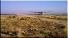
:yesnod:.. Also keep in mind ALOT of small private strips exist without the FAA's knowledge and that might be the case for your area..
 
Well what is the identifier? We can all use airnav and google earth
KCMA(ultralight)

When the picture comes up, let your eyes wander to the convergence of taxiways Echo and Delta as they turn onto Foxtrot at the West end of the field. The miniature airfield just to the South of that is our ultralight field.

For all but a few days a year, we are flying a left pattern for RWY 26. If you zoom in enough to see the hangars, the turnaround, and the North-South road that lines up with the East edge of the turnaround, you have the important landmarks for understanding our pattern.

We are required to stay to the West of that road on our base leg, and the power lines along that road tend to discourage cheating on that. Because of the power lines/poles/transformer and the Italian Cypress trees at the SouthEast corner of our little field, we either come in a bit high, or over the Easternmost hangar as we make our base-to-touchdown-no-room-for-final turn.
 
No way. Private strips are on the sectionals and so are 4 digit Identifiers and ATC can accept them. Why the heck would you lye about where you are headed ?


Smallest for me was 40' at WV62 windwood flyin resort. Smallest sort of runway was about 25'when we had to land on the taxi way at UKT when the airport was under construction.

I don't know, I am just telling you what he told me. He says he always tells them the 4-digit code and the other (lying) location too. I even heard him do it on my flight.

Something like:

(they ask for aircraft type and destination)

He says aircraft type and "Destination San Rafael, CA35, or Gnoss KDVO if that doesn't work"

I wouldn't be surprised if one time ATC said they had a problem and so he goes through that drill every time. Just supposin' of course, but it seems odd that an airport on the sectional could not be entered by ATC.
 
Casa Redondo in New Mexico. Owner said it was 25 ft, but then only cleared about 10-15 ft for us. I didn't do the landing. Hubby did. Here is the takeoff. Obviously barely wider than the wheel span. Note the cactus alongside the runway.
 

Attachments

  • RYtakeoff.jpg
    RYtakeoff.jpg
    18.9 KB · Views: 48
Last edited:
1400 X 20. Local private strip.

Glad I had the plane I have.
 
I asked my husband and he said a one lane road on the Navajo Res. That was about 12feet wide in a C195 with crosswind gear..... He flew milk bread and ice cream into the schools on the Res. In the early 60s. Lots of strange landing sites

I used to do a lot of flying on the Navajo res. Some places had actual runways, others it was just a dirt strip or a piece of road, and in a few places there was nothing.

Before Chinle got a paved airport, we used to have to make runs down the strip in low light (or no light) to chase off locals, dogs, horses, etc. The place was a quagmire when it was wet or partially frozen. Kids used to sit at the end of the strip and pop us with their .22's as we flew over. When it got lights, they were 60 watt lightbulbs in little expanded metalcages. It was really common to arrive to no runway lights, or half or most of the lights missing. The locals would unscrew the bulbs and steal them, and the power for the lighting system was an extention cord that came out of the dirt and plugged into a 110 outlet inside a hangar. As I recall, five airplanes were destroyed there after hitting horses, and one airplane overran the cattlegaurd at the end of the strip and hit a hogan.
 
For my CFI-ASEL I had to teach X-Wind to the examiner there (Kazer 61TE) 20 feet, the days you went to the FAA. Looks like they have resurfaced.
 
Last edited:
KIWH Wabash Indiana 1940 x 30 ft.
C98 Lake Village Indiana 2000 x 140 ft. grass/paved*

* 38 ft. Paved strip down center of runway with lights for night ops. (Or days when you're flying a rental that the flight school doesn't want on grass :( )
 
I was traveling last week and took a lesson at KUDD: 5002 x 70. So far, that's the narrowest runway I've landed on! (Fun flying out there in the desert, btw).
 
I was based at S44 Spanaway, WA for a number of years. 20 X 2700. Our airpark here in AZ 2AZ1 is 40 X 2200.

I have a terrible time making a nice approach to one of those 150 X 5000 monsters.:hairraise:

Paul
N1431A
N83803
2AZ1
 
I landed on a 30 foot wide strip this morning...great time. 7A4, Foster Field, Ill.
 
No way. Private strips are on the sectionals and so are 4 digit Identifiers and ATC can accept them. Why the heck would you lye about where you are headed ?

Not in all cases - only if the owner of the strip gives the info to the FAA to be included on the charts. 2 of the 3 private strips I use most often do not appear on any chart - but one of them is 5000' x 40' paved (excellent condition, constant use by several aircraft, with fuel and hangars!) and has existed for more than 40 years.

When I open flight following for my home strip (unmarked on the charts), I just give them distance and radial from a nearby VOR and tell them it's an unmarked private strip, haven't had a problem yet. I've seen my flights listed in FlightAware with the radial/distance listed as my destination. Likewise on departure, I give my location by radial and distance and request flight following to my destination.
 
Last edited:
2520 x 30 ft 71K Westport Airport Wichita, Kansas ... In the dark ... Twice ... :yikes:
 
Two spring to mind: Neither are the same way now. Petaluma, before the new runway was built was pretty narrow. Flew a Beaver in there for a terrific little airshow in the 1980s. And I managed to convince the owner that we could make some pesonality (money) by giving rides...and we did. At $10 a head, fifty bucks for a 5-7 minute ride around the patch. I remember thinking 'what a skinny runway for a heavy DHC-2'. Don't have numbers, but it seemed like a sidewalk compared to the Beavs' 50ft span. Made about 500 bucks!
Another Bay area airport that used to be fun to visit on a Saturday afternoon was Antioch. Approach was sort of around and over a small hill and, I'm guessing 25' wide and maybe 2500' long. Really separated the men from the boys, flying a Great Lakes bi-plane in there. Couldn't see much in a blind taildragger. Lots of crazy skydivers and an afternoon barbeque.
 
I'm a student pilot, based out of a grass strip that's 50-60 feet wide. It's a private airfield, and the owner often has one half of it closed—I believe to let the grass recover—leaving it 25-30' wide.

Everytime I fly to the nearby airport with their 9000x150ft runway, I flare way too high due to the optical illusion. It's different.
 
Last edited:
Back
Top