More turbulence questions

GauzeGuy

Pre-takeoff checklist
Joined
Jul 12, 2012
Messages
376
Location
KBJC
Display Name

Display name:
GauzeGuy
So, I finish up my nav log this morning and start to track down my CFI to get signed off for my long XC to KLAA and KLHX. I double check the wx on the FBO computer (I had a briefing printed out from DUATS but its now a couple hours old). I discover an AIRMET TANGO (surface to well into the FL's) conveniently centralized over EXACTLY where I was going to fly, moreover a couple PIREPS from CRJ's came in with mod turbulence at 12000 and 16000.

I bailed on the flight because I figured if the regional jets are having a good time, I'd be having even more "fun." CFI concurred.

Just curious if there's a general rule out there, other than if the PIREP aircraft is heavier than you are, your life is going to suck worse in those conditions? Is an AIRMET TANGO an automatic reason to bail from a flight in a light aircraft, or what else should I be looking at?
 
..... Is an AIRMET TANGO an automatic reason to bail from a flight in a light aircraft, or what else should I be looking at?

You are correct in bailing.. If a PIREP from a larger plane with a greater wing loading is calling mod turbulance, you can bet you will get beat up REAL good in a spam can...


Good call....:yes:
 
Yup. Generally agreed.

There are lots of weather patterns where 16,000 can be getting butt-kicked and 6,000 is smooth, but I generally prefer not to be the only possible PIREP submitter up finding out.

There's a small part of me that says you might have been fine, but the call to bail out is the conservative one.
 
There are lots of weather patterns where 16,000 can be getting butt-kicked and 6,000 is smooth, but I generally prefer not to be the only possible PIREP submitter up finding out.

There's a small part of me that says you might have been fine, but the call to bail out is the conservative one.

That's what I was wondering -- the CRJ @ 12000 was over KFLY, the CRJ @ 16000 was around KAPA. Of course, my plan was to not fly anywhere around that altitude but since an AIRMET TANGO was in place already, I figured the PIREPS only confirmed the forecast.

Still though, I'd like to one day figure out what is reasonable to fly around in, and which is not. For this situation, I figured since the BugSmasher isn't even 10% of the weight of the jets, it would not be a fun time...
 
what else should I be looking at?

Read the Airmet carefully. Quite frequently the Airmet is altitude specific; e.g. Moderate Turbulence above 12k feet.

Absent this kind of language, you made the right call.

One thing you also can do is call up the LockMart Briefer, and see if there are any recent Pireps at or near your intended altitude. I don't know how long pireps take to filter through the system....

-Skip
 
What Nate was hinting at is take a look at the winds aloft predictions and see if there is an obvious shear area.

That said, there've been lots of linnies the past couple days out here on the west side of the Rockies and they appeared to continue to the east. Impressive linnies. I have little doubt it'd be a bumpy ride out east. The bumps were probably up high but there is no way to say for certain that there wouldn't be problems down low.

I have done the "sneak down low in high winds" thing and it isn't a lot of fun.
 
Last edited:
Read the Airmet carefully. Quite frequently the Airmet is altitude specific; e.g. Moderate Turbulence above 12k feet.

The AIRMET was surface to FL 410, IIRC...

One thing you also can do is call up the LockMart Briefer, and see if there are any recent Pireps at or near your intended altitude. I don't know how long pireps take to filter through the system....

-Skip

Gotcha, I'll keep that in mind for the future... Thanks!
 
What Nate was hinting at is take a look at the winds aloft predictions and see if there is an obvious shear area.

That's what I'm wondering about -- what am I looking for? It is a shift in direction between 6000 / 9000 / 12000 winds aloft?
 
That's what I'm wondering about -- what am I looking for? It is a shift in direction between 6000 / 9000 / 12000 winds aloft?

If there is a strong flow over the mountians from the west to east then you can expect a bumpy ride at all levels.... IMHO.....

My policy is,, if there are lennies, my plane stays in the hangar..:yes:

Mod to severe turb.... Been there... Done that.. got the Tee shirt..:eek:
 
In addition to the items you already mentioned, I check here...

https://aviationweather.gov/adds/turbulence/turbnav

and here...

http://www.aviationweather.gov/adds/winds/

and here...

http://www.wrh.noaa.gov/zse/gdbufge...wind=no&runway=00/00&siteid=&site=den&siteid=

If it is just me, I can handle a little more than if I am hauling my family. Keep air sickness medication for passengers, sick sacks, bottled water, secure everything, tighten belts, stay xw current, stay under Va, top the tanks off for higher wing loading, and always have a backup plan. An AIRMET covers a very large 3000+ sq mi area and you may or may not run into moderate turbulence in one particular area. The best thing to do is like you did, stay on the ground.
 
That's what I'm wondering about -- what am I looking for? It is a shift in direction between 6000 / 9000 / 12000 winds aloft?

Yup, look for large variations in velocity and direction. Also look for changes in the forecasts vs. current.
 
That's what I'm wondering about -- what am I looking for? It is a shift in direction between 6000 / 9000 / 12000 winds aloft?

A significant shift in direction or speed.

I find it helps to ask around the FBO. It's very common for there to be layered structures confining the turbulence. AIRMET TANGO seems often to be rather conservative.

However, in the absence of any positive data, I wouldn't go either.

I discontinued my checkride over an AIRMET TANGO SFC TO FL200, with no PIREPs. Steep turns in that didn't sound fun.
 
If there is a strong flow over the mountians from the west to east then you can expect a bumpy ride at all levels.... IMHO.....

My policy is,, if there are lennies, my plane stays in the hangar..:yes:

Mod to severe turb.... Been there... Done that.. got the Tee shirt..:eek:

Because he needed another tshirt to replace the one that had his lunch all over it.

Did you notice the sky this afternoon? For photographers and tourists, it was incredible - the long almost straight line N-S over the foothills. Not so much fun if you were in a little airplane...

And yes, look at variations in winds aloft. If 9K is 200@15 and 12K is 30@20, you're pretty much guaranteed there's a major level of unpleasant flying in between.
 
And if you've got time, you may be interested in taking the Aviation Weather course over at Metro State Coll....er....University of Denver (sorry, my faculty card still reads MSCD and until they demand I get a new one....) It's usually taught by expert weather people who are also really good pilots so you get the right point of view as opposed to taking a course in the Meteorology Dept.
 
i always cancel a flight if there is Airmet Tango in effect for my intended flight path. ive been in heavy turbulence before i don't care to go back.
 
And if you've got time, you may be interested in taking the Aviation Weather course over at Metro State Coll....er....University of Denver (sorry, my faculty card still reads MSCD and until they demand I get a new one....) It's usually taught by expert weather people who are also really good pilots so you get the right point of view as opposed to taking a course in the Meteorology Dept.

Heh. Mine was taught by Nick Carter. TV weather guy, meteorologist, and pilot. Nice guy too.

Class was kinda pre-empted the week after he had a prop-strike in a taildragger 'cause we all wouldn't relent until he told us what happened.

Always thought he got a raw deal when Channel 9 let him go to keep Marty Coniglio -- assuming that's what happened.

Maybe he just got a better deal from Fox. I never asked. May be a bad assumption.

Dude is huge. I don't know what he trained in for his Primary but I bet him and a CFI in a Skyhawk with full tanks is over gross.
 
I did a lot of instruction in Colorado back in my CFI days. One thing I observed in a strong westerly flow is the winds hitting the western side of the Front Range then bouncing way up into the mid twenties ( somedays maybe even higher ) and then crashing down somewhere out east over the plains. How Far East depended upon the wind speed at altitude but its definitely not fun to run into in a light aircraft.
 
I did a lot of instruction in Colorado back in my CFI days. One thing I observed in a strong westerly flow is the winds hitting the western side of the Front Range then bouncing way up into the mid twenties ( somedays maybe even higher ) and then crashing down somewhere out east over the plains. How Far East depended upon the wind speed at altitude but its definitely not fun to run into in a light aircraft.

Heh. It was one of those that caused me to hit my head on the ceiling earlier this year.

Not a bump for hundreds of miles then ONE big one. Damn Mountain Wave. ;)
 
Scott.....

Agreed with everything you said..:yes:

Jackson is unique in that the Teton Range just 2 miles west of the Jackson Hole Airport is not a solid line of rocks, but has several deep canyons the traverse from the windward side to the leeward side. It just happens that a major canyon, Granite canyon, is directly upstream and when there is standing lenticulars forming, the probability of a severe windshear event taking place while on about a 3 mile final is a almost for sure deal. Most other places would not exhibit that quirk but because of the slowly rising terrian in the Snake River plain over in Idaho some of the high speed, upper level jet gets pushed down to ground level and is funneled though those canyons.

Just off my right wing is Death Canyon,, that one has a even greater funneling effect and it presents a wind shear event at about 5 miles out.

Thanks again for all you wise comments on weather... You are the MAN !!!
 

Attachments

  • 801 cabin 027.jpg
    801 cabin 027.jpg
    2 MB · Views: 12
  • 801 cabin 028.jpg
    801 cabin 028.jpg
    1.7 MB · Views: 8
Last edited:
Scott, there is a really obvious bias in that plot, toward heavy traffic areas.

There isn't any reason why Lake Tahoe should be "worse" than Mammoth. Terrain at Mammoth is much higher and rougher. But Tahoe sees a lot of traffic at low altitude that Mammoth doesn't, and is much closer to a big city airport (KRNO).

You can also spot Los Angeles, San Francisco, Salt Lake City, and Las Vegas on there. Those are not especially high turbulence areas, but they are high traffic areas.
 
Actually the plot is normalized to remove that bias, so it is a fairly accurate representation of the expected areas of turbulence. Formal studies such as this are careful about such bias.

I'd expect that, but it doesn't look all that plausible to me. Is there any explanation for the apparent correlation with western Class B airports? The only one left out is KPHX (and sort of KSEA). KSFO in particular is a headscratcher. Even moderate turbulence (let alone severe or extreme) isn't all that common here, especially compared to places like Reno or Owens Valley, but it looks like it is on that plot.
 
Last edited:
What day and time? I've never seen AIRMET Tango issued from the surface to FL410, ever...and I look at the weather nearly every day. There could be overlapping AIRMETs, but there are usually altitudes in between that are not part of the AIRMET.

Yesterday (11/29) around 1900z. You are correct, it was not a single AIRMET, it was a overlapping low and high level AIRMET.
 
yea the only little planes that fly when there is wave is towplanes.
 
There has been a SIGMET for severe turbulence just to the east of the Bay area for the last day or so.

Yes, there has been a winter storm here yesterday and today. Very showery (presumably convective), and expected to last through the next week. It's an outlier. As you probably know, a single event does not establish statistics. The normal pattern is light westerly winds and little to no turbulence, in the summer, and prevailing moderate westerlies in the winter.
 
That's interesting since I have several of my members that routinely fly in and out of that airport/region and have sent me pics of lennies, but they said it was a reasonably smooth/uneventful ride. Plus I don't see an excessive number of PIREPs in that area either (possibly that pilots just don't report it much). Next time you hear about this kind of severe wind shear on final, please let me know...I'd like to investigate it a bit more.

Here's a graphic from a study that was done using over a dozen years (early 90s to the mid-2000s) of severe or greater PIREPs at all altitudes. Certainly your area gets its share of severe reports, but not a huge hot spot based on this study.

Severe-Or-Greater-PIREPs.gif

Your comments are right on - except - if you'll notice that NS stretch of severe PIREPs thru the middle of Colorado is exactly where GauzeGuy (and many of us) are flying.
 
What is your definition of "severe"?
 
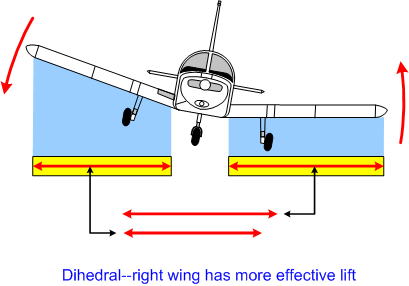
I googled' "dihedral airplane" this is what came up. :yikes:

Dihedral.gif
 
What is your definition of "severe"?

That's "defined" in the AIM, in 7-1-23 (table 7-1-9)

Turbulence that causes large, abrupt changes in altitude and/or attitude. It usually causes large variations in indicated airspeed. Aircraft may be momentarily out of control.

Occupants are forced violently against seat belts or shoulder straps. Unsecured objects are tossed about. Food Service and walking are impossible.
Unfortunately, that definition is a function of the weight and speed of the aircraft, so severe for a 747 isn't the same as severe for a c172.
 
Last edited:
Your comments are right on - except - if you'll notice that NS stretch of severe PIREPs thru the middle of Colorado is exactly where GauzeGuy (and many of us) are flying.

Yup and on the north end the "severe" ends just a bit south of where I always hit turbulence on my trips to WWW. The area from FNL north to CYS is always bumpy over the hills. I do believe the data are biased no matter how much Scott may protest. Basically if folks who fly there don't report then there won't be a chance for it to show up. The airliners going to DIA have a northwest gate that puts them just south of FNL...and the Yellowstone 7 Laramie transition runs just about over FNL I believe.
 
That's okay. I'm not protesting. Just trying to pass along some knowledge to those who might find it interesting...sorry for stirring the pot. :(

I appreciate the presented data. I believe many others do as well. I just keep try to compare it to my experience in order to evaluate.

Obviously it sheds light on areas in which I have no experience. Looking at the southeast it's obvious that conditions there can be ugly and I'd better get some guidance before going there (or at least not fly into or under any black clouds in that area).

On the other hand, out west it's probably better to study topography and winds aloft rather than take the map as gospel. No biggie, that's what we're supposed to do out here anyway.
 
Here's a graphic from a study that was done using over a dozen years (early 90s to the mid-2000s) of severe or greater PIREPs at all altitudes.

Severe-Or-Greater-PIREPs.gif

Scott:

I live just north of you, in the big red area to the lee of the Smokies, so I understand lee-side of mountain turbulence. Why is there so much turbulence off the coast of Florida, though? In my limited experience down there, if you avoid the thunderstorms, the ride is ok. And frequently when there are thunderstorms forming over the land, there are no storms just off the coast.

Wells
 
After 95 hrs and one year of flying, the worst turbulence was 12 hours after the tornadoes hit eastern Ky last spring. It was occasional light-moderate, 1000' agl over the windward foothills of the Appalachians. I slowed to 1.6-1.7 Vs with the occasional stall horn. My 10 hrs in Florida were fine even with nearby thunderstorms in May-June timeframe. I am always 3-7000' above the peaks of the Appalachians, so not much felt there either. I would say having our RV at gross and flying high with O2 makes our rides much more comfortable in the East.
 
Back
Top