LP Mins - RNAV (GPS) Approach

HPNPilot1200

En-Route
Joined
Jul 6, 2005
Messages
2,662
Location
Huntington Beach, CA
Display Name

Display name:
Jason
I was recently reviewing the new RNAV procedures for BXM and noticed they both list LP minima (localizer performance without vertical guidance). Has anyone ever seen this before? I haven't seen localizer performance minimums without vertical guidance until this approach though the FAA IFP indicates 35 are published. I'm thinking it may be relatively new.

I found AC 90-107 which discusses LP minima briefly, published in Feb 2011:
p. Localizer Performance without Vertical Guidance (LP). An RNAV function requiring WAAS, using a final approach segment (FAS) data block that computes, displays, and provides horizontal approach navigation using the horizontal accuracy and integrity of LPV without the approved vertical guidance. The LP line of minima is provided at locations where issues prevent the use of LPV vertical guidance, and provides a higher probability of achieving the lowest minimum at these locations.
attachment.php
 

Attachments

  • 10605R1R.pdf
    283 KB · Views: 0
  • BXM GPS 01R.JPG
    BXM GPS 01R.JPG
    113.3 KB · Views: 320
The LP approach type has been defined for several years, but the first few have just been published. In order to fly the LP approach type, the AFMS in the aircraft has to support it and the software version of the GPS has to support the approach type as well. Since the LP approach type does not support vertical guidance, the GPS units that can be used to fly it, can not use advisory vertical guidance. If the approach previously had a LNAV procedure that offered advisory vertical guidance (LNAV+V) and a LP approach has been added to the set of minimums, neither the LP nor the LNAV will now have advisory guidance (+V).
 
Since the LP approach type does not support vertical guidance, the GPS units that can be used to fly it, can not use advisory vertical guidance. If the approach previously had a LNAV procedure that offered advisory vertical guidance (LNAV+V) and a LP approach has been added to the set of minimums, neither the LP nor the LNAV will now have advisory guidance (+V).
I'm probably missing something, but that seems like something useful was thrown out unnecessarily. What's the rationale for doing away with the advisory guidance if it used to be available?

Am I giving the advisory guidance too much credit? Is it "better" to be able to perform the non-precision descent to the altitudes specified in the profile (which might allow you to get out of the clouds quicker and acquire the runway environment) rather than perform a stabilized (pseudo-precision) descent based on the advisory vertical guidance?

I think it was an oversight. Garmin could provide an advisory glidepath for the LP approach, but the current software doesn't permit it. They are aware of the issue. I have heard that the FAA has adopted a new policy that the LP won't be issued unless the MDA is at least 60 feet lower than the LNAV, but that doesn't affect LP approaches that have already been developed, at least a quarter of which have the exact same MDA as the LNAV, but as I noted and you restated, won't have the advisory glidepath available on either the LP or LNAV. I hope that Garmin will eventually update the software to provide the advisory glidepath on the LP approach, such as a LP+V.
 
I think it was an oversight. Garmin could provide an advisory glidepath for the LP approach, but the current software doesn't permit it. They are aware of the issue. I have heard that the FAA has adopted a new policy that the LP won't be issued unless the MDA is at least 60 feet lower than the LNAV, but that doesn't affect LP approaches that have already been developed, at least a quarter of which have the exact same MDA as the LNAV, but as I noted and you restated, won't have the advisory glidepath available on either the LP or LNAV. I hope that Garmin will eventually update the software to provide the advisory glidepath on the LP approach, such as a LP+V.
IIRC, most LP approach mins are such that you won't be able to see the runway/ALS on a 3° glidepath at the visibility limit without descending below the MDA so in worse case conditions you'd have to level off above any advisory glidepath and fly a steeper (4°) approach. That might be a reason to preclude advisory vertical guidance unless the FAA and Garmin revise their strict adherence to 3° slopes.
 
IIRC, most LP approach mins are such that you won't be able to see the runway/ALS on a 3° glidepath at the visibility limit without descending below the MDA so in worse case conditions you'd have to level off above any advisory glidepath and fly a steeper (4°) approach. That might be a reason to preclude advisory vertical guidance unless the FAA and Garmin revise their strict adherence to 3° slopes.

Lance,

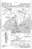
While it is true that even when there is a VDP at the MDA, the visibility requirements would be much higher if descent was continued to the runway on the 3 degree slope, for the LNAV or LP approach, the pilot is required to level off at or above the MDA unless the 91.175 requirements are met. Even if they are met, the advisory glidepath below the MDA does not guarantee obstacle clearance and one would be well advised not to use it unless they are familiar with the obstacle field at the particular airport. Remember a VDP only guarantees a 20 to 1 slope free of obstacles in the visual segment and a 3 degree slope comes awfully close to that at 19 to 1 slope. If there is no VDP depicted, then the visual segment isn't even clear on the 20 to 1 slope.:hairraise:

Discussing this with the FAA, they indicated their plan was to put an LP or LPV at each runway end. If the runway did not qualify for a LPV, then the LP would be used. In theory, the LP should permit a lower MDA than a LNAV in many cases, as the area evaluated for obstacles is smaller, so obstacles that affect the LNAV MDA might not affect the LP. They also indicate that the LP will overlay a LNAV, so the same procedure can be flown with a WAAS C145/146 GPS or a C129A GPS.

In many, if not most cases, the LNAV will already exist and have advisory vertical guidance. Laying a LP on top of the LNAV prevents the LNAV from having advisory vertical guidance, even if it had it prior to the addition of the LP. This is due to the fact that the GPS navigator will always load the approach with the greatest precision, in this case LP, so LNAV will never appear on the GPS except when the lateral integrity is inadequate to support the LP and a downgrade occurs. Downgrades to LNAV do not have vertical guidance.

The current implementation in the existing C146 GPS units do not offer advisory vertical guidance, but they could. Reading thru RTCA DO-229D, it describes advisory vertical guidance for LNAV approaches, but is silent on LP approaches. AC 20-138B discusses the subject and states that the GPS manufacturer can implement advisory vertical guidance for LP procedures. I discussed this with Garmin and asked them if they believed they could implement advisory vertical guidance on the LP procedure and they indicated that they could if they chose to do so. I followed up with the question if they intended to add the function and they said "Garmin is considering implementing advisory vertical guidance for LP approach types but does not have a firm plan at this point." They also indicated they had brought the issue to the FAA.

Most recently, I have heard second hand that the FAA will not implement a LP procedure unless there is at least a 60 foot improvement in a lower MDA when compared to the LNAV procedure.
 
Even if they are met, the advisory glidepath below the MDA does not guarantee obstacle clearance and one would be well advised not to use it unless they are familiar with the obstacle field at the particular airport.
If the 34:1 OCS is clear on an LNAV approach, there will be a shaded glide path down to the runway depicted on the profile view. If it isn't there, following the advisory glide path below MDA could have you picking branches out of your landing gear (or worse). See the profile view legend in the approach book for what it looks like.
 
I have updated the list of LP approaches that have been published. As of 7/28/11 there are 48 LP procedures. 12 of the 48 LP procedures have no improvement in the MDA over the LNAV MDA, it is still running at 25%. I see no point in publishing these LP procedures as as all they end up doing is eliminating the LNAV+V vertical guidance and make no improvement in the MDA or visibility requirement, it is a lose - lose proposition. The average value of improvement is still around a 66 foot reduction in the MDA over the LNAV.

View attachment LPs_072811 with notes on LNAV.zip
 
I flew the RNAV (GPS) RWY 31 approach into Bedford, IN (KBFR) the other day and expected my Garmin GNS530W (main operating software v3.3) to annunciate "LP". Instead it annunciated LNAV + V, i.e. the LNAV approach with an advisory vertical guidance.
When I questioned Garmin's Tech. Service I was informed today that Garmin at this time do not support LP approaches and that a software change was planned to support LP approaches, with no firm date for the software change.
I interpret their response that v3.3 software did NOT have the LP approach
capability, despite the fact that all of Garmins' literature indicates it does
 
I can't see how Garmin could get away with what they said to you without a service alert or an AD. The AFMS that comes with software version clearly states that LP approach minimums are supported. I will follow up in the morning.
 
From an Garmin AFM dated 7/31/09

4.2 Approaches without Vertical Guidance

The 400 Series unit supports Localizer Performance approaches
(annuciated as LP). Published LP minimums will be controlling in this
case.

NOTE:

If flying an LP approach, be prepared to fly the LNAV only
approach prior to reaching the final approach fix (FAF). If the
GPS integrity is not within LP approach limits, the system will
notify the pilot by a downgrade to LNAV message.

For additional information on LP approaches refer to the 400W Series unit
Pilot's Guide.

Seems pretty evident to me.
 
I talked to Jeppesen this morning. They point out that the problem is in the ARINC 424 database description does not currently support the LP type approach, so they can't code them in the database. They have raised the issue at the last ARINC 424 working group, but there is no time frame for this to be dealt with. So for now, LP approaches are a figment of someones imagination.
 
I talked to Jeppesen this morning. They point out that the problem is in the ARINC 424 database description does not currently support the LP type approach, so they can't code them in the database. They have raised the issue at the last ARINC 424 working group, but there is no time frame for this to be dealt with. So for now, LP approaches are a figment of someones imagination.
John,

I very much appreciate your follow-up with Jeppesen. If I understand your correctly, the problem is with Jeppesen/ARINC 424 data base, not with Garmin.
I think you are saying that no GPS unit using Jeppesen navigation data will provide the LP approach because the navigation data is not there; do I have this right ?

Best regards,

Rolf H. Scholz
 
Rolf,

You have it correct. Jeppesen is waiting on ARINC 424 version 20 that is supposed to be available by the end of this year, they are now using version 19. They also have to update their software to process the the LP procedure type and haven't provided a completion date for that update.

My understanding is that the GNS430W/530W software version 3.3 or later, the GNS480 version 2.3, and the GTN series all support the LP approach once Jeppesen provides the database data. The G1000 AFMS doesn't indicate that it provides LP support. The current AFMS that support LP indicate that there isn't advisory vertical available with the LP approach and because LP is chosen over LNAV, any LNAV approach that has advisory vertical guidance (LNAV+V) will have not have the +V once the LP approach is supported.
 
John, I am so glad somebody understands this stuff and can put it into English for the rest of us.
 
For those folks just getting into WAAS approaches, here's a summary chart that might help. (Interesting factoid - Unalakleet, AK has an LP approach.)

minima-summary.jpg
 
What's the difference?:dunno:

Basically one has an MDA (the same one that a non-WAAS LNAV approach has) and one has a DA. I believe the protected area is smaller on the LNAV/VNAV than on the LNAV+V.

Also, LNAV+V is only an annunciation. It's not an actual line in the minima section on the plate.
 
What's the difference?:dunno:
LNAV/VNAV is a precision-like approach system providing electronic glide path to a decision height. The glide path is generated using baro-aided WAAS data. LNAV+V is a pseudo-precision submode of ordinary LNAV which gives you lower-precision vertical steering from the FAF to the runway using only WAAS data (and not the higher precision data of LPV), but without the obstruction protections of a precision approach (i.e., ILS) or precision-like approach (LPV or LNAV/VNAV). Also, while you can fly the LNAV/VNAV glide path all the way to DH and then start your missed (so you'll sag below DH while powering up), on LNAV+V, you must level off at MDA without going below it at all. Finally, LNAV+V does not guarantee that you won't violate any intermediate step-downs inside the FAF, but LNAV/VNAV eliminates that issue.
 
What's the friggin' point of any approach that does not provide obstruction clearance?
 
What's the friggin' point of any approach that does not provide obstruction clearance?

Well the +V in LNAV+V is advisory vertical guidance. You still comply with the intermediate altitudes, which does provide obstruction clearance. The +V can be used to descend between intermediate altitudes or to do the final descent to the MAP.

Me, I don't hold any truck with LNAV+V. Its LPV or nothing for me.
 
What's the friggin' point of any approach that does not provide obstruction clearance?

Well, as long as you stay above the MDA of each segment you are guaranteed clearance. The LNAV+V is essentially an LNAV approach with an "unofficial" glidepath, i.e. advisory only. So Jepp doesn't guarantee anything with it other than a 3 degree slope. It's a hybrid.

BTW, LNAV/VNAV approaches are available with WAAS without any of the older Baro-equipment.
 
Basically one has an MDA (the same one that a non-WAAS LNAV approach has) and one has a DA. I believe the protected area is smaller on the LNAV/VNAV than on the LNAV+V.

Also, LNAV+V is only an annunciation. It's not an actual line in the minima section on the plate.

Both the LNAV and the LNAV/VNAV have the same lateral limits that are examined for obstacles.

In the case of the LNAV, the vertical protection is essentially 250 feet above the highest obstacle between the FAF and the MAP. If there is a step down on the final approach course between the FAF and the MAP, 250 feet of clearance is provided up to the step down waypoint and beyond that the MDA provides 250 feet of obstacle protection. LNAV+V is provided by the WAAS GPS manufacturer and is not part of the TERPS for the LNAV approach, however, the advisory glidepath will nominally clear the stepdown minimum. The LNAV+V is not considered a vertically guided approach and the glidepath is strictly advisory. The advisory glidepath is just an aid to assist the pilot making a stabilized descent to the MDA. Regardless, it is the pilot responsibility to comply with all altitudes depicted on the approach based on their altimeter. The altimeter is affected by temperature and particularly when warmer than standard conditions exist, it is possible that the advisory glidepath will be below the minimum altitude as determined by your altimeter at the step down fix. The altimeter is always primary. Following the glidepath below the MDA is not permitted and clearance of obstacles must be accomplished visually as it is possible for cumulo granite or other obstacles to be on the advisory glidepath when below the MDA and the threshold.

In the case of the LNAV/VNAV, the vertical protection is both a fixed amount of 250 feet when close to the runway and further out is a variable amount based on an Obstacle Clearance Surface (OCS) that underlays the glidepath at a shallower angle. Obstacles may not penetrate either the OCS or the close in level ROC (Required Obstacle Clearance). As stated by others, the LNAV/VNAV is a vertically guided approach and has a DA.
 
What's the friggin' point of any approach that does not provide obstruction clearance?

The LNAV approach does provide vertical obstruction clearance based on the altimeter. The advisory glidepath is not a part of the approach and a LNAV approach has not been evaluated for vertical guidance. However, on the LNAV final approach segment, you may use any descent rate that doesn't exceed a 7 to 1 slope. You may choose your own descent path or you may use the advisory glidepath between the FAF and the MDA.

If there is a step down on the final approach segment, the advisory glidepath will nominally clear the minimum step down altitude at the step down fix. This is usually accomplished with a steeper glidepath than the normal 3 degree default. As I stated in my prior post, the altimeter is affected by temperature, whereas the WAAS LNAV advisory glidepath is not. Since you are required to comply with the altimeter indication for all minimums, on a hot day, you may not be able to follow the advisory glidepath as it will put you below the step down minimum altitude as indicated by your altimeter.
 
Bottom line is that if you're flying a WAAS G1000 system (or other similar ones), you may see
LPV (and vertical deviation glidepath marker)
LNAV/VNAV (and vertical deviation glidepath marker)
LNAV +V (and vertical deviation glidepath marker)
LNAV (and only lateral guidance)

And you must know both which minimums to use, AND that the LNAV+V vertical guidance is not mandatory. You can fly below it as long as you stay above the MDA for the segment, and you may wish to do so. So far I've not seen any situations where staying on the LNAV+V "glidepath" would cause you to go below a segment MDA, but perhaps it's possible.

If you've got a WAAS GPS you'll normally see LPV if the approach is coded that way, but if you don't have the proper signal geometry or integrity it might "downgrade" to LNAV/VNAV, I think.

Tim,

The WAAS GPS will only downgrade to LNAV, never to LNAV/VNAV. In fact, for all practical purposes, in an aircraft with a WAAS GPS one can almost always ignore the LNAV/VNAV minimum. This is because if there is a LPV minimum, the LNAV/VNAV will never be annunciated and rarely is the LNAV/VNAV an improvement over the LPV minimums. I was preparing a presentation on WAAS approaches and tried to find an example of where the LNAV/VNAV was the highest service provided. I eventually found a few, but they are difficult to find and are going away.

Thanks. Could it downgrade to LNAV+V? I am thinking of a situation where the system doesn't trust it's vertical resolution enough for the LPV or LNAV/VNAV glidepath generation.
 
Well, as long as you stay above the MDA of each segment you are guaranteed clearance. The LNAV+V is essentially an LNAV approach with an "unofficial" glidepath, i.e. advisory only. So Jepp doesn't guarantee anything with it other than a 3 degree slope. It's a hybrid.

BTW, LNAV/VNAV approaches are available with WAAS without any of the older Baro-equipment.

I agree with your main points. The only minor nits are that the TCH and glidepath angle are determined by the procedure specialist and they are not fixed at 3 degrees, particularly when the advisory glidepath angle must be increased to clear a step down fix minimum.

Although it is true that the WAAS GPS are authorized to fly the LNAV/VNAV, there is very little practical application of the capability. One advantage of a Baro-VNAV system over the WAAS system is that the glidepath of the Baro-VNAV system moves with the temperature to the same degree that the altimeter does, so you don't have to worry about a minimum altitude being busted because you followed the advisory glidepath.
 
Keep in mind that on true precision approaches (i.e., ILS's), you are guaranteed obstacle clearance on the glide path up to the 34:1 OCS all the way down to the runway, not just to DH. With LNAV+V, there are no guarantees on the advisory glide path after you pass MDA -- the only obstruction clearance guaranteed there is the usual 250-300 feet at MDA from the FAF (or stepdown fix) inbound to the MAP (and then upwards on the 40:1 slope for the missed approach).

Where it gets funky is for LNAV/VNAV and LPV. You may or may not be guaranteed obstacle clearance below DH to the runway. The only way to tell is to look to see if there's that shaded glide path from the MAP down to the runway. If there is, you do get the same 34:1 OCS protection as an ILS. If there isn't, and you blindly follow the glide path past DH to touchdown, you may be picking tree branches out of your landing gear (or worse). See the RNAV 2 at KDAN for an example of the shading to show that protection, and the RNAV 3 at KHBI (which includes an LNAV/VNAV DA) for where it's not provided.
 
Thanks. Could it downgrade to LNAV+V? I am thinking of a situation where the system doesn't trust it's vertical resolution enough for the LPV or LNAV/VNAV glidepath generation.

No. The downgrade is caused by the Vertical Protection Limit (VPL) integrity exceeding the maximum allowed value. It would be theoretically possible to have a VPL of 35 meters for a LPV200 and still be able to satisfy the advisory vertical guidance value of 50 meters. But for LPV with a DH of 250 feet or higher, a LNAV/VNAV, and the LNAV+V all use the same VPL maximum of 50 meters.
 
No. The downgrade is caused by the Vertical Protection Limit (VPL) integrity exceeding the maximum allowed value. It would be theoretically possible to have a VPL of 35 meters for a LPV200 and still be able to satisfy the advisory vertical guidance value of 50 meters. But for LPV with a DH of 250 feet or higher, a LNAV/VNAV, and the LNAV+V all use the same VPL maximum of 50 meters.

Thanks much! I remember now why I was thinking about downgrading.

I went into a field where the chart showed LPV, LNAV/VNAV, and LNAV minimums, but the G1000 announced LNAV/VNAV. We'd guessed at the time that it was some sort of automatic downgrade, but in reality the LPV was published in the chart but not yet in the database because the LPV was a brand-new change, so the system thought the lowest minimums available were LNAV/VNAV.
 
See the RNAV 2 at KDAN for an example of the shading to show that protection, and the RNAV 3 at KHBI (which includes an LNAV/VNAV DA) for where it's not provided.

If I understand the example correctly, you may continue with a 3 deg glideslope until you are 3mn beyond the FAF whereby obstacle clearance is no longer guaranteed (in the case of the RNAV 3 at KHBI). And at this point your altitude is (? value) but > MDA/DA
 
If I understand the example correctly, you may continue with a 3 deg glideslope until you are 3mn beyond the FAF whereby obstacle clearance is no longer guaranteed (in the case of the RNAV 3 at KHBI). And at this point your altitude is (? value) but > MDA/DA
Not quite.

The VDP at 3nm past the FAF is where the 3.00 degree glide path up from the touchdown zone intersects the LNAV MDA of 1520. You cannot go below that MDA using LNAV only (or LNAV+V) unless, per 91.175, you have the runway environment in sight, the required flight vis, and can land using normal maneuvers/rate of descent.

However, with LNAV/VNAV, you can continue down via the LNAV/VNAV vertical steering to the LNAV/VNAV DA of 1320 with complete assurance of obstruction clearance as far as that DA. It is only if you attempt to follow the LNAV/VNAV vertical steering below that DA that you lose obstacle clearance protection.

Keep in mind that the obstruction clearance criteria for precision-like approaches such as LNAV/VNAV and LPV are different than for nonprecision approachles like straight LNAV (including LNAV+V, which isn't an FAA consideration). Precision-like approaches use a sloped obstruction clearance plane which runs up from the runway and gives a gradually reduced clearance as you go lower -- down to about 75 feet at DH. Nonprecision approaches use a level obstruction clearance surface, about 250 feet above the highest obstruction in the final approach zone from the FAF to the MAP (there are also considerations for the missed approach climb gradient, but we'll let that slide for this discussion). Thus, a 100-foot tree half a mile from the runway would be sufficiently below a 200-foot DH but would force an MDA of at least 350 HAT (assuming the ground is level -- easier for discussion purposes).

Now, here's where it gets tricky. Let's move that 100-foot tree a quarter mile closer to the runway. Now, if you continue to follow the vertical guidance, the top of that tree will catch your main wheels a quarter mile from touchdown. For an ILS approach, the 34:1 OCS must be clear all the way from the runway up. Since that tree is sticking up through the 34:1 OCS, if this were an ILS approach, it would be closed until the tree is chopped down to about 40 feet. For LNAV/VNAV and LPV, there may be obstructions through the OCS inside the MAP (intersection of GS and DA) -- all they do in that case is take away the shaded GS. You can still fly the approach, but it's up to you to visually acquire and avoid the tree as you continue below DA. So when you're flying an LNAV/VNAV or LPV approach, be darn careful about checking for that shaded GS on the profile view!
 
Last edited:
Is this why the FAA added GPS questions on the written?
 
No thanks. I'd rather ask "some guy on the internet" for his opinion.
 
So on non WAAS approaches is it just assumed they are LNAV? Here is an example that I recently flew while VFR just because when arriving on a clear sunny day.

Using the dive and drive from UMKOW to get down to 2000 at APCUD it became obvious that the vertical guidance which I wasn't using didn't sync up with the 2000 foot restriction at APCUD. When arriving at APCUD at 2000 the glideslope needle was about 2 1/2 dots below center and if following the guidence we would have been significantly lower than 2000'.

This entire thread is referencing the various types of approaches and each plate clearly states what it is, or has options to fly differing types such as LPV/LNAV, etc.. This one just shows S34, and circling. ??? Is there a story on why some approaches such as this on are light on information compared to others? In other words the approach mentions nothing about having vertical guidance from what I see, but my 430W was clearly providing it. I'm new to this and have holes such as this to fill in.
 
Last edited:
Back
Top