Kansas Kowbell Klassic

tonycondon

Gastons CRO (Chief Dinner Reservation Officer)
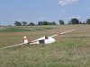
Joined
Mar 9, 2005
Messages
15,454
Location
Wichita, KS
Display Name

Display name:
Tony
Go Tony, Go! almost to Nebraska this time...
 
Appears to be down. Last message was "OK" - looks like a good field to plant it into.

But I can't see his glider in the satellite photo :goofy:

274.8 Km
 
I believe he was trying for Lincoln. That sure seems a long way to fly with no engine:eek:

Way to go, Tony.
 
distance from published coordinates of Sunflower to my SPOT GPS position at landing worked out to 167 miles and change.

Winner had 177.5 miles, 2nd was 170.6. I was third and fourth was a Ka-6 who was working the same direction as me and landed at the Fairbury, NE airport for 160.6 miles.

All mileage is statute. I'm working on uploading pictures now.
 
Picture of the glider after landing uphill into the wind in a cut wheat field, across the terraces. pretty ideal except for the terraces. flight report at my blog, http://cherokeesailplanes.blogspot.com
 

Attachments

  • P7100857.JPG
    P7100857.JPG
    886.4 KB · Views: 15
Congrats Tony. That looked like a winner to me. Never tried a glider. A longer distance than most of my powered flights.
 
Congratulations, Tony. I was following you on the Spot tracker... too bad it doesn't list altitude... and then looked at the satellite image over your last point and it looked great, close to two roads and it appeared flat. Interesting about the terraces.

I wondered the same thing as Dave about the handicapping or lack thereof.
 
there was a fair slope to the field where I landed. The pictures don't truly show it either. The terraces fall into the category of things you can see from 10 feet that you can't see from 100 feet. Oh well it wasn't too bad. This contest started back in the early 1960's and has never been handicapped. Doesn't bother me, I know that I did a good job yesterday and thems the rules.
 
Here is where everyone landed. obviously some difference in opinion on which direction was the best.

http://maps.google.com/maps/ms?ie=UTF8&hl=en&msa=0&msid=103636288166280475783.00048b32040ed69d654ab&ll=39.215231,-97.470703&spn=7.088507,10.26123&z=7
 
Back
Top