Is this too far?

Tristar

Pattern Altitude
Joined
Apr 7, 2005
Messages
1,837
Location
Lincoln, NE
Display Name

Display name:
Tristar
I'm having to send some of my students to a new examiner for either weight reasons or certificate reasons. The other examiners have my students plan their cross country to somewhere in the state or next state over. This guy wants my student to plan a 477 mile one way flight. I understand the idea behind students needing to know how to plan big flights but this seemed a bit much especially when they will be buying charts they probably wont use before they expire. It's a lot of work to plan out especialy when the examiners dont ask about every leg of the trip. Am I wrong?
 
I'm having to send some of my students to a new examiner for either weight reasons or certificate reasons. The other examiners have my students plan their cross country to somewhere in the state or next state over. This guy wants my student to plan a 477 mile one way flight. I understand the idea behind students needing to know how to plan big flights but this seemed a bit much especially when they will be buying charts they probably wont use before they expire. It's a lot of work to plan out especialy when the examiners dont ask about every leg of the trip. Am I wrong?

Tell your students to get foreflight. It has every sectional chart in the us.
 
DPEs have always had an item to: "Evaluate flight planning to 80% of the aircraft's range".
 
DPEs have always had an item to: "Evaluate flight planning to 80% of the aircraft's range".
The PP PTS only says that the flight plan shall be to the first fuel stop based on maximum payload and actual winds/weather. Not many light trainers can go 477 nm on one tank of gas with maximum payload and reasonable fuel reserves. Nevertheless, examiners do want to test the applicant on something more than a typical $100 hamburger run within the applicant's familiar area, and flights of 3 hours or so seem typical. So, 477 nm would be rather excessive if the trainee is showing up in a Cessna 150, but maybe not in Cessna 182.
 
My examiner had me plan a flight from W29 to ACY to HGR and back to W29 for a grand total of 330 miles. The devilish thing about it was that that route happens to go through every single kind of airspace imaginable. You go through a surface area Class E on descent to ACY, which is a Class C, then you just barely get into Philly's Class B, then skirt Wilmington's Class D, and then you go through P40 up by Camp David if you (foolishly) choose to go direct, then you land at HGR, which is a Class D, then you pass through FDK's Class D, before predictably going through that nasty little corridor in the DC SFRA between the DCA's and BWI's Class B.
 
The PP PTS only says that the flight plan shall be to the first fuel stop based on maximum payload and actual winds/weather. Not many light trainers can go 477 nm on one tank of gas with maximum payload and reasonable fuel reserves.
80% of fuel range of whatever the guy is flying....
Nevertheless, examiners do want to test the applicant on something more than a typical $100 hamburger run within the applicant's familiar area, and flights of 3 hours or so seem typical. So, 477 nm would be rather excessive if the trainee is showing up in a Cessna 150, but maybe not in Cessna 182.
3 hrs is pretty typical. 75% of range, maybe.
 
My examiner had me plan a flight from W29 to ACY to HGR and back to W29 for a grand total of 330 miles. The devilish thing about it was that that route happens to go through every single kind of airspace imaginable.
Gee, what a crazy idea for a checkride? :D I wonder how long it took that examiner to come up with a route which did that?
 
440nm, seems normal to me. I'd also not tell your students to use any cheats or toys to plan it, just drafting pencil, ruler, chart and nav log.

Remember there is always a gotcha, restricted airspace or something ;)
 
440nm, seems normal to me. I'd also not tell your students to use any cheats or toys to plan it, just drafting pencil, ruler, chart and nav log.

Remember there is always a gotcha, restricted airspace or something ;)

Really? I used fltplan.com, then laid it out on the chart. Everyone was fine with that. I also showed him during the oral that I did grasp the concept of a plotter and pencil. :)
 
My private ride planning was from THV-OKV and return. Hit all the airspace a that way as well. He still used the same route after all this time. My students got the same route. They are there to test your knowledge. It could be a long one or a short one. It's up to the examiner. I don't think this one is being to unreasonable. Remember as a Private Pilot you could fly coast to coast. I think it's reasonable to be able to show an examiner you could do it.
 
It's probably one extra chart? I'm not understanding the complaint. That just isn't much money in the grand scheme of things, in aviation.
 
My XC planning was from OJC - TUL - SUS - OJC. (KC area, Tulsa, St Louis, and back), about 650NM in a Warrior.

Had to use both sides of the same sectional but didn't need to buy another A/FD. I even threw in an extra stop between TUL and SUS since I'd never flow a leg that long before and told the DPE I might need a bathroom break between Tulsa and St Louis - he seemed to think that was prudent.
 
T, I don't think it is too far, but if you do ask the examiner why he does it. I'll bet you won't be the first. ;)
 
Tristan, Count me in the camp who don't think a flight of this magnitude is unreasonable. Heck, most, if not all, of the planning could be done with freely available online tools. The student can download the A/FD and the charts are available for a free download from the FAA, at least for now. I mean, only 6 months after Leslie and I got our certificates, we were taking a flight from Chicago to the Bahamas via Key West!
 
Gee, what a crazy idea for a checkride? :D I wonder how long it took that examiner to come up with a route which did that?

Ahaha yeah, not long I'm sure :) Though it is pretty easy to find screwy airspace around DC.
 
I think it is totally reasonable. Who knows. Maybe the week after he gets his private he'll fly from Lock Haven to Vancouver WA. I did!
 
My examiner had me plan a flight from W29 to ACY to HGR and back to W29 for a grand total of 330 miles. The devilish thing about it was that that route happens to go through every single kind of airspace imaginable. You go through a surface area Class E on descent to ACY, which is a Class C, then you just barely get into Philly's Class B, then skirt Wilmington's Class D, and then you go through P40 up by Camp David if you (foolishly) choose to go direct, then you land at HGR, which is a Class D, then you pass through FDK's Class D, before predictably going through that nasty little corridor in the DC SFRA between the DCA's and BWI's Class B.

Sounds like a good and thorough flight planning test.... If you can't navigate that route safely then maybe you should not be flying in the national airspace.:dunno:.. Geez.... it is a test ..:yes:
 
I'm having to send some of my students to a new examiner for either weight reasons or certificate reasons. The other examiners have my students plan their cross country to somewhere in the state or next state over. This guy wants my student to plan a 477 mile one way flight. I understand the idea behind students needing to know how to plan big flights but this seemed a bit much especially when they will be buying charts they probably wont use before they expire. It's a lot of work to plan out especialy when the examiners dont ask about every leg of the trip. Am I wrong?

can you clarify what you mean by "certificate reasons"?

I don't think the length is unreasonable and the planning process can be a learning experience too for someone who has never flown that far. However, I sympathise with the desire to avoid buying charts that won't be used. Only because of that, I'd consider calling the examiner to inquire on the necessity. But I'd probably talk to other CFIs who knew the examiner first. Some people don't respond well to the perception that someone's questioning their authority. If the examiner is one of those types, i'd just let it go.
 
Sounds like a good and thorough flight planning test.... If you can't navigate that route safely then maybe you should not be flying in the national airspace.:dunno:.. Geez.... it is a test ..:yes:

Haha yup...definitely the longest I've ever spent planning a flight :). If you can successfully navigate that route, you can navigate pretty much any airspace in the US.
 
With my 650nm xc planning for the checkride - I remember the DPE explaining the route, "I chose this route to show you an example of what kind of capability GA has."
 
Really? I used fltplan.com, then laid it out on the chart. Everyone was fine with that. I also showed him during the oral that I did grasp the concept of a plotter and pencil. :)


Really.

The DPE knows fltplan can plot the course
Your CFI knows fltplan can plot the course
You know fltplan can plot too

The question isn't can fltplan do it, we all know it can, the question is; given a ruler, pencle and chart can YOU plot the course.

The check-ride is where your student shows the DPE all the SKILLS he has learned, not his favorite websites and apps. God forbid the applicant is put in a situation where his trusty iWhatever F's up, then what, he commits hara kiri with his PDA stylus lol

God help 3/4 of you if one day I become a DPE lol

When you used the term "toys" in the previous post, I could tell exactly your thoughts on the subject. You'd just as soon have a student operate as though it's still the dark ages. And to prove what? That it's better to fly off on a cross country with far less information, than is easily now available? Just because that's the way it was?

How about working with students & modern technology, instead of pretending it doesn't exist?

L.Adamson
 
How about working with students & modern technology, instead of pretending it doesn't exist?

Because there are times when it doesn't. More importantly, there are times when "modern technology" appears to exist, but doesn't. This should not be fatal, but it is on occasion.

More information can be substantially worse if it is wrong.

It is a huge mistake to prepare students for the best case scenario alone.

Yep...............I read that same sentence in your prior statements. Thankfully, "more" information is usually correct, rather than wrong. You see, I always look at all of the accidents, in which useful information was not available. It's information that is now there for the asking.............thanks to modern technology. To suggest that someone should avoid it, is getting a bit rediculous.

FWIW-----------I'm always making inquires, about what is right with terrain map data bases, versus wrong. While there is a bit of incorrect information, such as a runway not lining up, it's usually just about spot on. In the meantime, let's let students know, the benefits of moving maps, inflight weather, terrain warnings, and so on.............instead of labeling them cheats & toys...
 
The checkride is an examination for competency, not an examination for how you can function with e-tools. Anybody can do that.

The USN gave me charge of a 50M aircraft. Once upon a time I had to get home with T.Elec. Failure. We did it with an astrolabe and a watch. Yeah, the internet would have been more convenient. WRONG CONTINENT, WRONG Century.

...and when the internet is down, you're sol. Like along the atlantic coast, right now. Unfortunately, that is this century, Correct continent.
 
Last edited:
The checkride is an examination for competency, not an examination for how you can function with e-tools. Anybody can do that.

Not hardly. There's a lot of instructors that would flunk "Glass 101" . And that's a fact!
 
Really.

The DPE knows fltplan can plot the course
Your CFI knows fltplan can plot the course
You know fltplan can plot too

The question isn't can fltplan do it, we all know it can, the question is; given a ruler, pencle and chart can YOU plot the course.

The check-ride is where your student shows the DPE all the SKILLS he has learned, not his favorite websites and apps. God forbid the applicant is put in a situation where his trusty iWhatever F's up, then what, he commits hara kiri with his PDA stylus lol

God help 3/4 of you if one day I become a DPE lol
Not a problem. AFS-800 is giving DPE's specific guidance allowing the use of computer planning systems to do the math, and I'm sure you wouldn't go against official guidance. Their position is that they want to see that you can fly safely the way you'll fly on your own the day after the checkride.
 
The checkride is an examination for competency, not an examination for how you can function with e-tools. Anybody can do that.

The USN gave me charge of a 50M aircraft. Once upon a time I had to get home with T.Elec. Failure. We did it with an astrolabe and a watch. Yeah, the internet would have been more convenient. WRONG CONTINENT, WRONG Century.

...and when the internet is down, you're sol. Like along the atlantic coast, right now. Unfortuantely, that is this century, Correct continent.

To expand on your edit....

What's wrong with teaching the students the use of internet tools, such as flight planners, weather, etc. Then follow through on charts for more detailed information. Plan the route with a combination of "e-tools" & maps...........then load it into a fine moving map GPS with in cockpit "weather" updates, that are especially useful if flying in mountain country. That's what I do. As I said before, why pretend it doesn't exist. I don't really care...........about, what we had to get by with in the old days. Many pilots were lost, because of the lack of real time information. It's here now, so use it!
We don't pretend it doesn't exist. The question being asked is, if you are stripped of all your batteries, can you still do it? This is an Examination Ride.

Not hardly. There's a lot of instructors that would flunk "Glass 101" . And that's a fact!
Re-post after you can display a CFI certificate. We'll see if you think the same way.

PS you've never seen my flight deck. Pretty heavily GPS- but I still have one stack devoted to Ground Nav....
 
Last edited:
L. Adamson...I take the opposite view.....

We are talking about "STUDENT" pilots... They should be able to demonstrate the ability to navigate using basic stick and rudder skills with Pilotage and other ground floor navigation tools to get from Point A to Point B... Once they demonstrate that then you can add the icing on the cake of Glass and Fufu nav tools.....

If the fancy stuff goes Tango Uniform they can hopefully get down safely. If they are trained on PFM glass stuff with no idea of the basics,, they are TOAST when the screen goes dark.:eek::sad:
 
Last edited:
On my instrument ride my DPE asked me to plan from Kansas City to Albuquerque which is a good 600 miles in a Cherokee. I had to plan a fuel stop and multiple flight plans. It took me a LOT of time and IMO was a bit ridiculous.

Not to mention I ended up having to buy like $50 in charts I didn't need and he didn't look at any of the planning.
 
Really.

The DPE knows fltplan can plot the course
Your CFI knows fltplan can plot the course
You know fltplan can plot too

The question isn't can fltplan do it, we all know it can, the question is; given a ruler, pencle and chart can YOU plot the course.

The check-ride is where your student shows the DPE all the SKILLS he has learned, not his favorite websites and apps. God forbid the applicant is put in a situation where his trusty iWhatever F's up, then what, he commits hara kiri with his PDA stylus lol

God help 3/4 of you if one day I become a DPE lol

Why would the DPE care how you planned the course? Doing it with a ruler, pencil and chart only shows that the applicant is willing to suffer bureaucratic nonsense to obtain the rating. By learning how to do "busy work" during the time that he/she could have otherwise spent learning more recent technology, like an ADF or something.

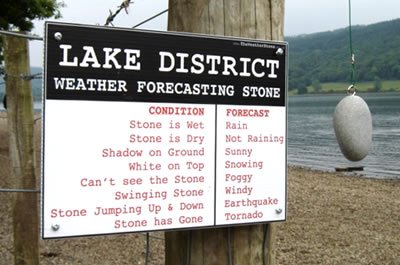
is this what you prefer to use for weather briefings?

weather-stone-d.jpg


I've never had to do an emergency flight plan before, but I suppose if my computer crapped out, I could find another one, or a myriad of other things before looking though 5 years worth of stuff in the attic for a plotter, ruler and pencil.
 
Last edited:
Not many light trainers can go 477 nm on one tank of gas with maximum payload and reasonable fuel reserves.

I did this twice - today - and both ways I did it with a sectional open in my lap and a finger on it, just to make sure I can still do it, which I like to do periodically to stay sharp. KMDD-KEOS direct nonstop this morning in my 172, 2 hours on the ground and direct nonstop return. Yeah I have a coupled 2-axis autopilot, and MFD with traffic and weather. But sometimes the plan goes into the outhouse and you still have to know how to navigate and handfly just like I did it today. I'm strangely comfortably with weeding out weak students in this manner, or at the very least provide a teachable moment. It's all fine and good to have "toys" - and I'll admit I use them on nearly every flight - but you also have to be able to do without the toys because eventually every one of them will take a vacation on you at some point.

Once they get their freshly minted PPL, they are going to think they know all there is about flying, because the US Gov't says they do. They will push the limits - I know, I did, and almost wrinkled an airplane in the process because I wasn't ready for it. It's better if they already know where the problems are.

By the way - it was 3.9 hours with a bit of tailwind on the way up, and 4.5 on the way back with average 10 knots headwind. I have 53 gallons usable and average 7.5-8gph in cruise.
 
Last edited:
Really.

The DPE knows fltplan can plot the course
Your CFI knows fltplan can plot the course
You know fltplan can plot too

The question isn't can fltplan do it, we all know it can, the question is; given a ruler, pencle and chart can YOU plot the course.

The check-ride is where your student shows the DPE all the SKILLS he has learned, not his favorite websites and apps. God forbid the applicant is put in a situation where his trusty iWhatever F's up, then what, he commits hara kiri with his PDA stylus lol

God help 3/4 of you if one day I become a DPE lol

Whoa back there, cowboy. The DPE asked for a flight plan, he got a flight plan. I asked if he cared whether it was done with or without on line or other tools; he said he was OK with whatever method I cared to use. The main purpose was to see if I could follow the bloody thing and navigate my way to where we were headed.

During the oral exam (could have sworn I made this point before, but maybe I was not sufficiently clear) we clearly established (at least to his satisfaction) my familiarity with and ability to read and use sectional charts. We also covered my ability to perform all the tasks required to plan a flight. Fuel planning, wind correction, distance measurement, TSD calculations, weather planning, alternate airports, all that good stuff. Even W&B and takeoff and landing performance. It was almost like... I dunno... an oral exam.

So I use the tools I have available to gather the data I need. If the on line tools are unavailable, then it's back to a sectional, plotter and pencil. Not a problem. I always have the route marked on the sectional anyway, as well as elapsed times to various checkpoints. I don't fly with an iPad or whatever... I don't trust them, and they're distracting. But on the ground, I'll use whatever lessens the workload.

In fact, at the time I did my checkride I wasn't even using the panel-mounted Garmin 396; I knew I needed to be able to fly and navigate without it. The DPE asked why I wasn't using it, and I told him that. After we did the hood work and unusual attitudes, I had no idea where we were and told him I'd use a couple of VORs to find our position. He said he'd already seen me use VORs for navigation and we had already discussed triangulation, he'd rather see me use the GPS to get us home - so I did.

So. While your point is valid, you can feel free to hop down from the high horse. I know perfectly well how to plan a flight without using web sites. The DPE knows I can do it. I am quite capable of using a pencil, pen or whatever other writing implement you might feel is required.
 
Not the issue being discussed. The glass you don't have can't fail in flight. Nor is it mandatory for training pilots. Many people would flunk the final exam for a course they haven't taken.

Not hardly. There's a lot of instructors that would flunk "Glass 101" . And that's a fact!
 
XC for my ride was about 300nm one way. And I had to overnight a sectional that I never used again. All because DPE likes to send people that way. I think he has route memorized.

On actual ride, we didn't even get to 1st checkpoint. 5 minutes after takeoff, I was asked to identify a town to my left. I did, and he ended the XC portion then and there.

If DPE wants to see XC planning, do it on same sectional at least.
 
Why should a DPE care or be limited to whether the route is limited to one sectional? Without much effort I can think of a number of reasons an examiner might want to see a flight plan to a place that's on another chart, the easiest is when the departure airport is close to the edge of a sectional. And how does the DPE know that a student is capable of the monkey motions required to draw the line on the chart(s)? Many posts allude to keeping a finger on the chart during XC trips, for which having the line drawn in the correct place can be handy.

XC for my ride was about 300nm one way. And I had to overnight a sectional that I never used again. All because DPE likes to send people that way. I think he has route memorized.

On actual ride, we didn't even get to 1st checkpoint. 5 minutes after takeoff, I was asked to identify a town to my left. I did, and he ended the XC portion then and there.

If DPE wants to see XC planning, do it on same sectional at least.
 
Adamson doesn't care if you believe in the value of tools. He's made it clear in the past that he thinks only the new tools are worth learning. In 10 years or so if ADS-B goes as it may, then GPS will be the only way to go. Until then, we still have the ground-based options that we should remain proficient in using.
 
Tris, to answer your question, I'm not sure that there's much benefit to the DPE's exercise as far as distance goes. I do see the multiple sectionals benefit. However, as sectionals go the way of NDBs, we'll be seeing less and less point to doing that.
 
Back
Top