- Joined
- Sep 6, 2011
- Messages
- 10,998
- Location
- Twin Cities, MN
- Display Name
- Jonesy
- Home Airfield
- KMSP / KFCM / KSGS
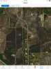
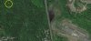
I was using the MyFlightbook.com app on my iPad and chose the option to show airports near me. As I zoomed in on Lydia Airpark just south of me I noticed something interesting....there "appears" to be a jet airliner on a modified left base for runway 18 (a grass strip!)  . Same image is used by Maps app on iPad. Haven't checked Google Earth.
Anyone else spot aircraft in satellite images?
. Same image is used by Maps app on iPad. Haven't checked Google Earth.Anyone else spot aircraft in satellite images?