denverpilot
Tied Down
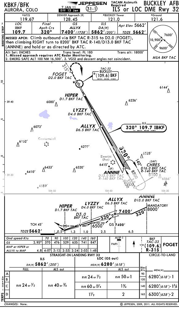
Here's a fun plate to look at and think about.
A friend who's regularly flying into and out of Buckley AFB shared this one with me.
Things to note or ask yourself:
- Where do you look up the frequency of "Chan 33" for the TACAN?
(For extra credit: Can you find it in Foreflight with your "I don't need paper charts" digital plates?)
- Why do you need it?
- How do you set this approach up in a G1000 equipped aircraft?


")
