Huge mud slide tonight

Tom-D

Taxi to Parking
Joined
Feb 23, 2005
Messages
34,740
Display Name
Tom-D
http://q13fox.com/2014/03/22/survivo...#axzz2wlCYhYRs

http://www.king5.com/news/local/Land...251709861.html
Looks like we might get another lake on the stilly.

death toll yet to be seen we know there are several. 3 as of now.

all towns down stream are warned to stay informed about river conditions as the mud slide may not hold the river when it breaches the top of the slide.

Our kids live down stream, we are very worried and the river conditions, their house is much higher than the river but, , ,
 
Tom, links no work. The 1st link is blank page. The 2nd link is "We're sorry, page no longer available." Hopes and prayers.....
 
http://q13fox.com/2014/03/22/survivo...#axzz2wlCYhYRs

http://www.king5.com/news/local/Land...251709861.html
Looks like we might get another lake on the stilly.

death toll yet to be seen we know there are several. 3 as of now.

all towns down stream are warned to stay informed about river conditions as the mud slide may not hold the river when it breaches the top of the slide.

Our kids live down stream, we are very worried and the river conditions, their house is much higher than the river but, , ,
This works better. http://www.king5.com/news/local/Nei...ne-along-with-horses-keepsakes-251746781.html
 
The news and pictures show that a major portion of a mountain came loose and covered near a square mile with mud and debris 10-20 feet of mud taking out a whole community. and blocking the river which is now filling a lake behind the mud dam. the water level in the new lake is rising about 2 feet per hour, and may flood several other communities.
 
This could get REAL ugly,, REAL fast...:hairraise:..

The slide occurred in a way that the major part of the slide went into the river first and then continued across the valley.

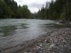
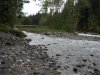
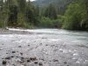
This was the river above the slide a year ago.
 

Attachments

  • DSCN0867.jpg
    DSCN0867.jpg
    220.1 KB · Views: 17
  • DSCN0868.jpg
    DSCN0868.jpg
    222.6 KB · Views: 14
  • DSCN0869.jpg
    DSCN0869.jpg
    217 KB · Views: 13
  • DSCN0870.jpg
    DSCN0870.jpg
    211.4 KB · Views: 14
It is a "slump." Most steep bank areas of the NW are susceptible to slumping. About 35 years ago 1/2 of Perkins Lane in Seattle slumped into Puget Sound. These were among the most expensive houses in Seattle. The remnants are still along the beach below.
 
The slide occurred in a way that the major part of the slide went into the river first and then continued across the valley.

This was the river above the slide a year ago.

Exact same thing happened here back in the 20's... Earthen dam held for a year and then failed,,, Washed out the county seat of Kelly and killed several people.....

Google Gros Ventre slide
 
The news and pictures show that a major portion of a mountain came loose and covered near a square mile with mud and debris 10-20 feet of mud taking out a whole community. and blocking the river which is now filling a lake behind the mud dam. the water level in the new lake is rising about 2 feet per hour, and may flood several other communities.

And when it tops the berm without a hardened spillway, the erosion is going to be really fast and a wall of water is going to come down the river valley.:yikes:
 
It is a slump, not a mudslide.

"""Slump-
A type of landslide in which a mass of rock breaks away along a curved surface and rotates more or less intact downslope. The sliding mass of rock is called a slump block. """

It has the classic curved surface, and slump block.

article-2587020-1C81908100000578-780_634x424.jpg
 
No 'could' about it...

the River (Stillaguamish) has reached the top of the berm, and has carved a spillway and it is holding, for now.
 
Last edited:
up date on the late news, 8 dead 14 missing.

If you would like to see the area, google map search " steelhead road Oso Wa."

you will see an active slide (slump) area which the south west end came off, filled the river and inundated the square mile area south of the river.
 
Back
Top