How does one inform the FAA that an airfield is now closed and no longer an airfield

gdwindowpane

Pre-takeoff checklist
Joined
Jan 25, 2018
Messages
368
Location
Halifax, Virginia
Display Name
gdwindowpane
Home Airfield
W78 - William M Tuck
We have a buyer for my Dad's property. There is an airstrip on it and it is listed on the sectionals as a private airstrip.

Buyer is not a pilot and will be returning runway to cultivation. He asked how he would inform the FAA that there is no longer an airstrip on the property.

I told him I wasn't sure but I knew a place to find out.

So how do you do it? Do I need to fill out a form 7480-1? Or is that just for "public" airports? Contact the local FSDO? State aviation department? This is in Virginia btw.

Thanks!

Chris
 
If the air port is not FAA funded, and has not been receiving FAA grants, what would happen if you just plowed it under and didn't tell anyone?

On second thought, a speculative question to my original question is what would happen if some pilot was having an engine-out problem and saw that runway on a chart and thought they could land there but runs into a combine or something.
 
Thanks for the replies. I'll start by calling Regional Airports Division and District Office.

My concern as well JOhnH, don't want flyers thinking that the property is a good option in case of emergency.
 
I was out flying about a couple of months ago, just cruising around, and decided at the last minute to do a touch and go at a small, rural, private airstrip that was on the sectional and open to the public. Yep, there it was on my Dynon PFD map. No airplanes outside; maybe they're in the hangar I see. No windsock. Well, I knew the wind in general so no big deal. Lined up and started the approach. Hmm. The runway looks funny. It looks like rows of vegetation. What the! There were corn rows right down the runway. Very short because this was April or early May. Of course, I aborted.
I called the state DOT Aviation office and asked what's up (the airport was on the State's map, as well). It's closed. No X showing. Did I check NOTAMS? Uh, well, no, I was just out cruising around and decided to land on a whim. Did I plan a flight via Foreflight? uh, no, I hadn't planned to land there when I took off.
Checked back home and yes, it was NOTAM'd closed.
On the next chart cycle the airport was off the chart.
Take down the windsock. Put up X's at least till the airport is off the chart. Send notices around to any training schools and local airports within 50 miles or so if it's not too much trouble.
 
Thanks for the replies. I'll start by calling Regional Airports Division and District Office.

My concern as well JOhnH, don't want flyers thinking that the property is a good option in case of emergency.

in an emergency, we'll look for anything that could be an option, field or not, right?
 
If the air port is not FAA funded, and has not been receiving FAA grants, what would happen if you just plowed it under and didn't tell anyone?

On second thought, a speculative question to my original question is what would happen if some pilot was having an engine-out problem and saw that runway on a chart and thought they could land there but runs into a combine or something.

This exact same thing happened in Florida a few years back.

"Post accident review of ATC data, controller statements, and publicly available documents revealed that even though the accident airplane would not have been able to glide far enough to reach the airport that the air traffic controller was vectoring the pilot to, he would not have been able to land at 91FA as it was no longer an operational airport and had been turned into a privately owned camp and retreat, and a water park existed where the airport used to be.

As a result, in order to improve safety, the FAA took the following actions:

1. FAA personnel re-emphasized to listed airport owners the necessity to keep the FAA informed of any changes to the status of their airports.

2. The FAA's Air Traffic Organization (ATO) verified nationwide that airports listed on the emergency radar vector maps were operational."
 
There are a number of private fields on the chart in Florida that don’t appear to exist in real life anymore. They’re pretty much all registered to farms. Sometimes if you circle a couple times and look hard you can see where the runway used to be.
 
If it was my field, I would lay out a large X on each end of the runway. Then I would let the FAA know that you closed your private airstrip.
I don't like the sound of closing any airstrip...bummer.
 
  • Like
Reactions: WDD
and saw that runway on a chart and thought they could land there
You have to be a steely eyed missile man to see a private grass strip from the air. In PA I would fly over a dozen of them and never see one. EFB photos are usually google sourced and years old.
 
You have to be a steely eyed missile man to see a private grass strip from the air. In PA I would fly over a dozen of them and never see one. EFB photos are usually google sourced and years old.
I’d hardly consider myself a steely-eyed missile man, but flying up and down the east coast I spot private strips all of the time. Usually they’re distinguishable by a length of grass that is dissimilar from other crops/grasses, with a connected stub to a pole barn or hangar. Sometimes you’ll see a plane or two parked as well. Seems quite of few of them are either not charted at all, or are not on the VFR sectional but in the aeronautical data, so that if you press on the map in ForeFlight the airstrip will appear in the results.

It amazing me how many private strips are out there. After perusing RAF and various Grass strip owners Facebook groups I’ve found many that are open to guests. Just in Virginia there’s probably a dozen or so that are open to granting permission to land…probably more, I just haven’t reached out. Heck, there’s a seafood/bbq place in South Carolina that has a 3,000’ grass strip, open for fly-in customers, across the street from the joint but not on the sectional chart or any aeronautical database.
In PA the farms all look like grass strips. If you a new to an area they are not easy to see.

Find the grass strip here coming from the West or North at say 3500ft. https://maps.app.goo.gl/QzYfQJUknFmbqqdUA

Google maps shows it, but there is no way you find that with your naked eyes. My EFB has augmented reality where it can use the camera to point out locations, but not all do.

Buy I do agree that some are easy to find https://maps.app.goo.gl/MVZuE8aSAVsWSada7
 
Last edited:
In PA the farms all look like grass strips. If you a new to an area they are not easy to see.

Find the grass strip here coming from the West or North at say 3500ft. https://maps.app.goo.gl/QzYfQJUknFmbqqdUA

Google maps shows it, but there is no way you find that with your naked eyes. My EFB has augmented reality where it can use the camera to point out locations, but not all do.

Buy I do agree that some are easy to find https://maps.app.goo.gl/MVZuE8aSAVsWSada7
That Broad Airport stands out like a sore thumb if you’ve spent years in a high wing aircraft looking at terrain and for strips. In a low wing they are very hard to find/discover.

Most grass strips that get abandoned seem to do so when the builder of the strip or their kid dies and the second or third generation doesn’t care and lets the strip go unmowed a few years. Easy to find, maybe better than other choices for emergency, but finito to use again. Others are just houses or commercial areas now. Know of strips gone forty years still on chart. And many never on a chart.

Anyhow pretty sure there’s a form to chart or unchart a private strip.
 
In PA the farms all look like grass strips. If you a new to an area they are not easy to see.

Find the grass strip here coming from the West or North at say 3500ft. https://maps.app.goo.gl/QzYfQJUknFmbqqdUA

Google maps shows it, but there is no way you find that with your naked eyes. My EFB has augmented reality where it can use the camera to point out locations, but not all do.

Buy I do agree that some are easy to find https://maps.app.goo.gl/MVZuE8aSAVsWSada7
Wow, I’ve never seen touchdown zone markers on a grass strip. Most of the strips I spot don’t have as much as white-painted tires lining the runway.
 
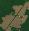
Yeah Dad's is pretty easy to identify. Especially when the crops have been cut. Wish I could have found some pilot(s) interested in it. Or wish it was closer to my current domicile.

1759104455953.png
 
Yeah Dad's is pretty easy to identify. Especially when the crops have been cut. Wish I could have found some pilot(s) interested in it. Or wish it was closer to my current domicile.

View attachment 145579
Wow that's a beauty. Fall is the easiest to identify - the runway grass will still be green, and of course, if there are crops, it's a blaze down the middle. Somewhat true in spring too.
 
Thanks for the replies. I'll start by calling Regional Airports Division and District Office.

My concern as well JOhnH, don't want flyers thinking that the property is a good option in case of emergency.
wouldnt that be something u would want pilots to know. to have an runway to land on as opposed to trees. would think u would want pilots not to think it’s someplace to land except in an emergency
 
Have you considered telling him that if he keeps the runway, you can visit him more often? Assuming you’re in the area.
 
Unfortunately my father passed away in June. That's the only reason we're selling the property, planes, etc.
 
If the air port is not FAA funded, and has not been receiving FAA grants, what would happen if you just plowed it under and didn't tell anyone?

On second thought, a speculative question to my original question is what would happen if some pilot was having an engine-out problem and saw that runway on a chart and thought they could land there but runs into a combine or something.
There are a lot of charted fields that are no longer in operation. Put a finger on your blue dot in ForeFlight when you're at home, and see what the nearest airports that show up are.

For me, the results go like this:

1) 0WI2 Doering Farms Airfield (2600 ft): Donated to the state of Wisconsin, now the Loew Lake Unit of the Kettle Moraine State Forest. If you squint at the satellite view you can tell where the runway used to be.
2) WI77 Willow Creek (1200 ft). I did some digging on this one a while back; the owner died in 2008 at the age of 94. He had a Private pilot certificate issued in 1953 and his last medical was in 1978. It's easy to see the east end of the runway from Willow Creek Rd and Appleton Ave, and there's a house that has two buildings out back, one of which was clearly a hangar. It's painted barn red and in the warmer parts of the year when the grass is green, I swear I can see a bright yellow Cub sitting in front of the hangar, but I'm quite sure nobody has flown in or out of here in 30+ years. :(
3) WN75 Erin Aero. Still exists, runway in the middle of a cornfield. This is where the US Open Blimp Crash happened in 2017. I've never seen any evidence of any other aircraft activity there, but the manager has a Private Pilot certificate issued in 2009 and current BasicMed so it's possible.
4) 02C Capitol Drive. Finally, a real, open, public airport!

Sadly, the situation seems pretty similar in most places where I've looked. I would bet that more than half of the private unpaved strips in the database haven't been used in 20+ years. :(
 
Back
Top