How do you use thunderstorm predictions?

ebykowsky

Cleared for Takeoff
Joined
Dec 12, 2012
Messages
1,405
Display Name

Display name:
goalstop
It's getting to the time of year here where we get thunderstorms on a regular basis, sometimes every day for a week. I know there are several predictive technologies out there for Tstorms, but how do you all use them? If there is a warning of convective activity in the area (even with no visible precip) do you guys fly? How conservative should one be when making a go-no-go call? I just have seen several warnings for convection on weather charts and even more METARS and TAFs with "TS" that turn out to be nothing. Obviously any significant or developing precip on a radar would be immediate no-go if in the area.
 
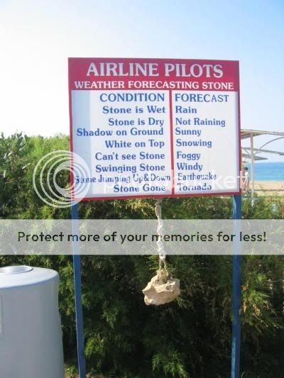
I usually look out the window and say something to the degree of "Yep, looks like a thundersterm."
 
I just go outside and look around. Seriously

If its humid and hot, and by noon the fair weather cumulus are showing some vertical development... 'you're gonna have a bad time'
 
Most of the time you can figure out if you can get where you want to go, otherwise you wouldn't launch. After that, it's anybody's guess. If you go, take a RON bag in the event you find yourself somewhere other than home when the weather turns to crap.

Having the bag along accomplishes two purposes:

1. You're less likely to do something stupid in weather you and your plane can't handle.

2. The weather gods will see the bag and know you have outsmarted them and that there's no reason to waste a good hail-storm.
 
Depends on why type of Tstms they are. If they're associated with a cold front (squal line) then I'm probably not flying. If they're the usual single cell / multi cell stuff that forms during the heating of the day then I go flying. In the SE it's almost a daily event during the summer. If we didn't fly or even if we tried to keep the recommended 20 miles away, there would be a lot of down time around these parts during the summer.
 
Ditto, ditto... assuming you are not planning to "find a gap" through forecast or reported squall lines (not for me!), all you do is keep checking ahead by whatever means you have onboard, while keeping an eye on the sky. Caution should be used going around Cbs, as their effects can be felt miles away (turbulence, hail, etc), but even when you are trying to get somewhere, isolated stuff is not necessarily a show-stopper. With IFR capability and/or onboard wx tools, you can "get away" with more, obviously.
I'm only VFR-rated, but I was along once for a ride in a Cherokee 6 at about 7000 MSL, with embedded cells near the route of flight, and the PIC kept us in fairly benign IMC the whole way, using just a StormScope and advisories from ATC (looking at precip on their radar, and forwarding PIREPs). We made a few minor detours, but overall I was impressed with how much could be done with those simple tools (and the PIC's extensive IFR experience).
 
Ditto, ditto... assuming you are not planning to "find a gap" through forecast or reported squall lines (not for me!)

It wasn't a squalll line, but I've btdt in a skyhawk. That's one of those mistakes you only make once.

539941_3274281776390_525268911_n.jpg
 
Most of the time you can figure out if you can get where you want to go, otherwise you wouldn't launch. After that, it's anybody's guess. If you go, take a RON bag in the event you find yourself somewhere other than home when the weather turns to crap.

Having the bag along accomplishes two purposes:

1. You're less likely to do something stupid in weather you and your plane can't handle.

2. The weather gods will see the bag and know you have outsmarted them and that there's no reason to waste a good hail-storm.

:yeahthat: Weather gods are really smart that way!
 
I posted about this in another thread. Forecasters and weather briefers are not always right. I needed to get my son back to where he's working this summer, a couple hundred miles northwest of where we were. There had been rain and building thunderstorms all afternoon that I had been watching on my iPad. The briefer painted a horrible picture of top to 45,000 and no way we could complete the flight VFR or IFR. I almost opted for a 10 hour car drive round trip. But after watching it another 45 min. it seemed doable. We flew it in great VFR conditions with no less than 4,000' ceilings and 10 miles visibility. A little over three hours later we were both back where we needed to be.
 
I usually look out the window and say something to the degree of "Yep, looks like a thundersterm."

I don't even need to work that hard - Colorado in the spring. Guranteed every afternoon. And it's why I have 3 UPS for the electronic equipment in the house.
 
Back to the OP's original questions of what's out there to help with Tstorm prediction...

Don't forget Scott D's www.AvWXWorkshops.com and his internet roadmap.

Spend some money on joining the site and 60-90 minutes of one on one time with him and you'll get an excellent overview of how to use the various weather products provided to us and compiled on his site. Scott can walk you through to major products (and a few of the minor ones) to see if any of those storms are headed your way.

It's a good investment in weather knowledge.

But if you don't want to spend the money....

w400_6a46e10c12ed6908fb30482f3b40df.jpg
 
I don't fly into them. Seems overly simple but flying VFR it is an easy policy. Here as in the south, if you don't fly on days with pop u convection you sit much of the summer out

Red Leader said:
Pick up your visual scanning!
 
I don't. Paying attention to thunderstorm forecasts tells you really about nothing as to if you'll be able to make a flight.

Instead I just wait until its time to go and start looking at the radar. If there is nothing that is going to rip me into shreds I go. Escape routes are the key to the game of thunderstorm chess.
 
It's getting to the time of year here where we get thunderstorms on a regular basis, sometimes every day for a week. I know there are several predictive technologies out there for Tstorms, but how do you all use them? If there is a warning of convective activity in the area (even with no visible precip) do you guys fly? How conservative should one be when making a go-no-go call? I just have seen several warnings for convection on weather charts and even more METARS and TAFs with "TS" that turn out to be nothing. Obviously any significant or developing precip on a radar would be immediate no-go if in the area.

I have cancelled 3 trips so far because of this! Getting close to go time and the weather looks doable but the forecast suggest we would not be able to make it back. So we cancel and wouldn’t you k now, the prettiest day ever. Seriously 3 times in the past 2 months! I don’t want to get to the point that I say screw it, from the past I'll know it will be good, but sometimes I just wish I would have pushed it and dealt with stuff on the horizon. I don’t take a lot of risk and since we didn’t have to go we canceled. But it is annoying,. I've never flown around pop ups so maybe I should grab my CFI and go fly on a day like that and see what happens.
 
Ah, the ol "Hope is my plan" method. :lol:

No it's the "I can't control the weather and the difference between a go and no go is much smaller then the margin of error for a thunderstorm forecast"
 
No it's the "I can't control the weather and the difference between a go and no go is much smaller then the margin of error for a thunderstorm forecast"

I agree with this, particularly for bumming around the local area. Convective forecasts are hit or miss. I've seen awful convective activity on days with low probability and a clear blue sky all day when the foreast said "batten down the hatches". Also, you don't get 30% convective activity, either there is convection where you want/need to be or there isn't. Looking out the window solves this issue. That makes it a heck of a planning tool.

Now, when I'm on an X/C trip, that's a different situation. In that case, I monitor frontal activity, weather radar, etc and try and get a handle on the direction, timing, etc. of the front. On the other hand, if we're talking afternoon pop-up's, I do my best to get going early and arrive before the big stuff develops in the afternoon.
 
I don't. Paying attention to thunderstorm forecasts tells you really about nothing as to if you'll be able to make a flight.

Instead I just wait until its time to go and start looking at the radar. If there is nothing that is going to rip me into shreds I go. Escape routes are the key to the game of thunderstorm chess.

:yeahthat:

I launch if there is no building storms and I have an out. Red is nothing to mess with, yellow is caution, green means go.

I've used XM weather and threaded some really cool lines of thunderstorms by flying parallel to them and waiting for a break in the action. When there is a break all the way through I'm in.
 
Depends on why type of Tstms they are. If they're associated with a cold front (squal line) then I'm probably not flying. If they're the usual single cell / multi cell stuff that forms during the heating of the day then I go flying. In the SE it's almost a daily event during the summer. If we didn't fly or even if we tried to keep the recommended 20 miles away, there would be a lot of down time around these parts during the summer.

:yeahthat:
 

Attachments

  • TS_over_Sanford.jpg
    TS_over_Sanford.jpg
    134.2 KB · Views: 23
Here in southern Florida, you can almost set your watch based on the afternoon thunderstorms. Almost everyday we will have thunderstorms in the mid afternoon, by night fall they are usually gone. I typically fly in the morning, but when that is not possible I see what the current activity is at the time of taking off and see where things are headed. If it seems there will be storms between where I am and where I want to be well then I am stuck wher I am until conditions change. Otherwise it is into the wild blue yonder we go. During the flight I keep a close on on stormscope and xmweather and steer clear of the storms, if that means turning around or getting on the ground so be it. I always have a plan B exit plan, that allows me to stay far away from the storms. I have yet found anything that has compelled me that it was so important it was worth the risk of chancing an close encounter with a thunderstorm.
 
Back
Top