eetrojan
Pattern Altitude
Hi all, I’m looking for some additional guidance on flying another VFR transition route over LAX.
As mentioned in another thread, I’m planning to fly the northbound “Mini Route”. I was originally thinking of going to Camarillo, but am now thinking I’ll land at Santa Monica airport instead.
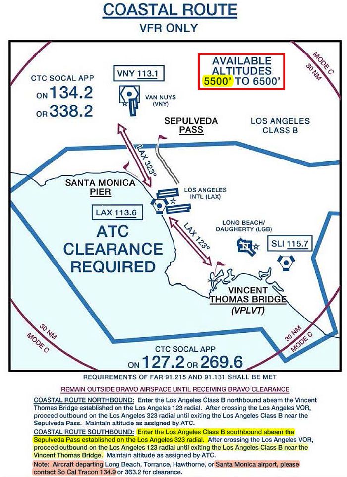
After that, I want to depart Santa Monica and take the “Coastal Route” (reproduced below) back to John Wayne.
The inset below says that Coastal Route is flown at assigned altitudes of 5500 to 6500’ (I’m guessing that it’s 5500 when flying southeast and 6500 when flying northwest).
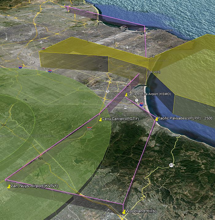
My question relates to getting to gaining sufficient altitude when departing SMO. In order to get to 5500, and be to the north of the LAX shelf if that matters, I would need to climb to the northwest and then turn back onto the Coastal Route.
The inset note says if departing Santa Monica airport, I should contact SoCal Tracon 134.9 for clearance, instead of SoCal App 127.2 which is normally used by aircraft to the north of the Bravo. What can I expect to hear from SoCal Tracon when departing SMO to transit through the Coastal Route? Will the Tracon allow me to climb to 5500 into the 50/100 Bravo shelf? While I wouldn't need to go as far as shown, and I could enter the Burbank charlie if I'm with SoCal, will they expect me to make the climb in a right hand spiral as sketched below?
Thanks!
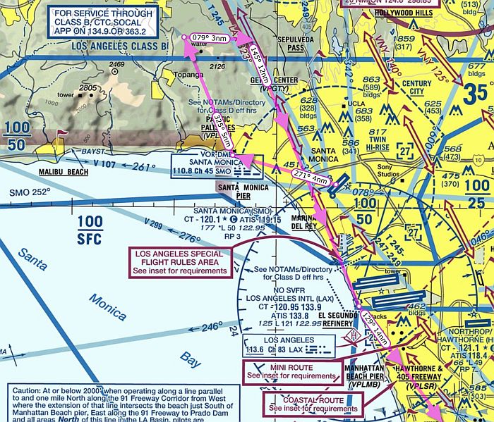
As mentioned in another thread, I’m planning to fly the northbound “Mini Route”. I was originally thinking of going to Camarillo, but am now thinking I’ll land at Santa Monica airport instead.
After that, I want to depart Santa Monica and take the “Coastal Route” (reproduced below) back to John Wayne.
The inset below says that Coastal Route is flown at assigned altitudes of 5500 to 6500’ (I’m guessing that it’s 5500 when flying southeast and 6500 when flying northwest).
My question relates to getting to gaining sufficient altitude when departing SMO. In order to get to 5500, and be to the north of the LAX shelf if that matters, I would need to climb to the northwest and then turn back onto the Coastal Route.
The inset note says if departing Santa Monica airport, I should contact SoCal Tracon 134.9 for clearance, instead of SoCal App 127.2 which is normally used by aircraft to the north of the Bravo. What can I expect to hear from SoCal Tracon when departing SMO to transit through the Coastal Route? Will the Tracon allow me to climb to 5500 into the 50/100 Bravo shelf? While I wouldn't need to go as far as shown, and I could enter the Burbank charlie if I'm with SoCal, will they expect me to make the climb in a right hand spiral as sketched below?
Thanks!