Glider Fun in TN

vontresc

En-Route
Joined
Aug 8, 2006
Messages
3,492
Location
Madison
Display Name
vonSegelGoober
Home Airfield
KMSN
In case anyone wants to meet up, I am going to be around Chattanooga all week flying gliders. We will mainly be flying the Sequatchie valley out of Jasper (KAPT), but today I am at Sarah Kelley's glider port in Benton

http://www.chilhowee.com

Stop on by if you're bored.

I'll post pictures and reports later.
 
have fun vonTrashCow. hey maybe if you get a rain day you could do a day trip over to tullahoma to check out the concordia? that would be nifty. looking forward to your reports!
 
Fun day today. The conditions weren't very strong, but it was a good day to get the cobwebs out after a winter of not flying. Took a tow to 2200' and played around in some weak low altitude wave. It was pretty localized and hard to pin down, but I managed to get up to 4500' MSL. Stayed up for a bit over an hour. The chillhowee airport is a wonderful place, and it felt a bit sad to have to leave it for the Jasper airport, but the ridge here is better :-)

Here's the OLC trace from today.

http://www.onlinecontest.org/olc-2.0/gliding/flightinfo.html?flightId=-723474179
 
Hey, what's the hardware and the software used for that? That's cool!

Is it available outside of soaring contests?

Many glider pilots now have GPS loggers they carry with them. The OLC really is just a way to "compete" outside of contests, and makes decentralized contests possible.

For the OLC you can technically just use your Garmin GPS to log the flight. You just have to follow some prescribed steps to upload your files.
 
Very cool!

In the statistics chart, what are the meanings of the various columns?

first column s[km] is distance, %Kurbel is % of time circling, Naufwinde is number of thermals, R/C [m/s] is average rate of climb, E is an efficiency number, basically equal to your achieved L/D for the leg in straight flight, and Vd [km/h] is the average speed for the leg.

The % circling and number of thermals is really low because pete made this flight in pure ridge lift where he basically never circled. That is also why the L/D is insanely high. Unfortunately the Ka-6 is not a 4000:1 glider.
 
Thanks.

Looks like no small feat to me - 4+ hours and all that back and forth distance. Neat stuff.
 
You need to change your signature to reflect your new accomplishment, Pete! :D It still sez Silver Badge! Great job... and it's a good thing you thought not to drink too much pop before you flew! :hairraise:
 
he still has to get a 3000 meter altitude gain before he can get the gold badge. perhaps he'll have to bring the Ka-6 out west sometime.
 
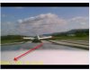
Well I got some of the video edited down.

I was using one of those "Spy Cameras" taped to the turtledeck.

 
Well I got some of the video edited down.

I was using one of those "Spy Cameras" taped to the turtledeck.

Damn, I was hoping for jet tow planes by the time 33 years in the future came...
attachment.php
 

Attachments

  • future.jpg
    future.jpg
    25.9 KB · Views: 25
Last edited:
Yeah I know I screwed up the timestamp on the camera...
 
Very cool. Makes me want to go get that glider rating done...

Instrument first... then I'll go play again in sailplanes...
 
Last edited:
Back
Top