[FONT="]All,
I have been using Garmin Pilot for over a month now and compared it to ForeFlight and WingX for functionality and cosmetics. I certainly wish we could combine the best from each app but that is of course not possible. I went with Pilot due to introductory price and the set of features / functionality. After a month of use I have generated almost 20 suggestions for bug fixes, functional and cosmetic improvements. Some of the fixes seem so obvious to a pilot and others are to improve the usability of the application, on my iPad. Haven't found how to attach a file to this forum so here is a cut and paste effort to show my observations. On a final note I still find Pilot has more functionality than the other 2 but improvements over the next year will determine which application I subscribe to in 2014. I have also reported each of these to "Aviation Support" email address at the Pilot developer contact.[/FONT]
[FONT="]
1. Many of the images in the Help PDF which show examples are labeled incorrectly. The vertical orientation is called "portrait" and not landscape. The horizontal orientation is "landscape" and not portrait. You'll probably want to correct that in your next release.[/FONT][FONT="]
[/FONT]
[FONT="]2. How can I change the name of bookmarked flight plans? The start and end points with airfields / waypoints are not descriptive. I would prefer to see “Maine to Baltimore” or “CAP FW Rt 1”.[/FONT][FONT="]
[/FONT]
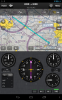
[FONT="]3. Do you have a North Up vs. Track Up feature in this version or will that come in a future update?[/FONT][FONT="]
[/FONT]
[FONT="]4. Increase user waypoints from 50 to 500[/FONT][FONT="]
[/FONT]
[FONT="]5. A more direct way to move between Map – FP – Trip Planning views than going thru the HOME button[/FONT][FONT="]
[/FONT]
[FONT="]6. Bug - With a flight plan active, then selecting "Direct To" function, the "Direct To" course will hold for a few minutes then revert back to the active flight plan prior to arriving at the Direct To destination. The Direct To destination should override any other planning active and retain the guidance to the selected destination.[/FONT][FONT="]
[/FONT][FONT="]7. When navigating with an active flight plan, the charts displayed by default will show the destination airfield, very nice. With a "Direct To" active, the charts displayed by default do not show those appropriate to the "Direct To" destination. You should make the charts for Direct To destination similar in function to Flight Plan destination. If a pilot selects Direct To there is a reason for going there and the related charts for that destination would be appropriate and reduce any need for additional screen changes and button pushes.[/FONT][FONT="]
[/FONT]
[FONT="]8. In Split screen mode, when displaying the Active NavLog, the bottom screen split should adjust automatically to maximize the amount of map showing. I entered a flight plan with 3 legs the switched to the map screen with split. The bottom half of the screen displayed the NavLog but with only 3 segments in the Flight Plan, over half of the bottom split was empty. This view should adjust automatically to maximize the map being displayed while showing the NavLog in its entirety. [/FONT][FONT="]
[/FONT]
[FONT="]9. Create a location on the FlyGarmin website, or a location appropriate to the Pilot GPS, and list all of the user suggested improvements, such as this. You could use status such as "Under Consideration", "In Development", "Scheduled for Release", etc. [/FONT]
[FONT="]10. Having to press "menu" while in the split screen mode to access charts, widgets, panel. etc. is cumbersome and inefficient. All split screen capabilities should be listed with either one-push selections on the bottom of the split or, as this program runs in an IOs environment, maybe a sideways swipe to scroll between the split screen functions. Either way, the central navigation buttons located at the top of the Pilot screen are indicative of a coding effort which has several independent modules connected by a menu, rather than a nice seamless integration. [/FONT][FONT="]
[/FONT][FONT="]11. When constructing a new flight plan to an unfamiliar area the pilot may not know the airport name but have the city name. Using the "Airport Information" module and searching for the city will result in the listing of airports in that area. A capability should be added to allow an airport found in the "Airport Information" module to be added into the flight plan. Presently we need to remember the identifier, flip back to flight plan and add the airport manually. Garmin may also want to consider adding "View on Map" to the Airport Information tab to allow a user to see the airport on the map being used.[/FONT][FONT="]
[/FONT]
[FONT="]12. Working with Alerts and found that Pilot will not allow an alert to be set without an active GPS position being received. The program complains that I am already 4771 miles past that alert location. Pilot should allow alerts to be created during the flight planning stage even when on the ground, especially when on the ground. This provides for a calm and undistracted planning activity without being rushed or jostled in the aircraft.[/FONT]
[FONT="]
[/FONT][FONT="]13. When approaching an airfield while flying VFR it continues to be a challenge to determine your aircraft position relative to the runways available. This is especially evident when arriving at an unfamiliar airfield. A feature which greatly reduces this effort is to portray the extended runways overlaid on the airfield symbol on the VFR sectional. This allows for very rapid and intuitive visualization of your position relative to the available runways. This works especially well when combined with the course line on the map, the approach to the traffic pattern becomes unmistakable. [/FONT][FONT="]
[/FONT]
[FONT="]14. Another functional mod to consider. I am planning a 300 mile x-country flight next week and flying VOR to VOR. It would be of value if the "Active NavLog", either in the "Trip Planning" or "Map" area would have a data element selection available for something like NavAid Freq. Hard copy kneeboard nav logs usually have a field for the navigational facility frequency for each way point if using something like a VOR/VORTAC.
[/FONT]
[FONT="]15. Working with a X-country trip and having an issue with the Fuel Rem data being displayed in the NavLog within Trip PLanning. Using a C-182 for the trip with 87 Gal on board, extended tanks. The first leg of the trip shows 52.7 miles flown, 8.6 Gal Burned, and 48.8 Gal remaining. This totals to 7.5 Gals total on board which is 30 Gal short of the A/C configuration of 87 Gal. I removed that aircraft, designated another, then re-entered the data for that C-182 in the Aircraft section with the same results. 30 Gals short in the NavLog for trip planning.
[/FONT][FONT="]
[/FONT][FONT="]16. Another item which would be of great help is to designate an aircraft as the default or primary. I have 5 aircraft entered and the flight plan keeps defaulting to the first on the list. I should be able to mark one as the default for all planning.
17. [/FONT][FONT="][FONT="]All user data erased from application after linking / unlinking from flyGarmin. This bug was recreated / confirmed by the Pilot development team on 1/29.[/FONT][FONT="]
[/FONT]
Thanks,
Mark
Maine
[/FONT]