Four Out Of Four Out Of Towners Scrapped Flights

Henning, you KNOW I have 1,000 to 4,000 foot peaks on the way to / from and around the GGB. The towers are 800 feet and you have to be above that. Skyscrapers are higher and recently someone said Alcatraz is protected and requires 2000 feet or something of clearance.
..

That must have been post-9/11. When I flew the bay tour we just stayed under 1500(?) feet and talked to SFO. I know that I flew over Alcatraz and the Golden Gate off of the "Mythbusters" runway.
 
Last edited:
It's been VFR in Kansas for like the last 200 days! Of course, there isn't much "site seeing" to be done here.
 
They must have been post-9/11. When I flew the bay tour we just stayed under 1500(?) feet and talked to SFO. I know that I flew over Alcatraz and the Golden Gate off of the "Mythbusters" runway.

I flew it a year ago and the kept me under 1500 over Alcatraz.
 
I flew it a year ago and the kept me under 1500 over Alcatraz.

I flew it TONIGHT and I was on with Nor Cal (flight following only) and I believe I selected my altitude at roughly 1800. They didn't complain but then again I flew AROUND it not over it (and the sectional on ForeFlight didn't say otherwise). Probably the best night flight I've ever flown. The two appreciative pilots in my plane didn't hurt either. One of the best flights I've ever had.
 
I flew it TONIGHT and I was on with Nor Cal (flight following only) and I believe I selected my altitude at roughly 1800. They didn't complain but then again I flew AROUND it not over it (and the sectional on ForeFlight didn't say otherwise). Probably the best night flight I've ever flown. The two appreciative pilots in my plane didn't hurt either. One of the best flights I've ever had.

I agree. Mine was a night flight and it was definately one of my best flights ever.
 
I flew it TONIGHT and I was on with Nor Cal (flight following only) and I believe I selected my altitude at roughly 1800. They didn't complain but then again I flew AROUND it not over it (and the sectional on ForeFlight didn't say otherwise). Probably the best night flight I've ever flown. The two appreciative pilots in my plane didn't hurt either. One of the best flights I've ever had.

Cool. Jealous. The 172 flies nice with two folks up front, but throw some weight in the back and it's even better. Glad you had fun!
 
I took the Arrow to Half Moon Bay yesterday. It was a HELLA nice day!

The lack of panel mount GPS is a bit disconcerting around all that Class B, but Foreflight on the Iphone clipped in to the kneeboard worked just as well!
 
My new plane has GPS though come to think of it I didn't once look at the screen except to tune the freq (I just flew the plane and am very familiar with the Bravo boundaries on the Bay Tour).

Wow, that is funny, I am now realizing I didn't once look at the GPS or the iPad Foreflight in my pax's lap. I hand flew / chose my own altitudes / maneuvered / got us back by knowledge of land marks. I guess I have to "unlearn" my primary training now and learn how to use tools.
 
Edit: I did ask him to show me the closest town on the iPad so when I dialed up Nor Cal for flight following I could say "Bolinas" or whatever so they could figure out which blip I was on their screen. Otherwise, a true aviation joy ride putting around the local area.
 
My new plane has GPS though come to think of it I didn't once look at the screen except to tune the freq (I just flew the plane and am very familiar with the Bravo boundaries on the Bay Tour).

Wow, that is funny, I am now realizing I didn't once look at the GPS or the iPad Foreflight in my pax's lap. I hand flew / chose my own altitudes / maneuvered / got us back by knowledge of land marks. I guess I have to "unlearn" my primary training now and learn how to use tools.

On my check ride, I assumed I was supposed to use only pilotage and dead reckoning and maybe track a VOR, but I did have a yoke mounted 496. When we came to the part where he disorients you, I started looking at landmarks and referring to the chart. The DPE pointed to the 496 and said "are you planning on using that?". He wanted to make sure that I knew how to use everything in the plane. That said, I am not sure I would be comfortable navigating through SF Bravo without a navaid, so that is impressive.
 
Really? SF Bravo is simple without a GPS. It hasn't changed in decades and we used to fly all over the place there with nothing more than a TAC chart and eyeballs; people weren't getting in trouble all the time. GPS is great for getting around, but by the time you have a license, you should know your home area airspace like the back of your hand.
 
Really? SF Bravo is simple without a GPS. It hasn't changed in decades and we used to fly all over the place there with nothing more than a TAC chart and eyeballs; people weren't getting in trouble all the time. GPS is great for getting around, but by the time you have a license, you should know your home area airspace like the back of your hand.
Agreed. The area around SF is one of the easiest to interpret visually from a a map, unlike, say, Kansas.
 
Really? SF Bravo is simple without a GPS. It hasn't changed in decades and we used to fly all over the place there with nothing more than a TAC chart and eyeballs; people weren't getting in trouble all the time. GPS is great for getting around, but by the time you have a license, you should know your home area airspace like the back of your hand.

Agreed. The area around SF is one of the easiest to interpret visually from a a map, unlike, say, Kansas.

I do, and agreed. It just allows me to shave it a little closer than I would on a visual basis. Maybe it's all in my head.
 
Agreed. The area around SF is one of the easiest to interpret visually from a a map, unlike, say, Kansas.

Kansas, you just figure out which highway/road you're over and the towns don't look alike... if you're low enough. :)
 
On my check ride, I assumed I was supposed to use only pilotage and dead reckoning and maybe track a VOR, but I did have a yoke mounted 496. When we came to the part where he disorients you, I started looking at landmarks and referring to the chart. The DPE pointed to the 496 and said "are you planning on using that?". He wanted to make sure that I knew how to use everything in the plane. That said, I am not sure I would be comfortable navigating through SF Bravo without a navaid, so that is impressive.

Thanks. I was nervous the first time I did it (my first flight as a private pilot and only a TAC with me on board). However, I'm born and raised in SF for the first 20 years of my life so I know the layout and can think like this:

Don't go pass Golden Gate Park at a certain altitude

Stay 2000 feet to the side of the skyscrapers

Make an imaginary line in your mind between Treasure Island and Embarcadero (that's the class charlie ring they often instruct you to stay out of).

Etc.

If it was not my home area you bet I'd want GPS.
 
Really? SF Bravo is simple without a GPS. It hasn't changed in decades and we used to fly all over the place there with nothing more than a TAC chart and eyeballs; people weren't getting in trouble all the time. GPS is great for getting around, but by the time you have a license, you should know your home area airspace like the back of your hand.

This is what I'm working on now, knowing my home area. In this case, I cleared the mountains, selected 1800 feet, called them up for advisories, and stayed at 1800. Simple as that.
 
Cool. Jealous. The 172 flies nice with two folks up front, but throw some weight in the back and it's even better. Glad you had fun!

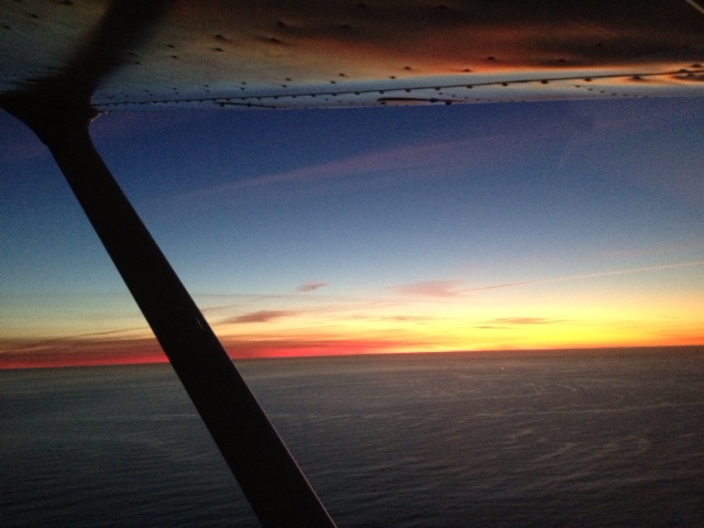
Not to make you more jealous but here it is in photo form (Pacific Ocean, Coastline, Bay Tour) thanks to the pilot in the back seat and his cell phone camera:


6791643005_ab133cbd7a.jpg


6791642809_4c30b23590_o.jpg


6791642913_241267d9bb_o.jpg


6791643115_fa5a7f67a2_o.jpg


6791643249_f010e6b1f1_o.jpg
 
I would think the Bay Area would be really easy to fly by reference to landmarks, they are everywhere and unmistakable. Try flying here with nothing but fields and 5 mile visibility.

I flew from one end of Florida to the other sans GPS (thing couldn't get a signal for some reason). You have to be a special kind of stupid to get lost with all that coastline.

I am that stupid. I once "got lost" / went the wrong way at night - when heading for the Golden Gate Bridge. I followed the wrong freeway / lights.

Thank goodness I will now start using GPS (but not "relying" on it).
 
Have you figured out how to tell the difference between the Bay and the Ocean yet?:popcorn:
 
But that incident of "lost" was when my pax asked about the "black hole" under us which I later realized was San Pablo Bay. I was SUPPOSED to follow the 101 freeway South towards the Golden Gate Bridge but instead I'd done a downwind departure from runway 29 and followed highway 37 which goes East. I quickly realized my mistake and went back to the 101. Eventually when we never made it I would have figured out why. One of those "duh" moments.
 
Really? SF Bravo is simple without a GPS. It hasn't changed in decades and we used to fly all over the place there with nothing more than a TAC chart and eyeballs; people weren't getting in trouble all the time. GPS is great for getting around, but by the time you have a license, you should know your home area airspace like the back of your hand.

My home airspace is Sacramento. I have only flown under the SF Bravo twice, when I was with my CFI. I fly into RHV pretty regularly, but that doesn't go into the Bravo.
 
Hi Kimberly
My boss and I are going to be in SF on friday to look at a Cessna 310 in KWVI. Im looking for a great mechanic to do a pre purchase inspection. Do you have any real good shops out there that you know about?

Thanks Mike
 
Hi Kimberly
My boss and I are going to be in SF on friday to look at a Cessna 310 in KWVI. Im looking for a great mechanic to do a pre purchase inspection. Do you have any real good shops out there that you know about?

Thanks Mike

The owner left for what I think is a vacation, but you can call the Petaluma Pilot Training Center (or Mangon Aircraft) at O69. Otherwise, the Sonoma Jet Center at KSTS. However, be aware that my places are more than 100nm from KWVI. Perhaps someone else local will chime in?
 
On my check ride, I assumed I was supposed to use only pilotage and dead reckoning and maybe track a VOR, but I did have a yoke mounted 496. When we came to the part where he disorients you, I started looking at landmarks and referring to the chart. The DPE pointed to the 496 and said "are you planning on using that?". He wanted to make sure that I knew how to use everything in the plane. That said, I am not sure I would be comfortable navigating through SF Bravo without a navaid, so that is impressive.
One of the things about checkrides, if it is in the plane you need to know how to use it. I don't recall if my DPE asked me to use the loran, but I'm pretty sure I set the BK 89B.
I find the more I know the area from above, the better I can pick out the landmarks; gps, sectional, or nothing. If I ever really get "lost", a quick check of any of the tools brings me back.
As to learning about the tools in your particular aircraft, you might think about borrowing or buying an owners manual for the device. There may also be a PC simulator out there you can practice with.
Some flight sims do a fairly decent job simulating the device. As some people have said, they may be good enough to do some chair flying prior to your flight. Deck out the cockpit with the tools, and you cn have a complete package.
 
Back
Top