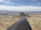
I’ve done that route 3 times, starting off near Milwaukee. Two times I overnighted in Raton, NM, the main reason being I wanted an earlier morning start on the next flying. During business hours they will help you get to a hotel in town, no courtesy car available as of late July this Summer, my last trip. I cut the corners some, but have done most of the sights along the way, including the ‘4 corners’ from 3000’ or so. Of course not much to see there.
One thing to watch are the surface winds, can howl at times. On top of that you ‘may’ plan an airport with one runway. I’ll always adjust the plan as needed. Of course stronger winds & terrain often leads to turbulence. As known, things are usually better early, until 12-1 or so, depending how much wind & terrain features you are dealing with.
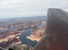
I’ve stopped at Page, AZ, GCN, & SGU. This last July I stayed at Cedar City, UT airport a few days before going to Toole, UT airport. They have a special way to pronounce Toole, different than one would expect.
Two of my trips were solo, the other with one. Performance wasn’t to much of an issue, I light loaded the fuel some, always climbing well before getting near any terrain I planned to cross, then having a 2500’+ buffer. A bit less buffer may be fine crossing one hill with an easy out on both sides. I didn’t go to any airport my plane isn’t designed for, the ones you see mentioned in the backcountry.
When I landed at GCN then SGU, we did 2 of the Grand Canyon ‘corridors’, since right there. I think they were at 10.5 & 11.5, depending on direction of flight. At those altitudes it’s not busy at all, any tour traffic is below you. The main thing is to climb ahead of time, starting the corridor level. The corridors are anchored by waypoints, easy-peasy.
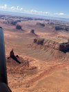
My favorite is Monument Valley, not too many rules there, but I don’t buzz any parking lots. I don’t need someone to hound me with ADS information.
When I left the Salt Lake area I climbed West of the Bravo, talked to approach. They let me through the airspace to fly the I-80 corridor to the east. I did all my flying VFR with ADS weather to Garmin Pilot on my IPad, max flexibility.
If you are just going to SGU, could go back the same way. If going further North, the I-80 corridor works. I realize there are more tenuous options between those routes, but they are easy, safe options. Just like any flying, weather factors in.




 illa.


