Crossing the Sierra Nevada, SFO->LAS

Charlie Tango, will you shut the F up for a couple of minutes? He is from New York, he is considering a PA-28-180 to go across some of the most forbidding landscape in this country. In the winter, I really don't want to be called out to pick what is left of him up with a shovel and a spoon.

He has "experience in the European alps" and such. Great. Ever gotten into a triple lenticular over the lee side of the Sierra and thrown into a rotor? I have. ANd it ain't much fun. And it ain't survivable unless you have been taught how to get out of it.

Charlie Tango, he asked how to get from SFO (which isn't going to be his airport of departure since nobody rents aircraft out of SFO) to LAS. He isn't going to go into LAS since light singles aren't welcome there.

Why don't we just give him the local best routing for his experience level and let it go at that.

THanks,

Jim

Wow Jim, how about you shut the f*** up? My opinion isn't the same as yours, so what? Perhaps I have some of the local knowledge about this route of flight that the OP was looking for? Perhaps extra hours of flying and hundreds of dollars in wasted fuel only to deny the OP the mountain flight he was looking for isn't the only advice that should be permitted?

I asked why not route him to Mexico because he was being told to go hundreds of miles out of his way, needlessly crossing high mountain ranges like the San Gabrials and San Bernardinos in order to clear Mammoth by several hundred miles, that was just Henning giving stupid advice so he could hear himself talk and it was fair to point out that wasn't a reasonable route.

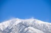
A pilot that has crossed the Alps a number of times is well qualified to do this simple crossing. I really doubt that you will get a call in Nevada City to bring your shovel and spoon down here. I have been living under Mammoth Pass for 35 years and really don't see your triple lennies creating a non-survivable crossing, like ever. True we do get some impressive waves, that's why soaring is so popular around here.
 
Hwy 14 doesn't go east. It goes north to 395.

You are correct, I was incorrect. I meant Hwy 178 which runs west/east and passes just south of Lake Isabella.

I've spent a lot of time in that area including where 14 intersects 395. Maybe that's why I was thinking of 14 when I meant 178.
 
I rented a Cherokee Six, with oxygen. We are 350lbs under gross.
Should give us enough headroom to cross Mammoth.
 
I rented a Cherokee Six, with oxygen. We are 350lbs under gross.
Should give us enough headroom to cross Mammoth.

That's adequate performance, as long as the weather and mechanicals cooperate.

Who has a Six on the line around here?
 
I've made many crossings at Friant and have done so in the winter, but never in an underpowered airplane. When I was flying my 180 Cherokee our preferred route to Las Vegas was direct PMD-HEC, and then into Vegas. This route is low and the Cherokees are capable of making the flight. From my home field in San Jose this route is 424 nm's and would take 2 hrs and 35 minutes according to FF if we left right now with my typical power settings.

Going Friant would be KRHV-FRA-NIKOL-OAL-BTY-HIDEN- and then what ever Vegas airport you choose. This is 405 nm's and would take 2 hours and 27 minutes per FF if we left now. The terrain is much more unforgiving going this route. Palmdale is your friend!
 
I made the crossing twice today, KMMH -> KTCY

West bound in the morning there was a north wind that reversed the normal flow over the crest at Mammoth Pass. I crossed the crest at 10,000' and something was weird. Sight picture and attitude were normal but my Rotax was over speeding, 2,000' / min sink but smooth as can be.

The return flight was uneventful, crossed at 11,500 and couldn't find a bump. I used to think a big snow pack was required for the Sierra to be beautiful but I realized today that all of that granite is amazing too.

After considering the route for the OP on the crossing I think direct to Yosemite Valley then head for Lee Vinning / Mono Lake. You will have to climb to 12,000' to be legal over the park's east entrance.
 
Last edited:
The notation on the San Francisco Sectional that used to tell you to stay 2000 AGL over Yosemite seems to have gone away.

I believe that "public law" expired a long time ago. It actually established a survey, the results of which were to be submitted to Congress. In the early 90s.

Now, 2000 AGL through a high pass like that is not a bad idea, but I don't think you're going to get a nasty fine like you will if you buzz the elephant seals on the Farallons.
 
The notation on the San Francisco Sectional that used to tell you to stay 2000 AGL over Yosemite seems to have gone away.

I believe that "public law" expired a long time ago. It actually established a survey, the results of which were to be submitted to Congress. In the early 90s.

That would explain why I couldn't find it on the sectional.

Now, 2000 AGL through a high pass like that is not a bad idea, but I don't think you're going to get a nasty fine like you will if you buzz the elephant seals on the Farallons.

The last time I saw the Farallons, it was from 10,500. Years ago, when I was multiengine current, I saw them from 2000 in a Duchess.
 

Attachments

  • 104_0443.JPG
    104_0443.JPG
    1.4 MB · Views: 24
  • 104_0444.JPG
    104_0444.JPG
    1.7 MB · Views: 25
One route that looks doable on a topography map would be Mariposa-Follow Central Yosemite Highway to Yosemite Village, then follow Tenaya Creek to Tenaya Lake, and then from there follow Tioga Road to Lee Vining. After that, turn south and head towards Bishop, Furnace Creek and so on...
Thoughts?
 
One route that looks doable on a topography map would be Mariposa-Follow Central Yosemite Highway to Yosemite Village, then follow Tenaya Creek to Tenaya Lake, and then from there follow Tioga Road to Lee Vining. After that, turn south and head towards Bishop, Furnace Creek and so on...
Thoughts?

Bingo!

On the way to Furnace Creek the Eureka Sand Dunes are remarkable but it costs a good climb to get a close look.
 

Attachments

  • eureka.jpg
    eureka.jpg
    972.9 KB · Views: 50
That's adequate performance, as long as the weather and mechanicals cooperate.

Who has a Six on the line around here?

MAKG1, I have a Cherokee 6/300 that I rent out of KPAO in WVFC.

I was just reading this thread and thinking of doing the V230 route across the Sierras to LAS. I was a little worried reading all the comments, but I guess those were mainly focused on the C180 aspect of it.

I took at Archer 1 to TVL several times. Once coming out of TVL in the summer DA (reported 8500) was so high I was only getting between 0-100 FPM. I am 130' and I was alone. I am not sure I would want to try crossing the V230 in that.

My first V230 crossing was in my Quad City Challenger with a 2-stroke 50hp Rotax. Navigated with a handheld nav/com (vor)

post-6-0-00394100-1369856754.jpg
 
Last edited:
The simple way to convince yourself that a direct routing makes no sense is to open up Skyvector, then put in your routing - then something like AVE GMN PMD then HEC and into VGT. Look at the minimal additional time it would take to take the 'safe' way around . . . its essentially nothing given the total flight time . . .

There are lots of airplanes permanently parked in that part of the Sierra from people doing exactly what you propose. You're essentially at gross and going down with the fuel burn - but you'll need 11500 to skirt through a pass at tree top level. With no hp reserve if you find a wave.

Its winter - forget the frozen inhospitable terrain - and consider for a moment there will be winds howling at those elevations regardless of what they are doing down low.

Winds at the airports in SoCal today were sporty but flyable. . . .but this is what it looked like at 10,000 today - you DoNT want to be up there in that -
 

Attachments

  • 10982872_10206109927537514_6407626747219927988_o.jpg
    10982872_10206109927537514_6407626747219927988_o.jpg
    270 KB · Views: 38
Last edited:
One route that looks doable on a topography map would be Mariposa-Follow Central Yosemite Highway to Yosemite Village, then follow Tenaya Creek to Tenaya Lake, and then from there follow Tioga Road to Lee Vining. After that, turn south and head towards Bishop, Furnace Creek and so on...
Thoughts?

you go down you're not getting rescued til Spring . .
 
I'm with MAKG... don't attempt it in that aircraft with that load. That's turbo country.

I flew an Archer II from KAPC to KLAS years ago. Route was down the Central Valley, over Tehachapi, then Palmdale, Victorville and along I-15 up to Vegas.

This your best bet...not much climbing at all. The closer you get to summer though, go early, as turbulence gets awful. Also, check your TAF's for predicted crosswinds in the afternoon at Vegas airports (e.g., KHND). They are frequently gusting 18 ~ 25 knots, direct crosswind. I have cancelled many a trip. Leave at the crack of dawn!
 
The simple way to convince yourself that a direct routing makes no sense is to open up Skyvector, then put in your routing - then something like AVE GMN PMD then HEC and into VGT. Look at the minimal additional time it would take to take the 'safe' way around . . . its essentially nothing given the total flight time . . .

There are lots of airplanes permanently parked in that part of the Sierra from people doing exactly what you propose. You're essentially at gross and going down with the fuel burn - but you'll need 11500 to skirt through a pass at tree top level. With no hp reserve if you find a wave.

Its winter - forget the frozen inhospitable terrain - and consider for a moment there will be winds howling at those elevations regardless of what they are doing down low.

Winds at the airports in SoCal today were sporty but flyable. . . .but this is what it looked like at 10,000 today - you DoNT want to be up there in that -

There is a noticeable difference, but not totally crazy.

According to Forflight ( PAO AVE GMN PMD then HEC and into VGT) is 3h 12m with current winds @140kts for my PA32.

(PAO KMPI KMNH BIH LAS) is 2h30m.

Camanche Pilot, are you saying you wouldn't make that crossing in the PA32 either or is it just the 180 your worried about? I can easily get to 13500 on a hot day with 4-5 adults in the PA32.
 
Three things Comanche Pilot just said I will dispute.

'there will be winds howling at those elevations regardless of what they are doing down low.' This might be true in the Spring, the Winter has lots of calm weather, of course not when a front is coming through.

'you'll need 11500 to skirt through a pass at tree top level' at 9,600 I would be at tree top level of about 10 minutes, 11,500 is well above the timber line and you don't have to come near any terrain at that altitude.

'you go down you're not getting rescued til Spring . .'

We just finished a new SAR facility. On that route you would have East and West side SAR after you right away and in many cases it would be hours.
 
It's a slam dunk flight over Mammoth.... just ask Mr Forbes. And he "was" a world-class balloonist and glider pilot.
 
There is a noticeable difference, but not totally crazy.

According to Forflight ( PAO AVE GMN PMD then HEC and into VGT) is 3h 12m with current winds @140kts for my PA32.

(PAO KMPI KMNH BIH LAS) is 2h30m.

Camanche Pilot, are you saying you wouldn't make that crossing in the PA32 either or is it just the 180 your worried about? I can easily get to 13500 on a hot day with 4-5 adults in the PA32.

The 'real world' difference, after climbs, vectors, etc is negligible. It adds 30 min to go around -
 
Three things Comanche Pilot just said I will dispute.

'there will be winds howling at those elevations regardless of what they are doing down low.' This might be true in the Spring, the Winter has lots of calm weather, of course not when a front is coming through.

'you'll need 11500 to skirt through a pass at tree top level' at 9,600 I would be at tree top level of about 10 minutes, 11,500 is well above the timber line and you don't have to come near any terrain at that altitude.

'you go down you're not getting rescued til Spring . .'

We just finished a new SAR facility. On that route you would have East and West side SAR after you right away and in many cases it would be hours.


My thoughts . . . . in winter the winds are usually fairly strong aloft. . . . except when the ridiculously resilient high is sitting over Nevada in winter.

At 9600 in the pass at actual tree top level the mountains are 4000' above you on both side - no thank you with no where to go.

at 11500 - the peaks are still 2000' above you on either side - flying in a pass with no where to land - in snow if you find a rotor and get pushed down - ok - not a risk I want to take with two other people on board. Are you planning on packing survival gear because that pass in winter is exactly the same as flying over 100nm of water - and you need to treat it as such and give the mountains the respect they deserve.

As for SAR - you can come get me unless the winds are 40 knots - or night time is coming by the time someone realizes you're overdue and missing in those mountains, or a million other reasons. and the airplane is not coming out of there until Spring. If ever.

I would not under almost any circumstances take that routing in a normally aspirated aircraft unless I know the winds aloft are under 20 knots -

YMMV.
 
I would not under almost any circumstances take that routing in a normally aspirated aircraft unless I know the winds aloft are under 20 knots -

YMMV.

Yea, I wouldn't consider it unless weather was appropriate. If any of these were true, it would be a no go for me.

>20 knts
Large temp difference between 9k-12k'
Large change in wind direction between 9k-12k
 
Last edited:
Back
Top