luvflyin
Touchdown! Greaser!
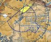
I've noticed that there are some Class D's that have extensions beyond the usual 4 nm. Usually these extensions are Class E Surface Areas, but in these cases they have actually extended the Class D. Is this done for some particular reason? It seems to be being done randomly. Is this the future? Are they in the process of extending Class D Airspace beyond the usual 4 nm radius all over the Country? There is one change that is already in effect by Notam, not charted yet (KSLE), where the Surface Area has been extended out beyond 8 nm and depending on how you read it, the whole thing could be Class D.
Examples I've found of "extensions" being Class D are, CSG MLU GGG SJT AEG MGE. By far a big majority of Class D's with extension still have the extensions as Class E Surface Areas. What's going on here?
Examples I've found of "extensions" being Class D are, CSG MLU GGG SJT AEG MGE. By far a big majority of Class D's with extension still have the extensions as Class E Surface Areas. What's going on here?