You are using an out of date browser. It may not display this or other websites correctly.
You should upgrade or use an alternative browser.
You should upgrade or use an alternative browser.
chart q of the day
- Thread starter Let'sgoflying!
- Start date
HPNPilot1200
En-Route
The New Orleans sectional notes MEF's in the area of that quadrant should not exceed 400 feet. The MORA provides at least 1,000 ft terrain clearance in non-mountainous areas, so 1,400 ft seems reasonable.
Let'sgoflying!
Touchdown! Greaser!
Yet adjacent, and identical gulf quadrants are 400'.
Something doesn't add up.
Something doesn't add up.
roncachamp
Final Approach
Yet adjacent, and identical gulf quadrants are 400'.
Something doesn't add up.
What adjacent and identical gulf quadrants are 400'?
Let'sgoflying!
Touchdown! Greaser!
Leaving right now but they are S and E of that one.
Still begs the question of what could be out there.
Still begs the question of what could be out there.
roncachamp
Final Approach
Leaving right now but they are S and E of that one.
Still begs the question of what could be out there.
Have you taken into consideration quadrants on the sectional are 30' by 30' while quadrants on the enroute chart are 1° by 1°?
Let'sgoflying!
Touchdown! Greaser!
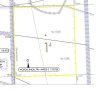
I saw it on a paper chart, let me see if I can locate and scan.