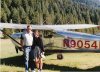
Bob's Ramblings from the PB.

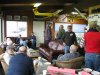
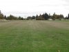
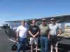
I got a call from John Cole, he is my wife’s sister Kate’s boy. It seemed that he and his brother Jimmy wanted to see if I could help them find a big horn sheep. One of the boys had drawn a sheep tag for the Owyhee hunting unit. They wondered if I could pick them up at the Rome airstrip by the Owyhee River and fly the river canyon to the south. This was in the 1980s and I still had the Cessna 170 N4558C. I wanted to do this for them, especially for Jimmy as he has suffered for years with Rheumatoid Arthritis. His back was bent so bad that he was looking at the ground when he was standing up. I asked when the season opened, and they said in a week. I said that was alright but I couldn’t fly if the season was already open. We made arrangements for the day they wanted me to pick them up and I agreed. They planned on camping next to the landing strip. Now Rome is south of Vale, about 85 or 90 miles. It is on highway 95 that goes to NV. The Owyhee River canyon is a great habitat for Big Horn Sheep. On the assigned day I flew to Rome early in the morning and much to my surprise found John and Jimmy camped right on the south end of the Rome runway. Now keep in mind this was late summer and this was a dirt runway, plus this is eastern Oregon, some call it the desert. I landed over their camp to the north, as that was into the wind. I taxied back and shut 58C down. I got out and said my hellos to the boys. We talked about the flight and they said that John was the only one going. I mentioned to them that they should have made their camp off of the runway. I told them that they had better put things away before I took off.
John and I loaded up and turned the plane around and away we went. When I turned to make a down wind departure we could barely see Jimmy for the dirt cloud all around him. We flew south for a few miles until we got to the steep canyon walls of the Owyhee canyon. I slowed down to 70 miles an hour with a couple notches of flaps and eased down in the canyon. Now the sides of the canyon were higher than we were flying. The rocks in the bottom of the river were half as big as a house. We flew along the river about half way to three forks of the Owyhee. We climbed out of the canyon to turn around as it was to narrow to make a 180 turn. We slowed again and reversed our course. John finally spotted some sheep and we made another pass. He used his binoculars to glass them. There was a nice ram in the bunch, and so we made sure John had a landmark, to find this location, when they returned with the truck. We flew back to the landing strip and landed. I asked Jimmy if he had a chance to cover the butter before we took off. We got quite a laugh out of their camping spot. The following week the boys bagged a nice Big Horn Sheep. ~ ~ ~

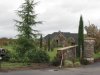
This is not the landing I made at Rome for this story.


http://www.youtube.com/skybobb#p/u/18/uxmcrQ1AMTA
 
Last edited:
(More of my ramblings)

Yesterday I went to Friday morning coffee at Lenhardts airport (1/08/10). Lenhard's is a little airport SE of Portland, OR. and I hangared my plane there for a couple of years when I brought it west with me for the winter months. This is an airport that you would all like. The people are all so friendly and they fly my kind of aircraft, tail wheel a lot of them, some air coupes, Stearmans, some PTs of different numbers. Some ultra lites, air knockers, a Oshkosh winner stagger wing Beach. You name it and it is probably there. Jack Lenhardt is the man that started this little place as a young man. He sprayed crops when he first started out. Gradually he improved from the grass strip to both grass and a paved runway. He has built hangars, has a mechanic on the field, and sells gas. If you know how you can taxi up to the truck, start it up pull the power take off on pump the fuel in your airplane, write it down on the clip board with you name and aircraft number and fly away. They will send you a bill at the first of the month. Jack's boy Glenn takes care of things around there, mowing, moving things around and is a hard worker.. Terri, Jack's daughter, runs the office part of the business and is a swell gal to deal with.
Well I had missed a couple of weeks but I went out Friday to the airport coffee time. When I got there I was informed that Jack had died on Thursday. I knew he had been fighting a battle with Leukemia but the last time I had seen him he seemed to be doing good. Well I didn't know how many people would show up for our regular Friday coffee. The place was packed. Glenn or Terri weren't there, but a long time friend and helper named Jim, the only name I know him by. Had the coffee ready and others like myself brought donuts and goodies. I was shocked at the news, but I guess his children are planning on keeping the place going. Jack had a lot of planes in his day and the pictures are on the walls of him in his war bird, his DC 3, and the Beloit he had built. He had plans to fly it across the English Chanel this year since it was the 100 year celebration of the first flight in the original Beloit in 1909. That was before he was diagnosed with cancer. When I had my plane at his airport we made several flights to Independence airport cafe for lunch, and one time we flew to Pacific City for lunch with another pilot. all of us flying our own airplane. Three guys in three airplanes, Jack in a Piper Colt, the other Bob in his RV, and me in my 182. Jack was a peach of a guy and I am going to miss him. ~ ~ ~
 

Attachments

  • Fri. Coffee at Lenhardt's..JPG
    Fri. Coffee at Lenhardt's..JPG
    2.1 MB · Views: 12
(More of my ramblings)

Yesterday I went to Friday morning coffee at Lenhardts airport (1/08/10). Lenhard's is a little airport SE of Portland, OR. and I hangared my plane there for a couple of years when I brought it west with me for the winter months. This is an airport that you would all like. The people are all so friendly and they fly my kind of aircraft, tail wheel a lot of them, some air coupes, Stearmans, some PTs of different numbers. Some ultra lites, air knockers, a Oshkosh winner stagger wing Beach. You name it and it is probably there. Jack Lenhardt is the man that started this little place as a young man. He sprayed crops when he first started out. Gradually he improved from the grass strip to both grass and a paved runway. He has built hangars, has a mechanic on the field, and sells gas. If you know how you can taxi up to the truck, start it up pull the power take off on pump the fuel in your airplane, write it down on the clip board with you name and aircraft number and fly away. They will send you a bill at the first of the month. Jack's boy Glenn takes care of things around there, mowing, moving things around and is a hard worker.. Terri, Jack's daughter, runs the office part of the business and is a swell gal to deal with.
Well I had missed a couple of weeks but I went out Friday to the airport coffee time. When I got there I was informed that Jack had died on Thursday. I knew he had been fighting a battle with Leukemia but the last time I had seen him he seemed to be doing good. Well I didn't know how many people would show up for our regular Friday coffee. The place was packed. Glenn or Terri weren't there, but a long time friend and helper named Jim, the only name I know him by. Had the coffee ready and others like myself brought donuts and goodies. I was shocked at the news, but I guess his children are planning on keeping the place going. Jack had a lot of planes in his day and the pictures are on the walls of him in his war bird, his DC 3, and the Beloit he had built. He had plans to fly it across the English Chanel this year since it was the 100 year celebration of the first flight in the original Beloit in 1909. That was before he was diagnosed with cancer. When I had my plane at his airport we made several flights to Independence airport cafe for lunch, and one time we flew to Pacific City for lunch with another pilot. all of us flying our own airplane. Three guys in three airplanes, Jack in a Piper Colt, the other Bob in his RV, and me in my 182. Jack was a peach of a guy and I am going to miss him. ~ ~ ~
When a fellow like that passes on, we all feel a hole....as in a piece of us has gone missing.....
 
( Rambling on)

The College I attended for four years is THE COLLEGE OF IDAHO located at Caldwell, ID. For the last few years Essie and I have been attending a reunion type get together at Three Rivers Campground at Lowell, ID. Lowell is located about 21 miles up river from the little town of Kooskia, ID. Essie and I fly the airplane into Kooskia, and our friends Dave and Dorothy Wright leave a car for us to make the last 21 miles. This one year was special as we planned to depart from this outing on a long cross country to Bloominton/Normal, IL. We had to load the Cessna with our gear for Kooskia, for our trip to IL., and then I was going to meet my son in law Kevin Plaza for a flight to Oshkosh. The year was 2003, the 100th year celebration of the Wright Brothers first flight.
We loaded the airplane put the car in the hangar and took off for Kooskia. This is a beautiful flight that takes a route over the hills between Midvale, Cambridge, Council, ID. and the Hells canyon of the Snake River. On farther north there are the Seven Devil Mountains, and then the Salmon River comes in as we fly over Riggins, ID. When we go over White Bird Hill and fly over the town of Grangevill, ID. We are just about to the little town of Kooskia. Kooskia, is in a valley along a stream that runs into the Clearwater River. The runway is grass and is plenty long. We landed parked and took our gear for the two nights we would be in Lowell and put them in the car that Dave had left for us. We drove up the Clearwater to Lowell. They call it the three Rivers Campground, as the Lochsa and the Selway, come together here to form the Clearwater River. This group started with 4 couples of C of I grads, and is now up to about 40 to 50 each year. We had a great time visiting, playing horse shoes, and a few other things.We also had some great meals, one night we had Crapie, (fish) that two of our fishing buddies caught and cooked. One night another couple furnished tri-tip steak and all the trimmings. I will try to finish this with the rest of our flight to IL. ( to be cont.) ~ ~ ~


http://www.youtube.com/watch?v=CMNSzlCj_bU
 
Last edited:
Oh man... Good times. Keep 'em comin', Bob, I love this stuff! Having been out there ever so briefly, I still love to follow these on the chart. Must... Go... Back...

BTW, what was the little strip we went into on the way back from Owyhee?
 
I think we landed at the Johnson's cow camp one called the Holdout cow camp. I have that one on my story of almost getting hit by that low flying single engine Jet aircraft. Just a few stories back. Bob
 
(Continued our flight to Bloomington, IL.)

After spending a few great days with my college buddies and their spouses, We were off for our trip to Bloomington, IL. We drove back to Kooskia loaded the plane and I gave it a good look over. We would be going over some rough country right off the bat, between Kooskia, and Hamilton, MT. There were some forest fires in the area and so we had smoke to content with, also we were heading east and soon we would be facing the morning sun. We had got a good early start, about 6:00 MT. as we wanted to reach Custer, SD. On this first day. Essie had agreed to go along on this cross country only if we didn’t try to make it all in one day. This was her first long cross country. It had only taken me 20 years to get her to this point and I sure didn’t want to screw it up. We were over some rough, timbered mountains as we passed over Moose Creek landing strip way out here in the Rocky Mountains. AS we crossed the last high point we could see Hamilton down below and we had to start down from our 9500 ft altitude to land at Hamilton, 3642 MSL on runway 16. We hadn’t fueled since we left Vale so we needed some fuel and a cup of coffee. We planned to stay out of the high country as we continued east so we did some IFR ( I follow roads) along the I-90 freeway, we flew over Anaconda, Butte, Bozeman, And then short of Billings we started to angle SE toward Sheridan, WY. This kept us north of the Big Horn Mountains. We landed at Sheridan and refueled 54 November. We were doing fine even though we had some heavy smoke in this part of our trip. I remember on pilot was asking another pilot what road he could be over as it was a freeway. The other pilot, a local pilot I gathered, answered maybe Cody. The first one asked where in the hell is Cody. I asked my wife, how would you like to be flying with that guy. However he did explain his problem, He said I am from California and am going to Minnesota. We took off and headed east, we were thinking about flying over the Devils Tower, but the wife just wanted to get to our first days destination. So we flew across Wy. and landed at Custer, SD. I have always been the kind of guy that has gone out of my way to help others. My friend Gail Halvorsen wrote in his book, Do good things for others and expect nothing in return, and good things will happen. Well that was about to come true. We needed a ride from the airport to the motel in Custer. I called a number I found on a card at the airport. This lady answered and I explained what I needed, I also explained that we would need an early ride back to the airport for and early departure. She said that they didn’t go to work until 8:00. I said that wouldn’t work then, and out of the blue she told me that her and her husband had just divorced, she had this big house and Essie and I could use the downstairs, bedroom, bath, shower, the whole works. I then could use her car in the morning to go to the airport and just leave the keys under the seat. Then it got better. She worked for a tour outfit for Mount Rushmore, and Crazy Horse Monuments. She picked us up and took us to her place, we showered and she went to a fast food place and picked us up some sandwiches. My wife and I took a little nap and Liz, the gal that was being so kind, asked if we would like to ride out to Mount Rushmore. I had seen it as a young boy, but my wife had never, so off we went to see the monuments. When we got to Mount Rushmore we said we didn’t feel like spending any time there, so Liz drove up and rolled down the window and said to the guard at the gate. “ Hey Charlie, we are just going in and turn around.” He said. “ O.K, Liz.” How lucky can you get! We got a good night sleep and gave Liz what we would have spent at the Motel. It worked out perfectly. The next morning the weather didn’t look great it had a threat of rain and there were a lot of clouds. When we took off and headed east, I remember talking with Essie, how there seemed to be a path of better weather right on our course. It stayed that way, all the way to our next fuel and eating stop, Denison, IW. ( to be cont.)
 
I think we landed at the Johnson's cow camp one called the Holdout cow camp. I have that one on my story of almost getting hit by that low flying single engine Jet aircraft. Just a few stories back. Bob

That's the one!
 
(Our IL. Trip continued)

It was strange how the weather was nasty looking to the North and to the South, but it was not to bad right out in front of us. We didn’t eat breakfast before we left that morning so we needed to get something at Denison. I had picked this as a fuel stop as they advertised that they had a courtesy car. We ordered fuel from the FBO got the keys to the car and headed for town. We found a place to eat and ordered breakfast. I don’t remember what she had but I remember it didn’t settle very good. We had just climbed up to altitude and maneuvered around Des Moines and Essie said she had to stop now. I hit the go to the nearest on the GPS and it said Pella, IW. So I circles down and landed at the place that makes all of those fancy new windows. She made a dash and then after she got in and we took off we had to climb back up to our cruising altitude again. At Burlington we crossed into IL. And flew not far from Abingdon, IL. Where my wife’s sister Jane lives. We planned on making a trip over there while we were in Bloomington, so we didn’t stop. We flew just south of DR. Bruce’s home field at Peoria, IL. And a short time later we made a landing straight in on runway 11 KBMI, Bloomington. My wife was happy and so was I that we hadn’t had weather to make us have to stay over anyplace. The plane had ran great and I had a few days to wait until I got to fly up to Oshkosh with my son in law that would be flying in from Portland later on in the month. My son at that time was working at a Nuclear Power Plant in Clinton, IL., where he was the plant manager. He gets his smarts from his mother! ( on to Oshkosh on the next installment)
 
(Oshkosh 2003 My first time)

I had sent and got the Oshkosh EAA Notams book, and I had read an article in the Plane and Pilot magazine about flying into Oshkosh. However I was still wondering if I was ready to do this for the first time, cold turkey so to speak. It was recommended that you fly in with someone else first. That of course wasn’t my style, I didn’t do that in the Idaho back country so I didn’t need to here. It was a go, my son in law Kevin Plaza would arrive on a Wed. and we would take off on Thur. All we needed to do was load all of our camping, sleeping, clothes, and cameras into the plane and we would be ready on Thursday morning early to fly from Bloomington to Oshkosh. It was raining lightly on our departure. I had checked the weather and it was supposed to get better the farther north we went. We were under a low overcast area, and I remember telling Kevin to be on the lookout for any towers sticking up high. The weather started to lift a little as we approached east of Rockford, IL. I had filed a flight plan with the FSS and I got a call from them asking about holes in the overcast. It seems there was someone trying to get under the overcast layer. I told them about where we were and that there was an opening over Lake Geneva. We continued on toward Ripon our starting point for a landing at Oshkosh. I told Kevin to keep his eyes open as there could be some other pilots with the same plan as ours, get there early before the rush hits. As we approached Ripon he said “ there’s one, and there is another, there is one over there, Oh! Hell they are all over.” I had to laugh, as we fell into line in front of a yellow cub. 1000 ft and 90 kts. Was the drill, follow the Railroad tracks to Fisk. Fisk is where the Approach controllers were stationed. I was hoping that we weren't going to have any snafus and have to make a circle around Rush Lake. That is where they send you if things foul up at the airport. They have the best of the best Controllers at Oshkosh. Silver high wing Cessna, Runway 9, wiggle your wings if you understand. A twist on the yoke left and right and a change in the frequency a few minutes later and we were on final for 09 Oshkosh. We had a red bi-plane ahead of us and the tower was having a hard time contacting him. He called him a lot of different airplane names, but to no avail. I was wanting the tower to tell me what I needed to do. I finally got the call and landed on the end of 09 and got off into the grass as soon as possible. We had a sign that had VAC on it for Vintage Aircraft Camping. A gentleman on a small scooter led us to our camping spot. We spent four great days at Oshkosh and then made a nice flight back to Bloomington. ~ ~ ~
 

Attachments

  • Aproach Oshkosh.bmp
    967.4 KB · Views: 11
Last edited:
(Some more rambling )

I received a call from the Sheriff dispatch asking if I could fly a deputy to check on a plane crash. I said I could and I would go and get the plane ready and meet him there. I hurried around and got out to the airport and checked things over topped off the tanks and checked the oil. I had time to remove a few bugs from my windshield. Bob Speelman showed up and said a hunter had reported a plane in the Owyhee river in the Hole in the Ground area. Now the Hole in the Ground isn’t really a hole in the ground, it is a very wide open space on the river, when above and below are tight canyon walls and narrow. It could of just as well been called the bowl, or wide spot. I knew if I flew a course just a little east of Mud Flat it would take us to the Hole in the Ground. It is about a 25 minute flight in my 182. I knew that there was a landing strip at the ranch at the Hole in the Ground , and also one at the Birch Creek Ranch. I also knew that a lot of super cub pilots landed in other places in this Owyhee country. We flew over the Ben O’dell reservoir and the Rhinehart Ranch and I turned east and started down river at the Hole. That Owyhee River canyon gets so narrow up stream from there that I didn’t think anyone would, or could land in that area. I also didn’t know of any landing places up stream. We flew the river until we were over the old Watson town site and didn’t see anything. We made a 180 and back tracked up stream. About a mile upstream from the Hole we spotted the airplane. It looked to be a straight tailed 172 or 182. The front part of the plane was in the water and the tail of the plane was up the bank. The river made a long gradual bend in this area and they had made a strip that went from waters edge to waters edge in this bend. It looked like this was a landing gone wrong. Maybe he or she couldn’t get it stopped in time. You might wonder why he didn’t do a go around. Well I wish I had a video or a picture to show you of this part of the canyon. It is a place called Iron Point and is about 400 feet deep and makes a sharp turn to the right just up river from where he went into the water. I know this a one way strip land up river and take off down river. We didn’t see anyone around the site, but we could tell that no one could get injured in this mishap. There is a road that comes to the edge of the canyon rim, and that is spot, from where the hunter had seen this airplane. There were no roads close, the ranch at the Hole was the closest place about 1 ½ mile east of the dunked airplane. Deputy Speelman told me to fly to a ranchers landing strip on Cow Creek, close to a little place on highway 95 called Sheaville, OR. Bob got on the radio to make sure it was alright for us to use the strip and the dispatch had to land line the ranch to get permission. There was another deputy driving a vehicle bringing a ATV to get to this location of the aircraft. About the time I circled the strip and looked it over we got the go ahead to land. I landed back to the east and I found out that wasn’t a good decision as when I flared to land the morning sun and the slow spinning prop nearly blinded me. Bob mentioned the fence and I was over it and got on the ground ok. We waited around for a while and the other deputy got there. Speelman went with Brad Williams the other deputy. I got to fly back to Vale by myself. What had happened is the pilot landed to hot and the landing area was too short, and he couldn’t get stopped in time. He hadn’t bothered to notify the County Sheriffs office so they had a lot of expense to check on the report of an airplane crash. ~ ~ ~
 
I am working on a Funeral talk I have to give for a man named Glen Hysell. He is one of my WWII heroes, and was in the same U.S. Army Unit as Audie Murphy. Murphy was the most decorated U.S. soldier in the second world war. Glen won a purple heart with a gold leaf cluster, signifying that he had been wounded twice. He showed me a small religious book that he had in his shirt pocket that a bullet hit and wadded up to the last page. Glen was 91 and a wonderful man. One of the greatest generation. For those of us that didn't have to serve, men like him picked up the tab for us. As we enjoy the same freedoms that they do. I will try to come up with a few more stories when I get this done on this Thurs.
 
Last edited:
A flight with my Daughter.


It was the 2nd of July 1998, I know the date as I wrote it on the back of the picture I gave my daughter, Beckie Ann Bement Plaza. We had a flight planned into Big Creek, ID. For breakfast. It was a beautiful day for the flight a few clouds, slight wind, and a lot of sun and blue sky. Big Creek Lodge and airstrip is about 100 miles ENE of Vale,OR., my home airport. Even though it was the 2nd of July there was still plenty of snow on the tops of these 9500 ft mountains around Big Creek. Our route would take us over Payette, ID. And then we would fly over Cascade Reservoir, just a little north of Yellow Pine, ID. And over what they call Profile Mountain. This mountain is named Profile mountain because from a certain view point it looks like the profile of Abe Lincoln’s face if he was laying on his back face up. The road into Big Creek from Yellow pine is only 23 miles but will take you about an hour to make the trip. However this morning you couldn’t make it as the road was still snowed in. We enjoyed a great flight in as Beckie had never made this trip before I loved showing her the different places. She isn’t all that crazy about flying but goes along just to spend some time with dad. I had been diagnosed with prostate cancer shortly before and since my older brother had died of the same disease, I think she was unsure of my future. The old 182 was purring like a kitten and we arrived over Big Creek and I set up for a landing. I was going to land without going down canyon and I had to make sure I got down low enough on down wind. The field elevation is 5743 ft MSL and so I wanted to be down to 6700 ft . There is a hog back ridge that sticks up so a person can’t see the strip when down wind. In fact it isn’t visible until you are almost ready to turn to final. It is very easy to show up at this point too high and a go around has to be started early as the strip goes up at the far or south end. The runway numbers are 1 and 19 but are not on the strip as it is grass and gravel. I got it right and we landed about a third of the way down on the 3200 ft strip. We parked and went over to the lodge to get some breakfast, only to be surprised as the lodge was closed. We found out later that the man that was running the lodge had caught a ride out with another pilot and they had crashed, killing the manager of the lodge. It was in some kind of litigation at this time. I knew of a bed and Breakfast that was about ½ a mile down the road to Yellow Pine, so we decided to walk down there. It was early in the morning, about 9:00 local time, We had only walked a short distance when we heard a noise and looked up to see a herd of elk coming up the road. They got off into the trees before I could get my camera ready to get a picture of them. We got to Gillyhans B&B and went in and they were in the process of cooking breakfast for their guests. We were informed that they only cooked for the Bed and Breakfast quests. We did get a cup of coffee however. While we were drinking our coffee my daughter, who is an elementary teacher, was talking to the guests as they awaited their breakfast. They were asking her all about a trip she had just made with a group of young people to Washington D.C. I think the owner, and cook of Gillyhans noticed that my daughter was entertaining her guests, and the first thing we knew here came our breakfast, along with the others. We had a nice time there and since they were going back to the airport strip we caught a ride back with them. Mr. Gillyhan took a nice picture, of Beckie and me by 9054 November. We had no trouble taking off and flying back to Vale. This was a great flight with a wonderful gal, my daughter Beckie Ann. ~ ~ ~


.
 

Attachments

  • IMG.jpg
    IMG.jpg
    154.8 KB · Views: 28
Benny took his final flight Thursday
I was unable to attend Benny's funeral on Thursday, as I have to take care of my wife. My old flying friend finally lost his bout with cancer. I got the word that the church was filled to overflowing with family and friends. He had lived in the Vale area all of his life. He was a farmer and a darn good one too. His good friend Kieth Gressley, the one that went on many of our flights, got up at the dinner after the funeral and told a little story.He told about how Benny, loved to go flying with me and that Keith had got to go along. He said that Benny made his last flight today and he will be waiting for me to join him later. I looked up the flights I made with Benny and his brother Emil, Keith and his son Rex. We made 2 flights to Big Creek, all the others were just one flight each to Sulphur Creek, The Flying "B" Ranch, Mackay Bar, Rome, OR. for brunch, Lands Inn, Dayville, OR. Johnson Creek, The Minam Lodge, and my Brothers place, landing at Rods strip. He loved to fly and at the auction for the Vale Mural Society he tried to buy my airplane ride each and every year, so I could take him to a new and different place in our area. I loved it and am sorry it has come to an end. RIP Benny my flying buddy!
__________________
 
Benny took his final flight Thursday

Sorry to hear that Bob... IIRC the docs hadn't given him nearly this much time, your flights obviously gave him not only a lot of joy, but something to fight for!

How's Essie doing?
 
Our trip to Gastons in 2005.

Essie was in West Linn and I was in Vale so to start our trip east I had to make a trip to West Linn to pick her up. It is 279 SM to Aero Acres from S49 Vale. I always enjoy that flight as if the weather is nice you can see the cascade mountains from Rainier To the three Sisters. Of course then there is Strawberry Mountain that is just above Prairie City, OR. we had a good flight back to Vale and had to load all the things we would need in Bloomington, and Gastons. As I said before our son and his family lived in Bloomington, IL. And he worked at the Nuclear Plant in Clinton. We were also going to take in a NASCAR race in Joliet, IL while we were visiting. We got our gear all loaded into the 182 and got a real early start on the morning of June 14 th, 2005. We flew around Boise airspace and had to stay out of the MOA around the Mountain Home Air Base. We climbed up to 9,500, and stayed there until we started over the mountains out of Pocatello, ID. There are some beautiful mountain valleys in the Preston, Soda Springs areas and we crossed Bear Lake in the corner of Idaho just before crossing into Wy. We had to bump up to 11500. to clear some of the terrain in this area. Then it was on to Rock Springs for our first fuel stop. The wind was blowing pretty good at RKS and I mentioned it to the FBO guy that was fueling our plane and he told me I needed to wait until afternoon when the wind starts to blow. So I didn’t say any more about the wind. We checked the weather on toward our next stop in North Platte and filed and off we went again. We had made 387.6 nm so far and the weather and the plane were cooperating just great. Now, my wife doesn’t like to make long flights, as I have mentioned before, so It was going to be 378.3 nm on to KLBF North Platte, and I was informed that is where we would spend the night. That was fine with me as it took 20 years to get her to make these kinds of flights with me. So you young guys that can’t get your wives to fly with you, just be patient. This part of the country east of Rock Springs is tall country. RKS is 6731.8’ at the airport, which is located up on a hill. We crossed the continental divide in around Rawlings, but we were a little south of there. We went passed Elk Mountain 11,156’ MSL. It is almost as tall at Mount Hood out in Oregon. We were cruising at 11500’. When we got passed Cheyenne, Wy we let down to 9,500’ for a little more Oxygen. We flew over Sidney, NE. I called FSS and canceled out flight plan. I don’t think it was 2:00 yet when we touched down on runway 30, North Platte Regional Airport Lee Bird Field. After making arrangements for a tie down, fuel and transportation, we found a motel with an early morning breakfast and a shuttle to take some other pilots to the airport. We settled in for the day and found a place to eat. We would finish our flight to Bloomington on the following day. ( to be continued )
 
A crew of a commuter plane needed to have a ride to the airport early the next morning so we got around early, too. We tried the complimentary breakfast and it was a regular breakfast with meat and the whole works. We loaded out bags on the shuttle and we were soon taxiing our plane out for a take off on runway 12 and heading east. We had another great day for weather. I had the GPS programmed for this trip and the next waypoint was RDK Red Oak, IA. Distance 245.5 nm. We would fly GPS direct and we would be flying parallel to highway I-80 most of the way across NE. I like this little stopping place of Red Oak, IA. They are real nice, as I have said before, they act like they appreciate your business. Our route took us north of Grand Island and Lincoln NE. and just south of Omaha . We landed on the grass runway at Red Oak and helped ourselves to a tank of 100LL. Used their bathroom bought some snacks and water. After checking the weather, notams, and filing our flight path we were off on our last leg of the flight to Blommington, IL. We climbed up to 5500 and settled in for the last 290 nm.stretch, and we would be there at about 1:30, if all went according to the plan. We were GPS direct to BMI on a course that would be having us cross the Mississippi River around Burlington, IA. We flew south of Peoria, IL. and called BMI about 10 miles out and got cleared for a straight in for runway 11.We taxied in to the FBO and our daughter in law was waiting for us. It was a great flight and we would be visiting for a while before we would finish our trip to Gastons. ( to be continued) ~ ~ ~
 
On to Gastons.

The day came that we were to fly to Gastons for the Pilots of America forum fly-in. My son and his wife were going to fly with us to Gastons. Their plan was to go to a wedding in Little Rock, while we were attending the fly-in. Our grandson was to pick them up at Gastons and drive them to Little Rock. We got all of our gear loaded and full fuel for the nearly 3 hour flight. It would be 301.0 nm from BMI to 3M0, and would take us through St.Louis airspace. We were directed to the active runway at BMI, runway 20. I asked for all of it and not an intersection take off. That runway is 8000’ long but you can’t use runway behind you. We climbed out and got on our heading to take us around Springfield and a little west of St. Louis. Son Bob had the chart in his lap and the girls in the back where making sure that I was keeping on course. They were looking for rivers, bridges, towers, lakes and anything to tell where we were. I was checking the GPS and keeping us on the line on the chart. We checked in with St. Louis Approach and got flight following through their airspace. Approach called and told me if I couldn’t see an airplane at 12 O’clock and 1 mile to climb immediately! I looked and didn’t see the plane so I started a climb, and that is when I saw the other plane above me, I pushed forward on the yoke. I heard my son ask what I was doing and told him I saw the other plane above me. I was glad to get out of their airspace. We had another close airplane as we arrived at gastons. A plane flying over the Bull Shoals Dam from west to east was coming our direction. I spotted him, but I am not sure he saw us. He kept coming and finally he turned left and went behind us. I wasn’t sure which way he was going to go. I called that we were crosswind for a left downwind for runway 24 Gastons. Steve See told me that the pattern was empty and come on down. I made a landing and our long cross country flight was ended. 2,129.2 nm. I had trouble closing my flight plan in the air and so I was trying to make a cell phone call to get it closed, as all of the ground crew came over to where we were parked. I missed some of the introductions because of this call I was trying to get accomplished. We got the award that year for coming the farthest. They said it was 1215.6, but not the route we took to get there. We had a great time at Gastons and when we got ready to fly home the weather wasn’t all that great. Haze and thunder storms. The FSS was a real help on departure from Mountain Home, where we stopped for fuel. He said to fly to W. Plains and we would miss the thunder storms. He gave me the GPS identifier and I plugged it in and flew to West Plains, then we found another airport east of St. Louis airspace to fly to. Then we selected BMI our final destination and flew home. What a great flight with family, and a great time with some folks that I had only met on the internet forums. I want to do it again while I still can , we will have to see how that plays out. ~ ~ ~
 
A tour out in the Owyhee Country.


A former student of mine, Travis Justus, was talking to me one day and said that he would like to take his mom and dad down over the Owyhee desert some day. We finally planned the trip for May 15, 2008. You see, I had dropped the ashes of Maxine and Max down by the old Copeland homestead, and Maxine was the mother of Marilyn Justus, Travis’s mother. Dave Justus had worked, and retired form the Oregon State Highway. Travis was working on a ranch out in the Owyhee desert country. Old Max was a chewing tobacco guy and so, Travis wanted to drop a chew of tobacco out for Max. On the appointed day we met at the Vale airport and I checked out the plane and did a good walk around. All was good and we loaded up and headed south our first destination would be the Copeland Place. We wouldn’t be landing but we would do a slow fly over the ridge where we had scattered the ashes a few years earlier. I have told the story before of the ashes drifting over some horses below. How someone had said that Max always tried to get Maxine to go horseback riding with him, and he never could. He finally got her on a horse. So now we slowed down and opened the right side window and Travis dropped his grandfather a chew. Also, it gave Marilyn and Dave a chance to really know the spot that we scattered the ashes. I pushed in the throttle, got rid of the two notched of flaps I had used to slow us down, and we continued on toward the Frying Pan ranch of Steve Russell’s. It also goes by the name of the Wilsey. As it was part of the larger Frying Pan Ranch. After flying over Steve’s place we turned east and headed for what is called Cedar Mountain. The old timers called it Juniper Mountain, but the BLM has another Juniper Mountain in their district, so they changed this one to Cedar. I had no more that mentioned that there were a few elk in this area , when Marilyn spotted a small bunch out of her window. We didn’t circle back as everyone looked and saw them. We flew over Cook stove reservoir, which is on the top of Cedar Mountain, flew south a short ways and then we turned back toward the Mud Flat ranch. I think it was Marilyn that said she had heard about Mud Flat and wondered where it was. We had only gone a little way in that direction when low and behold she saw more elk. She had real good eyes is all I can say. After circling Mud flat we headed for Rome, OR. That gave us a chance to point out the Rhinehart Ranch, and get a look at the Owyhee Canyon , form the hole in the ground, all the way to Rome. I showed them the rock formation they call the Pillars of Rome, and then we landed at the little Rome airstrip and ate breakfast at the little café there. Our return flight included a flight over the Jordan Craters, which is located NW of the town of Jordan Valley, OR. and Leslie Gulch, before making a landing at Pelican Point or Owyhee Reservoir State (28U) You can get the info on this airstrip on www.AirNav.com We checked out the Owyhee Hilton Hotel, a one room shack built in 1953, by a pilot from Winnemucca, NV. I like to land there as it is a rush for most passengers as they look at that landing strip from final approach, with water on both ends of the landing strip, and only 1840 ft. long. I have landed there hundreds of times and I don’t consider it a hard place to land. We flew on down the reservoir toward Owyhee Dam and then returned back to our starting point of Vale, OR. A great flight with some mighty fine folks. ~ ~ ~
 
( some more ramblings from Bob)


I got a phone call yesterday 2-21-10 from my old friend Dale Wilkins. Dale and I taught school at Vale High together for 20 years. He retired about 5 years before I did. The purpose of his call was to invite me to his 90th birthday party in a week or so. Dale had helped me do a project of making a list of all WWII Veterans in our area to post in the local papers. We wanted to thank all of those guys for their service. We also did a project at school where I went around with my video camera and got 4 veterans stories to use in Dave Eyler’s history class. Dale has been a great friend ever since about 1965. I had to tell him that I couldn’t come as my wife needed me in West Linn, OR I would have to miss his party. Dale was a WWII Veteran as he served in the Navy.

One time in 2007 Dale called me and said he needed to get to Portland, as one of his brothers was real bad and his other brother had told Dale he had better come quick. Well Dale had just had some back surgery and it would be a 7 hour trip for him by car. He asked me if there was any way I could take him and his wife Lil in my plane. I was going to visit my wife in the Portland area anyways so I said sure. I planned to land at Aero Acres on the edge of Oregon City. You can look it up on www.AirNav.com as OG30. It is a grass strip with houses lining each side of the runway. It has a towered power line on one end and tall trees on the other. It is listed as 1800X250 at 420’ elevation. The end with the power line drops off into a canyon so that just the top of the tower sticks up at the end of the runway on the south end. So on 4-3-07 we loaded into the 182 for a flight to Portland. The weather was good and it was a good day for flying. I have made this trip a lot of times and it is easy as far as I am concerned. It is 279 air miles, and usually is a 2 hour trip for me. There are lots of nice scenery on the flight. The Elkhorn Mountain around Baker City and the old gold mining town on Sumpter, There is also Strawberry Mt. by John Day, Then of course we cross the Cascade mountains, with Mount Hood at 11,200’, just east of Portland. We cruised at 8500’ until just south of Mt. Hood and then I started my let down for our destination. Now I hadn’t told Dale and Lil where we would be landing as I didn’t want him worrying about trees or power lines. I noticed him sitting up in his seat and looking at the wires approaching the front of the airplane. They are close to the end of the runway so a pilot has to be real close to land. This runway also slopes down a little to the north. We were on the ground before he could get to worked up over the approach. His brother was waiting and helped me get Dale out of the plane. He had a good visit with his brother, and it was a good thing, as he died about a week later.
The trip home was uneventful on the 5th except for some weather on the SW side of the Elkhorns , and so I went on the Baker City side of the mountains. Dale and Lil enjoyed the trip and thanked me lots for taking them. ~ ~ ~
 

Attachments

  • IMG_0483.JPG
    IMG_0483.JPG
    94.8 KB · Views: 17
  • IMG_0484.JPG
    IMG_0484.JPG
    75 KB · Views: 17
  • IMG_0499.JPG
    IMG_0499.JPG
    116.8 KB · Views: 19
Sorry I posted the wrong picture of the trees at the North end of this strip. I also forgot to mention that someone asked Dale where we landed at Portland International or Troutdale? He said Hell no we landed in someones back yard! Click on this link to see a picture on Dale after we had landed.

http://www.facebook.com/photo.php?pid=30320012&l=ec616dcc87&id=1578292210
 

Attachments

  • IMG_0485.JPG
    IMG_0485.JPG
    94.1 KB · Views: 25
Last edited:
(More of the same)

On March 18th 2009 I made a flight to the Phoenix, AZ. area to visit my son and grandson. My son Bob had asked me to fly my airplane down and give my grandson Brandon a few flights. Brandon thought he might like to learn to fly so we were going to do some flying while I was there. My friend Steve Paulson was dealing on a pick up truck in Reno on the internet and asked about a ride with me that far. I said that would be great to have someone to talk with for part of the trip. It was a great trip from Vale to Reno with lots of snow in the high parts of NV. I landed at a BLM airstrip on the edge of Reno called Spanish springs. It is 3540 long and 71’ wide. This will surprise you, but it is DIRT. We landed and I called the posted number for fuel. A guy showed up in a few minutes and fueled the plane. I had time to call Essie and tell her all was good. I had just replaced the six cylinders on my engine with six overhauled ones. I had about 4 hours on the engine before I started this trip. All was doing good, but you know how wives worry. So I told her the plane was good and so was I. Steve came and told me he thought he was going to buy the truck, but he was going to take it for a spin. I said that I was taking off after the FBO topped me off. I checked things off and checked the GPS for Kingman, AZ. and was off on the second leg for AZ. It was a good flight on across the western edge of NV. I went around Las Vegas on the west side and headed for Kingman. I crossed the Colorado River below the Hoover Dam. I circled over the Kingman airport and landed back to the west on runway 21. I spotted the self serve tanks and taxied there and shut down. I made a call to my wife and set out to find a bottle of water. I didn’t find the FBO, but did find a guy in a open building. I asked if there was a place to buy a bottle of water. He went over to a refrigerator and got a a bottle and handed it to me. I tried to pay him and he waved it off. There are still some nice people in this world. I fueled 54N and checked the GPS plus I looked in the oil door to make sure I was with out any oil leaks of any kind. It all looked good So I took off on my last leg of my trip to AZ. There are a lot of MOAs in this area so my trip would not be direct I had to use some intersections, and some VORs and some airports as I wove my way to Buckeye. When I left Vale I had to pre-heat my engine as it was quite cold. When I got to Buckeye it was 91 degrees the hottest day they had had to date. It was a good flight and I had several flights with Brandon while I was there. We flew to Sedona one time and Marana another. And we had one flight where we turned back because of high wind. I will tell about my return flight in the next installment and my flight over the Grand Canyon. ~ ~ ~
 
I almost forgot about the flight I took to Marana by myself to meet up with some AZ. PB forum guys. I can't remember if Jerry ordered pancakes or not.Oh! and guess who was the only one that flew in for this get together?
 

Attachments

  • IMG_0120.jpg
    IMG_0120.jpg
    30.7 KB · Views: 18
Return to Vale from AZ.


On April 17th I checked the weather and it looked like it would be good for my return flight back to Oregon. I had the plane all fueled and so I just had to do a pre flight, load up my gear, and head out. I had my route already programmed into my GPS and that was a good thing. As I said before there are a lot of MOAs and no fly zones in this neck of the woods. The last waypoint I had before crossing the Grand Canyon was the Peach Springs VOR. I was on a cruising altitude of 9500 Ft. MSL. From Peach Springs, I would fly direct to St. George Utah. I had the video on part time and was hand holding it to take from side to side of the Canyon. Usually I am talking a lot when I am videoing but I was speechless with the view I was witnessing. While I was in Buckeye the wind blew so hard one time that it opened my left side door. I didn’t get that window clean as you can see in the video. I found out later that I should have had a special chart for crossing the Canyon, but where I crossed was not in a no fly zone. I stopped in St. George for fuel, before continuing on north. I have a picture at the end of my canyon video that I believe is Mount Wheeler just south east of Ely, NV. I was up to 10.000 Ft. MSL at the time. That was my last fuel stop Ely, NV. I only took 18 gal. However I thought I would be getting low if I didn’t stop and top it off, and there aren’t any fuel stops between St. George and Vale, except Ely. I had to wait for the FBO operator to get back from a flight to top me off. I enjoyed the flight from Ely on home as I had flown over some of the northern part of this route on flights I had made before. I was glad to get home but I had a great flight to Az. and back. ~ ~ ~
http://www.youtube.com/watch?v=f1DpJoR6Sso
 
( another rambling story)

This is how to get in trouble with your wife and not really try very hard.

There were having a fly-in and an air show in Pendleton, OR. The date was 5-17- 03. and I was going to fly up by myself, as my wife was in West Linn at the time. They were going to have a ceremony honoring some of Jimmy Doolittle’s Raiders at the fly-in. They had a training base in Pendleton during WWII for B-25s. When you take off to the North West from runway 29 you can still see the parking circles and taxiways that the bombers used. They are in a wheat field now but still visible. I don’t think they learned the trick of how to takeoff of an aircraft carrier here, however did their basic training in the B-25s. I am sure you all know the story of Jimmy Doolittle and his raiders flying off of the aircraft carrier The USS Hornet.

A good friend of mine was in charge of the fly-in and airshow. His name was Terry Womack, and he is married to a Cindy Holton, sister to Bill Holton. I had both of them in High School, in Vale. I called my wife on the cell phone and told her I was not sure if I would be spending the night or flying back to Vale. I told her I was trying to get hold of Bryce Gunlach, a guy I used to coach with in Vale, that now lived in Pendleton. I did contact him but he didn’t really have room for me to stay with him. His son would have to sleep on the couch. Later on at the air show I ran into Bill Holton and he said they had two spare bedrooms and I could spent the night with them. When I went to call my wife again my cell phone battery needed charged. I didn’t bring my charger.

They had a dance at the big hangar that night and a Glenn Miller type orchestra playing the tunes of the 40s and 50s. I borrowed a car from Bill and went with Cindy and Terry to the dance. A lot of the folks there were dressed in the period dress and a lot of military dress also. They had some war birds parked in the far corners and tables all decorated up nice. It was a great evening.

The next morning I went to the airport to go home and my airplane would not start. It didn’t make a sound. I pushed the starter button and not a sound. So it was Sunday and I had to find a mechanic to drag it into a hangar and find the problem. It turned out to be the starter solenoid. It had broken off of the bracket that fastens to the starter and was hanging down the side on a wire,

Now while I was doing all of this unbeknownst to me Gunlach calls my wife and asks if I got home alright last night. She said she thought I stayed with him. He says.”no he didn’t stay with us”. Then she calls a friend in Vale to have him look in my hangar to see if my plane was there. He called back and told her the plane wasn’t there.

I finally got the airplane repaired and fired up and flew home. I put the plane away and when I got home I used the home phone to call the wife. I said “I’m home” and she didn’t sound happy for some reason. I thought that maybe she would be happier If I would get back in the plane and wind up on the top of Mount Emily in the Blue Mountains.

So now I call and tell her when I get someplace and when I get home. I learned a valuable lesson on this flight. ~ ~ ~
 
Last edited:
( Ron Sutphin- Bob’s ramblings)

Ron Sutphin gave me a call and wanted to know if it would be possible for me to give him a ride up to Preist Lake, to pick up a Super Cub he had purchased. Ron is a well know figure in some circles. At this time it was reported that he had about 40,000 flight hours logged. A lot of it was flown in the service, some even for Air America. You can check this link for his story. http://www.air-america.org/In_Remembrance/sutphin.shtml When he called it was in July of 2007, and he owned the Crowley Ranch in South Eastern Or. On the side he bought and sold STOL type aircraft. Now Priest Lake (67S) www.AirNav for the details. Is in the far Northern part of Idaho, and not far from the Canadian border. The man that he bought the Piper from had brought if down from Alaska and left it at Preist Lake for him. On the 7th of July 2007 we flew up to retrieve his purchase. I was just a little intimidated flying this man with all he had done. He had a chart in his lap and was following along. I had my GPS set on Sand Point as that is where her had told me we were going. We went up toward Enterprise on the back side of the Eagle Cap mountains, and onacross the Snake River toward Lewiston, ID. It was when we were about even with Moscow, ID. That he mentioned that we really needed to go to Priest Lake Forest Service strip. I changed my GPS way point and adjusted my heading to take up to Priest Lake.We passed Coeur d’Alene and Sand Point on the west side and landed on Runway 32 straight in at our destination. Ron found the key to the plane as there was no one around. He got in and started it and we headed to Sand Point to fuel the two planes, for the return flight. Thinks were going smoothly until after the fuel stop. When he went to fire the Super Cub back up, it wouldn’t start. We had to call a mechanic to come and check it out and get it started. I waited around to make sure he got it going before I headed back. I found out the next day that he got stranded in Grangeville, ID. As it didn’t start there either. He did finally get it fixed and home the following day. I had no trouble coming home in my 182.
I was deeply saddened to hear about Ron getting killed Oct. 3rd of that same year. It was not the same Super Cub, but another one he owned. It hit a electric power line and crashed into a dry wash. He was killed instantly. That information is also mentioned in this link story. http://www.air-america.org/In_Remembrance/sutphin.shtml ~ ~ ~
 
Ron Sutphin’s funeral


As I mentioned Ron was killed when his Super Cub caught a power line when he was flying looking at his cattle. I rode out in a Malheur County Sheriffs rig to look at the scene. I rode with the under Sheriff Brian Wolfe. I took some video of the scene where Ron crashed but I didn’t publish them and I won’t do that to Katarina, Rons wife. She is a CFI and has given me several of my BFRs. The plane came down from 35 ft up and landed on the prop and I think it pined him in the cockpit. I was there a few days after the crash and not right after it happened. The power Co. was there fixing the line so it must have been the following day. There was a NTSB member there looking and asking questions.

The funeral was to be held at the Crowley Ranch, which is about 65 miles south west of Vale, OR. The last 45 miles are on a dirt/gravel road. They have two landing strips close to the ranch one longer one is about 1 ½ miles south east and a shorter one right at the ranch. I of course was going to fly to the funeral. I planed on landing on the shorter of the two strips right at the ranch. I would be arriving from the north east ant this short strip ran north and south. I was just starting to make a cross wind approach for a left downwind to land back to the north when my heart almost stopped. I saw a airplane shadow moving from north to south just off to my left as I looked down to the ground. I had no idea that there was another plane in the area. I still didn’t know where it was. It turned out to be a RV of some number up above me, that was headed to the longer strip. Neither of us gave a call and I was on 122.9 and he was on 122.8 it turned out as we later discussed our near miss. He was above, with a low wing AC and I was below with a high wing one. I guess it looked pretty bad from the ground as some of the early funeral goers looked up at the airplane engine noise. Jim Holton, a relative of the other Holtons I have been talking about was the pilot of the RV, and lived in Ontario. Ontario runs on a freq. of 122.8. I should have been a lot more careful as there were about 4 or 5 pilots that flew in for the service that day. That is one of those things were I usually don’t see any planes as I fly into these ranch strips.

They had a good funeral service up on a hill above the ranch and it was a little different as when the casket was lowered into the grave they passed out the shovels and the people at the funeral shoveled in all of the dirt. If you were lucky you were on the side of the grave that had the wind at your back.~ ~
 
A flight to Sulphur Creek with my brother Dick and his wife Gay.

We had decided to make a flight to Sulphur Creek for and early morning breakfast. Sulphur Creek is located in the Frank Church Wilderness of Idaho. It is a roadless area since it is in the wilderness. It is located about 5 miles up Sulphur Creek off of the Middle fork of the Salmon River. This area is close to where they put in to float the middle fork of the Salmon. The put in location is called Dagger falls, and is the end of the road. They have a lodge and a small group of Cabins at Sulphur Creek. If you google. Suphur Creek Outfitters it will give you an idea of the activities they offer. They have a gravel, grass landing strip of about 2800 feet. There is a fence at the east end and tall trees at the opposite end. It is a one way land up canyon and take off down. The field elevation is just a little over 5800 ft. It is about an hour flight from S49 Vale, OR. my home airport. The route of flight takes you over Payette, Idaho, just a little south of Cascade, ID. and the Cascade Reservoir. You pass just south of Warm Lake and then pass over the forest service landing strip called Landmark. One more hill to cross and you are in the Sulphur Creek drainage. This particular morning I was flying at 9500 ft as I had a VFR easterly heading. I had to get down to a pattern attitude of 6800 ft. I planned to loose some altitude as I came down the ridge adjacent to the landing strip and I would go down toward the Salmon River and then come back up the creek toward the lodge. I lost down to the correct numbers and started a long final approach to a landing. It was about this time on a short final that I notice that right in the middle of the runway about half way down stood a mule. I didn’t think I had enough room to do a go around, so I was going to make a short, short landing and try to get stopped before I got to that mule. That is just in case he didn’t get out of our way. I got the plane slowed down as slow as I dared and cleared the fence at the lower end and just about that time I see a guy come running out of one of the cabins pulling up his pants and his shoe lasses flying and he was waving his arms and I could see his mouth wide open. He must have been hollering at that mule because he slowly sauntered off of the landing strip. That was the only bad part of a great trip and a good breakfast. If you happen to go into Sulphur Creek and plan on eating be sure to take a check or credit card as they don’t take cash in there. The trip home was uneventful.~ ~ ~
 
You pass just south of Warm Lake and then pass over the forest service landing strip called Landmark.

Bob,

Still loving these stories! :yes: I especially like the ones where I recognize something I flew over out there - I distinctly remember Landmark as the last place we flew over before landing at Johnson Creek just to the north. :)
 
Bob,

Still loving these stories! :yes: I especially like the ones where I recognize something I flew over out there - I distinctly remember Landmark as the last place we flew over before landing at Johnson Creek just to the north. :)

Kent, Yes if you had traveled east from Landmark for 10 minutes of so you would have been to Sulphur Creek. I think you might have gotten the bug for flying in the back country on your short training session there. :yesnod:
 
Scattering Ashes around Olive Lake


I saw Howard Ego at a Senior Citizen function and he asked me if I had ever scattered any ashes. I assured him that I had a few times. He said he had a relative from Halfway that had passed away and the wife had contacted him about getting his ashes scattered. He said that he couldn’t go and help so I called a long time friend that likes to fly with me by the name of Duane McPheeters. On the assigned day this nice lady arrived at the hangar with her husbands remains in a plastic container. I explained to her and Duane how we were going to do this and showed them the bag we would use. Dentingers Feed had given me a nice new plastic feed bag to use. I had my tennis ball in the bottom, to keep my rope from slipping off of the bag. I tied one end of the rope above the ball. And we carefully put the ashes in out of her container. I folded the bag, attached two 8 foot long streamers and a rubber band loosely around the folded bag, and the streamers. We were all ready to depart for Olive Lake. Olive Lake is for a general area, out between Baker City and John Day. The closest little landmark would be a little mining ghost town called Granite. Our heading was to the west from Vale. We flew up the valley over Brogan, past Ironside, Unity and by the old gold mining town of Sumpter. Back in the late 1800s when gold was found here they used a dredge to turn Cracker Creek upside down . Starting in 1912 they took over a million dollars worth of gold out of this valley with the dredge. It is still in the town of Sumpter as a museum. Sumpter also has a flee market three times a year, Memorial Day, the Fourth of July, and Labor day. Hundreds of people flock into Sumpter. Some info here: http://en.wikipedia.org/wiki/Sumpter_Valley_Gold_Dredge

Olive Lake is a little over 4100 ft. MSL, but is surrounded by some taller ridges. Vinegar Hill is one land mark, and Boulder Butte is another. Our flight time was about 40 min. each way. We arrived over out target area and made a circle to locate the ridge above the lake where she wanted him to be scattered. I used a couple notches of flaps and slowed to 80 Mi/hr. I told them to open the door and drop the bag out. I noticed they were having a little trouble and reached over to help push the door open. When I looked up I was in a pretty steep bank angle. I decided I had better just fly the airplane and let them do the rest. We didn’t all want to be down there with Tom, Bill, Jim or whatever his name was. They got the bag out and I finished my path along the ridge above the lake, and about 30 seconds later they opened the door and pulled the empty bag back in. We turned back for home. She explained tome on the return trip how her husband got his last trick in on her even after he had passed away. It seems she hated flying, but he had told her to promise to scatter his ashes over Olive Lake where they had spent so many great times together. She was told she had to promise to go in the plane and get them in the right place.
I was glad that I could help her on this trip and we got ur done !~ ~ ~
 
Last edited:
Kent, Yes if you had traveled east from Landmark for 10 minutes of so you would have been to Sulphur Creek. I think you might have gotten the bug for flying in the back country on your short training session there. :yesnod:

Might have? Oh no, I *did*, no doubt about it. It's one thing to see a beautiful mountain from the highway that runs next to it - It's entirely another thing to have that mountain 20 feet off your wingtip and use it to give you extra lift. I love flying because it's a challenge, and mountain flying and landing at backcountry airstrips not only adds to the challenge, it allows you to see some of the most beautiful sights possible.

Okay, I was going to post a bunch of pics here, but I don't want to hijack Bob's thread too much... So I posted them in a new thread here instead.

I think I need to move to Idaho or Oregon or somewhere out there simply so I can do more of it. MUCH more! :yes:
 
Debriefing Room -- Flight Reports
I got a PM from Shauert a while back saying he wanted to come to Vale and see me. I had met Scott in the Phoenix area Christmas time. My wife and I had traveled to Phoenix to visit my son and his family. Derek had flown me out to Marana for breakfast, and I met Scott there.
So Scott got to Vale at about 10:30 Sat. April 4. and I had the airplane out of the hangar and ready to go. We loaded up the cameras and rolled out to the run up slab to do the run up. Our runway and ramp is all gravel. We took off and flew down to the Owyhee Dam, then up the lake to the airstrip, about another 20 miles. We circled and landed back to the north. I had my video camera running and planned on making a video for Scott. All was going good until put the lens cap on and forgot to remove it. I hate it when I get a senior moment and it lasts all day. I got a picture of Scott seated on the front porch of the Owyhee Hilton Hotel signing the log book. Scott was snapping pictures like crazy of all the sights. We took off and continued on south up the Lake, I turned up Leslie Gulch. This is a beautiful spot with some great scenic rock outcropings. We continued south went over Jordan Craters one of the most recent lava flows in North America. We turned back north a little to get back to the Owyhee river. Above what they call the Hole in the ground is the Owyhee canyon. It is about 400 ft deep with straight up walls and a favorite rafting area. We then turned back North and we landed at Mud Flat Ranch. The runway was real soft and I thought I had a flat tire. My front tire was sinking down about 3-4 inches in some places. we thought there was someone there, as there was a pick up and horse trailer parked out front of the house. But, they were out riding for cattle. We then took off again, having a little trouble getting up some airspeed. I flew us over to their cow camp to see if they were there. I saw a friends pick up. So we made a landing at the Holdout Cow Camp. (I have some of these places on some of my videos on you tube) No one was there either so we took off again and flew back to S49 Vale and our morning flight was over. Scott seemed to really enjoy the flight and that made me feel good. I was so glad that he wanted to come up and go flying with me. Maybe he will add his thoughts on the flight. Bob
 
To say that I enjoyed the visit and the flight would be an understatement of epic proportions. I had a BLAST!

I pulled up to Bob's house and he was waiting out front. As soon as I got out of the car Bob said "Let's go flying!" Well, you don't have to ask me twice! Off we go to Miller Memorial Field in Vale, where Bob is Airport Manager and enjoys the perk of getting to keep his beautiful bird in the hanger, along with a vintage fire truck. I had no idea where we were headed and didn't really care. It was all new to me and it's really gorgeous around there.

Bob said we were going to stop by the Owyhee Hilton. I had no idea what this was about but was soon to be pleasantly surprised with my first dirt strip landing. And when I say "dirt strip" I mean somebody just scraped off the brush -- that's about it. Bob plunked that 182 in there like it was a 10,000 foot paved strip and we bobbed along the undulating path to a smooth stop where we got out and and enjoyed the sites. Another plane joined us while we were there but they wandered off someplace else.

We pressed on, touring some of the area and got to see Leslie Gulch and Jordan Crater. The contrast of the lava flow with snow still on it surrounded by the high mountain brush was stunning. The Hole in the Ground was amazing and for some reason I didn't get any pictures of it.

Coming in to Mud Flat Ranch was an adventure. The windsock consisted of the opening with the ring and about five inches of orange sock. Bob got to demonstrate his prowess with short-field-soft-field-cross-wind landings! Too bad nobody was home. You know you're dealing with some serious outbackers when they have snake-bite kits hanging from the wall of the kitchen.

We plopped in and as soon as we started the roll-out you could feel the dirt grabbing at the wheels. Getting out of there -- no problem. That's what ground effect is for. Yeeee Haaaaaa!

We cruised over to the Holdout Cow Camp in hopes of finding someone home. It looked promising with the truck parked by the cabin. This was the shortest, roughest field of the three and Bob made it look like a cake walk when he dropped that bird in. Alas, nobody was home here, either. So we left a note, ate some of their cookies, and pressed on. Getting out looked like it would be a thrill, and it was. It's short and rough. But downhill and with a "ski jump" at the end that launches you up enough to get going. And off we went.

We cruised over a couple lone fisherman on the river in their boats -- only way to get to some of those places is by boat; no roads. Passed a few ranchers herding their cows and a big flock of sheep.

Coming back in to Vale was smooth and Bob greased it in. We tucked the bird away and headed downtown for some lunch. We had a great time visiting over Yankee Pot Roast soup and fried halibut with French fries. Man, that was good food. On the way out, Bob stopped to say "hi" to one of the locals that was there eating. And the gentleman told me "If he says anything about a lug wrench, he's lying!" That turned into another great story.

Bob's got lots of great adventures to share and he's pretty much the town's offical-unoffical search and rescue, and all around guy with the plane that helps his neighbors anyway he can.

Thanks for a wonderful day, Bob. I will definitely be back.

Here are the photos that came out: http://hauert.net/pictures/vale/index.html
__________________
 
Got to fly twice in one weekend
After the string of weather here, it was a big deal for me!

Saturday, Bob Bement called and asked if I'd like to go flying. I'd love to, of course!

I'd have a little while before I could go, so Bob offered to fly out and pick me up at Aeroacres (OG30), which is closer to my home.

When I arrived at what I thought was Aeroacres, I realized I was at Fairways (OG20), and had no idea where Aeroacres was. Fortunately my wife is a master at internet searches, and quickly had directions for me.

Also fortunate was that Bob had beat me to Aeroacres, because had I not seen his 182 sitting in the grass, I would have driven right past thinking it was just another open field surrounding Oregon City.

We were soon taxiing to the upper end of the field for run-up, and a soft field takeoff. Soft field at Aeroacres means once in ground effect, pointing the nose at the house at the end of the field while gaining airspeed. Exciting I'm sure for someone looking out the front window of that house.

It was a beautiful day, though gusty winds made for a bumpy ride.

We headed for for a stop at Twin Oaks (7S3), where Bob made one of the nicest gusty crosswind landings I've been along on. (HIO, 7nm north, reported winds east at 16 gusting to 29).

We stopped in the office to chat with whoever was there, and headed off for the return to Aeroacres.

Below is a photo of Aeroacres as we circled to check the windsock.

Bob can sure work the rudder, and make a crosswind short/soft field landing look as easy as walking across the room.

A short trip, but a great time spent with someone who has been a mentor through my hours as a student and low time pilot.

All of my GA experience has been intro flights, lessons, or as PIC, so this was also my first time in the right seat. Cool.

Below is also a photo of Bob starting his 182 for the trip back to Lenhardt (7S9).

Sunday, I flew my wife and daughter down to Independence (7S5) for breakfast.

My favorite 172 was back on the line after being down for maintenance for a while, so I was excited.

We departed Twin Oaks with scattered clouds at 1500, and high overcast, but little wind.

As we headed south, we climbed above the scattered clouds, which became broken, until finding a large clear area to descend about 15nm north of Independence. From there it was 1000 agl to remain well below broken overcast.

After a good breakfast we headed northeast to follow the Willamette River, and overfly some tulip fields (very colorful). Again, we had to stay lower than I normally fly the valley due to some clouds, but the view was sure nice, and cleared the further north we traveled.

I've made the trip from Twin Oaks to Independence several times now, but each flight I find or experience something new, and it's always a thrill to fly in somewhere, eat, and take off again.

I love being a pilot!
Steve
(This is copied from the Purple Board Forum on a flight made April 9 2010)
 
Last edited:
A flight to Clover Creek Ranch with John Tiffany.

John tiffany stopped by the hangar about the time I was getting the plane ready to take a flight out to the Wilcox's Clover Creek Ranch. I had a copy of the Sunday Boise Idaho Statesman. I sometimes like to take the paper out there and have a cup of coffee or two with the Wilcox family. The husband Charles or Smiley as he was called his whole life, passed away a couple of years back. He is buried on a hill, his wife Joyce can see from the dinning room table.
The ranch is about 35 or 40 air miles west of Vale, OR. The owner of the ranch before they bought it had an airplane and had built a nice airstrip on a ridge just above the ranch house. It is a little up hill and is just dirt. But it is a good strip and usually quite smooth. We flew up over Bully Creek Reservoir and the old Bully Creek Dam that had washed out back about 1929. We flew over the McElroy ranch and the back side of Cottonwood Mountain and Juniper Mountain. We could see the snow capped peak of Ironside Mountain sticking up over the horizon. The strip at Clover Creek is about 3,800 ft. MSL. I circled the field and landed to the SW. The first part of the strip was ok and then I hit some rough cow tracks. They had been on the strip when it was really wet and the cows had sunk into the ground about 2 or 3 inches. and all of that was piled on top of the ground around the track hole. I thought it was going to break my front wheel off or shake my radios out of the plane. It was really bad. I couldn't understand it for a bit because the Ironside road district had always graded this strip when they did the road in from Cow Valley highway. We were taxiing back down to the end of the runway to get out to walk down to the house when it hit me. I asked John if he knew who usually graded this strip and we both said the name Steven Miner. You see Steve had passed away not long ago and he had worked for the Ironside Road District. He had always graded the strip when he did the road into the ranch. The person that took his place didn't know anything about the airstrip I guess. We had a nice visit with Joyce, Rick and Judy and then we walked back up the hill to the airplane. I usually taxi to the upper end of the strip and take off down hill, but I decided to take off up hill so to not have to cross those tracks again. So that is what I did, I got off of the ground stayed close to the ground and built up a little air speed and then went flying. I have a Video of this landing and please excuse the language. We had a good flight home.~ ~ ~
esx_qqf1Qsk
 
Landing on a gravel road.
My Friend had a little work to do for a large ranch Close to Paulina , OR. Paulina is out in the middle of no where. It is about 30 minutes east of Bend, Or. In my 182. They had a landing strip there at one time but it has sage brush growing up in it now. It had a gravel road running in front of the home place that looked ok for landing, the power line on the right side was not real close to the road. On the other side was a fence but was below the road. It was straight but not level, there was a little up and down. This ranch is called the GI Ranch and is about 67 miles in length from one end to the other. We flew over it and gave it a look on our way to Bend and planned to land there on our way back to S49 Vale, Or, my home base.
I flew down close as we arrived back over the ranch to take a real close look, It looked doable so I circled to the left and set up a down wind. About this time I see a pick up truck turn onto my landing site. So I didn't land I flew by to let the truck get down the road. But to my chargin, the pickup slowed and stopped on the road. It seemed the driver was watching the little airplane and was waiting to see what he was going to do. On the next circuit I lined up and landed over the top of the pickup on the road ahead of her. It turned out she was the wife of one of the ranch hands. That is one of the reasons that landing on a road is not a good idea. To many variables!!!! We had no other troubles the takeoff to the west was tough as the low sun was right in my face. It made the road hard to see.


http://www.n95vv.com/images/giranch2.jpg
__________________
 
Last edited:
Too many variables!!

In my limited experience landing on roads is great. Taking off, not so much. If nothing else, it is hard to see oncoming vehicles while on the ground :O
 
Too many variables!!

In my limited experience landing on roads is great. Taking off, not so much. If nothing else, it is hard to see oncoming vehicles while on the ground :O

I had a couple of road blockers on my takeoff. They went each direction to stop the traffic.
 
Back
Top