

Turbo-Arrow-Driver
Pre-takeoff checklist
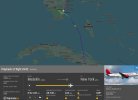
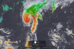
There's a link to the flight path on FlightRadar24 in this NY Post article. Below is the point where things went wrong, and the radar/satellite for about the same time.
Hurricane Isaias is in the general vicinity but they were maybe 450-500 miles East of the center. Any chance that's related or is this just one of those unforseeable events?
Flight path positioned at the point of turbulence:
Radar/satellite from about the same time:
Hurricane Isaias is in the general vicinity but they were maybe 450-500 miles East of the center. Any chance that's related or is this just one of those unforseeable events?
Flight path positioned at the point of turbulence:
Radar/satellite from about the same time: