fiveoboy01
Pattern Altitude
Plate in question:
http://aeronav.faa.gov/d-tpp/1511/00245r36.pdf
Today I flew the RNAV(GPS) RWY 36 approach in to Madison after being out doing some practice holding. I was coming in from the Northwest on a 150-ish degree heading at 3500 feet. The controller instructed me direct DEKEY and advised me to do the course reversal, cross DEKEY inbound at 3000 cleared for the approach etc.
So I loaded the approach into the 430W and activated it.
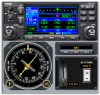
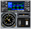
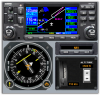
Soon as I crossed DEKEY "hold teardrop" annunciated and I was basically on the heading I needed to be for the entry. The CDI screen was up and after I crossed DEKEY and the teardrop annunciation, the DTK changed to 005... I was perplexed.. switched to the map page.. the magenta line on the GPS still showed a course outbound and then a turn back inbound, and the distance counter was counting up the 5 mile distance to the turn back inbound.
Once you enter the holding pattern(IE teardrop) for the course reversal, does the GPS autosequence to the final approach course heading? I didn't expect this and was very confused by it. It worked out fine, we were VFR and I had a safety pilot and I just turned back inbound after the 5 mile mark... but I need to know how this works because it might have been a little bit disastrous if I was alone in IMC turning the wrong way...
http://aeronav.faa.gov/d-tpp/1511/00245r36.pdf
Today I flew the RNAV(GPS) RWY 36 approach in to Madison after being out doing some practice holding. I was coming in from the Northwest on a 150-ish degree heading at 3500 feet. The controller instructed me direct DEKEY and advised me to do the course reversal, cross DEKEY inbound at 3000 cleared for the approach etc.
So I loaded the approach into the 430W and activated it.
Soon as I crossed DEKEY "hold teardrop" annunciated and I was basically on the heading I needed to be for the entry. The CDI screen was up and after I crossed DEKEY and the teardrop annunciation, the DTK changed to 005... I was perplexed.. switched to the map page.. the magenta line on the GPS still showed a course outbound and then a turn back inbound, and the distance counter was counting up the 5 mile distance to the turn back inbound.
Once you enter the holding pattern(IE teardrop) for the course reversal, does the GPS autosequence to the final approach course heading? I didn't expect this and was very confused by it. It worked out fine, we were VFR and I had a safety pilot and I just turned back inbound after the 5 mile mark... but I need to know how this works because it might have been a little bit disastrous if I was alone in IMC turning the wrong way...