RalphInCA
Cleared for Takeoff
For those of you who fly with FF, do you use the North Up or Track Up setting on the moving map? If track up, Centered or forward?
Personally, I prefer North Up. It's the way I read all maps. Now, if they added vector graphics like Garmin Pilot, I could see using Track Up since items with text would be oriented correctly for reading.
Personally, I prefer North Up. It's the way I read all maps. Now, if they added vector graphics like Garmin Pilot, I could see using Track Up since items with text would be oriented correctly for reading.
In USAF nav school we were taught to always use track up.
We were taught that people think they can fly south on a north up chart and keep everything straight, but really nobody can do that in the presence of any sort of distraction or excitement.
We were taught that people think they can fly south on a north up chart and keep everything straight, but really nobody can do that in the presence of any sort of distraction or excitement.
In USAF nav school we were taught to always use track up.
We were taught that people think they can fly south on a north up chart and keep everything straight, but really nobody can do that in the presence of any sort of distraction or excitement.
North up.
If you are not the greatest when it comes to reletive direction to a waypoint or airport, north-up will help you immensely. You can look at the map and clearly see you're northwest of the airport. With track up, that's not possible.

Very good point.
I'm not the strongest in that department.
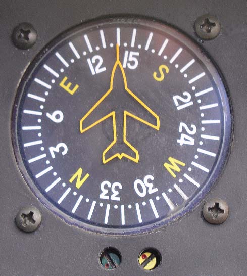
My "cheat" is to just glance at the tail end of the needle on my vertical card compass to say the direction from which I am coming.
For instance, one glance here and I can report "From the NW"
Works for me!
This is exactly what I do too! Although use the HI instead.

Regardless of app, if it supports it - always track up - that's just the way my instructor drilled into me.
That's an interesting thought to me. When a lot of us on here were getting instruction, there were no GPSs. There were no procedures drilled in. We have been left to wing it. I never even considered that there might be a right way, or wrong way to use a moving map.
")
That's an interesting thought to me. When a lot of us on here were getting instruction, there were no GPSs. There were no procedures drilled in. We have been left to wing it. I never even considered that there might be a right way, or wrong way to use a moving map.
"I usually like to line up the sectional to where I'm heading, but you seem to do fine like that".