Flight from NC to Washington state

4RNB

Line Up and Wait
PoA Supporter
Joined
May 24, 2016
Messages
849
Display Name

Display name:
4RNB
We might just fly commercial for this but I have to look at flying it myself.
C172 180 hp.
I’d love an airport to airport route suggested. Most of what I am looking at seems to need lots of flying above 10k
I’ve read about flying by roads?
I want to visit Vans, Bushliner, and try to see a plane my grandfather flew in the 40s. Still flying in Oregon.
I’m excited, she isn’t

Oh, then I’d fly home.
 
No one can plan the route for you. You will have to do that depending on the weather, plane's actual capabilities, your ability to fly a lot/little per day and tolerate turbulence, fuel weight/range, etc.
Based on what I know about 180HP 172s, you have many route options, since your plane can easily fly at 12,500. If you have enough time, simply plan a day at a time and you will have a fun and safe trip.
 
A couple of danger points:

-The Colorado Rockies
-High winds in the mountains
 
A few years ago, a guy from the Sacramento area purchased a Cherokee 180 here in Wisconsin and wanted to fly it home to California. He was rusty, had not flown in years. During his flight review I took him up to 10,000 feet to show him how anemic the climb performance was.

I recommended he stay on airways through the Rockies (which are usually close to interstate highways) and avoid the temptation to cut any corners. Crossing the mountains, I strongly recommended he not fly any time after noon, anytime it was expected to be windy, and that he approach the trip as a series of short cross-country flights and to be prepared to delay for weather.

He made the trip safely, texting me every day (for my own peace of mind) but he did spend two nights in Reno awaiting better weather.
 
I'd be having a blast crossing the Rockies but unless you have high density altitude and mountain experience, I'd suggest the southern route. Pretty much follow I-40 all the way to California and then turn north.
 
Here's a good discussion of routes:

 
I haven’t flown east-west across the country, but I have gone north-south a few different directions. There are some phenomenal sights to take in from the air. Mountains and storms are beautiful to see past your wingtip. The wildly varying landscape of the Colorado Plateau never ceases to amaze. Even the humble Ozarks blew me away the first time I flew over them. If you make the trip, keep your camera handy and don’t forget to post about it.

Are you instrument rated? Flyable IMC in the middle of the country is rare (unless you want to have the James Bond martini experience: iced up and shaken, not stirred), but the flight planning and route selection toolbox that comes with the instrument rating is helpful for a trip like this. The MEAs on airways are instructive for the altitudes and routes you can fly to avoid terrain. You can go lower and off-airways when you’re VFR, of course, but it really helps to understand the additional information on the IFR en route charts.

A few things to be aware of as you venture west:
* If you mostly fly east of the Great Plains, you probably cruise at 4,500 MSL and think that 7,500 MSL is higher than man was ever meant to go. By the time you get within sight of the Rockies, 4,500 will be pattern altitude and all the VFR traffic will be between 8,500 and 12,500.
* Get a pulse oximeter and use it to keep yourself aware of how your body is doing. A portable oxygen system is a good idea but I mostly use mine when I am IFR and have no choice but to go above 12,500 to avoid ice.
* Most of your airplane’s performance numbers are based on density altitude. Not just the takeoff numbers. If your service ceiling is 15,000, your indicated altitude is 12,000, and it’s warmer than standard (about -9C / 16F), you might be at the ceiling and your airplane won’t want to go higher.
* The desert is hot. Taking off from Phoenix, even in the late morning in January, can push your CHTs up into the discomfort zone.
* Loading to less than gross weight helps stack the deck in your favor (shorter takeoff, faster climb to a comfortable cruising OAT, higher service ceiling, etc.)
* Did I mention cruising OAT? Someone here on POA posted that he always climbs to an OAT of about 50F, whatever altitude that means. I don’t literally do this, but I’d rather be in smooth, comfortable, cool air with a headwind than bouncing around and rinsing vomit off the headliner with body sweat to save a few minutes.
* Try to keep the gas tanks full because the winds, broken or weird semi-self-serve fuel pumps, and all manner of other obstacles will conspire to eat up your reserves.
* Keep your eyes open for NORDO crop dusters taking off with tailwinds when you’re on final.
 
I few my 160 hp Warrior from New Orleans back to Washington. Most of the route would apply to your flight from NC to WA.
NEW-SEA
Here is the route for Google Earth:

Later, I flew east from WA to Knoxville then to S.Florida. Reversing the eastbound flight would work.
SEA-SUA-SEA
 
Last edited:
I haven’t flown east-west across the country, but I have gone north-south a few different directions. There are some phenomenal sights to take in from the air. Mountains and storms are beautiful to see past your wingtip. The wildly varying landscape of the Colorado Plateau never ceases to amaze. Even the humble Ozarks blew me away the first time I flew over them. If you make the trip, keep your camera handy and don’t forget to post about it.

Are you instrument rated? Flyable IMC in the middle of the country is rare (unless you want to have the James Bond martini experience: iced up and shaken, not stirred), but the flight planning and route selection toolbox that comes with the instrument rating is helpful for a trip like this. The MEAs on airways are instructive for the altitudes and routes you can fly to avoid terrain. You can go lower and off-airways when you’re VFR, of course, but it really helps to understand the additional information on the IFR en route charts.

A few things to be aware of as you venture west:
* If you mostly fly east of the Great Plains, you probably cruise at 4,500 MSL and think that 7,500 MSL is higher than man was ever meant to go. By the time you get within sight of the Rockies, 4,500 will be pattern altitude and all the VFR traffic will be between 8,500 and 12,500.
* Get a pulse oximeter and use it to keep yourself aware of how your body is doing. A portable oxygen system is a good idea but I mostly use mine when I am IFR and have no choice but to go above 12,500 to avoid ice.
* Most of your airplane’s performance numbers are based on density altitude. Not just the takeoff numbers. If your service ceiling is 15,000, your indicated altitude is 12,000, and it’s warmer than standard (about -9C / 16F), you might be at the ceiling and your airplane won’t want to go higher.
* The desert is hot. Taking off from Phoenix, even in the late morning in January, can push your CHTs up into the discomfort zone.
* Loading to less than gross weight helps stack the deck in your favor (shorter takeoff, faster climb to a comfortable cruising OAT, higher service ceiling, etc.)
* Did I mention cruising OAT? Someone here on POA posted that he always climbs to an OAT of about 50F, whatever altitude that means. I don’t literally do this, but I’d rather be in smooth, comfortable, cool air with a headwind than bouncing around and rinsing vomit off the headliner with body sweat to save a few minutes.
* Try to keep the gas tanks full because the winds, broken or weird semi-self-serve fuel pumps, and all manner of other obstacles will conspire to eat up your reserves.
* Keep your eyes open for NORDO crop dusters taking off with tailwinds when you’re on final.

I am instrument rated and current, not too experienced.
 
OK, I've just made reservations for commercial air travel, thanks for the pointers.

If we never make it back to the area, are there sight seeing flights worth the money? Maybe seaplane stuff to San Juan Islands?
 
OK, I've just made reservations for commercial air travel, thanks for the pointers.

If we never make it back to the area, are there sight seeing flights worth the money? Maybe seaplane stuff to San Juan Islands?
I got my RV-14 transition training in coastal Oregon. But the best flying to do in that entire state is hangar flying the Spruce Goose.
 
OK, I've just made reservations for commercial air travel, thanks for the pointers.

If we never make it back to the area, are there sight seeing flights worth the money? Maybe seaplane stuff to San Juan Islands?
In western Washington, there's stuff worth seeing pretty much everywhere you look. Kenmore Air flys seaplanes all over. (I'm less familiar with eastern Washington.)
 
OK, I've just made reservations for commercial air travel, thanks for the pointers.

If we never make it back to the area, are there sight seeing flights worth the money? Maybe seaplane stuff to San Juan Islands?
San Juans are gorgeous. For a day trip, fly into Friday Harbor and walk into town. For an overnight, fly or ferry to Friday Harbor and stay at Friday Harbor House if you can get reservations. You could also drive to Anacortes and take the ferry from there.
 
We might just fly commercial for this but I have to look at flying it myself.
C172 180 hp.
I’d love an airport to airport route suggested. Most of what I am looking at seems to need lots of flying above 10k
I’ve read about flying by roads?
I want to visit Vans, Bushliner, and try to see a plane my grandfather flew in the 40s. Still flying in Oregon.
I’m excited, she isn’t

Oh, then I’d fly home.
No need to fly above 10,000. Pick a route from NC to Billings, MT. Follow the highway to Missoula and fly up the valley to Kalispell. Cross the Rockies near there towards Sandpoint, ID. Can do it at 8500 feet, and you're in Washington half hour later. I did this in a Cherokee 180 with 0 issue.
 
Can you provide your start and finish points? I would not plan to fly high, those mountain waves can cause you to lose a lot of altitude quickly and you’ll find yourself having issues. You can do the route probably at 8500’ as the previous poster mentioned.
 
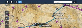
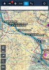
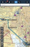
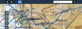
Copy this into your foreflight

KBNA KCPR 42.35°N/107.43°W 42.22°N/107.47°W 42.02°N/107.38°W 41.56°N/108.56°W 41.51°N/108.63°W 41.69°N/108.76°W 41.68°N/108.95°W KRKS KEVW 41.11°N/111.21°W 40.97°N/111.44°W 41.07°N/111.53°W 41.04°N/111.68°W 41.15°N/111.77°W 41.14°N/111.86°W 41.13°N/111.93°W KOGD 42.10°N/113.33°W 42.54°N/113.36°W KBYI KGNG U76 KBOI S87 44.60°N/117.46°W KBKE KLGD KPDT 1S5 46.62°N/120.49°W 46.83°N/120.44°W KELN 47.18°N/120.86°W 47.19°N/121.04°W 47.28°N/121.28°W 47.43°N/121.41°W 47.39°N/121.46°W 47.40°N/121.54°W 47.43°N/121.62°W 47.48°N/121.78°W KAWO

Highest point is 8,031’ and that’s using the highest point in a sector so the actual height should be lower but 8500’ would be fine, only fly on clear day VFR conditions. I did not plan for your fuel stops but a couple airports have cheap fuel, always a great idea to land and enjoy a crew car and lunch / dinner along the way.


IMG_0637.jpegIMG_0638.jpegIMG_0641.jpegIMG_0640.jpegIMG_0639.jpeg
 
Can you provide your start and finish points? I would not plan to fly high, those mountain waves can cause you to lose a lot of altitude quickly and you’ll find yourself having issues. You can do the route probably at 8500’ as the previous poster mentioned.

I kind of did. in the topic title. NC= North Carolina. Washington State= coast like Seattle and then down to Portland. Vans aircraft, Bushliner aircraft, and twin Oaks airpark
 
Copy this into your foreflight

KBNA KCPR 42.35°N/107.43°W 42.22°N/107.47°W 42.02°N/107.38°W 41.56°N/108.56°W 41.51°N/108.63°W 41.69°N/108.76°W 41.68°N/108.95°W KRKS KEVW 41.11°N/111.21°W 40.97°N/111.44°W 41.07°N/111.53°W 41.04°N/111.68°W 41.15°N/111.77°W 41.14°N/111.86°W 41.13°N/111.93°W KOGD 42.10°N/113.33°W 42.54°N/113.36°W KBYI KGNG U76 KBOI S87 44.60°N/117.46°W KBKE KLGD KPDT 1S5 46.62°N/120.49°W 46.83°N/120.44°W KELN 47.18°N/120.86°W 47.19°N/121.04°W 47.28°N/121.28°W 47.43°N/121.41°W 47.39°N/121.46°W 47.40°N/121.54°W 47.43°N/121.62°W 47.48°N/121.78°W KAWO

Highest point is 8,031’ and that’s using the highest point in a sector so the actual height should be lower but 8500’ would be fine, only fly on clear day VFR conditions. I did not plan for your fuel stops but a couple airports have cheap fuel, always a great idea to land and enjoy a crew car and lunch / dinner along the way.


View attachment 128157View attachment 128158View attachment 128159View attachment 128160View attachment 128161

Perfect (except we already bought tickets. will dream for next time.)
 
Perfect (except we already bought tickets. will dream for next time.)
It’s a fun adventure, do try it once. Take it slow, don’t be in a hurry to go anywhere. I also flew from Seattle area to Ketchikan Alaska, there’s great hiking in Ketchikan and Sitka, but weather there is a different animal, I had to turn around, divert and delay several times for all sorts of reasons.
 
Back
Top