Western US routes.

drjcustis

Pre-takeoff checklist
Joined
May 8, 2016
Messages
161
Display Name

Display name:
Drjcustis
I hope this is the correct place to post this.

I'm planning a flight from KBHM (Birmingham, AL) to KSLC (Salt Lake City.

This will be in a fixed gear PA 32. Oxygen available. IFR if needed.

Anyone have good or interesting routes through the mountains?


Sent from my iPad using Tapatalk
 
How much mountain flying experience do you have?
 
Cheyenne on V6 to Fort Bridger then you can pick NW to SW airways depending on where you in the SLC area you want to go. If you go the south way from Santa Fe radar and radio signals can get sparse and you'll be all alone for a while. I wouldn't suggest trying IFR in a Six through Colorado:eek:
 
Cheyenne on V6 to Fort Bridger then you can pick NW to SW airways depending on where you in the SLC area you want to go. If you go the south way from Santa Fe radar and radio signals can get sparse and you'll be all alone for a while. I wouldn't suggest trying IFR in a Six through Colorado:eek:

I've got the Cheyenne to Laramie, V4 to V6 route flight planned. Interesting route. Was hoping someone would have a southern route they could share.


Sent from my iPad using Tapatalk
 
I've got the Cheyenne to Laramie, V4 to V6 route flight planned. Interesting route. Was hoping someone would have a southern route they could share.


Sent from my iPad using Tapatalk
Southern route? Follow I-40 to the NM-Arizona line...turn rightish.
 
LaVeta Pass over the Great Sand Dunes up to Gunnison, Montrose and on to the NW. Lots of cool stuff through there
 
Fly where the best weather is. 13k will get you over most of the passes. Peaks top out at 14.5k. IFR routes quite high and not recommended unless you have deice.
 
  • Like
Reactions: Ted
I would avoid IFR. I am assuming this is a naturally aspirated plane with no de-ice. Adding IFR to that mix is asking for trouble with very few outs, especially if this is your first time out that way.
 
Dr J....i know the request was for routes, but more info needed here for useful advice. Is your 6 a 260 or 300? Heavy or light load? Long one day or RON? Leg lengths planned? As noted above, amount of mtn experience is unknown. Are you familiar with mixture management for high DA takeoffs? do you have XM ADS-B wx available?

I'll do my best here in generalities. I usually get change from my $.02 worth....it would be nice in the profile section to have access to experience levels etc to not make these replies insulting.

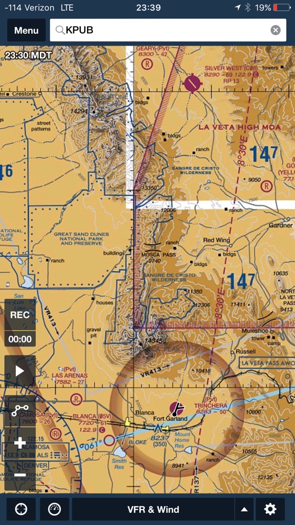
The route across S WY is definitely one that is suggested/flown by people venturing west for the first time who want to avoid the jagged granite of Colorado. Re S route, I don't know how far S you consider "South", but depending on your experience and desire for tighter terrain contours, there are routes through Pueblo to Gunnison to Grand Junction, then I-70 to I-15 and N to SLC or cut over from I-70 to Price UT to Provo and SLC. Mtn pass AWOS for Monarch pass and Cottonwood Pass would be helpful for this option. Another option from further N in the Denver area is Kenosha pass to Breckinridge to join I-70 near Vail pass and then basically Eagle, Rifle and join the route above. My preference on this route is 14,500 or higher and pick up mtn top winds from Copper Mtn AWOS.(CCU) and Sunlight Basin near Glenwood Springs (5SM) Next consideration out of the DEN area is Corona/Rollins Pass W of Boulder (pass is~12,000') then fly the wide open valley to Kremmling, turn NW to Rabbit Ears Pass near Steamboat Springs (~9600' high without as much sharp terrain as Corona) then Yampa river valley to Craig, Vernal, SLC. Helpful Mtn AWOS would be Berthoud Pass(0CO...ZERO CO) and MT Werner/ Walton pk (CO7)Near Steamboat. as mentioned above in another post, wx will likely be the factor that makes you choose one of these over the other.

For altitude needed, WY is lowest route. Corona pass route allows the quickest descent to 12.5 after crossing, but depending on winds, I like to cross ~14k. Kenosha, Breck, Vail would keep me at 14.5 until ~Rifle then 12.5 would work. Pueblo, monarch or Marshall pass, Gunnison route would keep me high, again around 14.5, for underlying ugly terrain until Montrose then 12.5.

For great scenery, all the southern routes would be a bit more "mtn attractive" than I-80 over WY, but that route is beautiful in a different way with wide open high desert and views N and S to mtn ranges. Having I-80 under you makes looking down more attractive.

Consider all of this as general advice since, like I said before, your experience/training/and aircraft altitude capabilities re mtn flying are all unknowns. Do any of these above routes on severe clear days, preferably early, with winds reported on the mtn top AWOS's at 30 or preferably lower. I rarely file IFR unless needed for >18k, but always get flight following from ZDV and ZLC. They are very accommodating. Below 15-16k, plan on brief periods of "radar contact lost", but don't squawk VFR/change freq unless told to to do so. Usually they will advise "expect radar contact in X miles" or "in X miles, contact Denver on X new freq". Best way to get in the system is to call DEN approach after departing a front range airport and get handoffs. Plan on headwinds on CO going west. Note the mtn top AWOS wind speed/directions being reported in real time by telephone before departure and plan your approach to, and possible emergency outs/turns, prior to crossing passes/highnridgelines, like Corona and the row of 14's W of Breckinridge particularly. With high winds from the west, all the high peaks, ridge lines and passes can have downdrafts on the lee side of many thousands of feet more than our planes can climb. Those days with high winds would lead me to suggest the WY route or using 16k as a minimum altitude for turbulence..... or stopping.

Search for CDOT Aviation AWOS (I am still riding with training wheels on this board and can't post a link). This site has a map of CO with all the AWOS sites located, and IIRC, the airport ones are differentiated from the mtn pass/tops by different colors. Many of them are not available very far out on the published VHF frequency until you're almost committed. But, they all have one minute weather available by phone call tom the listed numbers....CO Pilots Assn also used to have mtn flying advice on the site and also sponsors a mtn flying course every yr that would be a fun trip/excuse to fly W.

Re O2....use a pulse ox to determine the need for O2 use, which is usually going to be lower than the FAA regs. I aim to keep everyone's sats 90 or above. I fly so many high trips west at 16 or above that I even have an oxygen hood for my dog ..:). Also air at the mtn crossing altitudes is close to 0% humidity so drink water and stay hydrated on your longer legs.

<ramble off>...This post has gotten longer than intended. Feel free to PM or post if more info on any of these routes is desired.
 
Southern route? Follow I-40 to the NM-Arizona line...turn rightish.
:yeahthat:
You'll get some of the most visually stunning flying of your life this way... potential views of Painted Desert, Lake Powell, Monument Valley, Bryce and more. With proper planning you could do Grand Canyon and Sedona, too!
 
:yeahthat:
You'll get some of the most visually stunning flying of your life this way... potential views of Painted Desert, Lake Powell, Monument Valley, Bryce and more. With proper planning you could do Grand Canyon and Sedona, too!

Can't argue with stunning scenery on that route...I just returned from Powell and Monument.:) On the way home he could complete the tour with a great circle swing to Jackson Hole and Yellowstone :cheers:
 
Last edited:
LaVeta Pass over the Great Sand Dunes up to Gunnison, Montrose and on to the NW. Lots of cool stuff through there
Agreed, if you can get through the LeVeta Pass (SW of Pueblo) then you can decide to head towards Durango and either go through the mountains or stay south, follow the mesa around to Zion, and chose your point to turn right to Salt Lake. It all depends on the weather.

Winter is coming, there is already snow on the mountain tops.
 
LaVeta Pass over the Great Sand Dunes up to Gunnison, Montrose and on to the NW. Lots of cool stuff through there

I prefer Mosca Pass. Little known, very short, very narrow, but virtually impossible to get "caught" inside of, and only bad if the winds aloft are ripping out of the northwest -- which will make La Veta and every other pass horrid, too.

Waaaay shorter and lower on both sides than La Veta. Dumps you out westbound directly over the Great Sand Dunes National Monument inside the San Juan valley, which is nifty. Eastbound you're just popping out onto lower terrain. Easy to see over to see if you're climbing or descending too.

Fly where the best weather is. 13k will get you over most of the passes. Peaks top out at 14.5k. IFR routes quite high and not recommended unless you have deice.

Agreed. IFR in the rocks without a turbo and O2 isn't wise, even VMC. Often deadly IMC. MEAs are too bloody high.

I would avoid IFR. I am assuming this is a naturally aspirated plane with no de-ice. Adding IFR to that mix is asking for trouble with very few outs, especially if this is your first time out that way.

Yup.

Agreed, if you can get through the LeVeta Pass (SW of Pueblo) then you can decide to head towards Durango and either go through the mountains or stay south, follow the mesa around to Zion, and chose your point to turn right to Salt Lake. It all depends on the weather.

Winter is coming, there is already snow on the mountain tops.

And you'll be dead of exposure in a single night out here soon... if not already... depending on if you're ambulatory and what you brought with you to keep warm...

Sometimes the southern routes around the mountains really is the nice way to go. At least you'll only half freeze to death if you have to put it down somewhere. All depends on your level of risk desired.

Mosca is dead center in this screen shot. La Veta is bottom right. You need 1000' more altitude to cross La Veta. Because it's a notch in the ridge of really high stuff, Mosca LOOKS more intimidating on the chart, but in real life it's a nice big gap and you can easily see all the way across going either direction.

13c11f1b180d2aeedcc758a075808d18.png
 
+1 on Mosca Nate! Most always open when Hayden Ps and LaVeta Ps are obscured and offers a quick, benign transition from the Wet Mountain Valley to the San Luis Valley. Another one that I use when LaVeta Ps is down is North LaVeta. It's a little longer transition, but if weather is the issue, it's much like Mosca. My experience with both Monarch Pass and LaVeta passes is that they both can be reporting totally obscured while many of these alternatives are severe clear.

As a disclaimer, none of these passes should be flown under conditions of "mountain top obscurement" unless intimately familiar with the terrain, local weather phenomena and experienced with the nuances of flying "in" the mountains vs "over" the mountains.
 
I was coming up from the SW on the west side of that range headed to Pueblo. Plus LA Veta pass has the AWOS in it. The station is at about 10,000 (IIRC). So if it is reporting 6000 BKN, the clouds are really at 16,000MSL.

The range was solid cloud from south of Taos until almost LaVeta.
 
North to I80, turn left!


Sent from my iPhone using Tapatalk
 
This has been a phenomenal response. The wife and I are just now starting to map and understand some of these routes. I have no doubt that we will find something that works for us. Thank you to everyone that responded.


Sent from my iPad using Tapatalk
 
Good to hear you're looking at many possible routes. I've flown all over northern NM, CO, and southern WY. The advice to remain VFR is spot on. The advice to monitor winds aloft and adhere to limitations in the 25 to 30 knot range is spot on. There are places out here where the rotors off the mountains can take you to the ground if you get in the wrong spot. The advice to learn about high density altitude operations is spot on. Density altitude affects engine operation and aircraft ceiling. It kills people out here nearly every year.

You can do this flight without much exposure to true mountain operations by following the I-80 or I-40 routes. If you want to chat with folks about flying out here several are available. Nate will have his CFI shortly and he really likes to talk. Mark, a CFII, flew out here for many years but he lost his mind and moved back east. I think all of us want to avoid seeing another person have a bad day in the hills. Disclaimer: I'm not a CFI and don't pretend to be. I do have 800+ tt, all of it based in CO.
 
Nate will have his CFI shortly and he really likes to talk. Mark, a CFII, flew out here for many years but he lost his mind and moved back east. I think all of us want to avoid seeing another person have a bad day in the hills.

I'm the Nate he's talking about. And I won't pretend I have as much time up in the rocks in bad weather that Clark has, but I used to hang around CAP when I had time and also lived a lot closer to meeting locations, and Clark's right... we all get a little sad when we hear the same accident happening over and over or have to go search, for the same reasons.

Winds aloft and bad weather causing airplanes to run into rocks, are the number one causes of searches.

Poor choice of route or heading up the wrong drainage/valley uphill, where the terrain out-climbs the aircraft, is the second. Those happen in nice weather usually.

If weather is bad in the rocks, no go. Go around.

If the winds are high in the rocks, no go. Go around.

Once on a course you've chosen, be extra vigilant about your location at all times. Know exactly where you are in relation to your course. Mountains one hasn't flown in all look the same.

Try to never be in the center of valleys. You may need the entire width of the valley to turn around and fly back out if you went up the wrong one.

Never attempt to cross a pass or ridge you can't see over. If the ridge is climbing in your window and covering the valley on the other side, you're not going to make it across. If you can see the other side, and more of it continually, you're okay for now.

Approach ridgelines and passes at 45 degree angles whenever possible. If not possible, never head on. Same reason as flying the side of a valley. You need the least amount of turn to go away from it and downhill back the way you came, if you're suddenly in a downdraft / rotor.

Visualize winds aloft flowing over the terrain around you. It'll be just like water flowing over rocks in a stream. Downwind side of peaks is usually turbulent and bad. Alternatively, sometimes the downwind side of a valley is where the air came off the peak, dropped into the valley, and is going UP the slope on the other side.

There's my five minute talk on flying in the mountains. Others have already covered the density altitude part. :)
 
I think folks only talked a little about O2. You are probably aware that night vision suffers before anything else. It is real. Using O2 at night at 8,000 ft is a real good idea for some folks. I certainly use O2 at night at altitudes much lower than I use it in daylight. One night at FTG, I had to ask the tower to turn up the lights because the runway disappeared. Pattern altitude there is 6,500'. Lots of factors in night vision. Of course, single pilot, single engine at night in the rocks is usually a really bad idea. I did it exactly once....there are ways of doing it...I don't like'em.
 
Hey guys, FYI.....New AWOS under construction written up in the latest Co Pilots Assoc newsletter called Dakota Hill, S and E of Rollins/Corona Pass. Identifier will be C99. Hopefully full blown winter will hold off long enough for completion. Combined with Berthoud, this station will fill a void we have been missing for years when crossing Rollins/Corona Pass. CDOT has info on their site. Here is a vid link CPA provided. Maybe this is common knowledge, but today was the first time I read about it.

https://m.youtube.com/#/watch?v=BIXICO9xqMQ

Neat. I think I know that site.

Probably already pretty snowy on a bad road, and it won't be getting better. By end of October it's usually necessary to get out the SnoCat(s) to get to most of these.

Noticed the local FD has two older SnoCats in the station and the CO FD Mechanics trailer parked out front.

Someone must be volunteering some hours to get all the maintenance done before they're needed this season.

For the ham group(s) we're one big storm away from shutting down maintenance/upgrade trips to the high sites, and we'll be working on the lower sites for a little while longer.

And then the usual crossed fingers and knock on wood for no system failures until spring.
 
Back
Top