Rocky Mtn LSA Expo

We got over 1.5 inches of rain but no snow. I can't see the foothills yet to know how far down the snowline is. You are a bit higher elevation I believe.
I am at 6,400 feet. It's sometimes hard for people to believe this is over 1,000 feet higher than Denver because it's southeast.
 
I am at 6,400 feet. It's sometimes hard for people to believe this is over 1,000 feet higher than Denver because it's southeast.

Understand, but not for a pilot. That ridge has pushed me IFR or to cancel more than once. Quite a weather maker.
 
Understand, but not for a pilot. That ridge has pushed me IFR or to cancel more than once. Quite a weather maker.
True. They were supposed to start putting new shingles on my roof today. I saw the truck with the shingles onboard stop on the road in front of my house for a few minutes then drive away. There's no way he was going to stack them on the roof today. They were probably dispatched from the Denver area and had no idea about the conditions out here. You would think they would have gotten a clue as they drove out here though.
 
We're getting rain and snow in Golden. Snow line is just a few dozen feet higher than Golden here - just a bit higher than I-70/470 exit...

Jeffco's just a little tight - but at least it's calm!

KBJC 121347Z 00000KT 8SM -RA BKN005 BKN008 OVC015 04/03 A3004
 
Just saw a note that a stop in "LSA Tour #3" is going to coincide with the Expo at FTG. Dan Johnson posted the same release. Neither mentions the Expo, how curious.
Link: http://light-sport-hangar-flyin.blogspot.com/2011/05/lsa-tour-3-does-colorado-tomorrow.html

It is coordinated. Actually, we picked the date for the Expo before the Tour announced they were coming to Colorado. The tour didn't get the press release to us in time to include in the packet that went out to

1) every airport in Colorado
2) every flight school in Colorado
3) every flight school in 6 surrounding states
4) AOPA, EAA, WAI, 99s, GAN and local Colorado chapters
5) State pilot associations in the surrounding states
6) Every member of Colorado Pilots
7) Everyone else we could think of

Why? I dunno. Ask them.

Lots of folks have heard of the expo. You folks did get the word out. But this is the first I've heard of the 'Tour'. Hope they make it Saturday, the more the merrier.
 
But this is the first I've heard of the 'Tour'.
I heard about the first two but not this one. I am not well plugged into the traditional media. Apparently the guy with a Cub was instrumental in putting it together. I am a little surprised that he got to advertising so late though. Needs at least two weeks to put plans together.
-- P
 
Seems like it should be pretty nice, until the evening anyway. Much too nice for BBQ! :D

KDEN 140250Z 1403/1506 11008KT P6SM FEW070
FM140500 18007KT P6SM FEW080
FM140800 21009KT P6SM FEW080
FM141400 04010KT P6SM FEW050
FM141700 07012KT P6SM SCT050 BKN080
FM142100 07015KT P6SM VCSH BKN050 OVC080
FM150000 10010KT P6SM VCSH SCT025 OVC040
TEMPO 1500/1504 4SM -RA BR SCT012 BKN020

Is it going to be in the main terminal area? Are we wearing POA uniforms?

Going to be in the couty hangar - the big beige one just east of the terminal and west of Big Blue. And there will be BBQ for lunch.
 
Unfortunately I didn't make it down. The Wx on your side of the divide didn't look very conducive to a VFR approach out of Corona Pass. Wx up here (at least before 1:00pm) was excellent though, so I flew a large loop from Steamboat to Walden to Grandby to Rifle, and then back to Steamboat. I did a stop and go at both Walden and Grandby, and stopped at Rifle for a potty break. I left Rifle at about noon, and just north got into some strong updrafts (nothing like free altitude :wink2:). At that time there were just a couple of fluffy harmless cumulus clouds. By the time we got to Steamboat they were developed into tstorms. No wonder the thermals were so strong, they were trying to make a tstorm!!

Anyway hope it all went well at the Expo. I really wanted to see the LSAs (especially Eric's), but the Wx just didn't cooperate for me today. Looking forward to the next Colorado POA gathering.

Tony
You're right, the weather wouldn't have been favorable for getting here VFR from Steamboat. It turned out to be cloudy and chilly today, but there were still a reasonable number of airplanes and people.

Here are some pictures.

https://picasaweb.google.com/mdmurayama/RockyMountainLightSportExpo?authkey=Gv1sRgCISFgJfQ2vXfXQ#

Nice meeting Pete and friend and also seeing Murphey, Clark, Eric and others not from POA.
 
Unfortunately I didn't make it down. The Wx on your side of the divide didn't look very conducive to a VFR approach out of Corona Pass. Wx up here (at least before 1:00pm) was excellent though, so I flew a large loop from Steamboat to Walden to Grandby to Rifle, and then back to Steamboat. I did a stop and go at both Walden and Grandby, and stopped at Rifle for a potty break. I left Rifle at about noon, and just north got into some strong updrafts (nothing like free altitude :wink2:). At that time there were just a couple of fluffy harmless cumulus clouds. By the time we got to Steamboat they were developed into tstorms. No wonder the thermals were so strong, they were trying to make a tstorm!!

Anyway hope it all went well at the Expo. I really wanted to see the LSAs (especially Eric's), but the Wx just didn't cooperate for me today. Looking forward to the next Colorado POA gathering.

Tony

Yes, the wx really went south from even the Friday forecast. I waited an hour this morning before I felt I could make it to FTG. Then I had to leave early to be sure and get home. Rain/MVFR for the first 10 miles from FTG but made it home OK.

It was fun. Nice to see so many folks interested in Light Sport.

I'll get over SBS way soon Tony. Have to see how the Jabiru does in the mountains.
 
You're right, the weather wouldn't have been favorable for getting here VFR from Steamboat. It turned out to be cloudy and chilly today, but there were still a reasonable number of airplanes and people.

Here are some pictures.

https://picasaweb.google.com/mdmurayama/RockyMountainLightSportExpo?authkey=Gv1sRgCISFgJfQ2vXfXQ#

Nice meeting Pete and friend and also seeing Murphey, Clark, Eric and others not from POA.

Nice to see you and Clark again. Sorry I didn't get to talk more. Lots of interest in the Jabiru.
 
Nice to see you and Clark again. Sorry I didn't get to talk more. Lots of interest in the Jabiru.
I was going to take a picture of the Jabiru but there were always people clustered around it! I have this picture from another time, though.

2011-01-15%20at%2013-04-48.jpg
 
Yes, the wx really went south from even the Friday forecast. I waited an hour this morning before I felt I could make it to FTG. Then I had to leave early to be sure and get home. Rain/MVFR for the first 10 miles from FTG but made it home OK.

It was fun. Nice to see so many folks interested in Light Sport.

I'll get over SBS way soon Tony. Have to see how the Jabiru does in the mountains.

Sounds like I made the right decision this morning. If you do make it up here, let me know and I will take you to lunch.
 
I didn't make it to the Expo, but I hope a good time was had by all!

Here's my shots from the day...

http://gallery.me.com/denverpilot/100037

The description from our fearless leader... trimmed a bit to remove names and such...

-----

"Coke Can Shoot Out" at Centennial Airport

For 4 hours - on Saturday May 14th - in the main parking lot at Centennial, members practiced the basics of airborne photography in a very practical way. Using Cars, Cameras, and a Coke Can, that's right a Coke Can.

In this safe and inexpensive way - at the Group One Aerial Photography Workshop - crews worked through issues that can't be sorted out in the air or under mission pressures. Said Stan-Eval Officer Bob Beabout; "This isn't as easy as it looks."

In numerous recent briefings CAP-USAF has stated that "CAP is transitioning from a Search and Rescue Organization to an Information Gathering Team with many CUSTOMERS" and that Aerial Photography must become a "core competency."

Captains Steve Steinberger and Ed O'Brien of the Black Sheep designed a driving course to provide just such competency.

The course was 125 ft square and laid out on the large parking lot at Centennial Airport. With a car with crew always moving at less than walking speed and passing within 8 feet of the target crews learned: Team Coordination, flight profile, photo procedures, shot logging, mission briefings,
detailing pictures for posting, and uploading shots to WMIRS.

A's were given for shots which included the smallest font as readable (in this case the nutritional information), B's were given to clear pictures of middle
sized font (CAFFEINE FREE in this case.) AND, C's if you could read only the large red C O K E.

Each crew of 3 rotated positions in the car and practiced scanner (shooter) observer (information recorder) and pilot (driver). In this analogy of an actual flying photo mission each attendee got to check their equipment and see what their fellow crew-members were up against. "There's a lot to think about," stated Lt.Col Beabout.

Although no betting was permitted, friendly competitions arose between teams and extra time given to those working through problems specific to their equipment. It was a good shake out!

We'd like to thank the Centennial Airport Authority, Mayo Aviation, and Denver Jet Center for providing aid and comfort for this workshop.
 
For 4 hours - on Saturday May 14th - in the main parking lot at Centennial, members practiced the basics of airborne photography in a very practical way. Using Cars, Cameras, and a Coke Can, that's right a Coke Can.
Is that what was going on? I went to Centennial after the Expo to exchange my car for the rental that I'm driving to Wichita and I think the event was just finishing up. I asked someone if I could park my car there at the edge of the parking lot.
 
Is that what was going on? I went to Centennial after the Expo to exchange my car for the rental that I'm driving to Wichita and I think the event was just finishing up. I asked someone if I could park my car there at the edge of the parking lot.

HA! That was you?! I was standing to your right... you were talking to Ed O'Brien, the guy in the bright yellow ANSI jacket. ;)
 
In numerous recent briefings CAP-USAF has stated that "CAP is transitioning from a Search and Rescue Organization to an Information Gathering Team with many CUSTOMERS" and that Aerial Photography must become a "core competency."

Sigh. The "War on Drugs" continues. :frown2:
 
HA! That was you?! I was standing to your right... you were talking to Ed O'Brien, the guy in the bright yellow ANSI jacket. ;)
I drove up to him because the bright yellow made him look like the most official person!
 
Sigh. The "War on Drugs" continues. :frown2:

Maybe, but CAP is rarely called for that. DEA bought their own aircraft and pilots. (Nice grey Pilatus's, around here anyway.)

Missions lately have been for FEMA and other served agencies in the wake of disasters or in an attempt to warn of coming ones, so to speak.

One mission related to me that's very recent, the aerial photo crew was taking pictures to assist the emergency planners who were looking for "sand boils" along a levee in flood areas, for example. (A sign that the levee is failing, where the water "boils" out of the dry side surface of the levee.)

These are typically about 4' across... from 1000' AGL they're pretty hard to spot without good photo skills.

As far as the law-enforcement stuff -- you can vote it all away (option 1), you can pay for Pilatus'es and crews (current option), or you can pay roughly $150 a flight hour for an all volunteer crew and a much less expensive aircraft... and no member is required to participate in any of those missions if they so choose not to.

It's definitely very misleading to think those missions are anywhere close to the primary mission of CAP... far from it.
 
Me and Brian made it back too. Brian was PIC on the way down and made a decision to deviate around the weateher, thus making 2 refueling stops in La Junta and Santa Fe. He paid for it though, all of 5.3 hours at $130 with taxes. I only racked up 4.8. Writing it into logbook now.
 
Me and Brian made it back too. Brian was PIC on the way down and made a decision to deviate around the weateher, thus making 2 refueling stops in La Junta and Santa Fe. He paid for it though, all of 5.3 hours at $130 with taxes. I only racked up 4.8. Writing it into logbook now.

Sorry I didn't get to meet up with you Pete. Sounds like a fun XC though!
 
Me and Brian made it back too. Brian was PIC on the way down and made a decision to deviate around the weateher, thus making 2 refueling stops in La Junta and Santa Fe. He paid for it though, all of 5.3 hours at $130 with taxes. I only racked up 4.8. Writing it into logbook now.
Did you decide which airplane you want? :)
 
Me and Brian made it back too. Brian was PIC on the way down and made a decision to deviate around the weateher, thus making 2 refueling stops in La Junta and Santa Fe. He paid for it though, all of 5.3 hours at $130 with taxes. I only racked up 4.8. Writing it into logbook now.

You made it home safe - excellent! Detours are never a bad idea with the weather we've been having lately. And fuel cost at LHX is very reasonable. Sante Fe, on the other hand....
 
Maybe, but CAP is rarely called for that. DEA bought their own aircraft and pilots. (Nice grey Pilatus's, around here anyway.)

As far as the law-enforcement stuff -- you can vote it all away (option 1), you can pay for Pilatus'es and crews (current option), or you can pay roughly $150 a flight hour for an all volunteer crew and a much less expensive aircraft... and no member is required to participate in any of those missions if they so choose not to.

It's definitely very misleading to think those missions are anywhere close to the primary mission of CAP... far from it.

Maybe not the 182's, but the Airvans are used for that a LOT over this way. They've got the gear that can detect pot growing in between rows of corn.

And yes, it's better to be paying $150/hr than $1500/hr. It'd be better yet if we'd just do away with the whole charade so it'd be $0/hr instead.

This whole photography thing, while I'm sure it has some very good uses, seems to be something that'll be put to highly suspect uses in the future too. :( Focusing on that, especially with the "transitioning FROM S&R" just doesn't sound right to me.

I hear ya. The laws are written in such a way that (at least right now) no one in a CAP aircraft can observe any humans doing anything without a law-enforcement person aboard. And they have their own rules about what they can look at and for.

No one in CAP is allowed to be "deputized" or anything of the sort -- in fact it's specifically banned in the CAP regulations.

We fly at the request of the Air Force or in some Wings at the request of the State under completely separate funding for those two, and the Air Force isn't interested at all in law-enforcement, really. States, well... that's up to them.

Most law-enforcement agencies are so insular that they don't "trust" a non-law-enforcement flight crew anyway, in most areas of the country.

I think the crux of the matter is that even though CAP has a long and successful history as a SAR group, lots of agencies actually tasked with SAR won't use us even for that role. Sheriff's departments like having their own "flight branch" and since it's generally the Sheriff who authorizes search missions of any sort, they launch their own people.

Typical inter-agency mis-trust and/or poorly coordinated interoperability. CAP is unique in that it can bring air, ground and communications assets to bear all at the same time with crews and ground teams who've already worked with each other (important - try teaching a Sheriff how your grid square system works over the radio so they can drive to a crash site -- but GPS lat/long has mostly fixed that problem since I was doing CAP long before the aircraft had a direct on-board readout of lat/long). How it's not unique, is that like any government or quasi-government agency, they don't always work well together.

The dedication of almost all government agencies to train on FEMA's Incident Command System, means that in larger scale events where more assets are needed than can be found locally, CAP can "plug-in" and do some of the jobs needed. The trend toward Disaster Services seems to be growing.

AFRCC can let a Wing know that there's an ELT going off... but there's just not much of that going on anymore. Whether it's the 121.5/406 debacle that's causing less ELT activations or just pilots making bigger mistakes and destroying the aircraft so completely the ELT doesn't work... I dunno. Colorado Wing was definitely called out to look for the Malibu that went in down in Southern Colorado earlier this year coming up from PHX, and CAP aircraft and crews were utilized... but so were Army Guard units, and USFS assets (snowmobiles), etc.

It seems that CAP has at least caught on to the concept that no event is going to be handled by any single agency anymore -- we're just an "asset" for various things. Those things tend far more toward Emergency Services than law-enforcement. Law-enforcement is "important" enough to society that they have their own air assets -- except in times of Disaster -- and they call in other law-enforcement air operations folks using "Mutual Aid" agreements even then.

CAP typically gets called when there's just a huge need for more eyeballs looking down on things. Floods, Hurricanes, Fires (less on fires... again, wildfire managers have their own Air Wings these days on 24/7 call).

I remember when Radiological Monitoring (think geiger counters here...) was still a specialty track in the CAP Emergency Services tasks. You know... the Russkies would nuke something and we'd have to go flying to see how "hot" it was. There's some great duty for ya...

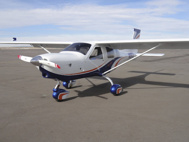
Here in Colorado, I don't have the numbers and I'm not part of "leadership" for Air Ops, but as a regular ol' member looking at our sortie list, the far and away vast majority of funded flights are Cadet Orientation flights. Almost nothing else (including currency, even in the Airvan) are paid flights, and we're a LUCKY Wing with some of our funding coming from the State.

The State sees a need to keep a trained group of pilots and ground support going for things they want done, so they subsidize maintenance somewhat beyond what CAP National does, around here. That pushes our hourly rate down a bit over say a flight club, but even proficiency flights have to be documented as to exactly what you're doing to maintain that proficiency (there are published numbered suggested flight profiles), released by a Flight Release Officer, uniforms must be worn, lots of pre-requisites and documentation of training must be done -- it's a lot of work.

Folks that think it's a "flight club" usually get sore about a year into it. Emphasis is on crew coordination and specific mission-oriented tasks, etc.

Recently something like 40 pilots showed up for a Mountain Flying ground-school, as one example. That's a lot of pilots who might not otherwise have done any formal Mountain Flight training. In order for them to get full credit for the course, however -- they'll have to go fly in the Mountains with an Instructor Pilot that's rated in CAP. That's on their own dime. (There was at least a formal request done to try to get State money to offset that a little bit, but budgets are tight and ... the answer was no.)

So... I hear ya on the whole "law enforcement" thing but being on the "inside" I see very little of it. If there's Wings that are flying a ton of those "find the evil pot-grower" flights, it very likely might be the STATE government who's paying for that. Hard to say, since the folks involved aren't supposed to be talking about it -- that could put law-enforcement personnel's lives in danger since those innocuous little plants usually do have folks with guns who like to kill the people trying to stop them from growing them...

The law-enforcement angle didn't exist at all when I first joined in the early 90's... but back then there were lots of pilots seemingly crashing airplanes every other month too... so... SAR mission was hot and heavy. I remember both looking for and then reading the NTSB reports on various mountain crashes in my 20's, which gave me a healthy respect for the big rocks.

I can see why National and Wings picked up on being truck drivers for LEOs as a way to keep doing some flying, having qualified folks be the "truck driver" for the MIB's in back... but there's very few qualified folks in our Squadron (and we're big... 90 people) and even less missions of that type these days. Seems like a bit of a "flash in the pan" thing. SAR and Disasters seem to be the bread and butter of the organization, and that's the reason for the "moving away from SAR" comments we have heard from the USAF... in a big disaster you use the big fuel-sucking birds like the helicopters for SAR, plucking people via cables, and you use the cheap aircraft (CAP) to get lots and lots of visual information.

Of course, they also use non-piloted vehicles for such things, but sometimes you need humans to describe it to get a better "feel" for what's going on. In the grand scheme of things, we're a lot cheaper to fly than even a UAV, and we show up relatively self-sufficient as long as there's a way to fuel us and feed us.
 
I was going to take a picture of the Jabiru but there were always people clustered around it! I have this picture from another time, though.

2011-01-15%20at%2013-04-48.jpg

And the weather was so much nicer when that picture was taken!
 
I thank everyone who worked to put up and run the Expo.
 
A few pictures:


N7342J sits across from Jim Lee's Phoenix, the only 2 airplanes that flew in overnight, apparently.


During the day the ramp area hosted the LSA tour and other visitors, while locals were in the hangar.


Someone flew in a Bulldog B.125.


Evektor was the only low-wing airplane into which a tall pilot can fit. Jim plainly told me not to even attempt fitting into Phoenix. Chris said the same about Gobosh. Eric tried to close SportCruiser's canopy on me, but there was 2 more inches to go to latch.
 
Back
Top