Anybody here used the new GPS+VFR charts, designed for folks that are (duh!) flying VFR with GPS? They look nice. Wondering what your thoughts are after using them, versus a conventional sectional:
Review:
http://www.jetwhine.com/2008/09/going-my-way-jeppesens-vfrgps-charts/
Things I like:
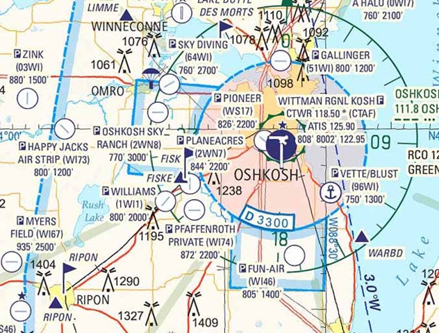
* Runway orientation at grass strips, which would make them a lot easier to find in an emergency.
* Identifiers for private strips, which helps finding them on your GPS.
* Effective altitudes of special use airspace is right there on the chart, rather than a table at the edge of the chart.
* Large airports have the airport boundary depicted to make it easier to spot farther out.
Things I dislike:
* I see a dotted blue line at the edge of where class E goes down to 700 AGL. That makes things a bit confusing (with class D), IMHO.
* The colors. It doesn't look like it's as easy to look at as a normal sectional. If you're gonna follow roads, it's probably better as they're easy to see. Otherwise... Ouch! E is for eyestrain. The colors actually look remarkably to an old 1960's-era sectional I have.
As for the review...
"The chart shows the intersections that appear on your moving map. VFR checkpoints, like the Ripon and Fisk shown above, are easy to see purple flags." Ummm... Yeah, just like on a NACO sectional. How 'bout that.
The verdict? I'm not gonna use 'em, but hopefully Jepp has the same effect on sectionals as they've had for approach plates and the NACO stuff makes some improvements as a result. That benefits everyone.