Go/No Go for Austin tomorrow

Challenged

Pattern Altitude
Joined
Apr 4, 2011
Messages
1,901
Location
Louisiana
Display Name

Display name:
Challenged
I'd like some opinions on making a go/no-go decision to fly to Austin tomorrow morning with my wife, for a wedding. This would be a fairly significant cold-front that we're flying into from the east (Louisiana). It looks like I could leave today and there would be no problems, but, due to my wife's work schedule, this is not an option.

Forecast at time of arrival (10 AM on Friday October 26):
Wind: 360 @ 20 knots
Temp: 55
Cloud Base: 3100 to 6000 feet
Vis: Greater than 6
Thunderstorm/Precip: 20%
Dew Point: 36

Austin Executive (KEDC) has a 6000 feet runway, but it faces Northwest at 310, which gives me a crosswind component a little over 15. Weathermeister shows the wind at 006, which puts crosswind even worse at over 17 (more than demonstrated for my airplane).


Flying our Sierra should save us at least 9 hours of travel time, so it's obviously very tempting to me to use the plane. I have about 260 hours TT, 23 hours of Instrument work, including an hour and a half under the hood just 2 days ago.

Thanks for any constructive input.

Here's the dynamic usairnet weather link for Austin:
http://www.usairnet.com/cgi-bin/launch/code.cgi?Submit=Go&sta=KAUS&state=TX
 
That is really going to be tough because only you really know what your limits are. So with that said, how comfortable are you with the winds? Is that your only concern? It says you are flying to Austin, but from where?
Are you worried about the ceilings? Just trying to see what your thoughts are first.

Cheers
 
The runway at EDC is very large, and a 15 knot crosswind component should not be a problem, at all, for a Sierra.

That said, if the cosswind is bad enough to really be an issue, then you can use Rwy 34, the original Birds' Nest runway (or what remains of it, anyway), which while shortened, is still maintained and used. It may be short, but if a north wind is strong enough to make landing 31 challenging, it will also ensure that you don't need much of 34 at all.

Edit: By the way, the FBO at KEDC has the best service I have ever experienced. Tell us what you think of it.
 
Flying to Austin from Baton Rouge.

Winds, ceiling and comfort are rolled into my concerns. The ceiling forecast is for 90% coverage, but seems to be fairly high. That said, if it's solid overcast and I have to fly under that for an hour and a half, my wife is not going to like the expected bumpiness very much. I would guess a 12 to 14 knot crosswind is probably the max I've done in my Sierra (this summer when flying to the Orlando area). I really didn't have too much trouble with it, but it's just not something I get to practice very often where I live, as we don't have steady winds here.
 
Only you can make the decision to go or not.

What I do is set minimums for take off and enroute weather. If the weather is below my minimums I don't go.


Good luck either way.
 
Last edited:
On Airnav, rwy. 16/34 at KEDC is listed as 1550x25, which is about half the size of the shortest runway I've ever used. With a very strong direct headwind I guess it wouldn't be horrible, but generally seems a bit iffy to me, since it's out of my practiced approaches.
 
What is the enroute weather look like?

You will need to ensure that the ceilings are going to stay high enough for you to make it there. If you can see that the enroute weather looks good enough for you to feel comfortable then go for it and always have a plan out if your wrong.

Like others have said, you will be the one to make that call.
 
There are several approaches to making the go/no go.

Assume no go and then look for reasons to go. Reasons, not wishes. Is the weather acceptable enroute and at destination? Are there a couple airports along the route where you could land (under predicted conditions) and drive the rest of the way? Is the aircraft airworthy and otherwise ready in all respects? etc.

Assume go and the look for reasons to abort. Is there any one area along the route in which conditions would be unacceptable? What do the alternate airports look like? What's broken on the aircraft? How is the pilot feeling?

If you're not comfortable with the answers to the questions then cancel the flight and drive. During the drive evaluate the weather and learn about how it actually looked compared to the prediction. File that info away for the next go/no go decision.

At low time it's just tough to make the call and we end up canceling flights or getting ourselves in trouble. If you go, be willing to stop short or return home. Avoid get-thereitis.
 
Thank you for the ideas so far, btw...there's obviously a number of variables to consider, but it's helpful just to sort of walk through the process with input from you guys.
 
Thank you for the ideas so far, btw...there's obviously a number of variables to consider, but it's helpful just to sort of walk through the process with input from you guys.

Part of the "Go" decision is to make sure you have an out. If the weather turns bad, conditions are too rough, etc, ... divert, land and sit it out. Practice doing this in the air with your NRST function on your GPS. If you don't have a GPS get one. ;)

"I'd rather be on the ground wishing I was in the air, than in the air wishing I was on the ground."
Source: A very wise and experienced pilot.
 
Last edited:
There's nothing much worse than an uncomfortable flight with a passenger who is unaccustomed to or nervous about the bumps. Assuming your assessment of the weather is that the flight can be conducted safely but perhaps uncomfortably (at least the outbound leg) then your primary issue is to determine how your SO feels about the decision. If 9 more hours of smooth highway (which, BTW is not guaranteed, especially during road-repair months) is preferable to 9 less that include some bumps, you have to weigh the various factors and make the call.

I think that full disclosure of everything you're thinking about is the best way to proceed, since you are establishing the patterns for all future travel and don't want to screw it up the first time.
 
Written at about 24:15Z 10/25.......

TRW and rain along the route as of 12Z as this cold front sags all the way to the gulf.

Baton Rouge LA (Baton Rouge Metropolitan, Ryan Field) [KBTR] terminal forecast
[SIZE=-1]issued on the 25th at 11:25am UTC (1125Z), valid from the 25th at 12 noon UTC (12Z) through the 26th at 12 noon UTC (12Z)[/SIZE]12n UTC (12Z)wind calm, visibility 1/2 mile, fog, indefinite ceiling 100 feet2:00pm UTC (1400Z)wind 080° at 4 knots, visibility 3 miles, mist, 300 feet broken3:00pm UTC (1500Z)wind 100° at 6 knots, visibility greater than 6 miles, 3,000 feet scattered11:30pm UTC (2330Z)wind 130° at 3 knots, visibility greater than 6 miles, sky clear8:00am UTC (0800Z)wind calm, visibility 1 mile, mist, indefinite ceiling 200 feet

.


So Tomorrow AM at 7:00 am, mist, V 1 mile, Ceiling 200. Are you instrument rated? I would be thinking hard about this even IR'd in a twin, lightly loaded. Looking at stations to the west, as a premonition of things to come, they're saying clearing, as you get behind the front. This may still be a make but you'll have to leave cloer to 12N I think.....3500 foot ceilings along the way later in the day.

The wind 010 forecast at Austin suggests to me, a low atmosphere "short wave" along the front meaning it may not clear up quite so well at AUS. Winds ought to be from the west or NW after a cold front!

So unless you are IR'd, the AM departure is not going to happen. And I'd be very wary of what's going to develop at AUS as of this moment. Information, however becomes MUCH better in about 6 hours....
 

Attachments

  • Prog chart.doc
    238.5 KB · Views: 4
I've learned that if I need someone else's opinion to make the decision, the decision has already been made - I don't go. Only in very rare situationsn has this turned out to be the wrong decision. But I didn't regret it.


Assume you fly, and need to take one of your outs. Will that end up delaying your arrival in Austin or even prevent it entirely?
 
Don't forget to report in over 41XS.
Over 41XS? No, I'll never get over 41XS.
 
On Airnav, rwy. 16/34 at KEDC is listed as 1550x25, which is about half the size of the shortest runway I've ever used. With a very strong direct headwind I guess it wouldn't be horrible, but generally seems a bit iffy to me, since it's out of my practiced approaches.

If you land at 50 knots and you have a 20kt sustained wind - you've only got 30 kts over the ground. 1550' should be plenty in that scenario.

Does it have to be AUS? And not a satellite airport with better runway alignment?

You seem to be more worried about the arrival - but the departure is going to be equally challenging - fronts always slow down as they approach the higher pressures found over water in the Gulf . . .
 
Last edited:
Good advice from all above. Scott's comment about the prep/planning even if you DON'T go, being a great way to learn, is a very good one.

I'll do a train-of-thought here on stuff I just looked at for your flight, and you can take or leave... the data changes significantly throughout the day before sometimes, so this could be totally wrong by tomorrow morning... :)

When I do an "initial pass" at a weather decision, it's to look for red flags. Clark's "look for a reason not to go" method.

I want to know TAFs at departure, destination and along the way... just a perusal of them. Since they're not out yet, that's tough until later today. Out of all of the info available, TAFs are often REALLY good at hitting local phenomena that won't show up in a wider-scale product.

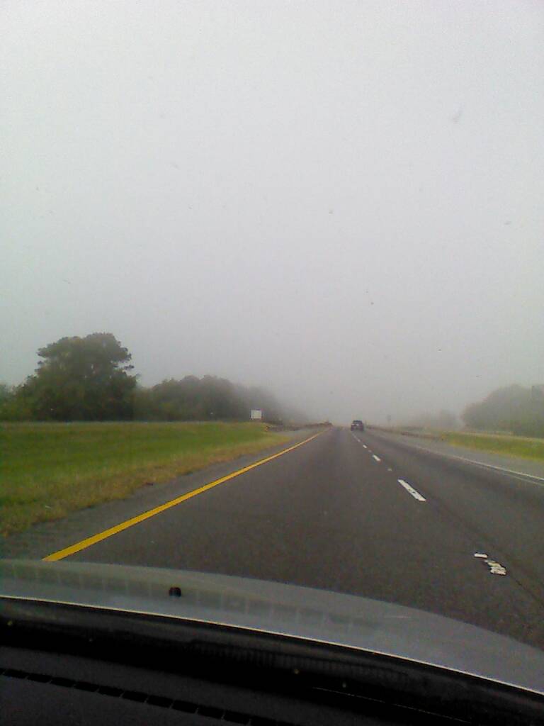
What I *DO* see right now, is that you have a TAF that shows LOW IFR at your departure point through 7AM CDT. That doesn't bode well if this is a VFR flight.

If this is a "must go" trip, I start thinking that a couple of hours isn't going to always make a significant weather difference, and the decision to drive may be nailed right there. I don't want to be standing on a ramp at the departure end hoping the weather lifts to launch, even if it's supposed to get better Westbound, if I have a hard arrival time required at the other end. Too much temptation to launch into a sucker hole at the departure end.

You said you need to be there at 10AM. Same time zone, so... in my airplane you have to depart 2:36 before 10 AM with no wind. Westbound, you're probably slogging upstream with the Salmon this time of year, so... longer.

Adding slop for other stuff that comes up, you're launching at 7AM out of KBTR; and it's LOW IFR at that time. We're already at GAME OVER unless you can go significantly later. Frankly, if it's a must go... I'm done right there VFR. Ain't happening.

I might take a peek at the next round of TAFs and if it suddenly goes from LOW IFR to CAVU in an hour, I'd be very supicious, but might re-assess. I would also need to know if my 10 AM arrival at KAUS could really be noon. If so... maybe a peek later. That's... IF... the rest of this pans out...

Let's get the big picture now and see "why?"...

http://www.hpc.ncep.noaa.gov/sfc/90fwbg.gif

That cold front is headed for your destination today, and going to keep swinging round to the right and head for you. That's why the LOW IFR, and the mess.

VFR, the best place to fly is usually right after that front has PASSED your departure point if you're flying Westbound. Cold fronts generally have a "sweeping out the crap" effect... behind them is usually a good place to be. (That's INSANELY GENERAL, there's lots of reasons that's not always true.)

I don't think it's going to get completely past you by your planned departure time, and you really need that High to push on down and clear out the crud by shoving it East.

So, even though we're already at GAME OVER, for the mental game... my first look at current map... don't like it for VFR. We're up to strike two for me.

As an exercise, we'll keep going, but at two strikes I'm probably already long-gone at this point, packing the car.

By the way, at this "big picture" look point, look at more than one chart. Note how this crayola kindergarten chart makes life look a lot nicer...

http://www.hpc.ncep.noaa.gov/dailywxmap/index.html

Don't fall into that trap.

Here's another trap, and it really depends on your comfort level... the Area Forecast.

http://aviationweather.gov/products/fa/ftworth

It isn't yet right for your timeframe but note how for today it has lots and lots of "Outlook... VFR" on it.

Yes, but... look at TAFs along the route... all of the route is Marginal VFR, not because of ceilings (once you're West of Lafayette), but because of early morning MIST.

The Area Forecast does this, and it's a common gotcha... mist, light rain, etc... all technically VFR... but do YOU feel comfortable flying in mist all the way from LA to TX?

That's a judgement call for you...

What I think, when I see mist all along the flight path through 07:00 CDT (And when the next TAFs are out, that'll tell a better story...), I think a few things...

- Flying VFR through mist/scattered clouds/crud just kinda sucks... it's busywork. If you're up for cloud dodging and crap visibility the whole way... ok.

- The TAF only goes through 07:00 right now. Dewpoints will GENERALLY separate still this time of year after sunrise, and the mist and clouds may rise a bit and/or at least there will be altitudes underneath the crud that are flyable.

- Right now MOST of those TAFs also say it's Scattered 6000... that's not super bad... it's the water content and whether or not it's soggy that's the issue for VFR through this area for the moment. But I'm looking for anything worse...

- And there it is... there's some lower stuff in there though, too... KCXO TAF says Overcast 2500 through 07:00 CDT.

The big picture here is that you're stuck underneath a ragged overcast that goes from scattered to overcast, and is going to keep you at 1500 AGL most of the way there. Ick.

Okay, looking at the KAUS TAF... it doesn't go out into the overnight hours yet... they have Overcast 3500 and Thunderstorms, Rain, and CU through midnight CDT. Not good, but not really a decision-maker for this route, with all of the above better info right now.

Let's look at the Prog Chart...

http://aviationweather.gov/data/products/swl/ll_06_4_cl_new.gif

What I see here, is that you're "racing" the front. Note how the High north of Texas is going to bulge and elongate that front to put it squarely on top of your route of flight, by comparing the location of the front on the left panel to the right. The area of bad weather is EXPANDING along where you want to go, and that's not typically good. Also almost the entire route of flight is inside the green line, meaning precip. Which matches the MIST commentary above. Sloppy.

So... I ain't keen on this as a VFR flight at all. Especially with a hard time deadline at the other end.

Now... what'd be fun is some comments on whether or not folks would do this flight IFR in a single, non-FIKI, your average spam can... I'll hold off on my thoughts on that, as I'm interested in some of the thought-processes... being a total noob IR rated guy.
 
Last edited:
A good resource

http://www.aviationweather.gov/products/afd/

WIDESPREAD STRATUS WITH IFR/MVFR CIGS ACROSS MOST OF SOUTH CENTRAL
TEXAS WILL LIFT TO VFR FEW-SCT CUMULUS BY MIDDAY. PATCHY BR/FG
WITH VLIFR/LIFR VSBYS EAST OF I-35 WILL DISSIPATE BY MID MORNING.
A COLD FRONT WILL ENTER THE HILL COUNTRY EARLY THIS EVENING AND
MOVE ACROSS ALL OF SOUTH CENTRAL TEXAS BY THE OVERNIGHT HOURS.
EXPECT FRONTAL PASSAGE KDRT AT 00Z...KAUS AT 02Z...KSAT AT 03Z AND
KSSF AT 04Z. MOISTURE CONVERGENCE AND LIFT ALONG THE FRONTAL ZONE
WILL GENERATE ISOLD TO SCT SHRA/TSRA AND HAVE MAINTAINED PROB30 IN
THE TAFS. WEAK ISENTROPIC LIFT WILL DEVELOP LOW VFR STRATUS THAT
WILL PERSIST OVERNIGHT INTO FRIDAY. IT MAY LOWER TO MVFR AT TIMES
IN PATCHY -RA. HOWEVER...DUE TO UNCERTAINTY HAVE LEFT OUT OF TAFS.


http://www.aviationweather.gov/products/swl/

^ Good too. Not effective yet for your proposed flight time. Check later today.
 
Last edited:
HOWEVER...DUE TO UNCERTAINTY HAVE LEFT OUT OF TAFS.

I never like seeing the pros say "uncertainty" when it comes to an entire route, without a known "out"... and the only "out" here seems like a northbound turn THROUGH the front, or a run down to the southern tip of Texas...

And those just SUCKETH mightily as options... :)
 
I would launch in the 310 no question. (It's a Q and FIKI) In my 172? Nope. :nonod:

Why not? There is no icing and ceilings won't be bad at all. As long as you go IFR, not a problem at all. In fact I'm also planning on flying in that area tomorrow and I certainly have no FIKI (and none needed in this case).
 
Yeah I ran out of time to look at convection... I just assumed it along a frontal line and by then had already found other reasons not to go VFR. :)

Since its a mental game, the assumption of convective along that frontal boundary should have been stated.

It's fun to hash these out because my assumptions were quietly guiding that answer too, but not stated.
 
Why not? There is no icing and ceilings won't be bad at all. As long as you go IFR, not a problem at all. In fact I'm also planning on flying in that area tomorrow and I certainly have no FIKI (and none needed in this case).

Because of the convective risk. Of course I'd look at convective forecasts closer to departure, but IMHO stumbling along IMC in convective activity isn't the brightest course of action.
 
gena9egy.jpg


I decided to play it safe, so we're in the process of making the seven and a half hour drive right now.

Sent from my Nexus 7 using Tapatalk 2
 

Attachments

  • uploadfromtaptalk1351263154143.jpg
    uploadfromtaptalk1351263154143.jpg
    39.3 KB · Views: 5
Last edited:
I drive the left lane too... 6 mph over the limit and I use my mirrors... The trucks have killed the right lane ..:yes::eek:
 
I decided to play it safe, so we're in the process of making the seven and a half hour drive right now.

Playing it safe is never a bad idea IMHO. Have a great trip.
 
<PIC>
I decided to play it safe, so we're in the process of making the seven and a half hour drive right now.

Sent from my Nexus 7 using Tapatalk 2

Made my brother make a 4 hr drive home a few weeks ago due to a chance of TS. With the XM, I felt confident I could make it, but decided to play it safe. He sent me a picture like that just outside the airport at his place. Always nice to know you made the right decision.
 
looked flyable though. . . . certainly IFR and you need to get on top of the haze to about 4-5k - but its flyable with onboard systems and a plan B, C and D -
 
I drive the left lane too... 6 mph over the limit and I use my mirrors... The trucks have killed the right lane ..:yes::eek:


The left lane is for passing only. "Fast Lane" is relevant. There will always be someone who is faster.
 
The left lane is for passing only. "Fast Lane" is relevant. There will always be someone who is faster.


Yup.... I USE my mirrors and when a faster guy /gal comes along I am in the right lane 1/4 mile before they get to me.. I make sure I don't hold anyone up as I hate it when it happens to me.:mad:
 
Back
Top