skidoo
Line Up and Wait
So here is a scenario I tend to have a lot this time of year.
Departure KGPI
Destination KBIL
Airplane: Cessna T182T - G1000
Fuel: enough to fly to destination and back plus reserves.
Weather:
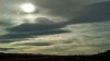
Departure: OC to Broken - Ceiling 5K, temp 38F
Airmet for Icing 5K to 12K in the departure area. One Pirep confirmed light ice from 7.5K to 10K. No icing forecast 15K or above.
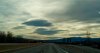
Enroute: All airports enroute are reporting VFR and ceilings of 8K to 12K. Radar show scattered areas of snow showers such that one could route around them. But Satellite shows clouds mostly OC to Broken most of the Route.
Destination: Clear or ceiling at 12K or higher (i.e.> 15K MSL)
Visibility: > 10 everywhere underneath or above, except areas of precipitation.
Options:
1) File IFR, find a hole at departure, climb to 15K, get clearance and fly on top, expect destination to be clear in 2 hours.
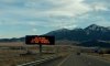
2) Fly VFR, stay low like 5 to 7K, follow the valleys and interstate. Need to cross two major passes above 6K to 6.5K MSL.
3) Just Drive.
For 1), my concern is counting on a hole being present when I am ready to depart.
For 2), My concern is getting stuck in a valley that happens to be precipitating across the valley at the time. What is my out if the valley fills in ahead and then also behind with no airfields available. Do I choose to circle and wait, or set it down on the highway or field, or take my chances with ice, declare an emergency and climb to the top?
For 3), This is an easy choice and is my choice for now. But, my concern is if I am being too cautious. Maybe so in the flatlands, but in these mountains, maybe not so much?
My other question is when icing is forecast as possible from 5K to 12K MSL, but ceilings are being reported at 10K AGL (i.e. 13K MSL), what am I to think regarding icing in that area? In that case, if I flew at 10K msl, I would be 3K under the ceiling... This is what frustrates me so much regarding the icing forecasts...
For those of you with experience in the Western Mountains, any input?
Departure KGPI
Destination KBIL
Airplane: Cessna T182T - G1000
Fuel: enough to fly to destination and back plus reserves.
Weather:
Departure: OC to Broken - Ceiling 5K, temp 38F
Airmet for Icing 5K to 12K in the departure area. One Pirep confirmed light ice from 7.5K to 10K. No icing forecast 15K or above.
Enroute: All airports enroute are reporting VFR and ceilings of 8K to 12K. Radar show scattered areas of snow showers such that one could route around them. But Satellite shows clouds mostly OC to Broken most of the Route.
Destination: Clear or ceiling at 12K or higher (i.e.> 15K MSL)
Visibility: > 10 everywhere underneath or above, except areas of precipitation.
Options:
1) File IFR, find a hole at departure, climb to 15K, get clearance and fly on top, expect destination to be clear in 2 hours.
2) Fly VFR, stay low like 5 to 7K, follow the valleys and interstate. Need to cross two major passes above 6K to 6.5K MSL.
3) Just Drive.
For 1), my concern is counting on a hole being present when I am ready to depart.
For 2), My concern is getting stuck in a valley that happens to be precipitating across the valley at the time. What is my out if the valley fills in ahead and then also behind with no airfields available. Do I choose to circle and wait, or set it down on the highway or field, or take my chances with ice, declare an emergency and climb to the top?
For 3), This is an easy choice and is my choice for now. But, my concern is if I am being too cautious. Maybe so in the flatlands, but in these mountains, maybe not so much?
My other question is when icing is forecast as possible from 5K to 12K MSL, but ceilings are being reported at 10K AGL (i.e. 13K MSL), what am I to think regarding icing in that area? In that case, if I flew at 10K msl, I would be 3K under the ceiling... This is what frustrates me so much regarding the icing forecasts...
For those of you with experience in the Western Mountains, any input?