jlmcgraw
Filing Flight Plan
- Joined
- Apr 18, 2014
- Messages
- 5
- Display Name
Display name:
Jesse McGraw
All,
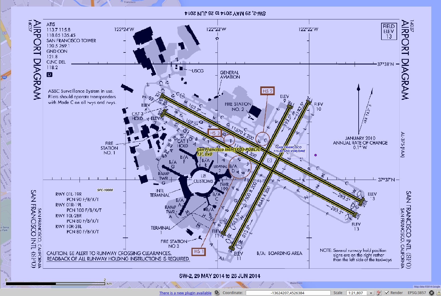
As an addition to my code for georeferencing Instrument Procedures I've written a utility to do the same for airport diagrams.
Like my other code it doesn't currently work with miltary diagrams but it does work for 650 civilian airports
The code is available here: https://github.com/jlmcgraw
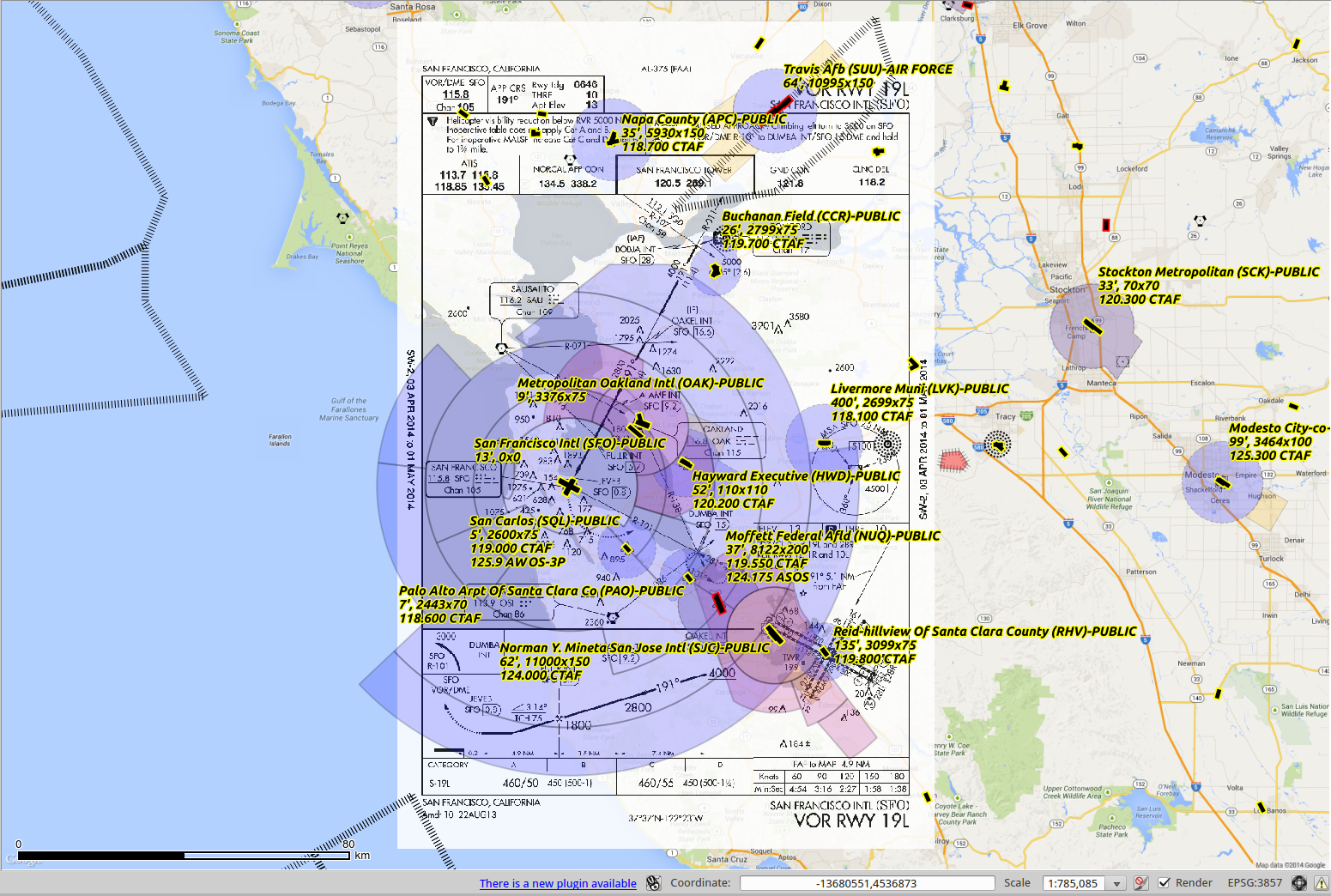
Load the aviatonMap project (https://github.com/jlmcgraw/aviationMap) into QGIS and then load the .VRT output of this utility to see how it matches up with the data from the FAA (kinda cool to see it work)
Please let me know if you have any questions or comments.
-Jesse
As an addition to my code for georeferencing Instrument Procedures I've written a utility to do the same for airport diagrams.
Like my other code it doesn't currently work with miltary diagrams but it does work for 650 civilian airports
The code is available here: https://github.com/jlmcgraw
Load the aviatonMap project (https://github.com/jlmcgraw/aviationMap) into QGIS and then load the .VRT output of this utility to see how it matches up with the data from the FAA (kinda cool to see it work)
Please let me know if you have any questions or comments.
-Jesse