SkyHog
Touchdown! Greaser!
- Joined
- Feb 23, 2005
- Messages
- 18,431
- Location
- Castle Rock, CO
- Display Name
Display name:
Everything Offends Me
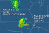
TRAKE205032?
TRAKE205032?

Just a guess based on the format, 205 degrees and 32 miles from TRAKE intersection. What's the source?
Just a guess based on the format, 205 degrees and 32 miles from TRAKE intersection. What's the source?
TRAKE205032?
TRAKE205032 is where the aircraft is coming from. KBPK is where it's going. If you look at the other aircraft's data block on the display, the corresponding locations are the 9A1 and 3MO airports. The controlled portion of the flight may not have started at an airport; for instance it may be a pop-up IFR clearance. TRAKE is an intersection of radials off the COU (Columbia) and FTZ (Foristell) VORs west of St Louis Missouri. As mentioned, the numbers following the intersection name are radial and distance.
Plug in the two locations of skyvector.com to see the route of flight.
A bit odd though that it would reference the position to an intersection instead of a closer navaid. The same point could be described as VIH283014.
Tell the computer that.. the computer was most likely programmed to pick the closest point... it was not restricted to NAVAID. It could pick Coordinates Nxx.xx.xxxWxxx.xx.xxx if it wanted to.. that is all it knows.