Tj1376
Pre-takeoff checklist
Why am I an idiot?
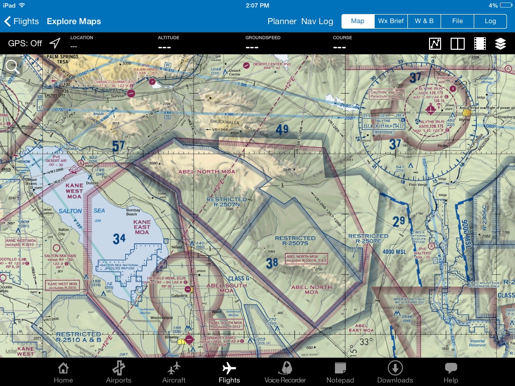
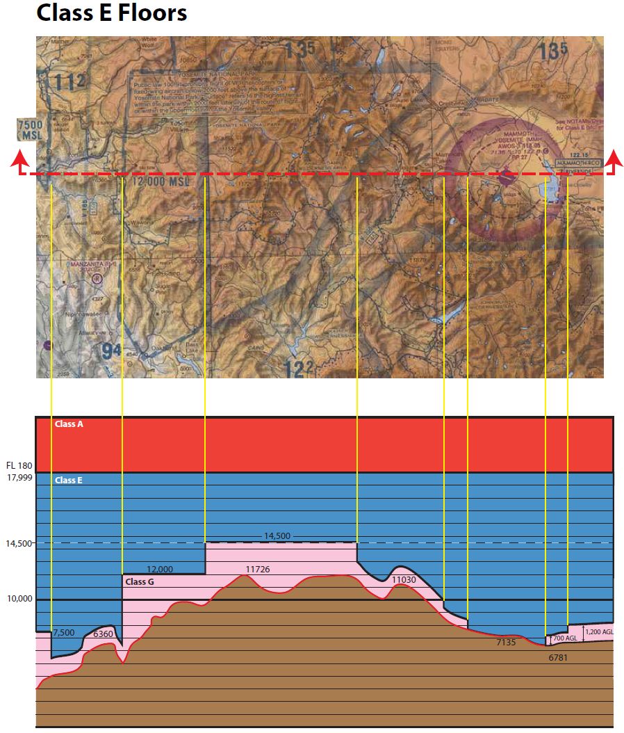
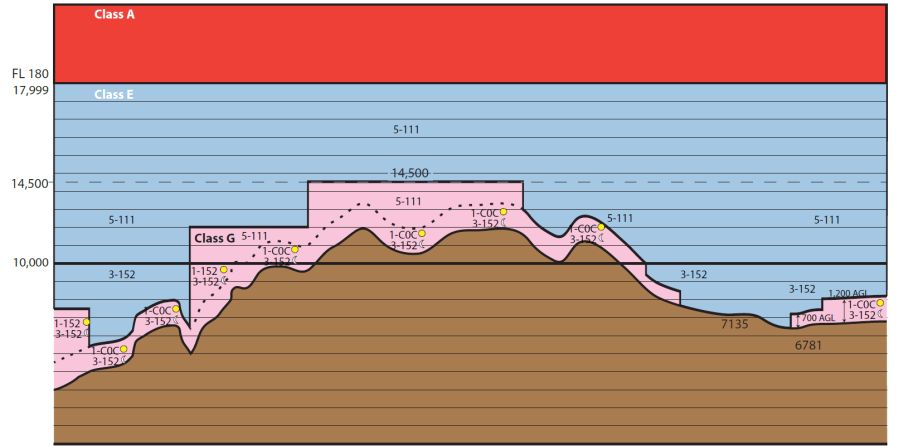
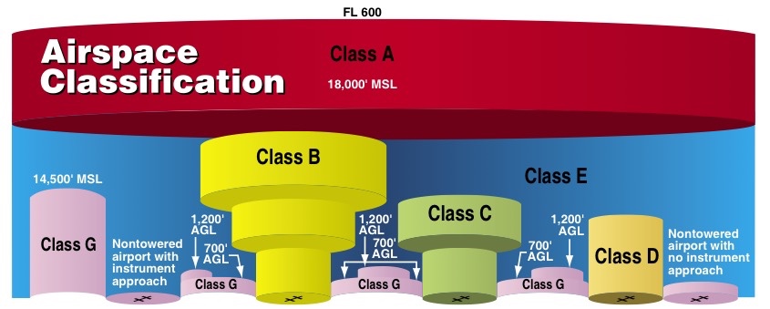
When does class G extend all the way up to 14.5k? I get class G can go up to 700agl if the magenta line is around an uncontrolled airport. What I don't understand is when class G goes up to 1200 agl and when it goes all the way up.
Do you all have any ideas on how I can keep this straight?
Sent from my iPad using Tapatalk