Chart Symbol Clarification

kontiki

Cleared for Takeoff
Joined
May 30, 2011
Messages
1,121
Display Name

Display name:
Kontiki
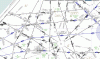
Noticed this chart symbol for the first time (zig zag thing in attached photo). I was actually reading an article in IFR magazine and following along on Garnin Pilot, it's nowhere near me.

It was easy to find the symbol in the Chart Users Guide, but I was hoping to find more of an explanation. Can anyone fill me in?

Chart Users Guide here -> http://www.faa.gov/air_traffic/flig...aero_guide/media/Chart_Users_Guide_12thEd.pdf
 

Attachments

  • Chart Symbol.gif
    Chart Symbol.gif
    254 KB · Views: 73
Unusable airway - probably due to a crappy VOR. Look in the 'green book' and you'll find all sorts of VOR's with unusable radials beyond a certain distance. If you look it says R-279 unusable beyond 50nm. It's 49nm from BAF to WIGAN.
 
As the user above stated its unusable. Sometimes it may only be unusable during certain times of the year or day due to various reasons which is why they don't remove the airway as it exists, and may be useable on the next chart during that time of year.
 
As the user above stated its unusable. Sometimes it may only be unusable during certain times of the year or day due to various reasons which is why they don't remove the airway as it exists, and may be useable on the next chart during that time of year.

I might wager a guess that they want to keep the official airway "intact" and continuous rather that starting and stopping V-292 - or having to rename one section of it to something else. But I also don't know what the airway assignment rules are, so I could be Samsonite.
 
You mean I'm not supposed to make 120 degree turns every two miles while tracking V-292?

Leaving it there but "unusable" as a victor airway allows them to give the /G crowd a way to stay on 292 all the way without them having to issue a clearance like

..V292 WIGAN T295 SAGES V292..
 
Hmm. So what's the MEA on T295 between SAGES and WIGAN? It's 6400 between LAAYK and SAGES. 6100 between WIGAN and SASHA. The airway ends in a "T" at WIGAN indicating MEA change. And it ends in a "T" at SAGES indicating MEA change. I wonder why they didn't print T295V292 right next each other on the SAGES WIGAN segement like on the WIGAN BOWAN segement.
 
Unusable airway - probably due to a crappy VOR. Look in the 'green book' and you'll find all sorts of VOR's with unusable radials beyond a certain distance. If you look it says R-279 unusable beyond 50nm. It's 49nm from BAF to WIGAN.

That's curious.

The same situation is in central California, but with a different notation:

https://skyvector.com/?ll=37.695774357236,-121.13067627168904&chart=302&zoom=1

ECA R-147 is labeled "unsuable" on the chart, and the course number is crosshatched, not the airway.

It also has both an old-school MEA and a "G" MEA -- and they are equal. Isn't an MEA supposed to guarantee reception? Doesn't that conflict with the "unusuable" notation?

Why multiple notations for the same thing?
 
Someone here recently pointed out that the flight check standards for airways and VOR accuracy changed a while back, which triggered an upgrade of the flight check systems in the aircraft, which made a lot of VOR stuff that had been charted for years, suddenly "unusable", but I can't find the reference to it now.

But that's when all this "unusable" stuff started showing up everywhere and piles of FDC NOTAMs for it all until it was charted.

There was of course "unusable" stuff before, but there was a lot of "newly unusable" stuff after that change. And the airways have been left there, since folks will just fly them with the GPS... And many VORs are on the chopping block... Etc etc etc.
 
Back
Top